|
Walmley
Walmley is a suburban village situated in the civil parish of Sutton Coldfield, West Midlands. It lies within the City of Birmingham on its northeastern outer fringe, where it forms part of the Sutton Walmley and Minworth electoral ward. It is in southern Sutton Coldfield, close to Minworth Minworth is a suburban village situated in the civil parish of Sutton Coldfield, West Midlands. It lies within the City of Birmingham on its northeastern outer fringe, where it forms part of the Sutton Walmley and Minworth electoral ward and ..., Wylde Green, Pype Hayes and south of Thimble End. It is approximately northeast of Birmingham City Centre. It is the main focus of the Sutton New Hall Birmingham City Council ward. History The origins of Walmley are unknown, however, it is believed it may have formed as a community for workers at the nearby halls of Langley Hall, West Midlands, Langley Hall, New Hall Manor, Penns Hall and Peddimore Hall. It may have originally begun at a poin ... [...More Info...] [...Related Items...] OR: [Wikipedia] [Google] [Baidu] |
Walmley Library And Community Hall
Walmley is a suburban village situated in the civil parish of Sutton Coldfield, West Midlands. It lies within the City of Birmingham on its northeastern outer fringe, where it forms part of the Sutton Walmley and Minworth electoral ward. It is in southern Sutton Coldfield, close to Minworth, Wylde Green, Pype Hayes and south of Thimble End. It is approximately northeast of Birmingham City Centre. It is the main focus of the Sutton New Hall Birmingham City Council ward. History The origins of Walmley are unknown, however, it is believed it may have formed as a community for workers at the nearby halls of Langley Hall, New Hall Manor, Penns Hall and Peddimore Hall. It may have originally begun at a point near Penns Hall as it had a major influence in the area, employing many for its activities in Penns Mill and other industries. A small community of Langley developed on the Fox Hollies Road and was mentioned in the Domesday Book, however, it was nothing more than a hamlet with ... [...More Info...] [...Related Items...] OR: [Wikipedia] [Google] [Baidu] |
Sutton Walmley And Minworth
Sutton Walmley and Minworth is one of 69 electoral wards in Birmingham, England. Sutton Walmley and Minworth is one of the eight wards that make up the Parliamentary Constituency of Sutton Coldfield and the Royal Sutton Coldfield Town Council. The ward is made up of the Walmley village, Minworth village and the Wiggins Hill hamlet. Abbreviation: S.W.M Population and housing According to the 2011 Population Census, there were 16,437 people living in Sutton Walmley and Minworth. Most housing within the area is modern semi-detached and detached. Around Walmley the housing is pre-war build, though in areas towards Minworth, Thimble End and Falcon Lodge, it is more modern housing dating from the 1970's. New housing estates have been built on the former Warren House Farm and New Shipton Farmland, creating New Hall Manor Estate and a new addition to the New Hall Estate. Politics They're two councillors representing Sutton Walmley and Minworth in the Birmingham city counci ... [...More Info...] [...Related Items...] OR: [Wikipedia] [Google] [Baidu] |
Sutton Coldfield
Sutton Coldfield or the Royal Town of Sutton Coldfield, known locally as Sutton ( ), is a town and civil parish in the City of Birmingham, West Midlands, England. The town lies around 8 miles northeast of Birmingham city centre, 9 miles south of Lichfield, 7 miles southwest of Tamworth and 7 miles east of Walsall. Sutton Coldfield and its surrounding suburbs are governed under Birmingham City Council for local government purposes but the town has its own town council which governs the town and its surrounding areas by running local services and electing a mayor to the council. It is in the Historic county of Warwickshire, and in 1974 it became part of Birmingham and the West Midlands metropolitan county under the Local Government Act 1972. History Etymology The etymology of the name Sutton appears to be from "South Town". The name "Sutton Coldfield" appears to come from this time, being the "south town" (i.e. south of Tamworth and/or Lichfield) on the edge of the "col f ... [...More Info...] [...Related Items...] OR: [Wikipedia] [Google] [Baidu] |
Peddimore Hall
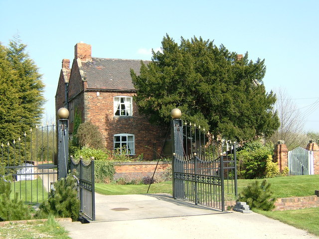
Peddimore Hall is a manor house in the Walmley area of Sutton Coldfield in Birmingham, West Midlands, England. It is a Scheduled Ancient Monument and a Grade II listed building. It is now in use as a private residence. Peddimore was first mentioned in 1281 when it was conveyed by Thomas Arden of Ratley to Hugh de Vienne and subsequently to Thomas and Rose de Arden of Hanwell in 1286. In 1288, the owners of Peddimore Hall were allowed by the Earl of Warwick, William de Beauchamp to fish in Ebrook (now Plants Brook) on his land, allow his pigs to roam in the woods and was allowed to remove timber for building reparations.Walmley Residents Association: A brief history of Peddimore A building on site is first mentioned in 1361 when |
Sutton New Hall
Sutton New Hall is one of the 40 electoral wards in Birmingham, England and is named after New Hall, a medieval manor house. Sutton New Hall is one of the four wards that make up the Parliamentary Constituency and formal district of Sutton Coldfield. The ward lies to the south-east of Sutton Coldfield town centre and covers Walmley, Walmley Ash, Thimble End and Minworth. It covers an area of . Population and housing According to the 2001 Population Census, there were 21,487 people living in 8,896 households in Sutton New Hall rising to a population of 22,455 in 9,433 households at the 2011 Census. Most housing within the area is modern semi-detached and detached. Around Walmley the housing is pre-war build, though in areas towards Minworth, Thimble End and Falcon Lodge, it is more modern housing dating from the 1970s. New housing estates have been built in Thimble End and also on the former Warren House Farm and New Shipton Farmland, creating New Hall Manor Estate and a new ... [...More Info...] [...Related Items...] OR: [Wikipedia] [Google] [Baidu] |
Penns Railway Station
Penns railway station is a disused railway station which served the village of Walmley in Sutton Coldfield when it was in the historic county of Warwickshire, now the West Midlands. The station was opened in 1879 and was located on the Midland Railway Company's Walsall - Water Orton Branch as the first station on the line after leaving their Birmingham to Derby line between Castle Bromwich and Water Orton. The line then developed into the Sutton Park Line. In 1965, the station closed and was demolished the next year as part of the Beeching Axe The Beeching cuts (also Beeching Axe) was a plan to increase the efficiency of the nationalised railway system in Great Britain. The plan was outlined in two reports: ''The Reshaping of British Railways'' (1963) and ''The Development of the ..., which had also resulted in all stations on the same line being closed. The line was retained for freight trains. The only surviving feature of the railway station is Penns Lane Bridge ... [...More Info...] [...Related Items...] OR: [Wikipedia] [Google] [Baidu] |
Penns Hall
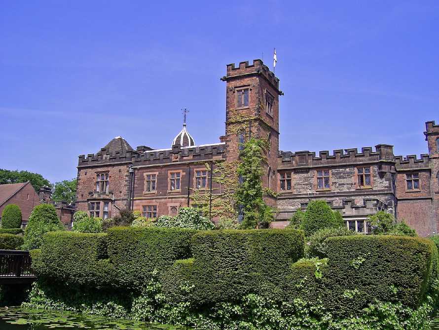
Penns Hall is a building on Penns Lane, Walmley, Sutton Coldfield, Birmingham, England, operated as a hotel and country club by Ramada International. It is a Grade B locally listed building, and is licensed as a venue for civil marriages and civil partnerships. Plants Brook, a tributary of the River Tame, flows through its grounds. A long pool formed by the damming of Plants Brook named Penns Lake is also part of the hotel grounds. This is today used as a carp fishing lake operated by Fosters Fisheries. History In 1618, John Penn was operating two water mills for corn milling and for blade sharpening in Sutton Coldfield. The Websters, a Presbyterian family, operated a blade mill at Perry Barr, Birmingham and in about 1750, Joseph Webster acquired the additional lease of the Penns Mills which property in 1776 comprised a house and two dwellings adjoining a wire mill and a fulling mill, called Penns Mills. He and his son Joseph Webster developed a wire drawing business and ... [...More Info...] [...Related Items...] OR: [Wikipedia] [Google] [Baidu] |
Minworth
Minworth is a suburban village situated in the civil parish of Sutton Coldfield, West Midlands. It lies within the City of Birmingham on its northeastern outer fringe, where it forms part of the Sutton Walmley and Minworth electoral ward and borders the North Warwickshire district. The village is immediately adjacent to the Sutton suburb of Walmley, the hamlet of Wiggins Hill and the Warwickshire village of Curdworth. The River Tame runs through the south of the area. Minworth has close transport links to the M6, M6 Toll and M42 motorways, while the closest rail station is nearby Water Orton railway station in Water Orton, Warwickshire. History Minworth's name probably came from Mynna's Estate. Minworth and Curdworth both originated in the 6th or 7th centuries, being established by Angle settlers, and are historically associated with the Arden family (William Shakespeare's maternal relations). Peddimore Hall is a double-moated farmstead and can be associated with the Ardens ... [...More Info...] [...Related Items...] OR: [Wikipedia] [Google] [Baidu] |
Pype Hayes
Pype Hayes is a modern housing estate area in the east of the Erdington district of Birmingham. It is within the Tyburn ward. Covering the postcodes of B24 and B76. Etymology The name of the area derives from a major landowner in Erdington called Henry de Pipe. On this land he built a house which later developed into Pype Hayes Hall. History Pype Hayes developed mainly during the 20th century as a result of the expansion of Erdington northwards towards the Chester Road. The Chester Road follows the line of the ancient drover's road called the Welsh Road. It developed during the 17th century as a major thoroughfare through Birmingham. Stage coaches used the road and it developed a reputation as a haven for highwaymen. All the land in Pype Hayes was owned as part of an estate with Pype Hayes Hall at its centre. This was a prominent hall in the area and the nearest settlement was Holifast Grange to the north-west. The construction of the Birmingham and Fazeley Canal in the sou ... [...More Info...] [...Related Items...] OR: [Wikipedia] [Google] [Baidu] |
Thimble End
Thimble End is a neighbourhood on the outskirts of Sutton Coldfield, Birmingham, England. It has been developed several times with the construction and expansion of housing estates on the land with the most recent being completed in 2005. Situated between Walmley, Minworth and Signal Hayes, the area is small in comparison to Walmley and Minworth and is covered by the Sutton New Hall ward. The area was once farmland used by farmers residing in Walmley and Minworth however the need for extra living space after World War II World War II or the Second World War, often abbreviated as WWII or WW2, was a world war that lasted from 1939 to 1945. It involved the vast majority of the world's countries—including all of the great powers—forming two opposin ... prompted the construction of a small housing estate on the site. This was further expanded in the 1970s and the final part of the farmland was constructed on by 2005. The newest housing estate was named Thimble End ... [...More Info...] [...Related Items...] OR: [Wikipedia] [Google] [Baidu] |
Langley Hall, West Midlands
Langley Hall was a manor house just off Fox Hollies Road, one mile from the centre of Walmley in Sutton Coldfield in the historic county of Warwickshire. The date of construction is unknown; however, by the 13th century, it was the seat of de Beresfords of Wishaw. One member of the family was the Chief Justice of the Common Pleas in 1289, and another was a confidential retainer to the Black Prince. Langley Hall was a large house, with a moat surrounding it and a pond and fishery within its grounds. It was held by the Earl of Warwick. In 1327, Edmund de Beresford had licence to crenellate the house, making it into a fortified building. The hall passed into the ownership of the Hores before being owned by the Pudseys, strong supporters of the Parliamentarians during the English Civil War. In the reign of Henry VII, Edith Hore formed a relationship with Rowland Pudsey, and they soon married resulting in Rowland acquiring the hall and estate. One of his descendants, Henry Pudsey ... [...More Info...] [...Related Items...] OR: [Wikipedia] [Google] [Baidu] |
Erdington
Erdington is a suburb and ward of Birmingham in the West Midlands County, England. Historically part of Warwickshire and located northeast of central Birmingham, bordering Sutton Coldfield. It was also a council constituency, managed by its own district committee. The former council district consisted of the ward of Erdington, and Tyburn, (formerly Kingsbury), Stockland Green and Kingstanding, although all of Kingstanding and most of both Tyburn and Stockland Green wards lie outside the historical boundaries of Erdington. Stockland Green was formerly part of Aston, Kingstanding part of Perry Barr and Tyburn (Tyburn Road South & Birches Green) partially split between Aston and Hodge Hill ( Castle Vale). Erdington (ward) was part of the Sutton Coldfield constituency before 1974. History Erdington Manor Erdington had its own manor house, Erdington Hall, which was protected on three sides by a double moat and on the fourth by the River Tame. It had developed from a small forti ... [...More Info...] [...Related Items...] OR: [Wikipedia] [Google] [Baidu] |


