|
Wakefield Metropolitan District
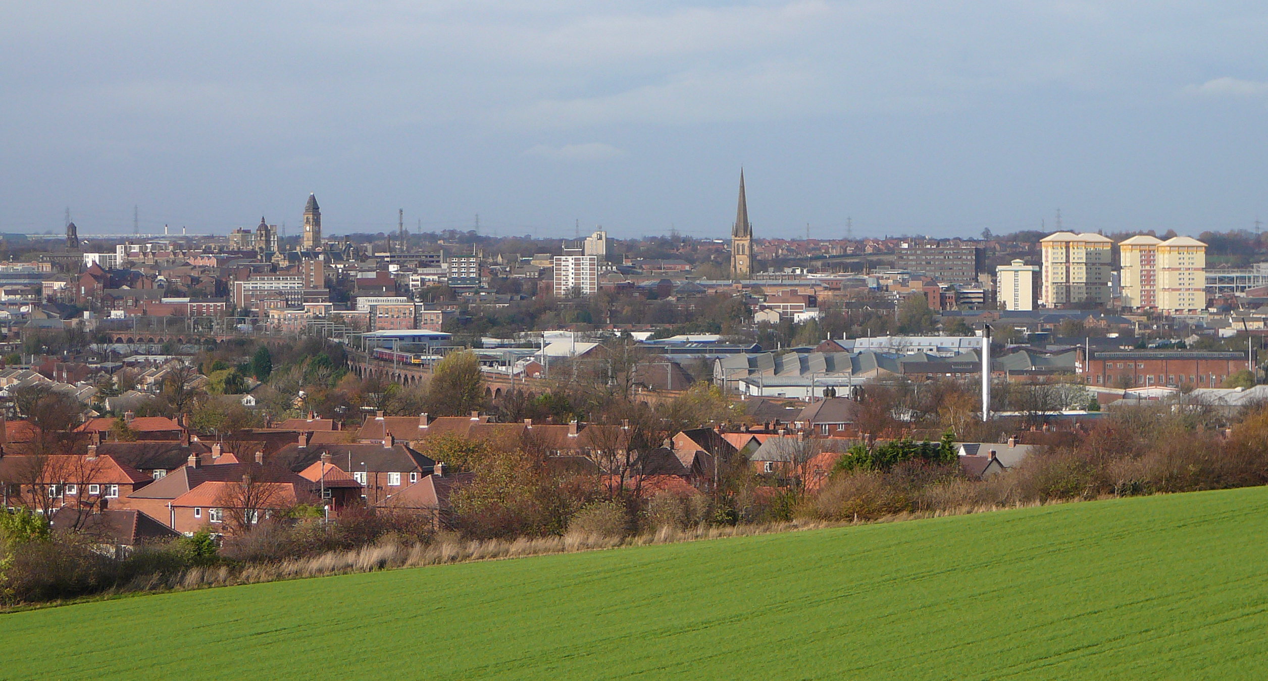
The City of Wakefield is a local government district with the status of a city and metropolitan borough in West Yorkshire, England. Wakefield, the largest settlement, is the administrative centre of the district. The population of the City of Wakefield at the 2011 Census was 325,837. The district includes the ''Five Towns'' of Normanton, Pontefract, Featherstone, Castleford and Knottingley. Other towns include Ossett, Horbury, Hemsworth, South Kirkby and Moorthorpe and South Elmsall. The city and district are governed by Wakefield Metropolitan District Council from headquarters in County Hall. In 2010, Wakefield was named as the UK's third most musical city by PRS for Music. Economy The economic and physical condition of several of the former mining towns and villages in Wakefield District have started to improve due to the booming economy of Leeds – and an increase in numbers of commuters to the city from the sub-region – and a recognition of undeveloped assets. For ... [...More Info...] [...Related Items...] OR: [Wikipedia] [Google] [Baidu] |
City Status In The United Kingdom
City status in the United Kingdom is granted by the monarch of the United Kingdom to a select group of communities. , there are 76 cities in the United Kingdom—55 in England, seven in Wales, eight in Scotland, and six in Northern Ireland. Although it carries no special rights, the status of city can be a marker of prestige and confer local pride. The status does not apply automatically on the basis of any particular criterion, though in England and Wales it was traditionally given to towns with diocesan cathedrals. This association between having an Anglican cathedral and being called a city was established in the early 1540s when King Henry VIII founded dioceses (each having a cathedral in the see city) in six English towns and granted them city status by issuing letters patent. City status in Ireland was granted to far fewer communities than in England and Wales, and there are only two pre-19th-century cities in present-day Northern Ireland. In Scotland, city status ... [...More Info...] [...Related Items...] OR: [Wikipedia] [Google] [Baidu] |
Jon Trickett
Jon Hedley Trickett (born 2 July 1950) is a British Labour Party politician who has been the Member of Parliament (MP) for Hemsworth in West Yorkshire since a 1996 by-election. He was Shadow Lord President of the Council from 2016 to 2020 and served as Shadow Minister for the Cabinet Office from 2011 to 2013 and 2017 to 2020. He was the Labour Party National Campaign Coordinator under Jeremy Corbyn from 2015 to 2017. Trickett served as the Parliamentary Private Secretary to Prime Minister Gordon Brown from 2008 to 2010 and was promoted to the Shadow Cabinet by Ed Miliband in 2011 as Shadow Minister for the Cabinet Office. Trickett was appointed Shadow Secretary of State for Communities and Local Government under new Party Leader Jeremy Corbyn in September 2015, before serving as Shadow Secretary of State for Business, Innovation and Skills from July to October 2016. He was later appointed Shadow Minister for the Cabinet Office by Corbyn in February 2017, alongside his portfo ... [...More Info...] [...Related Items...] OR: [Wikipedia] [Google] [Baidu] |
Featherstone
Featherstone is a town and civil parishes in England, civil parish in the City of Wakefield, West Yorkshire, England, two miles south-west of Pontefract. Historic counties of England, Historically part of the West Riding of Yorkshire, in 2011 it had a population of 15,244. Featherstone railway station is on the Pontefract Line. History Despite most population growth taking place around the Industrial Revolution, Featherstone traces its history back much further than this. The Domesday Book (1086) records "In Ferestane [Featherstone] and Prestone [Purston] and Arduwic [Hardwick] and Osele [Nostell], Ligulf had 16 carucates of land for geld, and 6 ploughs may be there." It is thought that a local public house, the Traveller's Rest, can trace its origins to the 17th century whilst the former Jubilee Hotel, a listed building now converted to apartments, once provided a resting place for wealthy Victorians and their horses. Standing stone's just outside the village indicate that th ... [...More Info...] [...Related Items...] OR: [Wikipedia] [Google] [Baidu] |
Pontefract
Pontefract is a historic market town in the Metropolitan Borough of Wakefield in West Yorkshire, England, east of Wakefield and south of Castleford. Historically part of the West Riding of Yorkshire, it is one of the towns in the City of Wakefield District and had a population of 30,881 at the 2011 Census. Pontefract's motto is , Latin for "After the death of the father, support the son", a reference to the town's Royalist sympathies in the English Civil War. Etymology At the end of the 11th century, the modern township of Pontefract consisted of two distinct and separate localities known as Tanshelf and Kirkby.Eric Houlder, Ancient Roots North: When Pontefract Stood on the Great North Road, (Pontefract: Pontefract Groups Together, 2012) p.7. The 11th-century historian, Orderic Vitalis, recorded that, in 1069, William the Conqueror travelled across Yorkshire to put down an uprising which had sacked York, but that, upon his journey to the city, he discovered that the cro ... [...More Info...] [...Related Items...] OR: [Wikipedia] [Google] [Baidu] |
Normanton, West Yorkshire
Normanton is a town and civil parish in the City of Wakefield in West Yorkshire, England. It is north-east of Wakefield and south-west of Castleford. The civil parish extends west and north to the River Calder, and includes the large village of Altofts. At the time of the 2011 Census, the population of the civil parish was 20,872. The Normanton ward of the Wakefield City Council does not include Altofts, but includes the civil parish of Warmfield cum Heath to the south-west of Normanton. The ward had a population of 16,220 in 2011. History The ''Domesday Book'' gives information on 'Norman-tune' as: In Normantune there are 10 carucates for geld, which 5 plows can plough. 2 thegns had 2 manors there T.R.E. Now, in the King's hand there are 6 villeins there, and 3 bordars, a priest and a church, with 3 ploughs, of meadow. Pasturable wood (land) 6 furlongs in length and 1 in breadth. The whole of this land lies in the soc of Wachefelt, except the Church. T.R.E. it was ... [...More Info...] [...Related Items...] OR: [Wikipedia] [Google] [Baidu] |
Administrative Centre
An administrative center is a seat of regional administration or local government, or a county town, or the place where the central administration of a commune is located. In countries with French as administrative language (such as Belgium, Luxembourg, Switzerland and many African countries), a (, plural form , literally 'chief place' or 'main place'), is a town or city that is important from an administrative perspective. Algeria The capital of an Algerian province is called a chef-lieu. The capital of a district, the next largest division, is also called a chef-lieu, whilst the capital of the lowest division, the municipalities, is called agglomération de chef-lieu (chef-lieu agglomeration) and is abbreviated as A.C.L. Belgium The chef-lieu in Belgium is the administrative centre of each of the ten provinces of Belgium. Three of these cities also give their name to their province ( Antwerp, Liège and Namur). France The chef-lieu of a département is known as the ''pr ... [...More Info...] [...Related Items...] OR: [Wikipedia] [Google] [Baidu] |
Metropolitan Borough
A metropolitan borough (or metropolitan district) is a type of local government district in England. Created in 1974 by the Local Government Act 1972, metropolitan boroughs are defined in English law as metropolitan districts within metropolitan counties. All of the metropolitan districts have been granted or regranted royal charters giving them borough status (and in some cases, they also have city status).Local Government Act 1972, Schedule I, Part I, Metropolitan Counties and Metropolitan Districts Metropolitan boroughs have been effectively unitary authority areas since the abolition of metropolitan county councils by the Local Government Act 1985.Local Government Act 1985 c.51 Metropolitan boroughs pool much of their authority in joint boards and other arrangements that cover whole metropolitan counties, such as city regions or combined authorities, with most of the latter having a metro mayor. History London metropolitan boroughs (1900–1965) The term "metropolitan boro ... [...More Info...] [...Related Items...] OR: [Wikipedia] [Google] [Baidu] |
Nomenclature Of Territorial Units For Statistics
Nomenclature of Territorial Units for Statistics or NUTS (french: Nomenclature des unités territoriales statistiques) is a geocode standard for referencing the subdivisions of countries for statistical purposes. The standard, adopted in 2003, is developed and regulated by the European Union, and thus only covers the member states of the EU in detail. The Nomenclature of Territorial Units for Statistics is instrumental in the European Union's Structural Funds and Cohesion Fund delivery mechanisms and for locating the area where goods and services subject to European public procurement legislation are to be delivered. For each EU member country, a hierarchy of three NUTS levels is established by Eurostat in agreement with each member state; the subdivisions in some levels do not necessarily correspond to administrative divisions within the country. A NUTS code begins with a two-letter code referencing the country, as abbreviated in the European Union's Interinstitutional Style ... [...More Info...] [...Related Items...] OR: [Wikipedia] [Google] [Baidu] |
ONS Coding System
ONS codes are geocodes maintained by the United Kingdom's Office for National Statistics to represent a wide range of geographical areas of the UK, for use in tabulating census and other statistical data. These codes are also known as GSS codes, where GSS refers to the ''Government Statistical Service'' of which ONS is part. The previous hierarchical system of codes was replaced as from January 2011 by a nine-character code for all types of geography, in which there is no relation between the code for a lower-tier area and the corresponding parent area. The older coding system has now been phased out. Geography of the UK Census Information from the 2011 Census is published for a wide variety of geographical units. These areas include: * Counties in England * Districts within English counties, and Unitary Authority areas served by one council providing district and county functions * Unitary council areas in Wales, Scotland, and Northern Ireland * Civil parishes ( communities i ... [...More Info...] [...Related Items...] OR: [Wikipedia] [Google] [Baidu] |
British Summer Time
During British Summer Time (BST), civil time in the United Kingdom is advanced one hour forward of Greenwich Mean Time (GMT), in effect changing the time zone from UTC±00:00 to UTC+01:00, so that mornings have one hour less daylight, and evenings one hour more. BST begins at 01:00 GMT every year on the last Sunday of March and ends at 01:00 GMT (02:00 BST) on the last Sunday of October. The starting and finishing times of daylight saving were aligned across the European Union on 22 October 1995, and the UK retained this alignment after it left the EU; both BST and Central European Summer Time begin and end on the same Sundays at 02:00 Central European Time, 01:00 GMT. Between 1972 and 1995, the BST period was defined as "beginning at two o'clock, Greenwich mean time, in the morning of the day after the third Saturday in March or, if that day is Easter Day, the day after the second Saturday in March, and ending at two o'clock, Greenwich mean time, in the morning of the day a ... [...More Info...] [...Related Items...] OR: [Wikipedia] [Google] [Baidu] |

.jpg)


_(10004827914).jpg)
