|
Wadden
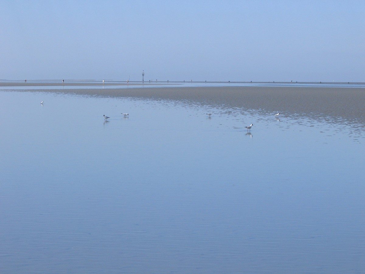
The Wadden Sea ( nl, Waddenzee ; german: Wattenmeer; nds, Wattensee or ; da, Vadehavet; fy, Waadsee, longname=yes; frr, di Heef) is an intertidal zone in the southeastern part of the North Sea. It lies between the coast of northwestern continental Europe and the range of low-lying Frisian Islands, forming a shallow body of water with tidal flats and wetlands. It has a high biological diversity and is an important area for both breeding and migrating birds. In 2009, the Dutch and German parts of the Wadden Sea were inscribed on UNESCO's World Heritage List and the Danish part was added in June 2014. The Wadden Sea stretches from Den Helder, in the northwest of the Netherlands, past the great river estuaries of Germany to its northern boundary at Skallingen in Denmark along a total coastline of some and a total area of about . Within the Netherlands, it is bounded from the IJsselmeer by the Afsluitdijk. Historically, the coastal regions were often subjected to large floods, r ... [...More Info...] [...Related Items...] OR: [Wikipedia] [Google] [Baidu] |
Schleswig-Holstein Wadden Sea National Park
The Schleswig-Holstein Wadden Sea National Park (german: Nationalpark Schleswig-Holsteinisches Wattenmeer) is a national park in the Schleswig-Holstein area of the German Wadden Sea. It was founded by the Parliament of Schleswig-Holstein on 1 October 1985 by the National Park Act of 22 July 1985 and expanded significantly in 1999. Together with the Lower Saxon Wadden Sea National Park, the Hamburg Wadden Sea National Park and those parts of Elbe estuary which are not nature reserves, it forms the German part of the Wadden Sea. The national park extends from the German-Danish maritime border in the north down to the Elbe estuary in the south. In the North Frisian area, it includes the mudflats around the geest-based and marsh islands and the '' Halligen'' (undyked islands). There, the mudflats are 40 km wide in places. Further south lie areas of mudflats which contain particularly large sandbanks. In addition to the plants and animals that are typical of the entire Wadde ... [...More Info...] [...Related Items...] OR: [Wikipedia] [Google] [Baidu] |
Lower Saxon Wadden Sea National Park
The Lower Saxon Wadden Sea National Park (german: Nationalpark Niedersächsisches Wattenmeer) was established in 1986 and embraces the East Frisian Islands, mudflats and salt marshes between the Bay of Dollart on the border with the Netherlands in the west and Cuxhaven as far as the Outer Elbe shipping channel in the east. The national park has an area of about . The National Park organisation is located in Wilhelmshaven. In June 2009, the National Park became a UNESCO World Heritage Site along with the Schleswig-Holstein Wadden Sea and the Dutch Wadden Sea, highlighting its unique intertidal ecosystem and high biodiversity. Ecology The habitats to be protected by this park include the mudflats, salt marshes, beaches, dunes and estuaries on the North Sea. Special attention is given to the wildlife and flora typical of the Wadden Sea of which the park forms a part. The coast of the North Sea is unusually flat. The seabed descends in places only a few centimetres per kilomet ... [...More Info...] [...Related Items...] OR: [Wikipedia] [Google] [Baidu] |
Frisian Islands
The Frisian Islands, also known as the Wadden Islands or the Wadden Sea Islands, form an archipelago at the eastern edge of the North Sea in northwestern Europe, stretching from the northwest of the Netherlands through Germany to the west of Denmark. The islands shield the mudflat region of the Wadden Sea (large parts of which fall dry during low tide) from the North Sea. The Frisian Islands, along with the mainland coast in the German Bight, form the region of Frisia (German and Dutch: ''Friesland''), homeland of the Frisian people. Generally, the term Frisian Islands is used for the islands where Frisian languages, Frisian is spoken and the population is ethnically Frisian. In contrast, the term Wadden Islands applies to the entire archipelago, including the Dutch language, Dutch-speaking westernmost islands of Texel and Vlieland and Danish language, Danish-speaking Danish Wadden Sea Islands further north off the west coast of Jutland. Most of the Frisian Islands are environment ... [...More Info...] [...Related Items...] OR: [Wikipedia] [Google] [Baidu] |
Hamburg Wadden Sea National Park
The Hamburg Wadden Sea National Park (german: Hamburgisches Wattenmeer) is the smallest of the three German Wadden Sea National Parks which protect the single ecological entity of the Wadden Sea reaching from Den Helder to Esbjerg. It is an exclave of the city state of Hamburg in North Germany and lies 12.5 km off Cuxhaven in the estuary of the Elbe in the North Sea (German Bight) and includes the islands of Neuwerk, Scharhörn and Nigehörn. It is made up mainly of sand and mixed mudflats with shallow creeks, sand bars (''Plaaten'') and the dune islands. In 2011 the national park was added to the Wadden Sea World Heritage Site, highlighting its intact intertidal ecosystem, importance as a breeding area for many species of birds, and uniquely high biodiversity. National park In accordance with a ruling by the Hamburg Parliament on 9 April 1990 the area was reclassified as the Hamburg Wadden Sea National Park. On 5 April 2001 the law was updated and the national park a ... [...More Info...] [...Related Items...] OR: [Wikipedia] [Google] [Baidu] |
Wadden Sea National Park, Denmark
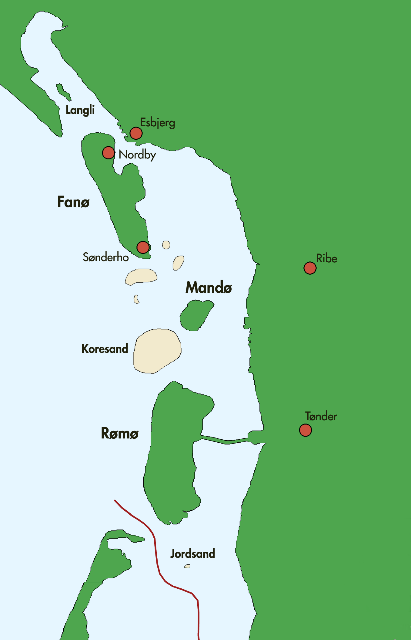
Wadden Sea National Park (Nationalpark Vadehavet) was designated a Danish national park on 17 January 2008, effective 2010.Nationalpark Wadden Sea Vadehavets formidlerforum (the collaboration of 'Wadden Sea communication forum') The Wadden Sea National Park is - except by far the largest of Denmark's national parks and covers the Danish part of the from to the German border, and includes the islands of |
North Sea
The North Sea lies between Great Britain, Norway, Denmark, Germany, the Netherlands and Belgium. An epeiric sea on the European continental shelf, it connects to the Atlantic Ocean through the English Channel in the south and the Norwegian Sea in the north. It is more than long and wide, covering . It hosts key north European shipping lanes and is a major fishery. The coast is a popular destination for recreation and tourism in bordering countries, and a rich source of energy resources, including wind and wave power. The North Sea has featured prominently in geopolitical and military affairs, particularly in Northern Europe, from the Middle Ages to the modern era. It was also important globally through the power northern Europeans projected worldwide during much of the Middle Ages and into the modern era. The North Sea was the centre of the Vikings' rise. The Hanseatic League, the Dutch Republic, and the British each sought to gain command of the North Sea and access t ... [...More Info...] [...Related Items...] OR: [Wikipedia] [Google] [Baidu] |
Lauwersmeer National Park
Lauwersmeer National Park ( nl, Nationaal Park Lauwersmeer) is a national park in the provinces of Friesland and Groningen in the Netherlands. It consists of the southern and eastern parts of the Lauwersmeer (previously Lauwerszee). As part of the Dutch Wadden Sea Conservation Area, it was inscribed on the UNESCO World Heritage List for its outstanding biodiversity and its large, relatively pristine intertidal ecosystem. Geography In the north of the Netherlands, the Lauwers river forms part of the east-west border between the provinces of Friesland and Groningen. The Lauwers flows from south to north into the Wadden Sea. The Lauwersmeer is its estuary, which is connected to the sea via a sluice at Lauwersoog. The national park consists of most of the Lauwersmeer and is situated in the Frisian municipalities of Dongeradeel and Kollumerland c.a. in Friesland and the Groningen municipality of De Marne. History On 25 May 1969, the Lauwers Sea was enclosed and separated from the ... [...More Info...] [...Related Items...] OR: [Wikipedia] [Google] [Baidu] |
Levee
A levee (), dike (American English), dyke (English in the Commonwealth of Nations, Commonwealth English), embankment, floodbank, or stop bank is a structure that is usually soil, earthen and that often runs parallel (geometry), parallel to the course of a river in its floodplain or along low-lying coastlines. The purpose of a levee is to keep the course of rivers from changing and to protect against flooding of the area adjoining the river or coast. Levees can be naturally occurring ridge structures that form next to the bank of a river, or be an artificially constructed fill dirt, fill or wall that regulates water levels. Ancient civilizations in the Indus Valley civilisation, Indus Valley, ancient Egypt, Mesopotamia and China all built levees. Today, levees can be found around the world, and failures of levees due to erosion or other causes can be major disasters. Etymology Speakers of American English (notably in the Midwestern United States, Midwest and Deep South) u ... [...More Info...] [...Related Items...] OR: [Wikipedia] [Google] [Baidu] |
Den Helder
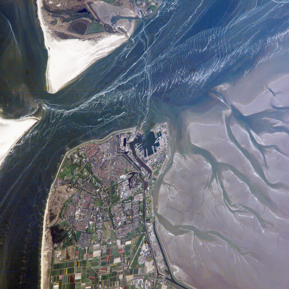
Den Helder () is a municipality and a city in the Netherlands, in the province of North Holland. Den Helder occupies the northernmost point of the North Holland peninsula. It is home to the country's main naval base. From here the Royal TESO ferryboat service operates the transportation link between Den Helder and the nearby Dutch Wadden island of Texel to the north. Etymology Before the year 1928 the official name of Den Helder was Helder. The origin of the name Helder is not entirely clear. The name Helder may have come from ''Helle/Helde'', which means "hill" or "hilly grounds", or from ''Helre'', which means a sandy ridge. Another explanation is that the name derived from ''Helsdeur'' (Hell's Door), likely because in the water between Den Helder and Texel (called Marsdiep) the current was so strong that many ships were lost. History Huisduinen was the original older part of the city, whereas Helder itself was a nearby smaller hamlet. When a harbour was built near Hel ... [...More Info...] [...Related Items...] OR: [Wikipedia] [Google] [Baidu] |
Netherlands
) , anthem = ( en, "William of Nassau") , image_map = , map_caption = , subdivision_type = Sovereign state , subdivision_name = Kingdom of the Netherlands , established_title = Before independence , established_date = Spanish Netherlands , established_title2 = Act of Abjuration , established_date2 = 26 July 1581 , established_title3 = Peace of Münster , established_date3 = 30 January 1648 , established_title4 = Kingdom established , established_date4 = 16 March 1815 , established_title5 = Liberation Day (Netherlands), Liberation Day , established_date5 = 5 May 1945 , established_title6 = Charter for the Kingdom of the Netherlands, Kingdom Charter , established_date6 = 15 December 1954 , established_title7 = Dissolution of the Netherlands Antilles, Caribbean reorganisation , established_date7 = 10 October 2010 , official_languages = Dutch language, Dutch , languages_type = Regional languages , languages_sub = yes , languages = , languages2_type = Reco ... [...More Info...] [...Related Items...] OR: [Wikipedia] [Google] [Baidu] |
Afsluitdijk
The ''Afsluitdijk'' (; fry, Ofslútdyk; nds-nl, Ofsluutdiek; en, "Closure Dyke") is a major dam and causeway in the Netherlands. It was constructed between 1927 and 1932 and runs from Den Oever in North Holland province to the village of Zurich in Friesland province, over a length of and a width of , at an initial height of above sea level. The ''Afsluitdijk'' is a fundamental part of the larger Zuiderzee Works, damming off the Zuiderzee, a salt water inlet of the North Sea, and turning it into the fresh water lake of the IJsselmeer. It is a major landwinning project and a quicker road-connection between the North and West of the Netherlands. The motorway on the ''Afsluitdijk'' was the initial demonstration site for a speed limit in the Netherlands. History Reasons for construction The Afsluitdijk (literally translated: shut-off-dyke) was completed in 1932, thereby shutting off the Zuiderzee (lit: Southern Sea) from the North Sea. Until then, the Zuiderzee had b ... [...More Info...] [...Related Items...] OR: [Wikipedia] [Google] [Baidu] |
Westerhever Salzwiesenrest
Westerhever ( da, Vesterhever) is a municipality in Nordfriesland in the German state of Schleswig-Holstein. Geography Westerhever lies on the northwestern tip of the Eiderstedt Peninsula. The Westerheversand Lighthouse is a major landmark on the peninsula which is surrounded by salt marshes. The saltmarshes, lighthouse, and beaches A beach is a landform alongside a body of water which consists of loose particles. The particles composing a beach are typically made from rock, such as sand, gravel, shingle, pebbles, etc., or biological sources, such as mollusc shel ... attract about 80,000 visitors every year. History The island Westerhever was first settled by humans in the 12th Century. The first humans there built a ring dike to protect the land. References External links Municipalities in Schleswig-Holstein Nordfriesland {{SchleswigHolstein-geo-stub ... [...More Info...] [...Related Items...] OR: [Wikipedia] [Google] [Baidu] |


