|
Wisconsin's 87th Assembly District
The 87th Assembly District of Wisconsin is one of 99 districts in the Wisconsin State Assembly. Located in northwest Wisconsin, the district comprises all of Rusk and Taylor counties and most of Sawyer County, as well as parts of northwest Marathon County. It includes the cities of Hayward, Ladysmith, and Medford, and contains the Lac Courte Oreilles Indian reservation. The district is represented by Republican James W. Edming James W. Edming (born November 22, 1945) is an American businessman and Republican politician. He is a member of the Wisconsin State Assembly since 2015, representing the 87th Assembly district. Biography From Glen Flora, Wisconsin, Edming gr ..., since January 2015. The 87th Assembly District is located within Wisconsin's 29th Senate district, along with the 85th and 86th Assembly districts. List of past representatives References {{Wisconsin state legislature districts Wisconsin State Assembly districts Clark County, Wisconsi ... [...More Info...] [...Related Items...] OR: [Wikipedia] [Google] [Baidu] |
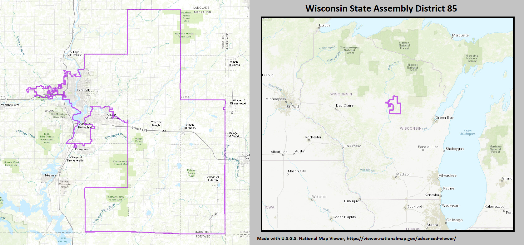
Wisconsin Assembly, District 85
The 85th Assembly District of Wisconsin is one of 99 districts in the Wisconsin State Assembly. Located in north-central Wisconsin, the district comprises much of eastern Marathon County, Wisconsin, Marathon County, including the cities of Wausau, Wisconsin, Wausau and Schofield, Wisconsin, Schofield, and the villages of Elderon, Wisconsin, Elderon, Hatley, Wisconsin, Hatley, and Rothschild, Wisconsin, Rothschild. The district is represented by Republican Party (United States), Republican Patrick Snyder, since January 2017. The 85th Assembly District is located within Wisconsin Senate, District 29, Wisconsin's 29th Senate district, along with the Wisconsin Assembly, District 86, 86th and Wisconsin Assembly, District 87, 87th Assembly districts. History The district was created in the 1972 redistricting act1971 Wisc. Act 304 which first established the numbered district system, replacing the previous system which allocated districts to specific counties. The 85th district w ... [...More Info...] [...Related Items...] OR: [Wikipedia] [Google] [Baidu] |
Adams County, Wisconsin
Adams County is a county in the U.S. state of Wisconsin. As of the 2020 census, the population was 20,654. Its county seat is Friendship. The county was created in 1848 and organized in 1853. Sources differ as to whether its name is in honor of the second President of the United States, John Adams, or his son, the sixth President, John Quincy Adams. History The founders of Adams County were from upstate New York. These people were "Yankee" settlers, that is to say they were descended from the English Separatists who settled New England in the 1600s. They were part of a wave of New England farmers who headed west into what was then the wilds of the Northwest Territory during the early 1800s. Most of them arrived as a result of the completion of the Erie Canal and the end of the Black Hawk War. They got to what is now Adams County by sailing up the Wisconsin River from the Mississippi River on small barges which they constructed themselves out of materials obtained from the su ... [...More Info...] [...Related Items...] OR: [Wikipedia] [Google] [Baidu] |
Elroy, Wisconsin
Elroy is a city in Juneau County, Wisconsin, United States, along the Baraboo River and at the east end of the Elroy-Sparta Bike Trail. The population was 1,442 at the 2010 census. History Elroy was named in 1858, supposedly after a place in Scotland. By another account, the original residents chose "LeRoy" as the name for the community and its post office, but were informed that another community in the state had that name already. Switching the first two letters was suggested and adopted. A post office called Elroy has been in operation since 1862. Elroy was for many years an important railroad hub in the area. The Baraboo Air Line Railroad reached Elroy in the 1870s. The Air Line was later acquired by the Chicago and North Western Railway and the line was pushed on to Sparta, Wisconsin. It eventually became the main line of the CNW between Chicago, Illinois and Winona, Minnesota. The Chicago, St. Paul, Minneapolis and Omaha Railway also became a presence in Elroy when ... [...More Info...] [...Related Items...] OR: [Wikipedia] [Google] [Baidu] |
Tommy Thompson
Tommy George Thompson (born November 19, 1941) is an American Republican politician who most recently served as interim president of the University of Wisconsin System from 2020 to 2022. A member of the Republican Party, he previously served as the 42nd governor of Wisconsin from 1987 to 2001 and 19th United States secretary of Health and Human Services from 2001 to 2005, in the cabinet of President George W. Bush. He is the longest-serving governor in Wisconsin history, holding office from January 1987 until February 2001, and is the only person to be elected to the office four times. During his tenure as governor he was also chair of Amtrak, the nation's passenger rail service. He was chairman of the Republican Governors Association in 1991 and 1992, and the National Governors Association in 1995 and 1996. After his time in the Bush Administration, Thompson became a partner in the law-firm Akin Gump and Independent Chairman of Deloitte's Center for Health Solutions. He has ... [...More Info...] [...Related Items...] OR: [Wikipedia] [Google] [Baidu] |
Birnamwood (town), Wisconsin
Birnamwood is a town in Shawano County, Wisconsin, United States. The population was 711 at the 2000 census. The unincorporated community of Shepley is located partially in the town. The Village of Birnamwood is located mostly within the town. Geography According to the United States Census Bureau, the town has a total area of 31.4 square miles (81.3 km), all of it land. Demographics At the 2000 census there were 711 people, 259 households, and 197 families in the town. The population density was 22.6 people per square mile (8.7/km). There were 309 housing units at an average density of 9.8 per square mile (3.8/km). The racial makeup of the town was 89.73% White, 8.44% Native American, 1.13% Asian, and 0.70% from two or more races. Hispanic or Latino of any race were 1.13%. Of the 259 households 32.4% had children under the age of 18 living with them, 61.4% were married couples living together, 7.7% had a female householder with no husband present, and 23.9% were non ... [...More Info...] [...Related Items...] OR: [Wikipedia] [Google] [Baidu] |
Earl W
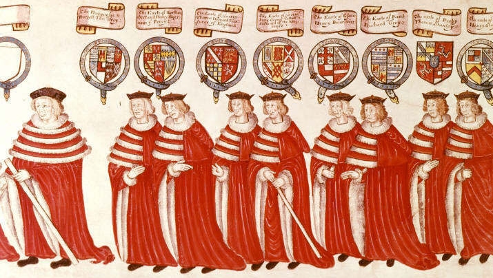
Earl () is a rank of the nobility in the United Kingdom. The title originates in the Old English word ''eorl'', meaning "a man of noble birth or rank". The word is cognate with the Scandinavian form ''jarl'', and meant "chieftain", particularly a chieftain set to rule a territory in a king's stead. After the Norman Conquest, it became the equivalent of the continental count (in England in the earlier period, it was more akin to a duke; in Scotland, it assimilated the concept of mormaer). Alternative names for the rank equivalent to "earl" or "count" in the nobility structure are used in other countries, such as the '' hakushaku'' (伯爵) of the post-restoration Japanese Imperial era. In modern Britain, an earl is a member of the peerage, ranking below a marquess and above a viscount. A feminine form of ''earl'' never developed; instead, ''countess'' is used. Etymology The term ''earl'' has been compared to the name of the Heruli, and to runic ''erilaz''. Proto-Norse ''e ... [...More Info...] [...Related Items...] OR: [Wikipedia] [Google] [Baidu] |
Shawano County, Wisconsin
Shawano County (pronounced SHAW-no) (originally Shawanaw County) is a county located in the U.S. state of Wisconsin. As of the 2020 census, the population was 40,881. Its county seat is Shawano. Shawano County is included in the Shawano, WI Micropolitan Statistical Area, which is also included in the Green Bay-Shawano, WI Combined Statistical Area. History Its name is from a modified Ojibwa term meaning "southern"; it was the southern boundary of the Ojibwa nation. A Menominee chief named ''Sawanoh'' led a band that lived in the area. Many citizens of Shawano believe the lake, county, and city (Town of Shawanaw founded 1853 and changed to Shawano in 1856), were named after Chief Sawanoh. A historical marker placed in 1958 near the lake along Highway 22 states the lake was named as the southern boundary of Chippewa (Ojibwe) territory. Various historical recordings of the spelling of Shawano include Sawanoh, Shawanaw, Sharuno, Shabin, Savannah, and Savanah. This shows the ... [...More Info...] [...Related Items...] OR: [Wikipedia] [Google] [Baidu] |
Oconto County, Wisconsin
Oconto County is a county in the U.S. state of Wisconsin. As of the 2020 census, the population was 38,965. Its county seat is Oconto. The county was established in 1851. Oconto County is part of the Green Bay, WI Metropolitan Statistical Area and the Green Bay- Shawano, WI Combined Statistical Area. History First visited by French explorers in the 17th century, Oconto County is among the oldest settlements in Wisconsin. Father Claude-Jean Allouez of the Roman Catholic Jesuit order said the first Mass in Oconto. Among the first settlers was Joseph Tourtilott, who explored much of the Oconto River watershed. Oconto County was created in 1851 and organized in 1854. Geography According to the U.S. Census Bureau, the county has a total area of , of which is land and (13%) is water. Adjacent counties * Marinette County - northeast * Door County - southeast, border is in Green Bay * Brown County - south * Shawano County - southwest * Menominee County - west * Langlade ... [...More Info...] [...Related Items...] OR: [Wikipedia] [Google] [Baidu] |
Menominee County, Wisconsin
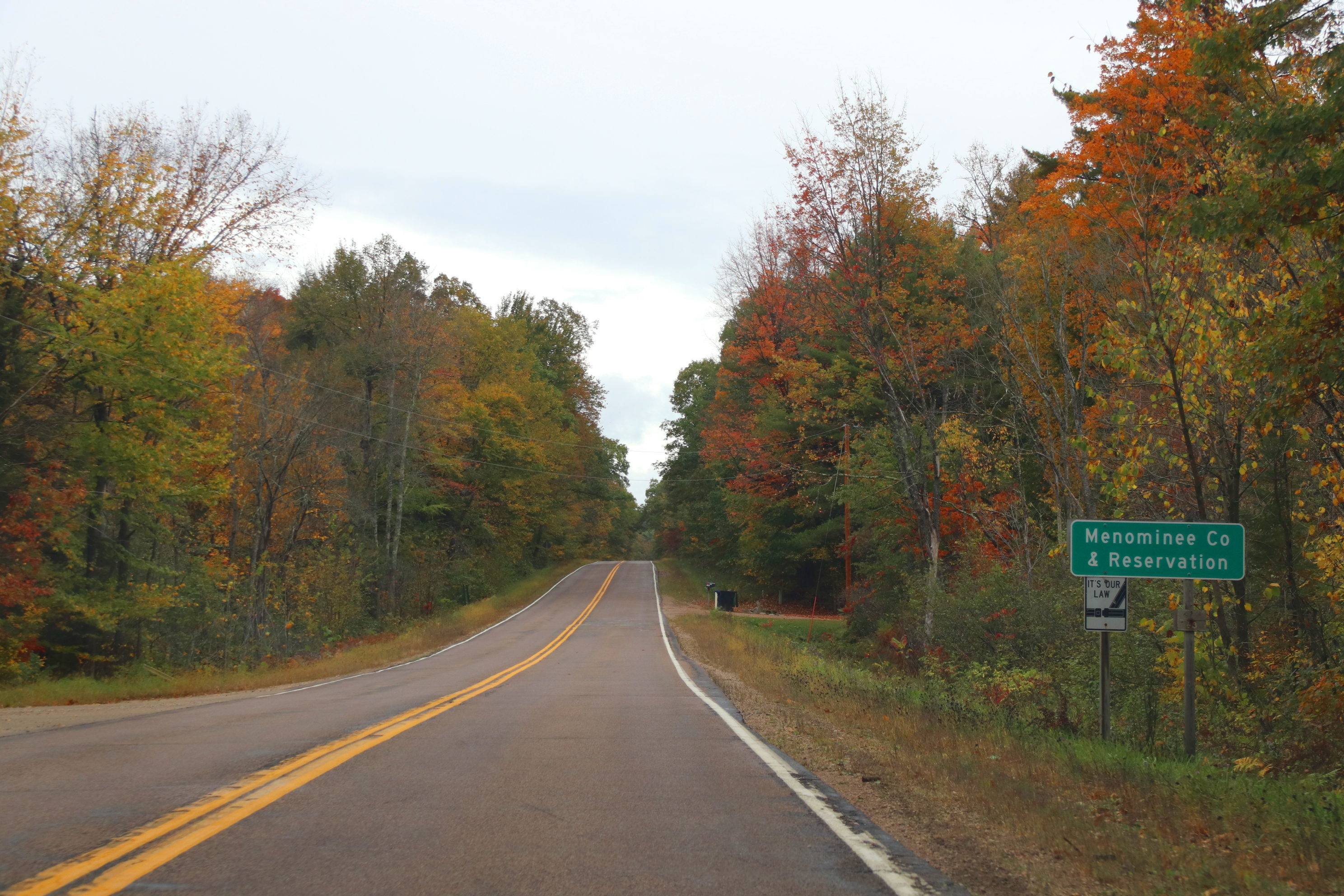
Menominee County is a county in the U.S. state of Wisconsin. As of the 2020 census, the population was 4,255, making it the least populous county in Wisconsin. Its county seat is in the community of Keshena. Menominee is Wisconsin's newest county, having been created in 1959 after recognition of the Menominee tribe was terminated by federal law. In 1974, the tribe regained federal recognition and restoration of most of its reservation. Today Menominee County is essentially coterminous with the boundaries of the federally recognized Menominee Indian Reservation. Menominee County is included in the Shawano, WI Micropolitan Statistical Area, which is also included in the Green Bay-Shawano, WI Combined Statistical Area. History The county was created from the northeastern portion of 7 townships of Shawano County and the Western 3 townships of Oconto County on July 3, 1959, in anticipation of the termination of the Menominee Indian Reservation in 1961. The reservation stat ... [...More Info...] [...Related Items...] OR: [Wikipedia] [Google] [Baidu] |
Langlade County, Wisconsin
Langlade County is a county located in the U.S. state of Wisconsin. As of the 2020 census, the population was 19,491. Its county seat is Antigo. History Langlade County was created on March 3, 1879, as New County. It was renamed Langlade County, in honor of Charles de Langlade, on February 20, 1880, and fully organized on February 19, 1881. The county's original borders extended northward from the top of Shawano County up to the Michigan state line. Between 1881 and 1885, the borders of Langlade County changed as nearby Lincoln and Shawano counties added or gave up area. Langlade lost its northernmost area along the Michigan border to Forest County when it was created in 1885. Geography According to the U.S. Census Bureau, the county has a total area of , of which is land and (1.9%) is water. The highest point in the county is at the foot of the Basswood Lookout Tower west of Summit Lake (elev:1857') Adjacent counties * Oneida County - northwest * Forest County - northe ... [...More Info...] [...Related Items...] OR: [Wikipedia] [Google] [Baidu] |
Shawano, Wisconsin
Shawano (pronounced SHAW-no) is a city in Shawano County, Wisconsin, United States. The population was 9,305 at the 2010 census. It is the county seat of Shawano County. Geography According to the United States Census Bureau, the city has a total area of , of which, is land and is water. Demographics 2010 census As of the census of 2010, there were 9,305 people, 3,960 households, and 2,299 families residing in the city. The population density was . There were 4,309 housing units at an average density of . The racial makeup of the city was 82.4% White, 0.7% African American, 12.3% Native American, 0.4% Asian, 0.1% Pacific Islander, 1.2% from other races, and 2.8% from two or more races. Hispanic or Latino of any race were 3.1% of the population. There were 3,960 households, of which 28.9% had children under the age of 18 living with them, 40.7% were married couples living together, 12.6% had a female householder with no husband present, 4.8% had a male householder with n ... [...More Info...] [...Related Items...] OR: [Wikipedia] [Google] [Baidu] |


