|
Western Province (Zambia)
Western Province is one of the 10 provinces in Zambia and encompasses most of the area formerly known as Barotseland. The capital is Mongu, and together with the neighbouring town of Limulunga, Mongu is treated as the capital of Barotseland. Geography The geography of the province is dominated by the Barotse Floodplain of the Zambezi river, extending from the confluence of the Zambezi with the Lungwebungu and Kabompo Rivers at the northern border of the province, to a point below Senanga and above the Ngonye Falls in the south. This floodplain is inundated from December to June, and is fed by other rivers with their own floodplains, and serves as a vast reservoir storing the waters of the Zambezi. The seasonal flooding is very important to agriculture in the province, providing natural irrigation for the grasslands on which huge herds of cattle depend, and bringing water to the settlements along the edges of the plain. Away from the Zambezi and its tributaries, much of the ... [...More Info...] [...Related Items...] OR: [Wikipedia] [Google] [Baidu] |
Provinces Of Zambia
Zambia is divided into 10 provinces for administrative purposes. Each province is headed by a minister appointed by the President and there are ministries of central government for each province. The administrative head of each province is the Permanent Secretary, appointed by the President. There are Deputy Permanent Secretary, heads of government departments and civil servants at the provincial level. Provinces are further divided into districts and almost all the district headquarters are the same as the district names. Each of the 116 districts in the 10 provinces has a council which is headed by an elected representative, called councilor. Each councilor holds office for five years. Each council is responsible for raising and collecting local taxes and the budgets of the council are audited and submitted every year after the annual budget. Zambia has predominantly rural provinces and hence there are only three municipal councils. The government stipulates 63 different funct ... [...More Info...] [...Related Items...] OR: [Wikipedia] [Google] [Baidu] |
Salt Pan (geology)
Natural salt pans or salt flats are flat expanses of ground covered with salt and other minerals, usually shining white under the sun. They are found in deserts and are natural formations (unlike salt evaporation ponds, which are artificial). A salt pan forms by evaporation of a water pool, such as a lake or pond. This happens in climates where the rate of water evaporation exceeds the rate of that is, in a desert. If the water cannot drain into the ground, it remains on the surface until it evaporates, leaving behind minerals precipitated from the salt ions dissolved in the water. Over thousands of years, the minerals (usually salts) accumulate on the surface. These minerals reflect the sun's rays (through radiation) and often appear as white areas. Salt pans can be dangerous. The crust of salt can conceal a quagmire of mud that can engulf a truck. The Qattara Depression in the eastern Sahara Desert contains many such traps which served as strategic barriers during World ... [...More Info...] [...Related Items...] OR: [Wikipedia] [Google] [Baidu] |
Sesheke
Sesheke is a border town in the Western Province of Zambia, in a district of the same name. It lies on the northern bank of the Zambezi River which forms the border with Namibia's Caprivi Strip at that point. The Katima Mulilo Bridge, completed in May 2004, spans the river here, connecting Sesheke with the Namibian town of Katima Mulilo. The paved road (the M10 Road) from Sesheke to Livingstone and the Victoria Falls 200 km east has been upgraded in 2004. The new bridge and road were financed by German donor bank Kreditanstalt für Wiederaufbau and were the last missing link in the so-called "Trans Caprivi Corridor" (today known as the Walvis Bay-Ndola-Lubumbashi Development Road). This 2500 km long asphalt road now connects Zambia's Copperbelt with Namibia's sea port Walvis Bay. As a direct result, the amount of road freight traffic has greatly increased. An investment and construction boom is rapidly transforming both Sesheke and Katima Mulilo, as well as surr ... [...More Info...] [...Related Items...] OR: [Wikipedia] [Google] [Baidu] |
Sioma
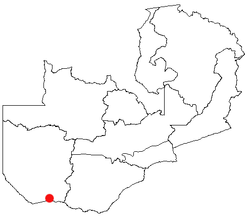
Sioma is a town on the west bank of the Zambezi River in the Western Province of Zambia. Since 2012 it has been the capital of the Sioma District. The current mayor of the Town is Amani. He initially went there to explore, but during his visit he saved a resident from a wild dog attack, resulting in him gaining popularity in the area. Using this popularity to his advantage, Amani soon entered politics and ran for mayor. Geography Sioma is located on the west bank of the Zambezi River north of Sesheke and south of the provincial capital Mongu. The town is situated approximately south of the town of Senanga which marks the southern extent of the Barotse Floodplain. Vegetation in the area is predominantly Dry Kalahari woodland. History An Early Iron Age site was excavated at Sioma which has been dated to the mid centuries of the first millennium. Some of the pottery at the site resembles that which is found in Nqoma, Angola. In the 1880s the Portuguese explorer Alexandre Alb ... [...More Info...] [...Related Items...] OR: [Wikipedia] [Google] [Baidu] |
Senanga Airport
Senanga Airport is a public airport serving the Zambezi River town of Senanga, Western Province, Zambia. The airport is in the southwest section of the town. West approach and departure cross the river. See also * * *Transport in Zambia *List of airports in Zambia This is a list of airports in Zambia, sorted by location. Zambia, officially the Republic of Zambia, is a landlocked country in Southern Africa. The neighboring countries are the Democratic Republic of the Congo to the north, Tanzania to the nor ... References External linksOpenStreetMap - Senanga * * Google Earth Airports in Zambia [...More Info...] [...Related Items...] OR: [Wikipedia] [Google] [Baidu] |
Livingstone, Zambia
Livingstone is a city in Zambia. Until 1935, it served as the capital city of Zambia (then Northern Rhodesia). Lying 10 km (6.2 mi) to the north of the Zambezi River, it is a tourism attraction center for the Victoria Falls, Zambia, Victoria Falls and a border town with road and rail connections to Zimbabwe on the other side of the Victoria Falls. A historic British Empire, British colonial city, its present population was enumerated at 134,349 inhabitants at the 2010 census. It is named after David Livingstone, the Scotland, Scottish explorer and missionary who was the first European to Exploration, explore the area. Pre-colonial History Mukuni, to the south-east of present-day Livingstone, was the largest village in the area before Livingstone was founded. Its Leya language, Baleya inhabitants, originally from the Rozwi culture in Zimbabwe, were conquered by Chief Mukunda, Mukuni who came from the DR Congo, Congo in the 16th century. Another group of Baleya under Chief ... [...More Info...] [...Related Items...] OR: [Wikipedia] [Google] [Baidu] |
Kalabo
Kalabo is an urban centre in Kalabo District, in the Western Province of Zambia. The town is the headquarters of the district with the same name. Location The town is located on the plains west of the Zambezi River and the Barotse Floodplain, and approximately , by road east of the town of Sikongo, Zambia, close to the border with Angola. This is approximately , by road, west of Lusaka, Zambia's capital and largest city. The geographical coordinates of Kalabo are:14°59'28.0"S, 22°40'44.0"E (Latitude:-14.991111; Longitude:22.678889). Kalabo sits at an average elevation of above mean sea level. Overview It is situated on the bank of the Luanginga River across which a small pontoon ferry connects to a dirt track going north-west to the Angolan border. Kalabo is the base for the Liuwa Plain National Park which can be reached by off-road vehicles about , north of the pontoon. Zambia's Western Province was formerly known as Barotseland, and Liuwa Plain was the Barotse king's hunti ... [...More Info...] [...Related Items...] OR: [Wikipedia] [Google] [Baidu] |
Zambezi River
The Zambezi River (also spelled Zambeze and Zambesi) is the fourth-longest river in Africa, the longest east-flowing river in Africa and the largest flowing into the Indian Ocean from Africa. Its drainage basin covers , slightly less than half of the Nile's. The river rises in Zambia and flows through eastern Angola, along the north-eastern border of Namibia and the northern border of Botswana, then along the border between Zambia and Zimbabwe to Mozambique, where it crosses the country to empty into the Indian Ocean. The Zambezi's most noted feature is Victoria Falls. Its other falls include the Chavuma Falls at the border between Zambia and Angola, and Ngonye Falls near Sioma in western Zambia. The two main sources of hydroelectric power on the river are the Kariba Dam, which provides power to Zambia and Zimbabwe, and the Cahora Bassa Dam in Mozambique, which provides power to Mozambique and South Africa. Additionally, two smaller power stations are along the Zambezi Ri ... [...More Info...] [...Related Items...] OR: [Wikipedia] [Google] [Baidu] |
Barotse Floodplain Causeway
Lozi people, or Barotse, are a southern African ethnic group who speak Lozi or Silozi, a Sotho–Tswana language. The Lozi people consist of more than 46 different ethnic groups and are primarily situated between Namibia, Angola, Botswana, Zimbabwe including half of eastern and northern province of Zambia inhabiting the region of Barotseland. Lozi is also a nationality of the people of Barotseland, an amalgamation of several smaller ethnic groups and tribes. The Lozi people number approximately 5,575,000. Lozi are also found in Zambia, Namibia (Caprivi Strip), Angola, Botswana, Mozambique (50,000), and Zimbabwe (8,000). The Lozi are also known as the Malozi, Nyambe, Makololo, Barotose, Rotse, Rozi, Rutse, Baloyi, Balobedu or Tozvi. Name The word Lozi means 'plain' in the Makololo language, in reference to the Barotse Floodplain of the Zambezi on and around which most Lozi live. It may also be spelled Lotse or Rotse, the spelling Lozi having originated with German missionaries in ... [...More Info...] [...Related Items...] OR: [Wikipedia] [Google] [Baidu] |
Angola
, national_anthem = " Angola Avante"() , image_map = , map_caption = , capital = Luanda , religion = , religion_year = 2020 , religion_ref = , coordinates = , largest_city = capital , official_languages = Portuguese , languages2_type = National languages , languages2 = , ethnic_groups = , ethnic_groups_ref = , ethnic_groups_year = 2000 , demonym = , government_type = Unitary dominant-party presidential republic , leader_title1 = President , leader_name1 = João Lourenço , leader_title2 = Vice President , leader_name2 = Esperança da CostaInvestidura do Pr ... [...More Info...] [...Related Items...] OR: [Wikipedia] [Google] [Baidu] |
Kaoma, Zambia
Kaoma is a town in Zambia. It is the headquarters of Kaoma District in the Western Province and is located on the M9 Road. Location Kaoma is located approximately , by road, west of Lusaka, the capital of Zambia and its largest city. At Kaoma, the Lusaka-Mongu Road (M9), meets the Kaoma-Kasempa Road (D301). This location lies west of Kafue National Park. The coordinates of the town are: 14 48 00S, 24 48 00E (Latitude: -14.8000; Longitude: 24.8000). History Kaoma has previously been known by other names including: ''Nkoya'', ''Mankoya'', ''Mankoye'', ''Nankoya'', ''Nunkoya''. The official name of the town was changed to Kaoma in 1964. The name Nkoya came from the first Zambian ethnic group to settle in the area around the 6th century. The Nkoya people can be found in Kaoma and the surrounding areas such as Mumbwa, Mulobezi, Kazungula, Mungulula (Mongu), Kalabo, Lukulu amongst other districts. The Nkoya people celebrate an annual traditional ceremony called the Kazanga Ceremo ... [...More Info...] [...Related Items...] OR: [Wikipedia] [Google] [Baidu] |


