|
Waikato District Health Board
The Waikato District Health Board (Waikato DHB) is a district health board with the focus on providing healthcare to the Waikato region of New Zealand. History The Waikato District Health Board, like most other district health boards, came into effect on 1 January 2001 established by the New Zealand Public Health and Disability Act 2000. 2021 Ransomware attack In mid-May 2021, the Waikato District Health Board's hospital computer systems and phone lines were affected by a ransomware attack. On 25 May, an unidentified group claimed responsibility for the hack and issued an ultimatum to the Waikato DHB, having obtained sensitive data about patients, staff and finances. Hackers later dumped confidential medical, financial and patients' data onto the dark web, forcing the DHB to work with cyber-experts to minimise any potential privacy disclosures. The Waikato DHB and New Zealand Government ruled out paying the ransom. By mid-June 2021, the Waikato DHB had managed to restore most ... [...More Info...] [...Related Items...] OR: [Wikipedia] [Google] [Baidu] |
Waikato Hospital
Waikato Hospital is a major regional hospital in Hamilton, New Zealand, Hamilton, New Zealand. It provides specialised and emergency healthcareWaikato Hospital (from the Waikato District Health Board website. Retrieved 2007-10-09.) for the Midlands and Waikato area with patients referred there from feeder hospitals like Whakatāne Hospital, Whakatāne, Lakes area, Tauranga, Thames, New Zealand, Thames, Tokoroa and Rotorua.Waikato Hospital in Overload for Fourth Day in Row - Waikato District Health Board media release, via ''Scoop'', 10 August 2007 Facilities Waikato District Health Board employs more than 6000 people and plans, funds and pr ...[...More Info...] [...Related Items...] OR: [Wikipedia] [Google] [Baidu] |
2006 New Zealand Census
The New Zealand Census of Population and Dwellings ( mi, Te Tatauranga o ngā Tāngata Huri Noa i Aotearoa me ō rātou Whare Noho) is a national population and housing census conducted by government department Statistics New Zealand every five years. There have been 34 censuses since 1851. In addition to providing detailed information about national demographics, the results of the census play an important part in the calculation of resource allocation to local service providers. The 2018 census took place on Tuesday 6 March 2018. The next census is expected in March 2023. Census date Since 1926, the census has always been held on a Tuesday and since 1966, the census always occurs in March. These are statistically the month and weekday on which New Zealanders are least likely to be travelling. The census forms have to be returned by midnight on census day for them to be valid. Conducting the census Until 2018, census forms were hand-delivered by census workers during the lead ... [...More Info...] [...Related Items...] OR: [Wikipedia] [Google] [Baidu] |
Tokoroa
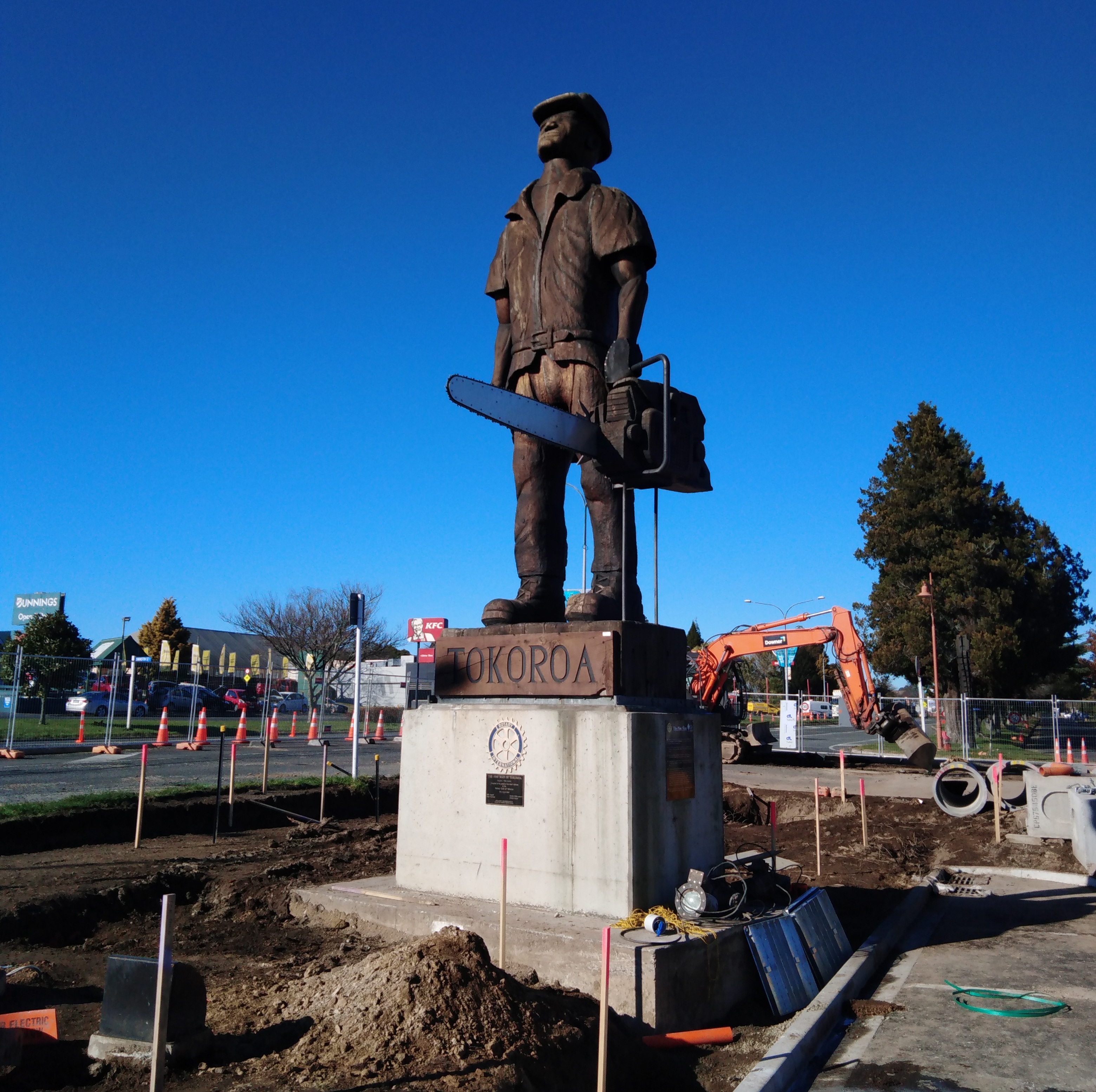
Tokoroa ( mi, Te Kaokaoroa o Pātetere) is the fifth-largest town in the Waikato region of the North Island of New Zealand and largest settlement in the South Waikato District. Located 30 km southwest of Rotorua, close to the foot of the Mamaku Ranges, it is midway between Taupo and Hamilton on State Highway 1. History and culture Early history Tokoroa was the name of a chief of the Ngāti Kahupungapunga, who was slain by Raukawa during the siege of Pōhaturoa, a volcanic plug adjacent to Atiamuri, 27 km south of Tokoroa. This battle took place around 1600 as the Ngāti Raukawa moved into the southern Waikato. The name ''Tokoroa'' first appeared on the early maps of the 1860s, although this was for an area 50 km north east of today's Tokoroa. Foundations, growth and decline Tokoroa is one of the most recent towns in New Zealand history. The township was established (circa) 1917 by the Matarawa Land Company as a potential farming area; a few families had al ... [...More Info...] [...Related Items...] OR: [Wikipedia] [Google] [Baidu] |
Thames-Coromandel District
The Thames-Coromandel District is a territorial authority district in the North Island of New Zealand, covering all the Coromandel Peninsula and extending south to Hikutaia. It is administered by the Thames-Coromandel District Council, which has its seat in the town of Thames. It was the first district council to be formed in New Zealand, being constituted in 1975. The district lies within the Waikato Regional Council area. Its only land boundary is with Hauraki District. Demographics The district had a population of live in Thames, in Whitianga, in Whangamatā, and in Coromandel. Thames-Coromandel District covers and had an estimated population of as of with a population density of people per km2. Thames-Coromandel District had a population of 29,895 at the 2018 New Zealand census, an increase of 3,717 people (14.2%) since the 2013 census, and an increase of 3,957 people (15.3%) since the 2006 census. There were 12,471 households, comprising 14,625 males and 15,27 ... [...More Info...] [...Related Items...] OR: [Wikipedia] [Google] [Baidu] |
Thames, New Zealand
Thames () ( mi, Pārāwai) is a town at the southwestern end of the Coromandel Peninsula in New Zealand's North Island. It is located on the Firth of Thames close to the mouth of the Waihou River. The town is the seat of the Thames-Coromandel (district), New Zealand, Thames-Coromandel District Council. The Māori people, Māori iwi are Ngāti Maru (Hauraki), Ngāti Maru, who are descendants of Marutuahu's son Te Ngako. Ngāti Maru is part of the Ngati Marutuahu confederation of tribes or better known as Hauraki Iwi. Thames had an estimated population of 15,000 in 1870, but this declined to 4,500 in 1881, and it has increased modestly since. It is still the biggest town on the Coromandel. Until 2016, a historical Oak, oak tree that was planted by Governor George Grey stood on the corner of Grey and Rolleston streets. Demographics Thames covers and had an estimated population of as of with a population density of people per km2. Thames had a population of 7,293 at the 2018 Ne ... [...More Info...] [...Related Items...] OR: [Wikipedia] [Google] [Baidu] |
Matamata-Piako District
Matamata-Piako District is a local government area in the Waikato region of New Zealand. It lies to the east of the city of Hamilton. Geography The district encompasses the southern end of the Hauraki Plains and much of the Thames Valley, and is bounded in the east by the Kaimai Range. The rivers Piako and Waihou run through the district. The towns of Matamata, Morrinsville and Te Aroha are all within the district, with the Council's head office based in Te Aroha. The main industry in the region is dairy farming and Thoroughbred breeding and training. Other communities in the district include Mangateparu and Waitoa. Populated places Matamata-Piako District consists of the following towns, localities, settlements and communities: * Matamata Ward: ** Buckland ** Gordon ** Hinuera ** Matai ** Matamata ** Okauia South ** Okauia ** Paratu ** Peria ** Piarere ** Richmond Downs ** Selwyn ** Taihoa ** Tamihana ** Te Poi ** Turangaomoana ** ''Waharoa'' ** Walton ** Wardvi ... [...More Info...] [...Related Items...] OR: [Wikipedia] [Google] [Baidu] |
Morrinsville
Morrinsville is a provincial town in the Waikato region of New Zealand's North Island, with an estimated population of as of The town is located at the northern base of the Pakaroa Range, and on the south-western fringe of the Hauraki Plains. Morrinsville is around 33 kilometres east of Hamilton and 22 kilometres west of Te Aroha. The town is bordered by the Piako River to the east and the Waitakaruru Stream to the south. History and Culture Pre-European settlement Prior to European settlement of New Zealand, the hills around present-day Morrinsville were occupied by the Ngati Werewere Māori people of the Ngati Haua Iwi, and the site of the present-day town was on or near to an old Māori route between the upper Waihou-Piako basin and the Ngāruawāhia area. Following European settlement, some early European traders are believed to have traversed this route prior to 1834 when the Rev. J. Morgan travelled up the Piako River to near the future town site and crossed west ... [...More Info...] [...Related Items...] OR: [Wikipedia] [Google] [Baidu] |
Waipa District
Waipa District is a municipality in the Waikato region of New Zealand that is administered by the Waipa District Council. Its most populous town is Cambridge. The seat of the council is at the second most populous town, Te Awamutu. The district is south and south-east of the city of Hamilton. It has five wards: Te Awamutu, Cambridge, Pirongia, Maungatautari and Kakepuku. Although the official name remains Waipa District, the council sought in 2020 a simpler means of changing to Waipā District, which is the orthographic form it uses. History The District was formed from Waipa County Council and its town boroughs in 1989. The county boundaries had varied since five ridings were formed in Waipa county in 1876: Newcastle, Hamilton, Mangapiko North and South, Rangiaowhia, and Pukekura. In 1902 it covered and had an additional riding, Tuhikaramea. In 1923 Waipa County covered and had a population of 9,275, with of gravel roads, of mud roads and of tracks. Geography The Waikato ... [...More Info...] [...Related Items...] OR: [Wikipedia] [Google] [Baidu] |
Te Awamutu
Te Awamutu is a town in the Waikato region in the North Island of New Zealand. It is the council seat of the Waipa District and serves as a service town for the farming communities which surround it. Te Awamutu is located some south of Hamilton on State Highway 3, one of the two main routes south from Auckland and Hamilton. Te Awamutu has a population of making it the fifth-largest urban area in the Waikato behind Hamilton, Taupō, Cambridge and Tokoroa. The town is often referred to as "The Rose Town of New Zealand" because of its elaborate rose gardens in the centre of the town. Many local businesses use "Rosetown" in their name, and the symbol of the rose is widely used on local signs and billboards. The local paper, ''Te Awamutu Courier'', has a symbol of a rose in the masthead on its front page. History and culture Tainui Maori first settled in the area in about 1450, according to noted Tainui historian Te Hurinui-Jones. Te Awamutu means "the river cut short", as it ... [...More Info...] [...Related Items...] OR: [Wikipedia] [Google] [Baidu] |
Waitomo District
Waitomo District is a territorial authority, located in the Waikato region, at the north of the King Country area in the North Island of New Zealand. A small part of the district, the locality of Tiroa, however, lies in the Manawatū-Whanganui region. The District covers the west coast from Te Maika, on Kawhia Harbour, to the north of Taharoa, to Mokau in the south and extends inland to Maniaiti / Benneydale and Mount Pureora. Demographics Waitomo District covers and had an estimated population of as of with a population density of people per km2. Waitomo District had a population of 9,303 at the 2018 New Zealand census, an increase of 396 people (4.4%) since the 2013 census, and a decrease of 135 people (−1.4%) since the 2006 census. There were 3,384 households, comprising 4,695 males and 4,605 females, giving a sex ratio of 1.02 males per female. The median age was 38.2 years (compared with 37.4 years nationally), with 2,082 people (22.4%) aged under 15 years, 1, ... [...More Info...] [...Related Items...] OR: [Wikipedia] [Google] [Baidu] |
Braemar Hospital
Braemar Hospital is one of the New Zealand's largest private hospitals. It is owned by the Braemar Charitable Trust located in Hamilton, New Zealand. There was a separate and unrelated organisation, Braemar Hospital in Nelson, New Zealand which provided long term psychiatric care for children. It was founded in 1926 and moved from Lake Road in 2009. The hospital is located on Ohaupo Road, Melville. It carries out 10,000 surgical and medical procedures a year. It started a bowel-cancer screening service in 2014. In 2015 it had 85 beds, eight theatres and two endoscopy units. It was the first private hospital in New Zealand to offer endoscopic ultrasound and the first hospital in Australasia to install ultra high-definition imaging tools in the operating theatres, which enabled it to expand the range of keyhole surgery. It says that the fees charged "are very reasonable and any surplus we make goes back into the hospital or the charitable activities that we do, like supplying ... [...More Info...] [...Related Items...] OR: [Wikipedia] [Google] [Baidu] |


