|
WOEID
A WOEID (Where On Earth IDentifier) is a unique 32-bit reference identifier, originally defined by GeoPlanet and now assigned by Yahoo!, that identifies any feature on Earth. In 2009, Yahoo! released GeoPlanet's WOEID data to the public, with the last release on 1 June 2012, after which Yahoo! decided to cease making the data downloadable until they "determine a better way to surface the data as a part of the service". WOEIDs are used by a number of other projects, including Flickr, OpenStreetMap, TwitterWOEID Search EngineanNations24 WOEID of some popular locations on Earth From WOEID Search Engine: * 4118 - Toronto * 44418 - London * 615702 - Paris * 2295019 - New Delhi * 2295380 - Varanasi * 2442047 - Los Angeles * 2459115 - New York * 2487956 - San Francisco * 23424851 - Iran * 29128560 - Kaithi Example E.g. Berlin does not know about Germany, which itself doesn't know about Europe and so forth. GeoPlanet records, or places as they are calle ... [...More Info...] [...Related Items...] OR: [Wikipedia] [Google] [Baidu] |
GeoPlanet
GeoPlanet is a computer platform for coordinating world-wide geographic information, and providing both text and cartographic output, such as digital maps for any location in the world. It provides a location infrastructure for search engines, portals and both Web and WAP sites. It was developed by GDC, a London-based geographic information company, which was acquired by Whereonearth in 1998. When Whereonearth spun off GDC in 2002, it kept GeoPlanet. When Yahoo! purchased Whereonearth in 2005, it acquired GeoPlanet. An integral part of GeoPlanet is the WOEID A WOEID (Where On Earth IDentifier) is a unique 32-bit reference identifier, originally defined by GeoPlanet and now assigned by Yahoo!, that identifies any feature on Earth. In 2009, Yahoo! released GeoPlanet's WOEID data to the public, with the ... (Where On Earth IDentifier), a unique 32-bit reference identifier, now assigned by Yahoo!, that identifies any feature on Earth. In addition to the strict numerical WOEID, GeoPl ... [...More Info...] [...Related Items...] OR: [Wikipedia] [Google] [Baidu] |
List Of Geocoding Systems
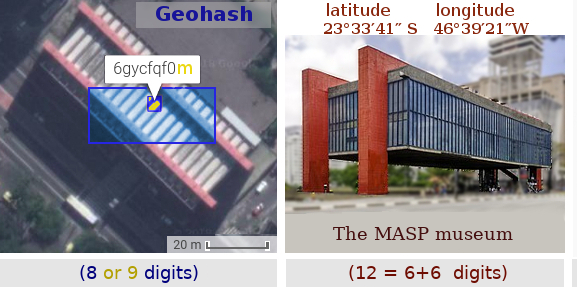
A geocode is a code that represents a geographic entity (location or object). It is a unique identifier of the entity, to distinguish it from others in a finite set of geographic entities. In general the ''geocode'' is a human-readable and short identifier. Typical geocodes and entities represented by it: * ''Country code'' and subdivision code. Polygon of the administrative boundaries of a country or a subdivision. The main examples are ISO codes: ISO 3166-1 alpha-2 code (e.g. AF for Afghanistan or BR for Brazil), and its subdivision conventions, such as subdivision codes (e.g. AF-GHO for Ghor province) or subdivision codes (e.g. BR-AM for Amazonas state). * ''DGG cell ID''. Identifier of a cell of a discrete global grid: a Geohash code (e.g. ~0.023 km2 cell 6vjyngd at the Brazilian's center) or an OLC code (e.g. ~0.004 km2 cell 58PJ642P+4 at the same point). * ''Postal code''. Polygon of a postal area: a CEP code (e.g. 70040 represents a Brazilian's ... [...More Info...] [...Related Items...] OR: [Wikipedia] [Google] [Baidu] |
Yahoo!
Yahoo! (, styled yahoo''!'' in its logo) is an American web services provider. It is headquartered in Sunnyvale, California and operated by the namesake company Yahoo Inc., which is 90% owned by investment funds managed by Apollo Global Management and 10% by Verizon Communications. It provides a web portal, search engine Yahoo Search, and related services, including My Yahoo!, Yahoo Mail, Yahoo News, Yahoo Finance, Yahoo Sports and its advertising platform, Yahoo! Native. Yahoo was established by Jerry Yang and David Filo in January 1994 and was one of the pioneers of the early Internet era in the 1990s. However, usage declined in the late 2000s as some services discontinued and it lost market share to Facebook and Google. History Founding In January 1994, Yang and Filo were electrical engineering graduate students at Stanford University, when they created a website named "Jerry and David's guide to the World Wide Web". The site was a human-edited web directory, or ... [...More Info...] [...Related Items...] OR: [Wikipedia] [Google] [Baidu] |
Flickr
Flickr ( ; ) is an American image hosting and video hosting service, as well as an online community, founded in Canada and headquartered in the United States. It was created by Ludicorp in 2004 and was a popular way for amateur and professional photographers to host high-resolution photos. It has changed ownership several times and has been owned by SmugMug since April 20, 2018. Flickr had a total of 112 million registered members and more than 3.5 million new images uploaded daily. On August 5, 2011, the site reported that it was hosting more than 6 billion images. Photos and videos can be accessed from Flickr without the need to register an account, but an account must be made to upload content to the site. Registering an account also allows users to create a profile page containing photos and videos that the user has uploaded and also grants the ability to add another Flickr user as a contact. For mobile users, Flickr has official mobile apps for iOS, Android, and an op ... [...More Info...] [...Related Items...] OR: [Wikipedia] [Google] [Baidu] |
OpenStreetMap
OpenStreetMap (OSM) is a free, open geographic database updated and maintained by a community of volunteers via open collaboration. Contributors collect data from surveys, trace from aerial imagery and also import from other freely licensed geodata sources. OpenStreetMap is freely licensed under the Open Database License and as a result commonly used to make electronic maps, inform turn-by-turn navigation, assist in humanitarian aid and data visualisation. OpenStreetMap uses its own topology to store geographical features which can then be exported into other GIS file formats. The OpenStreetMap website itself is an online map, geodata search engine and editor. In 2004, OpenStreetMap was created by Steve Coast in response to the Ordnance Survey, the United Kingdom's national mapping agency, failing to release its data to the public and under free licences. Initially, maps were created only via GPS traces, but it was quickly populated by importing public domain geographical ... [...More Info...] [...Related Items...] OR: [Wikipedia] [Google] [Baidu] |
Twitter
Twitter is an online social media and social networking service owned and operated by American company Twitter, Inc., on which users post and interact with 280-character-long messages known as "tweets". Registered users can post, like, and 'Reblogging, retweet' tweets, while unregistered users only have the ability to read public tweets. Users interact with Twitter through browser or mobile Frontend and backend, frontend software, or programmatically via its APIs. Twitter was created by Jack Dorsey, Noah Glass, Biz Stone, and Evan Williams (Internet entrepreneur), Evan Williams in March 2006 and launched in July of that year. Twitter, Inc. is based in San Francisco, California and has more than 25 offices around the world. , more than 100 million users posted 340 million tweets a day, and the service handled an average of 1.6 billion Web search query, search queries per day. In 2013, it was one of the ten List of most popular websites, most-visited websites and has been de ... [...More Info...] [...Related Items...] OR: [Wikipedia] [Google] [Baidu] |
Discrete Global Grid
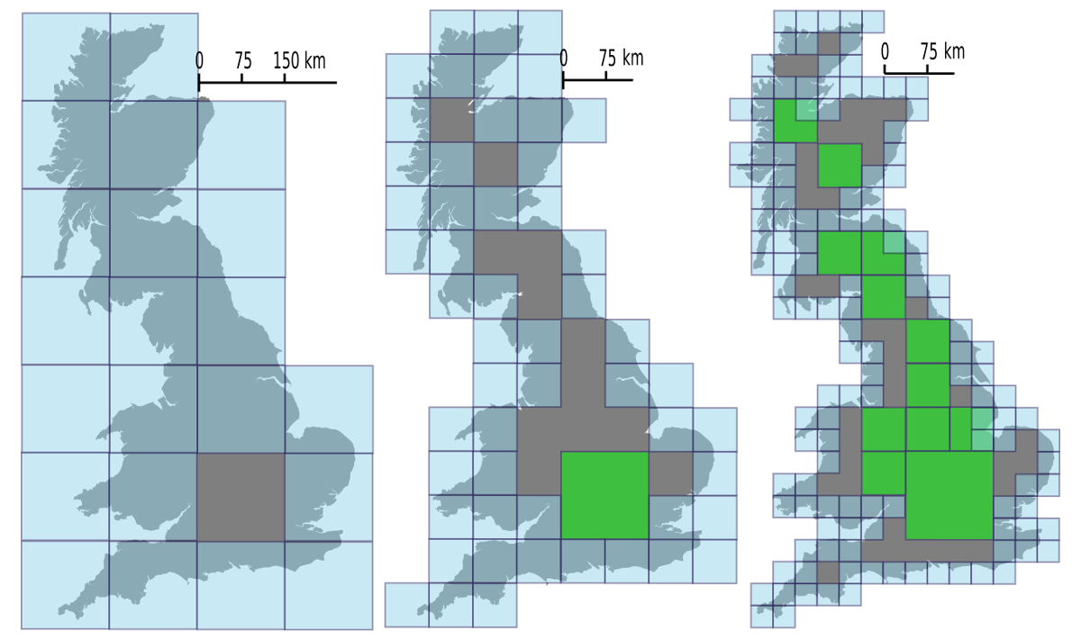
A discrete global grid (DGG) is a mosaic that covers the entire Earth's surface. Mathematically it is a space partitioning: it consists of a set of non-empty regions that form a partition of the Earth's surface. In a usual grid-modeling strategy, to simplify position calculations, each region is represented by a point, abstracting the grid as a set of region-points. Each region or region-point in the grid is called a cell. When each cell of a grid is subject to a recursive partition, resulting in a "series of discrete global grids with progressively finer resolution", forming a hierarchical grid, it is called a hierarchical DGG (sometimes "global hierarchical tessellation" or "DGG system"). Discrete global grids are used as the geometric basis for the building of geospatial data structures. Each cell is related with data objects or values, or (in the hierarchical case) may be associated with other cells. DGGs have been proposed for use in a wide range of geospatial applicati ... [...More Info...] [...Related Items...] OR: [Wikipedia] [Google] [Baidu] |
Geographic Object Identifiers
Geography (from Greek: , ''geographia''. Combination of Greek words ‘Geo’ (The Earth) and ‘Graphien’ (to describe), literally "earth description") is a field of science devoted to the study of the lands, features, inhabitants, and phenomena of Earth. The first recorded use of the word γεωγραφία was as a title of a book by Greek scholar Eratosthenes (276–194 BC). Geography is an all-encompassing discipline that seeks an understanding of Earth and its human and natural complexities—not merely where objects are, but also how they have changed and come to be. While geography is specific to Earth, many concepts can be applied more broadly to other celestial bodies in the field of planetary science. One such concept, the first law of geography, proposed by Waldo Tobler, is "everything is related to everything else, but near things are more related than distant things." Geography has been called "the world discipline" and "the bridge between the human and th ... [...More Info...] [...Related Items...] OR: [Wikipedia] [Google] [Baidu] |


