|
Vranja
Vranja ( it, Aurania) is a village in the municipality of Lupoglav, in Istria County, Croatia , image_flag = Flag of Croatia.svg , image_coat = Coat of arms of Croatia.svg , anthem = "Lijepa naša domovino"("Our Beautiful Homeland") , image_map = , map_caption = , capit .... In 2011, the village had 98 residents. References Populated places in Istria County {{Istria-geo-stub ... [...More Info...] [...Related Items...] OR: [Wikipedia] [Google] [Baidu] |
Lupoglav, Istria County
Lupoglav ( it, Lupogliano) is a village and municipality in Istria, Croatia. The village population is 288, with a total of 924 in the municipality (2011). The Lupoglav Municipality is situated on the northeast of the Istrian Region. To the east it borders with the Primorsko-Goranska County and with the Istrian municipalities of Lanišće and Cerovlje and the City of Buzet. The municipality is crossed by the arterial roads that connect the Istrian region with the rest of Croatia – the Istrian Y and the tunnel of Učka. The municipality has a surface area of 92.19 km2, i.e. it accounts for 3.27% of the territory of the Istrian Region. The Castle Mahrenfels which belonged to the family Herberstein and later to the counts Brigido is situated over the village. The settlements in the municipality are as follows: * Boljun Boljun ( it, Bogliuno) is a village in the municipality of Lupoglav, in Istria County, Croatia , image_flag = Flag of Croatia.svg , ima ... [...More Info...] [...Related Items...] OR: [Wikipedia] [Google] [Baidu] |
Istria County
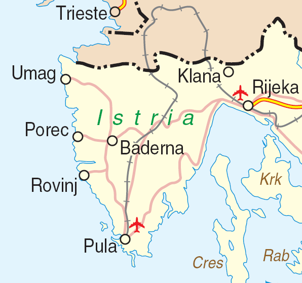
Istria County (; hr, Istarska županija; it, Regione istriana, "Istrian Region") is the westernmost county of Croatia which includes the biggest part of the Istrian peninsula ( out of , or 89%). Administrative centers in the county are Pazin, Pula and Poreč. Istria County is the most prominent Italian-speaking part of Croatia. History The caves near Pula (in latinium ''Pietas Julia''), ''Lim fjord'', ''Šandalja'', and ''Roumald's cave'', house Stone Age archaeological remains. Less ancient Stone Age sites, from the period between 6000 and 2000 BC can also be found in the area. More than 400 locations are classified as Bronze Age (1800–1000 BC) items. Numerous findings including weapons, tools, and jewelry) which are from the earlier iron era around the beginning of common era. The Istrian peninsula was known to Romans as the ''terra magica''. Its name is derived from the Histri, an Illyrian tribe who as accounted by the geographer Strabo lived in the region. Roma ... [...More Info...] [...Related Items...] OR: [Wikipedia] [Google] [Baidu] |
Croatia
, image_flag = Flag of Croatia.svg , image_coat = Coat of arms of Croatia.svg , anthem = "Lijepa naša domovino"("Our Beautiful Homeland") , image_map = , map_caption = , capital = Zagreb , coordinates = , largest_city = capital , official_languages = Croatian , languages_type = Writing system , languages = Latin , ethnic_groups = , ethnic_groups_year = 2021 , religion = , religion_year = 2021 , demonym = , government_type = Unitary parliamentary republic , leader_title1 = President , leader_name1 = Zoran Milanović , leader_title2 = Prime Minister , leader_name2 = Andrej Plenković , leader_title3 = Speaker of Parliament , leader_name3 = Gordan Jandroković , legislature = Sabor , sovereignty_type ... [...More Info...] [...Related Items...] OR: [Wikipedia] [Google] [Baidu] |
.jpg)
