|
Vogeltown (Wellington)
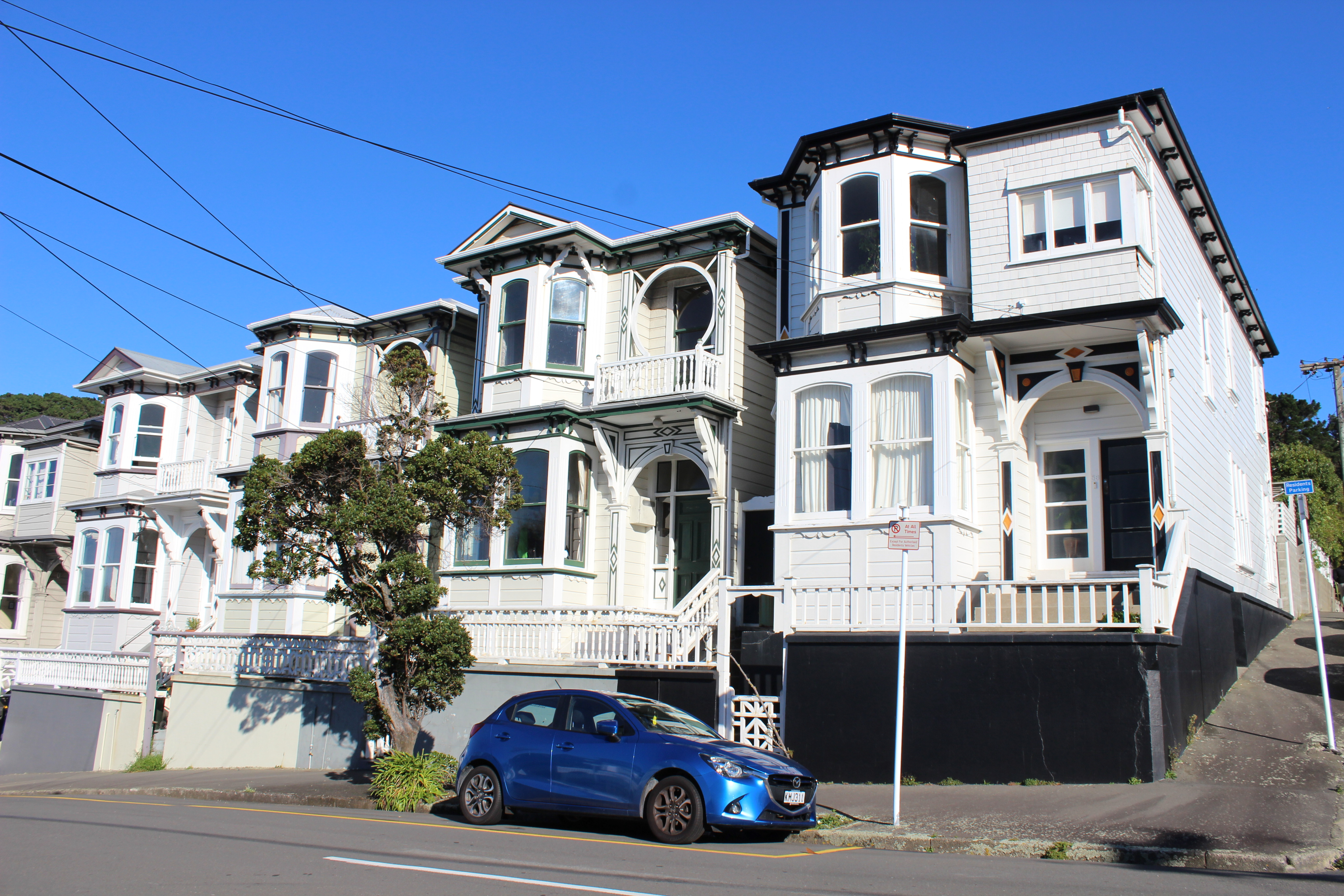
Vogeltown is a hillside suburb of Wellington, New Zealand, on the eastern slopes of Brooklyn, Wellington, Brooklyn and overlooking Newtown, New Zealand, Newtown. It is sometimes considered part of Mornington, Wellington, Mornington. In later Maori times parts of the area now occupied by Vogeltown and eastern Brooklyn were used for cultivation by the Te Aro hapu (sub-tribe) of the Te Atiawa, the dominant tribe in the region. In European times the area became known as the Omaroro cultivation area, and control and ownership remained with Te Aro. The area primarily used for cultivation were located north of Pearce Street on what is now part of Wellington town belt, Wellington's Town Belt and this area is a protected site under the Town Belt Management Plan and the Wellington District Plan. There is no record of alienation of the land from the original owners until 25 March 1859, when the Te Aro people led by Mohi Ngaponga leased the section to one John H E Wright for 14 years a ... [...More Info...] [...Related Items...] OR: [Wikipedia] [Google] [Baidu] |
Mount Cook, Wellington
Mount Cook is an inner suburb of the metropolitan area of Wellington, The North Island, New Zealand, 1.74 km dead south of Wellington's Central Business District. Its local constituency area is the Wellington Central, and is part of the City of Wellington local government area. The suburb stands on the southern fringe of the central city alongside Te Aro and to the north of Newtown. History After being settled by Maori since roughly 1000 CE, the Mount Cook area was situated on a fertile hill, just south of Te Aro Pā. The hill was the origin-point of the original survey marks through Wellington. It was given its current name by the New Zealand Company, after Captain James Cook (the mountain in the South Island was named separately), and was the suite of a large British military base, and later a prison that was "loathed by Wellingtonians", and demolished in 1931. During the Victorian and Edwardian eras, Mt Cook became a favoured suburb of Wellington's elite, and many ... [...More Info...] [...Related Items...] OR: [Wikipedia] [Google] [Baidu] |
Newtown, Wellington
The suburb of Newtown lies in the southern part of Wellington in New Zealand. It lies east of Vogeltown, between Mount Cook and Berhampore. The main thoroughfares of Newtown are Riddiford St, leading from Mount Cook to Berhampore and Melrose, and Constable St, leading from Newtown to Kilbirnie. History Originally a working-class suburb, Newtown has followed gentrification trends in recent years, attracting large numbers of immigrants, students and young professionals and resulting in an ethnically diverse population. The Wellington City Council District Plan identifies Newtown as a suburb with an "identifiable or distinct character".''Newtown! Community in a Wellington Suburb'' edited by Martin Doyle (1998, Wellington Safer Community Council, Wellington City Council) Demographics Newtown, comprising the statistical areas of Newtown North, Newtown West and Newtown South, covers . It had an estimated population of as of with a population density of people per km2. Newt ... [...More Info...] [...Related Items...] OR: [Wikipedia] [Google] [Baidu] |
Berhampore, New Zealand
Berhampore is a suburb of Wellington, New Zealand. It lies towards the south of the city, four kilometres from the city centre, and two kilometres from the coast of Cook Strait. It is surrounded by the suburbs of Vogeltown, Newtown, Melrose, Island Bay, Kingston, and Mornington. The suburb was named after Berhampore in Bengal, one of the battlefields at the start of the Battle of Plassey of 1757. Also surrounding Berhampore is the Berhampore Golf Course as well as a very extensive green belt (known as the town belt) with many walkways In American English, walkway is a composite or umbrella term for all engineered surfaces or structures which support the use of trails. ''The New Oxford American Dictionary'' also defines a walkway as "a passage or path for walking along, esp. a ... and trail, tracks connecting outlying areas. The suburb also boasts some of Wellington's best all weather sports fields, on Adelaide Road and the national hockey stadium. Alongside the golf cou ... [...More Info...] [...Related Items...] OR: [Wikipedia] [Google] [Baidu] |
Mornington, Wellington
Mornington is a suburb of Wellington, New Zealand, on the southern hills behind Brooklyn. It is named after the Duke of Wellington's father, the Earl of Mornington. The original Mornington is in County Meath, and was the Irish seat of the Duke's father. It was named in 1878 from the time when J.F.E. Wright (1827-1891) subdivided his land in the south-west of the city in partnership with Jacob Joseph, and created the suburbs of Mornington and Vogeltown. Demographics Kingston-Mornington-Vogeltown statistical area, which includes Kingston and Vogeltown, covers . It had an estimated population of as of with a population density of people per km2. Kingston-Mornington-Vogeltown had a population of 3,165 at the 2018 New Zealand census, an increase of 237 people (8.1%) since the 2013 census, and an increase of 276 people (9.6%) since the 2006 census 6 (six) is the natural number following 5 and preceding 7. It is a composite number and the smallest perfect number. In math ... [...More Info...] [...Related Items...] OR: [Wikipedia] [Google] [Baidu] |
Brooklyn, Wellington
Brooklyn is a suburb of Wellington, the capital city of New Zealand. Geography Location Brooklyn is 3 km south of Wellington's central business district on the eastern slopes of the hills above Happy Valley. Nearby suburbs and areas include: * To the north: Aro Valley and Highbury * To the east: Mount Cook * To the south: Vogeltown, Mornington and Ōwhiro Bay * To the west: Kowhai Park, Panorama Heights, Mitchelltown, Karori. Parks and Town Belt Central Park Central Park (named after the area of the same name in New York) separates Brooklyn from the city. Established in 1913 on Town Belt land, the park features a set of wrought-iron gates at its main entrance: the then Mayor, John Pearce Luke donated them in 1920. During World War II, American forces established a military camp in the park between 1942 and 1944. In October 1942 building work started with an initial requirement to accommodate 416 men of the US Marine Corps. The partly built camp could a ... [...More Info...] [...Related Items...] OR: [Wikipedia] [Google] [Baidu] |
Wellington
Wellington ( mi, Te Whanganui-a-Tara or ) is the capital city of New Zealand. It is located at the south-western tip of the North Island, between Cook Strait and the Remutaka Range. Wellington is the second-largest city in New Zealand by metro area, and is the administrative centre of the Wellington Region. It is the world's southernmost capital of a sovereign state. Wellington features a temperate maritime climate, and is the world's windiest city by average wind speed. Legends recount that Kupe discovered and explored the region in about the 10th century, with initial settlement by Māori iwi such as Rangitāne and Muaūpoko. The disruptions of the Musket Wars led to them being overwhelmed by northern iwi such as Te Āti Awa by the early 19th century. Wellington's current form was originally designed by Captain William Mein Smith, the first Surveyor General for Edward Wakefield's New Zealand Company, in 1840. The Wellington urban area, which only includes urbanised ar ... [...More Info...] [...Related Items...] OR: [Wikipedia] [Google] [Baidu] |
New Zealand
New Zealand ( mi, Aotearoa ) is an island country in the southwestern Pacific Ocean. It consists of two main landmasses—the North Island () and the South Island ()—and over 700 smaller islands. It is the sixth-largest island country by area, covering . New Zealand is about east of Australia across the Tasman Sea and south of the islands of New Caledonia, Fiji, and Tonga. The country's varied topography and sharp mountain peaks, including the Southern Alps, owe much to tectonic uplift and volcanic eruptions. New Zealand's capital city is Wellington, and its most populous city is Auckland. The islands of New Zealand were the last large habitable land to be settled by humans. Between about 1280 and 1350, Polynesians began to settle in the islands and then developed a distinctive Māori culture. In 1642, the Dutch explorer Abel Tasman became the first European to sight and record New Zealand. In 1840, representatives of the United Kingdom and Māori chiefs ... [...More Info...] [...Related Items...] OR: [Wikipedia] [Google] [Baidu] |
Newtown, New Zealand
The suburb of Newtown lies in the southern part of Wellington in New Zealand. It lies east of Vogeltown (Wellington), Vogeltown, between Mount Cook, Wellington, Mount Cook and Berhampore, New Zealand, Berhampore. The main thoroughfares of Newtown are Riddiford St, leading from Mount Cook to Berhampore and Melrose, and Constable St, leading from Newtown to Kilbirnie, New Zealand, Kilbirnie. History Originally a working class, working-class suburb, Newtown has followed gentrification trends in recent years, attracting large numbers of immigrants, students and young professionals and resulting in an ethnically diverse population. The Wellington City Council District Plan identifies Newtown as a suburb with an "identifiable or distinct character".''Newtown! Community in a Wellington Suburb'' edited by Martin Doyle (1998, Wellington Safer Community Council, Wellington City Council) Demographics Newtown, comprising the statistical areas of Newtown North, Newtown West and Newtown ... [...More Info...] [...Related Items...] OR: [Wikipedia] [Google] [Baidu] |
Julius Vogel
Sir Julius Vogel (24 February 1835 – 12 March 1899) was the eighth premier of New Zealand. His administration is best remembered for the issuing of bonds to fund railway construction and other public works. He was the first Jewish prime minister of New Zealand. Historian Warwick R. Armstrong assesses Vogel's strengths and weaknesses: Early life Born in London, Vogel received his early education at University College School in University College, Gower St London. He later studied chemistry and metallurgy at the Royal School of Mines (later part of Imperial College London). He emigrated to Victoria, Australia in 1852, being editor of several newspapers on the goldfields, including the ''Inglewood'' ''Advertiser'' and the ''Maryborough and Dunolly Advertiser''. After an unsuccessful attempt to enter the Victorian Parliament in the Avoca district in August 1861 (he lost to James Macpherson Grant and Benjamin George Davies), he moved to Otago in October 1861, where he becam ... [...More Info...] [...Related Items...] OR: [Wikipedia] [Google] [Baidu] |
William Clayton (architect)
William Henry Clayton (17 November 1823 – 23 August 1877) was a Tasmanian-born colonial architect who practised initially in Tasmania and then in New Zealand. He was New Zealand's first (and only) Colonial Architect, serving in the position from 1869 up until his death. In this role, he and his office were responsible for the design of numerous government buildings. Early life and education William was born on 17 November 1823, at Norfolk Plains, Australia. William's grandfather (who bore the same name) had been sentenced in 1802 to transportation for seven years to Australia for the possession of a purportedly stolen sheepskin. His wife Sarah and three-year-old Henry accompanied him on the convict ship ''Glatton'' which reached New South Wales in 1803. At the age of 16 Henry received a land grant in Tasmania, which enabled him to become a prosperous businessman by the time his son William was born. As well as land holdings, by the 1840s Henry also owned several flour mills ... [...More Info...] [...Related Items...] OR: [Wikipedia] [Google] [Baidu] |


