|
Vlotbrug
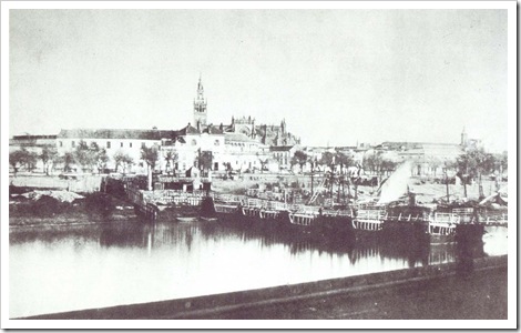
Vlotbrug (plural, nl, vlotbruggen) translates from Dutch into English as "float bridge". In its broadest sense, it includes pontoon bridges. In a narrower sense, it includes floating swing bridges which pivot either centrally or from one or both banks of a body of water to allow vessels to pass through. (A modern example is Queen Emma Bridge in Curaçao.) In the Dutch province of North Holland, a vlotbrug is a retractable pontoon bridge which opens for water traffic by retracting in its long direction, with the roadway sliding under fixed structure(s) on canal bank(s). This article relates to bridges of that design. In the eastern Netherlands, a name for that design of bridge was scholle."Scholle" seems to be, or at one time to have been, a local name for a type of flat-bottomed boat in at least one part of the Netherlands. See :nl:Wierumerschouw. History and design The Noordhollandsch Kanaal in North Holland was constructed 1820-1824. Many vlotbruggen were built across i ... [...More Info...] [...Related Items...] OR: [Wikipedia] [Google] [Baidu] |
Hellevoetsluis
Hellevoetsluis () is a small city and municipality in the western Netherlands. It is located in Voorne-Putten, South Holland. The municipality covers an area of of which is water and it includes the population centres Nieuw-Helvoet, Nieuwenhoorn, and Oude en Nieuwe Struiten, all former municipalities. Hellevoetsluis is located on the Haringvliet with the sea, beach, and dunes close by, on the extreme southern edge of the Rijnmond and Europoort areas, close to the broad Zeeland landscape. The name translates as "lock at the foot of the Helle". The Helle was a small local river that disappeared over time. History The area has been settled since before Roman times and was concentrated around a body of water called the "Helle", which was later Latinized by the Romans to "''Helinium''" and "''Helius''". The name Hel(le) Voet, ''Helius' foot'' or "(land at) the lowest point of Helius", appears in documents from the 13th century and later, such as in 1395, when the Nieuw-Helvoet Polder ... [...More Info...] [...Related Items...] OR: [Wikipedia] [Google] [Baidu] |
Pontoon Bridge
A pontoon bridge (or ponton bridge), also known as a floating bridge, uses float (nautical), floats or shallow-draft (hull), draft boats to support a continuous deck for pedestrian and vehicle travel. The buoyancy of the supports limits the maximum load that they can carry. Most pontoon bridges are temporary and used in wartime and civil emergencies. There are permanent pontoon bridges in civilian use that can carry highway traffic. Permanent floating bridges are useful for sheltered water crossings if it is not considered economically feasible to suspend a bridge from anchored piers. Such bridges can require a section that is elevated or can be raised or removed to allow waterborne traffic to pass. Pontoon bridges have been in use since ancient times and have been used to great advantage in many battles throughout history, such as the Battle of Garigliano (1503), Battle of Garigliano, the Battle of Oudenarde, the Operation Plunder, crossing of the Rhine during World War II, the ... [...More Info...] [...Related Items...] OR: [Wikipedia] [Google] [Baidu] |
Noordhollandsch Kanaal
The Noordhollandsch Kanaal ("Great North Holland Canal") is a canal originally meant for ocean-going ships. It is located in North Holland, Netherlands. The canal was of great significance in Dutch history. Location The canal is about 75 kilometers long. Nowadays, it is a canal that connects several cities in North Holland. It starts at Den Helder in the north, and then goes through Alkmaar and Purmerend, and ends opposite the IJ at Amsterdam. As such it is one of the many canals in the Netherlands. However, from its construction till about 1880 it had a totally different character, because it was a canal meant for ocean-going ships. Ships would sail from the Americas or East-Asia, and then be towed along the canal from Den Helder to Amsterdam. Context and Plans The Zuiderzee becomes less navigable During the 17th century the Zuiderzee became ever less navigable for sea-going ships of the cities on its shores. Amsterdam was especially challenged by the shallows nea ... [...More Info...] [...Related Items...] OR: [Wikipedia] [Google] [Baidu] |
Float (nautical)
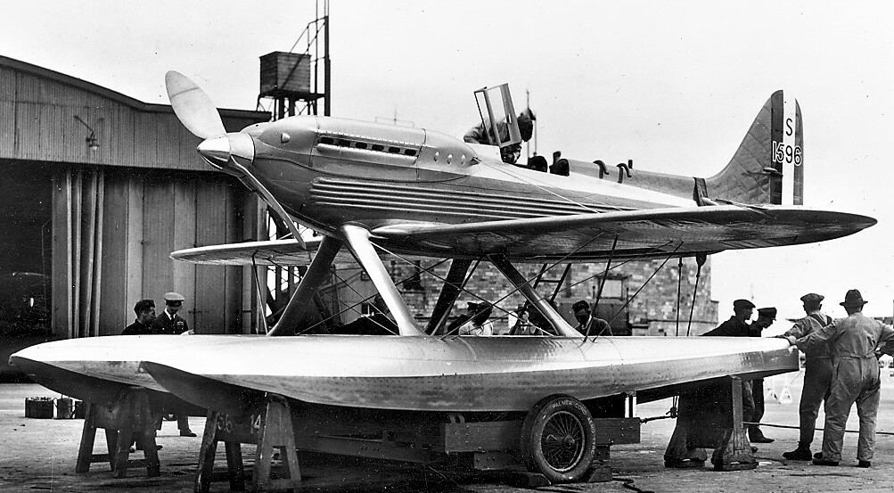
Floats (also called pontoons) are airtight hollow structures, similar to pressure vessels, designed to provide buoyancy in water. Their principal applications are in watercraft hulls, aircraft floats, floating pier, pontoon rhinos, pontoon causeways, and marine engineering applications such as salvage. During World War II the United States Navy Civil Engineer Corps developed a modular steel box (pontoon) for the Seabees to use. It was an industrial sized Lego system of pre-drilled pre-cut angle iron and steel plate that could be assembled anywhere for which they became famous. They used them to facilitate amphibious landings. With the pontoons Seabees assembled docks, causeways, and rhinos to whatever size needed. They allowed landings on Sicily where no one thought possible. They ferried Patton across the Rhine and put the Marines ashore on Okinawa. They would be used during the Korean War in the landing at Inchon in 1950 and again in Lebanon during the 1958 Leban ... [...More Info...] [...Related Items...] OR: [Wikipedia] [Google] [Baidu] |
't Zand, Schagen
t Zand is a village in the Dutch province of North Holland. It is a part of the municipality of Schagen and lies about south of Den Helder. History The village was first mentioned in 1770 as "eene herberg, het zand genoemt", and is named after an inn which was colloquially called Zand (sand), but whose official name was 't Wapen van Alkmaar. 't Zand developed in the northern part of the Zijpe- and Hazepolder which were ''poldered'' between 1596 and 1597. The construction of the Noordhollandsch Kanaal between 1821 and 1824, resulted in a modest growth. 't Zand developed as a Catholic settlement, because clandestine churches were tolerated in the area. The Catholic O.L. Vrouwe Visitatie Church was built in 1863 and is a modest design. The church was deemed unstable in 1920, and large buttresses have been built to strengthen the construction. Education In 't Zand there are two primary schools; there are no secondary schools. Zandhope is a small village school with four classrooms ... [...More Info...] [...Related Items...] OR: [Wikipedia] [Google] [Baidu] |
Fender (boating)
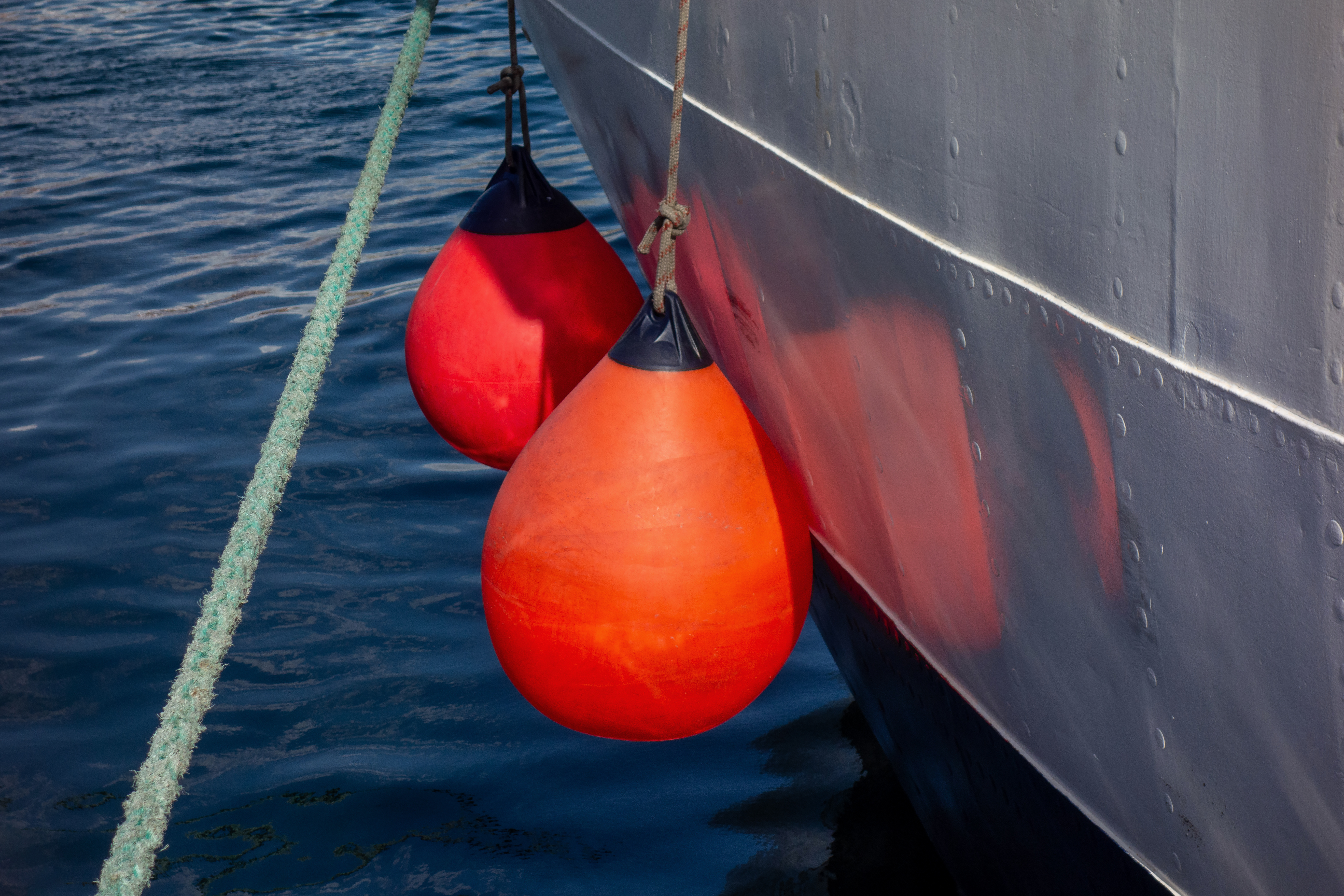
In boating, a fender is a bumper used to absorb the kinetic energy of a boat or vessel berthing against a jetty, quay wall or other vessel. Fenders, used on all types of vessels, from cargo ships to cruise ships, ferries and personal yachts, prevent damage to vessels and berthing structures. To do this, fenders have high energy absorption and low reaction force. Fenders are typically manufactured out of rubber, foam elastomer or plastic. Rubber fenders are either extruded or made in a mold. The type of fender that is most suitable for an application depends on many variables, including dimensions and displacement of the vessel, maximum allowable stand-off, berthing structure, tidal variations and other berth-specific conditions. The size of the fender unit is based on the berthing energy of the vessel which is related to the square of the berthing velocity. Historically, fenders were knotted from rope in a variety of patterns and shapes. Often damaged lines would be used for t ... [...More Info...] [...Related Items...] OR: [Wikipedia] [Google] [Baidu] |
Traffic Light
Traffic lights, traffic signals, or stoplights – known also as robots in South Africa are signalling devices positioned at intersection (road), road intersections, pedestrian crossings, and other locations in order to control flows of traffic. Traffic lights consist normally of three signals, transmitting meaningful information to drivers and riders through colours and symbols including arrows and bicycles. The regular traffic light colours are red, yellow, and green arranged vertically or horizontally in that order. Although this is internationally standardised,1968, as revised 1995 and 2006Vienna Convention on Road Signs and Signals United Nations Publication ECE/TRANS/196. ISBN 978-92-1-116973-7. URL Accessed: 7 January 2022. variations exist on national and local scales as to traffic light sequences and laws. The method was first introduced in December 1868 on Parliament Square in London to reduce the need for police officers to control traffic. Since then, electricity ... [...More Info...] [...Related Items...] OR: [Wikipedia] [Google] [Baidu] |
South Holland
South Holland ( nl, Zuid-Holland ) is a province of the Netherlands with a population of over 3.7 million as of October 2021 and a population density of about , making it the country's most populous province and one of the world's most densely populated areas. Situated on the North Sea in the west of the Netherlands, South Holland covers an area of , of which is water. It borders North Holland to the north, Utrecht and Gelderland to the east, and North Brabant and Zeeland to the south. The provincial capital is the Dutch seat of government The Hague, while its largest city is Rotterdam. The Rhine-Meuse-Scheldt delta drains through South Holland into the North Sea. Europe's busiest seaport, the Port of Rotterdam, is located in South Holland. History Early history Archaeological discoveries in Hardinxveld-Giessendam indicate that the area of South Holland has been inhabited since at least c. 7,500 years before present, probably by nomadic hunter-gatherers. Agriculture and perman ... [...More Info...] [...Related Items...] OR: [Wikipedia] [Google] [Baidu] |
Nissewaard
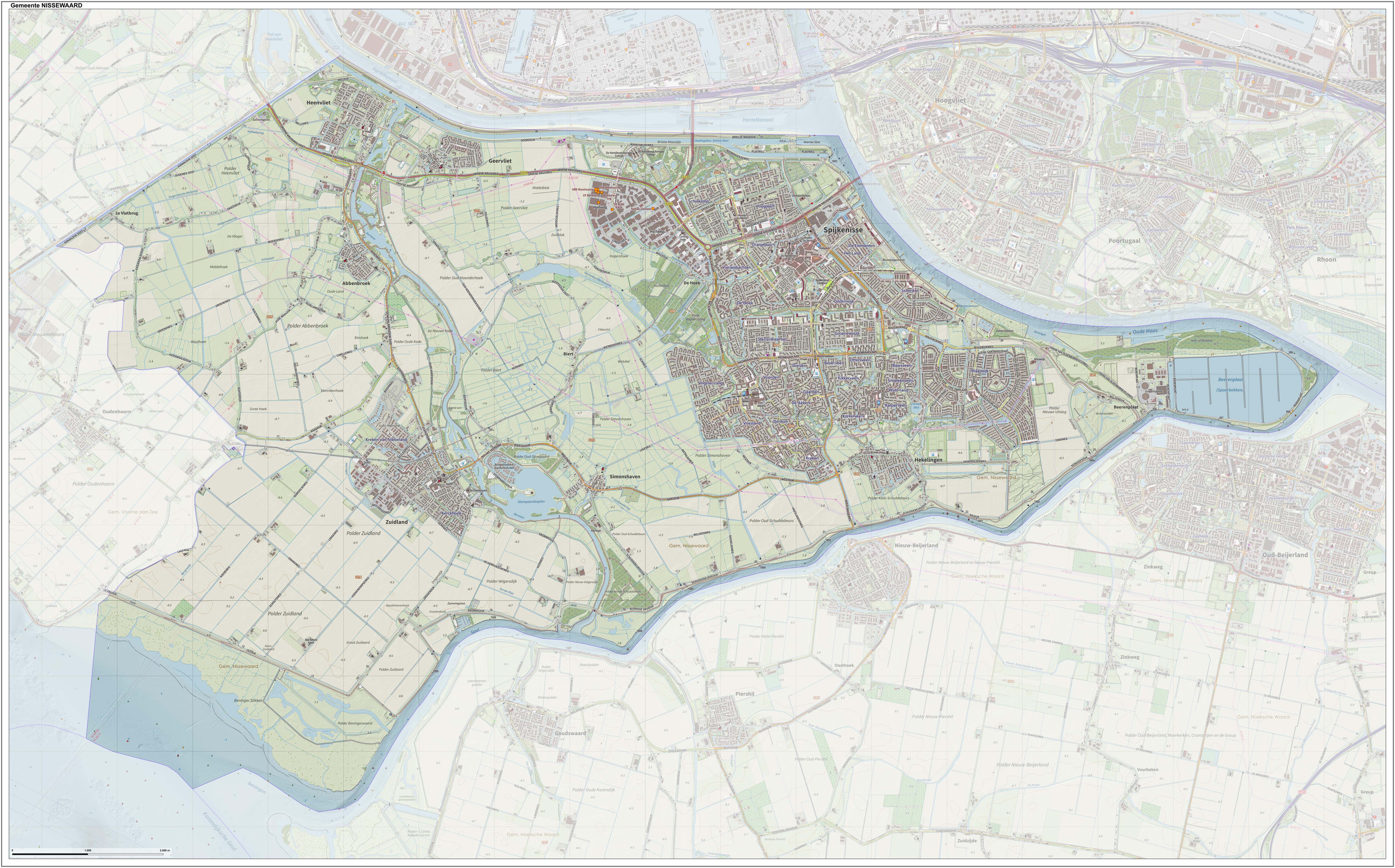
Nissewaard () is a municipality in the Netherlands, located on the island of Voorne-Putten, in the south of the province of South Holland. It was created through a merger of the municipalities of Spijkenisse and Bernisse on 1 January 2015. Nissewaard has a population of about 85,000 as of 2014. Topography ''Dutch topographic map of the municipality of Nissewaard, June 2015'' Notable people * Dirk van Hogendorp (1761 in Heenvliet – 1822), Dutch officer and author * Jan Campert (1902 in Spijkenisse – 1943) a journalist, theater critic and writer * Marleen de Pater-van der Meer (1950 in Hekelingen – 2015) a Dutch politician * Jan Bechtum (born 1958 in Spijkenisse) a Dutch guitarist and composer * Erik de Jong (born 1961 in Spijkenisse) known as Spinvis, a Dutch one-man music project * Medy van der Laan (born 1968 in Spijkenisse) a retired Dutch politician * Alexander van Oudenaarden (born 1970 in Zuidland) a Dutch biophysicist and systems biologist * Sied van Ri ... [...More Info...] [...Related Items...] OR: [Wikipedia] [Google] [Baidu] |
De Stolpen
De Stolpen (sometimes just "Stolpen"''VUGA's Alfabetische Plaatsnamengids van Nederland'' (13th edition), VUGA, 1997.) is a hamlet in the Dutch province of North Holland. It is part of the municipality of Schagen, and is located about 3 km northwest of the village of Schagerbrug.''ANWB Topografische Atlas Nederland'', Topografische Dienst and ANWB, 2005. In 2005, the municipal council of the former municipality of Zijpe Zijpe () is a former municipality in the Netherlands, in the province of North Holland. In 2013, Zijpe and Harenkarspel merged into Schagen. Population centres The former municipality of Zijpe consisted of the following cities, towns, villages ... decided that the N9 road had to be moved; as a consequence, all of the houses in De Stolpen would have to be demolished. The national government changed this decision in December 2006, which saved the hamlet. This saved what is essentially a row of a few contiguous homes on the north side of the road. Reference ... [...More Info...] [...Related Items...] OR: [Wikipedia] [Google] [Baidu] |
Sint Maartensbrug
Sint Maartensbrug is a village in the Dutch province of North Holland. It is a part of the municipality of Schagen, and lies about 14 km northwest of Heerhugowaard. History The village was first mentioned in 1613 as "Sinte Maertensbrugge", and means "bridge (over the Groote Sloot on the road to) Sint Maarten". Sint Maartensbrug is a cross shaped village which appeared shortly after the area was ''poldered'' between 1596 and 1597. It consists of a linear settlement along the Groote Sloot and another linear settlement along the road. The Dutch Reformed church is a wide aisleless church with wooden tower which was built in 1696. The ''polder'' mill N-G or Noorder G was probably built in the second half of the 17th century. It was in service until 1958 when it was replaced by a Diesel powered pumping station. Between 1969 and 1972, the windmill was restored and is frequently in service on a voluntary basis. Gallery File:Sint Maartensbrug - Grote Sloot 173.jpg, Farm in Sint ... [...More Info...] [...Related Items...] OR: [Wikipedia] [Google] [Baidu] |
Burgerbrug
Burgerbrug is a village in the Dutch province of North Holland. It is a part of the municipality of Schagen, and lies about 14 km north of Alkmaar. The village was first mentioned in 1840 as "Burgerbrug of Eenigenburgerbrug", and is named after the bridge over the Groote Slot. Burgerbrug was settled soon after the ''polder'' was created in 1597. It is a cross shaped settlement with one part along the Groote Sloot and the other part along the road. The Catholic Birth of Out Lady Church is an aisleless church built in 1866 as a replacement of the clandestine church A clandestine church ( nl, schuilkerk), defined by historian Benjamin J. Kaplan as a "semi-clandestine church", is a house of worship used by religious minorities whose communal worship is tolerated by those of the majority faith on condition th .... Burgerbrug was home to 185 people in 1840. Three ''polder'' mills are still present in Burgerbrug. Two of the windmills probably date from 1597. Gallery File:Bur ... [...More Info...] [...Related Items...] OR: [Wikipedia] [Google] [Baidu] |


