|
Vitu Islands
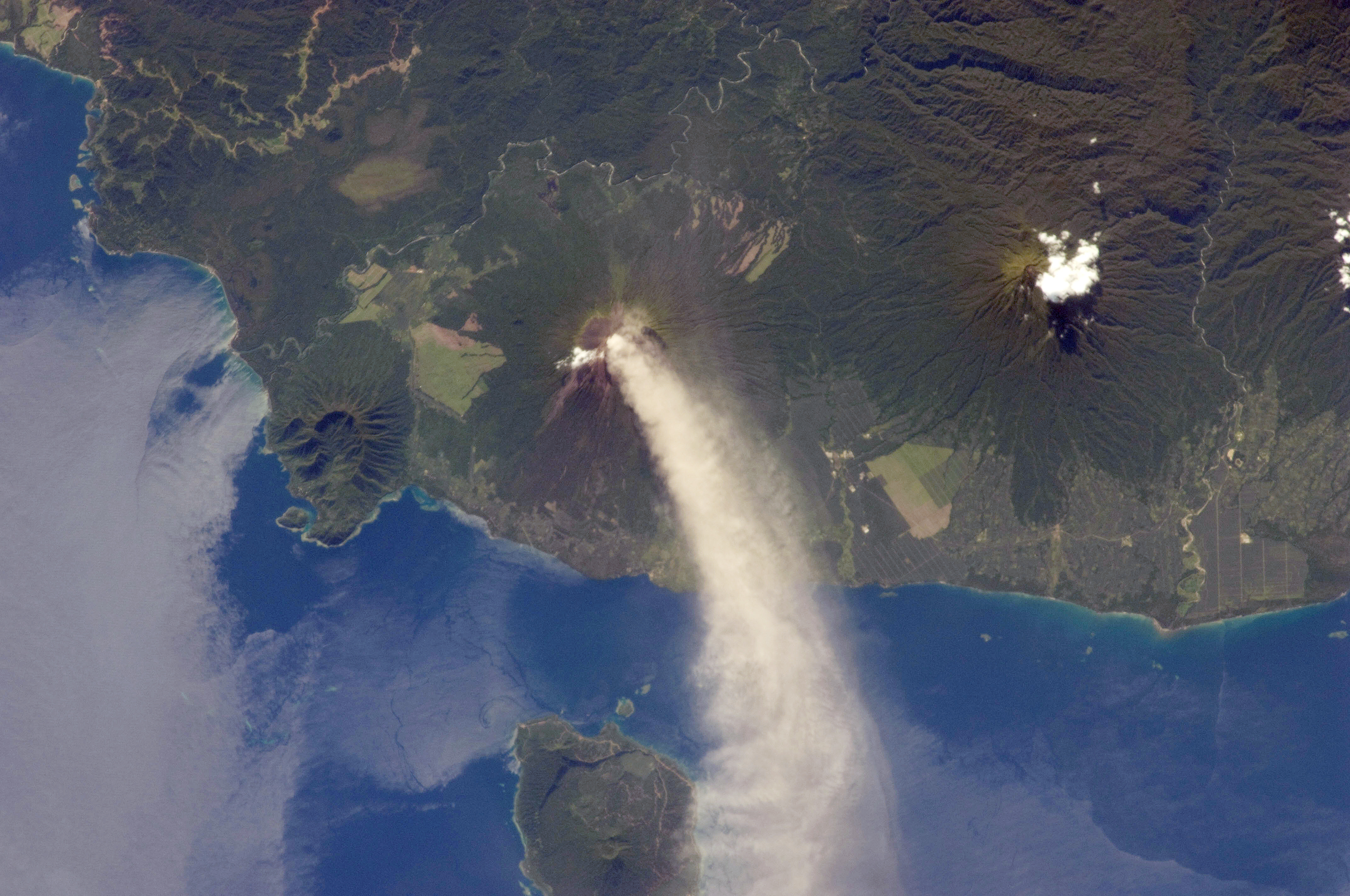
The Vitu Islands are a volcanic group with an area of 37 sq mi (96 km²) located in the Bismarck Sea off New Britain, in the southwestern Pacific Ocean. They are not technically part of the Bismarck Archipelago. Administratively they are part of Papua New Guinea. Formerly called the French Islands, the group is sometimes known as the Witu Islands. Geography The islands are volcanic ocean peaks, much as they are reef-ringed, not atolls, and are thereby highly fertile. Garove (Vitu, or Big Witu) and Unea (Bali) are the largest islands. The group was the chief copra centre of Papua New Guinea, although cocoa is now the main crop harvested due to the depressed prices available for copra. The islands are situated west of north of the Willaumez Peninsula The Willaumez Peninsula is located on the north coast of New Britain in the West New Britain Province. It was named after Jean-Baptiste Philibert Willaumez by Antoine Bruni d'Entrecasteaux Antoine Raymond Joseph de Br ... [...More Info...] [...Related Items...] OR: [Wikipedia] [Google] [Baidu] |
Volcanic Group
A volcanic group is a stratigraphic group consisting of volcanic strata. They can be in the form of volcanic fields, volcanic complexes and cone A cone is a three-dimensional geometric shape that tapers smoothly from a flat base (frequently, though not necessarily, circular) to a point called the apex or vertex. A cone is formed by a set of line segments, half-lines, or lines con ... clusters. Notable volcanic groups See also * * * * * * * References {{reflist Volcanic landforms Volcanoes ... [...More Info...] [...Related Items...] OR: [Wikipedia] [Google] [Baidu] |
Bismarck Sea
The Bismarck Sea (, ) lies in the southwestern Pacific Ocean within the nation of Papua New Guinea. It is located northeast of the island of New Guinea and south of the Bismarck Archipelago. It has coastlines in districts of the Islands Region, Momase Region, and Papua Region. Geography Like the Bismarck Archipelago, it is named in honour of the first German Chancellor Otto von Bismarck. The Bismarck Archipelago extends round to the east and north of the sea, enclosing the Bismarck Sea and separating it from the Southern Pacific Ocean. To the south it is linked to the Solomon Sea by the Vitiaz Strait. Official boundaries The International Hydrographic Organization defines the Bismarck Sea as "that area of the Pacific Ocean, South Pacific Ocean off the northeast coast of New Guinea", with the following limits: ''On the North and East.'' By the Northern and Northeastern coasts of the islands of New Ireland (island), New Ireland, New Hanover Island, New Hanover, the Admiralty I ... [...More Info...] [...Related Items...] OR: [Wikipedia] [Google] [Baidu] |
New Britain
New Britain ( tpi, Niu Briten) is the largest island in the Bismarck Archipelago, part of the Islands Region of Papua New Guinea. It is separated from New Guinea by a northwest corner of the Solomon Sea (or with an island hop of Umboi the Dampier and Vitiaz Straits) and from New Ireland by St. George's Channel. The main towns of New Britain are Rabaul/Kokopo and Kimbe. The island is roughly the size of Taiwan. While the island was part of German New Guinea, it was named Neupommern ("New Pomerania"). In common with most of the Bismarcks it was largely formed by volcanic processes, and has active volcanoes including Ulawun (highest volcano nationally), Langila, the Garbuna Group, the Sulu Range, and the volcanoes Tavurvur and Vulcan of the Rabaul caldera. A major eruption of Tavurvur in 1994 destroyed the East New Britain provincial capital of Rabaul. Most of the town still lies under metres of ash, and the capital has been moved to nearby Kokopo. Geography New Britain e ... [...More Info...] [...Related Items...] OR: [Wikipedia] [Google] [Baidu] |
Bismarck Archipelago
The Bismarck Archipelago (, ) is a group of islands off the northeastern coast of New Guinea in the western Pacific Ocean and is part of the Islands Region of Papua New Guinea. Its area is about 50,000 square km. History The first inhabitants of the archipelago arrived around 30–40,000 years ago. They may have traveled from New Guinea, by boat across the Bismarck Sea or via a temporary land bridge, created by an uplift in the Earth's Crust (geology), crust. Later arrivals included the Lapita people. The first European to visit these islands was Dutch explorer Willem Schouten in 1616. The islands remained unsettled by western Europeans until they were annexed as part of the German protectorate of German New Guinea in 1884. The area was named in honour of the Chancellor of Germany (German Reich), Chancellor Otto von Bismarck. On 1888 Ritter Island eruption and tsunami, 13 March 1888, a volcano erupted on Ritter Island causing a megatsunami. Almost the entire volcano fell into t ... [...More Info...] [...Related Items...] OR: [Wikipedia] [Google] [Baidu] |
Papua New Guinea
Papua New Guinea (abbreviated PNG; , ; tpi, Papua Niugini; ho, Papua Niu Gini), officially the Independent State of Papua New Guinea ( tpi, Independen Stet bilong Papua Niugini; ho, Independen Stet bilong Papua Niu Gini), is a country in Oceania that comprises the eastern half of the island of New Guinea and its offshore islands in Melanesia (a region of the southwestern Pacific Ocean north of Australia). Its capital, located along its southeastern coast, is Port Moresby. The country is the world's third largest island country, with an area of . At the national level, after being ruled by three external powers since 1884, including nearly 60 years of Australian administration starting during World War I, Papua New Guinea established its sovereignty in 1975. It became an independent Commonwealth realm in 1975 with Elizabeth II as its queen. It also became a member of the Commonwealth of Nations in its own right. There are 839 known languages of Papua New Guinea, one of ... [...More Info...] [...Related Items...] OR: [Wikipedia] [Google] [Baidu] |
Unea (Terra ASTER)
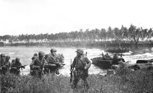
Unea Island is an island in Papua New Guinea located in the Vitu Islands. It was occupied by Japan in World War II. The Uneapa (or Bali) language is natively spoken on this island. In the local language, it is called ''Uniapa'' or ''Uneapa''. The term ''Unea'' comes from the Vitu language Vitu (also spelled Witu or Vittu, referred by their own speakers as ''pole matotota'' "true speech" or ''pole Vitu'' "Vitu speech") or Muduapa is an Oceanic languages, Oceanic language spoken by about 7,000 people on the islands northwest of the ..., and they descend from a proto-form ''*Uneap'' or ''*Uniap'', reflecting the addition of an echo vowel in Uneapa and the regular loss of final consonants in Vitu. References Islands of Papua New Guinea {{PapuaNewGuinea-island-stub ... [...More Info...] [...Related Items...] OR: [Wikipedia] [Google] [Baidu] |
Unea Island
Unea Island is an island in Papua New Guinea located in the Vitu Islands. It was occupied by Japan in World War II. The Uneapa (or Bali) language is natively spoken on this island. In the local language, it is called ''Uniapa'' or ''Uneapa''. The term ''Unea'' comes from the Vitu language Vitu (also spelled Witu or Vittu, referred by their own speakers as ''pole matotota'' "true speech" or ''pole Vitu'' "Vitu speech") or Muduapa is an Oceanic languages, Oceanic language spoken by about 7,000 people on the islands northwest of the ..., and they descend from a proto-form ''*Uneap'' or ''*Uniap'', reflecting the addition of an echo vowel in Uneapa and the regular loss of final consonants in Vitu. References Islands of Papua New Guinea {{PapuaNewGuinea-island-stub ... [...More Info...] [...Related Items...] OR: [Wikipedia] [Google] [Baidu] |
Copra
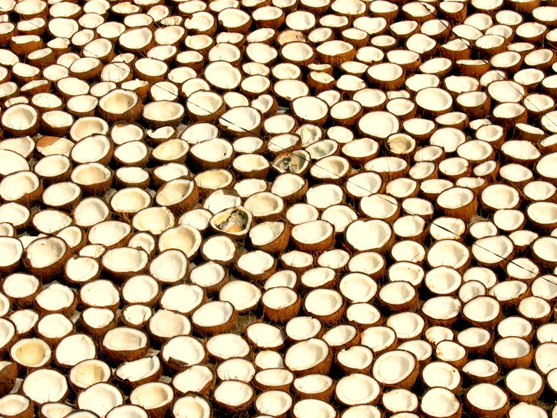
Copra (from ) is the dried, white flesh of the coconut from which coconut oil is extracted. Traditionally, the coconuts are sun-dried, especially for export, before the oil, also known as copra oil, is pressed out. The oil extracted from copra is rich in lauric acid, making it an important commodity in the preparation of lauryl alcohol, soaps, fatty acids, cosmetics, etc. and thus a lucrative product for many coconut-producing countries. The palatable oil cake, known as copra cake, obtained as a residue in the production of copra oil is used in animal feeds. The ground cake is known as coconut or copra meal. Production Copra has traditionally been grated and ground, then boiled in water to extract coconut oil. It was used by Pacific island cultures and became a valuable commercial product for merchants in the Polynesia, South Seas and South Asia in the 1860s. Nowadays, coconut oil (70%) is extracted by crushing copra; the by-product is known as copra cake or copra meal (30%) ... [...More Info...] [...Related Items...] OR: [Wikipedia] [Google] [Baidu] |
Willaumez Peninsula
The Willaumez Peninsula is located on the north coast of New Britain in the West New Britain Province. It was named after Jean-Baptiste Philibert Willaumez by Antoine Bruni d'Entrecasteaux Antoine Raymond Joseph de Bruni, chevalier d'Entrecasteaux () (8 November 1737 – 21 July 1793) was a French naval officer, explorer and colonial governor. He is perhaps best known for his exploration of the Australian coast in 1792, while .... West New Britain Province Peninsulas of Papua New Guinea {{WestNewBritainProvince-geo-stub ... [...More Info...] [...Related Items...] OR: [Wikipedia] [Google] [Baidu] |
Islands Of Papua New Guinea
An island (or isle) is an isolated piece of habitat that is surrounded by a dramatically different habitat, such as water. Very small islands such as emergent land features on atolls can be called islets, skerries, cays or keys. An island in a river or a lake island may be called an eyot or ait, and a small island off the coast may be called a holm. Sedimentary islands in the Ganges delta are called chars. A grouping of geographically or geologically related islands, such as the Philippines, is referred to as an archipelago. There are two main types of islands in the sea: continental and oceanic. There are also artificial islands, which are man-made. Etymology The word ''island'' derives from Middle English ''iland'', from Old English ''igland'' (from ''ig'' or ''ieg'', similarly meaning 'island' when used independently, and -land carrying its contemporary meaning; cf. Dutch ''eiland'' ("island"), German ''Eiland'' ("small island")). However, the spelling of the word ... [...More Info...] [...Related Items...] OR: [Wikipedia] [Google] [Baidu] |


