|
Vine Street (Philadelphia)
Vine Street is a major east-west street in Center City, Philadelphia, Pennsylvania. It begins at the Delaware River, and proceeds west until 20th Street, where it merges with the Benjamin Franklin Parkway. In West Philadelphia, it begins again near the intersection of 52nd Street & Haverford Avenue, and ends just past 66th Street, in Cobbs Creek Park. Vine Street is non-continuous between 5th and 7th Streets, because of the Vine Street Expressway and the approach to the Benjamin Franklin Bridge. It was part of Philadelphia's original street plan, laid out by William Penn and Thomas Holme in 1682, and remained the northern border of the City of Philadelphia until 1854. It forms the northern border of Franklin Square and Logan Circle. Parkway Central Library, the main branch of the Free Library of Philadelphia system and the (now-vacant) Family Court Building The Philadelphia Family Court Building also known as Juvenile and Domestic Branches of the Municipal Court, is a hi ... [...More Info...] [...Related Items...] OR: [Wikipedia] [Google] [Baidu] |
Map Of The Original City Of Philadelphia In 1682 By Thomas Holme
A map is a symbolic depiction emphasizing relationships between elements of some space, such as objects, regions, or themes. Many maps are static, fixed to paper or some other durable medium, while others are dynamic or interactive. Although most commonly used to depict geography, maps may represent any space, real or fictional, without regard to context or scale, such as in brain mapping, DNA mapping, or computer network topology mapping. The space being mapped may be two dimensional, such as the surface of the earth, three dimensional, such as the interior of the earth, or even more abstract spaces of any dimension, such as arise in modeling phenomena having many independent variables. Although the earliest maps known are of the heavens, geographic maps of territory have a very long tradition and exist from ancient times. The word "map" comes from the , wherein ''mappa'' meant 'napkin' or 'cloth' and ''mundi'' 'the world'. Thus, "map" became a shortened term referring to ... [...More Info...] [...Related Items...] OR: [Wikipedia] [Google] [Baidu] |
Philadelphia, Pennsylvania
Philadelphia, often called Philly, is the List of municipalities in Pennsylvania#Municipalities, largest city in the Commonwealth (U.S. state), Commonwealth of Pennsylvania, the List of United States cities by population, sixth-largest city in the U.S., the second-largest city in both the Northeast megalopolis and Mid-Atlantic (United States), Mid-Atlantic regions after New York City. Act of Consolidation, 1854, Since 1854, the city has been coextensive with Philadelphia County, Pennsylvania, Philadelphia County, the List of counties in Pennsylvania, most populous county in Pennsylvania and the urban core of the Delaware Valley, the Metropolitan statistical area, nation's seventh-largest and one of List of largest cities, world's largest metropolitan regions, with 6.245 million residents . The city's population at the 2020 United States census, 2020 census was 1,603,797, and over 56 million people live within of Philadelphia. Philadelphia was founded in 1682 by William Penn, ... [...More Info...] [...Related Items...] OR: [Wikipedia] [Google] [Baidu] |
Delaware River
The Delaware River is a major river in the Mid-Atlantic (United States), Mid-Atlantic region of the United States. From the meeting of its branches in Hancock (village), New York, Hancock, New York, the river flows for along the borders of New York (state), New York, Pennsylvania, New Jersey, and Delaware, before emptying into Delaware Bay. It is the longest free-flowing river in the Eastern United States. The river has been recognized by the National Wildlife Federation as one of the country's Great Waters. The river's drainage basin, watershed drains an area of and provides drinking water for 17 million people. The river has two branches that rise in the Catskill Mountains of New York: the West Branch Delaware River, West Branch at Mount Jefferson (New York), Mount Jefferson in Jefferson, New York, Jefferson, Schoharie County, New York, Schoharie County, and the East Branch Delaware River, East Branch at Grand Gorge, New York, Grand Gorge, Delaware County, New York, ... [...More Info...] [...Related Items...] OR: [Wikipedia] [Google] [Baidu] |
Benjamin Franklin Parkway
Benjamin Franklin Parkway, commonly abbreviated to Ben Franklin Parkway and colloquially called the Parkway, is a boulevard that runs through the cultural heart of Philadelphia. Named for founding father Benjamin Franklin, the mile-long Parkway cuts diagonally across the grid plan pattern of Center City's northwest quadrant. It starts at Philadelphia City Hall, curves around Logan Circle, and ends before the Philadelphia Museum of Art. Attractions The Parkway is the spine of Philadelphia's Museum District. Some of the city's most famous sights are here: Cathedral Basilica of Saints Peter and Paul; Swann Memorial Fountain; Parkway Central Library, the Family Court Building, the Franklin Institute, Moore College of Art and Design, the Academy of Natural Sciences, the Rodin Museum, Eakins Oval, the Barnes Foundation and the Philadelphia Museum of Art. From its northern end, the Parkway provides access to Fairmount Park through Kelly Drive (formerly East River Drive), ... [...More Info...] [...Related Items...] OR: [Wikipedia] [Google] [Baidu] |
West Philadelphia
West Philadelphia, nicknamed West Philly, is a section of the city of Philadelphia. Alhough there are no officially defined boundaries, it is generally considered to reach from the western shore of the Schuylkill River, to City Avenue to the northwest, Cobbs Creek to the southwest, and the SEPTA Media/Wawa Line to the south. An alternate definition includes all city land west of the Schuylkill; this would also include Southwest Philadelphia and its neighborhoods. The eastern side of West Philadelphia is also known as University City. Topography The topography of West Philadelphia is composed of rolling hills rising slowly from the Schuylkill River toward Cobbs Creek in the west and toward Belmont Plateau in the northwest. This gradual elevation makes the skyline of Center City visible from many points in West Philadelphia. The Wynnefield neighborhood is a location frequently used by photographers and organizers of civic events. Demographics According to the 2010 census, ... [...More Info...] [...Related Items...] OR: [Wikipedia] [Google] [Baidu] |
Cobbs Creek, Philadelphia
Cobbs Creek is a neighborhood located in the West Philadelphia section of Philadelphia, Pennsylvania, United States, named for the creek which forms part of Philadelphia's western border. Cobbs Creek is generally bounded by Market Street to the north, Baltimore Avenue to the south, 52nd Street to the east, and the border of Upper Darby along Cobbs Creek to the West. In 1998, the Cobbs Creek Automobile Suburb Historic District was created, with Cobbs Creek Parkway, Spruce Street, 52nd Street, and Angora Street its boundaries. The District protects 1049 buildings, with Tudor Revival, Colonial Revival, and Bungalow/Craftsman architectural styles contained within the district. Philadelphia architect William Alesker, who was involved in the plans for a Trump Tower in Center City, and Evangelical minister Tony Campolo, one of Bill Clinton's spiritual advisers, lived, respectively, in the 6200 blocks of Pine and Delancey Streets back in the 1940s and 1950s. Fires from the 1985 bom ... [...More Info...] [...Related Items...] OR: [Wikipedia] [Google] [Baidu] |
Benjamin Franklin Bridge
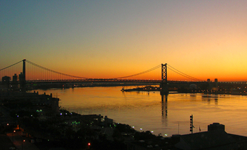
The Benjamin Franklin Bridge, originally named the Delaware River Bridge and known locally as the Ben Franklin Bridge, is a suspension bridge across the Delaware River connecting Philadelphia, Pennsylvania, and Camden, New Jersey. Owned and operated by the Delaware River Port Authority, it is one of four primary vehicular bridges between Philadelphia and southern New Jersey, along with the Betsy Ross, Walt Whitman, and Tacony-Palmyra bridges. It carries Interstate 676/ U.S. Route 30, pedestrians/cyclists, and the PATCO Speedline. The bridge was dedicated as part of the 1926 Sesquicentennial Exposition, celebrating the 150th anniversary of the signing of the United States Declaration of Independence. From 1926 to 1929, it had the longest single span of any suspension bridge in the world. History Plans for a bridge to augment the ferries across the Delaware River began as early as 1818, when one plan envisioned using Smith Island, a narrow island off the Philadel ... [...More Info...] [...Related Items...] OR: [Wikipedia] [Google] [Baidu] |
William Penn
William Penn ( – ) was an English writer and religious thinker belonging to the Religious Society of Friends (Quakers), and founder of the Province of Pennsylvania, a North American colony of England. He was an early advocate of democracy and religious freedom, notable for his good relations and successful treaties with the Lenape Native Americans. In 1681, King Charles II handed over a large piece of his North American land holdings along the North Atlantic Ocean coast to Penn to pay the debts the king had owed to Penn's father, the admiral and politician Sir William Penn. This land included the present-day states of Pennsylvania and Delaware. Penn immediately set sail and took his first step on American soil, sailing up the Delaware Bay and Delaware River, past earlier Swedish and Dutch riverfront colonies, in New Castle (now in Delaware) in 1682. On this occasion, the colonists pledged allegiance to Penn as their new proprietor, and the first Pennsylvania General ... [...More Info...] [...Related Items...] OR: [Wikipedia] [Google] [Baidu] |
Thomas Holme
Thomas Holme (1624–1695) was the first Surveyor General of Pennsylvania. He laid out the first and original plan for the city of Philadelphia. Holme was one of the Valiant Sixty, a group of early leaders and activists in the Religious Society of Friends (Quakers). Life Holme was born in Lancashire, England, on November 3, 1624, to a yeoman named George and his wife Alice (née Whiteside). He married Sarah Croft in 1649, and soon enlisted in the army under the leadership of Oliver Cromwell, where he attained the rank of captain. It may have been in the army that he gained some experience in surveying. After retiring he was granted more than 4,000 acres (16 km²) in County Wexford, Ireland, which was then under the control and colonization of England. At some point he joined the Quaker movement in Ireland, reputedly converted by George Fox, founder of the sect. There he met fellow Quaker William Penn, founder of Pennsylvania. In 1682, Penn wrote to Holme from the colony ... [...More Info...] [...Related Items...] OR: [Wikipedia] [Google] [Baidu] |
Franklin Square (Philadelphia)
Franklin Square is one of the five original open-space parks planned by William Penn when he laid out the city of Philadelphia, Pennsylvania, in 1682. It is located in the Center City area, between North 6th and 7th Streets, and between Race Street and the Vine Street Expressway (I-676). Penn included this piece of green space in his original city plan as one of five squares, although the park was slow to develop because it was a marshy land. Originally, the park was a place for settlers to meditate and set a virtuous behavior to set a proper example. The park was supposed to be landscaped to have settlers understand the value of nature. In the 1920s, the park was abandoned and the surrounding area became known locally as the tenderloin with an entertainment district featuring taverns and bordellos, and became a place for individuals experiencing homelessness to sleep on the park's benches, resulting in its reputation as Philadelphia's skid row. In 2003, Historic Philadelphia, Inc ... [...More Info...] [...Related Items...] OR: [Wikipedia] [Google] [Baidu] |
Logan Circle (Philadelphia)
Logan Circle, also known as Logan Square, is an open-space park in Center City Philadelphia's northwest quadrant and one of the five original planned squares laid out on the city grid. The centerpiece of the park is the Logan Circle, a circular area centered on a large water feature, bounded by a traffic circle carrying 19th Street and the Benjamin Franklin Parkway (with connections to 18th and 20th streets to the east and west and Race and Vine Streets to the south and north). The circle exists within the original bounds of the square; the names Logan Square and Logan Circle are used interchangeably when referring to the park. Originally "Northwest Square" in William Penn's 1684 plan for the city, the square was renamed in 1825 after Philadelphia statesman James Logan. The park is the focal point of the eponymous neighborhood. Logan Square was added to the National Register of Historic Places in 1981. History Prior to the 1800s the city developed along the Delaware Rive ... [...More Info...] [...Related Items...] OR: [Wikipedia] [Google] [Baidu] |


