|
Vermont Transit Corridor
The Vermont Transit Corridor is a proposed bus rapid transit line in the Metro Busway network in Los Angeles, California with plans to convert it to a heavy rail subway line in the future. It is planned to operate on a north-to-south route on Vermont Avenue between the B Line's Vermont/Sunset station and the C Line's Vermont/Athens station on the Metro Rail system. The project feasibility study was released in February 2019 with a proposed completion date of 2028 for BRT and after 2067 for rail. It is part of Metro's '' Twenty-eight by '28'' initiative and is partially funded by Measure M. The route will have signal priority at traffic lights and will have a dedicated right of way. Metro reports the initial cost is $425 million. History Until 1963, Vermont Avenue was served by several Los Angeles Railway Yellow Car streetcar lines: the F, K, R, S, U, and V. After streetcars ceased running under the Los Angeles Metropolitan Transit Authority, tracks were t ... [...More Info...] [...Related Items...] OR: [Wikipedia] [Google] [Baidu] |
Bus Rapid Transit
Bus rapid transit (BRT), also called a busway or transitway, is a bus-based public transport system designed to have much more capacity, reliability and other quality features than a conventional bus system. Typically, a BRT system includes roadways that are dedicated to buses, and gives priority to buses at intersections where buses may interact with other traffic; alongside design features to reduce delays caused by passengers boarding or leaving buses, or paying fares. BRT aims to combine the capacity and speed of a light rail or metro system (LRT, HRT) with the flexibility, lower cost and simplicity of a bus system. The world's first BRT system was the Busway in Runcorn New Town, England, which entered service in 1971. , a total of 166 cities in six continents have implemented BRT systems, accounting for of BRT lanes and about 32.2 million passengers every day. The majority of these are in Latin America, where about 19.6 million passengers ride daily, and w ... [...More Info...] [...Related Items...] OR: [Wikipedia] [Google] [Baidu] |
Streetcar
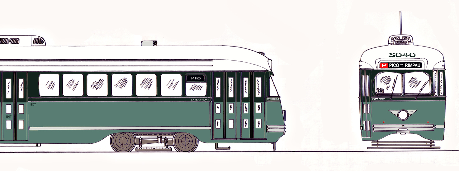
A tram (called a streetcar or trolley in North America) is a rail vehicle that travels on tramway tracks on public urban streets; some include segments on segregated right-of-way. The tramlines or networks operated as public transport are called tramways or simply trams/streetcars. Many recently built tramways use the contemporary term light rail. The vehicles are called streetcars or trolleys (not to be confused with trolleybus) in North America and trams or tramcars elsewhere. The first two terms are often used interchangeably in the United States, with ''trolley'' being the preferred term in the eastern US and ''streetcar'' in the western US. ''Streetcar'' or ''tramway'' are preferred in Canada. In parts of the United States, internally powered buses made to resemble a streetcar are often referred to as "trolleys". To avoid further confusion with trolley buses, the American Public Transportation Association (APTA) refers to them as "trolley-replica buses". In the United ... [...More Info...] [...Related Items...] OR: [Wikipedia] [Google] [Baidu] |
Natural History Museum Of Los Angeles County
The Natural History Museum of Los Angeles County is the largest natural and historical museum in the western United States. Its collections include nearly 35 million specimens and artifacts and cover 4.5 billion years of history. This large collection is comprised not only of specimens for exhibition, but also of vast research collections housed on and offsite. The museum is associated with two other museums in Greater Los Angeles: the Page Museum at the La Brea Tar Pits in Hancock Park and the William S. Hart Ranch and Museum in Newhall. The three museums work together to achieve their common mission: "to inspire wonder, discovery, and responsibility for our natural and cultural worlds." History NHM opened in Exposition Park, Los Angeles, California, United States in 1913 as The Museum of History, Science, and Art. The moving force behind it was a museum association founded in 1910. Its distinctive main building with fitted marble walls and domed and colonnaded rotunda, ... [...More Info...] [...Related Items...] OR: [Wikipedia] [Google] [Baidu] |
Lucas Museum Of Narrative Art
The Lucas Museum of Narrative Art is a museum founded by filmmaker George Lucas and his wife, businesswoman Mellody Hobson. Once completed, the museum will hold all forms of visual storytelling, including painting, photography, sculpture, illustration, comic art, performance, and video. It is under construction in Exposition Park in Los Angeles, California. The museum is expected to open in 2025. Collections The Lucas Museum will house works by artists such as Judith F. Baca, N.C. Wyeth, Carrie Mae Weems, Diego Rivera, Norman Rockwell, Ralph McQuarrie, Jacob Lawrence, Kadir Nelson, Paul Cadmus, Yinka Shonibare, and Jack Kirby. In 2021, the museum announced the acquisition of the archive of materials related to the development and execution of Judith F. Baca's half-mile-long mural ''The History of California'', popularly known as ''The Great Wall of Los Angeles'', located in the San Fernando Valley. Also in 2021, the museum acquired Robert Colescott's painting ''George Washing ... [...More Info...] [...Related Items...] OR: [Wikipedia] [Google] [Baidu] |
Exposition Park (Los Angeles)
Exposition Park is a in the south region of Los Angeles, California, in the Exposition Park neighborhood. Established in 1872 as an agricultural fairground, the park includes the Los Angeles Memorial Coliseum, Banc of California Stadium, the California Science Center, the Natural History Museum of Los Angeles County, and the California African American Museum. The Lucas Museum of Narrative Art is under construction. Bounded by Exposition Boulevard to the north, South Figueroa Street to the east, Martin Luther King Jr. Boulevard to the south and Vermont Avenue to the west, it is directly south of the main campus of the University of Southern California. The park is public open space, managed by the Sixth District Agricultural Association. Features Exposition Park houses the following: * LA84 Foundation/John C. Argue Swim Stadium * Banc of California Stadium ** Home of Los Angeles FC * Lucas Museum of Narrative Art (under construction) * Los Angeles Memorial Coliseum ** ... [...More Info...] [...Related Items...] OR: [Wikipedia] [Google] [Baidu] |
Slauson Avenue
Slauson Avenue is a major east–west thoroughfare traversing the central part of Los Angeles County, California. It was named for the land developer and Los Angeles Board of Education member J. S. Slauson. It passes through Culver City, Ladera Heights, View Park-Windsor Hills, South Los Angeles, Huntington Park, Maywood, Commerce, Montebello, Pico Rivera, Whittier, and Santa Fe Springs. The street runs from McDonald Street in Culver City and to Santa Fe Springs Road, where it becomes Mulberry Drive in Whittier. Mulberry Drive ends at Scott Avenue in South Whittier. Transit Metro Rail There are three major transit stations (two light rail) on Slauson Avenue. They include the Slauson Station of the Metro A Line and the Hyde Park Station on the Metro K Line. Metro Bus and Freeways Slauson/I-110 Station of the Metro J Line is elevated in the median of Interstate 110 freeway. Metro Local line 108 operates on Slauson Avenue. The eastern terminus of the State Route ... [...More Info...] [...Related Items...] OR: [Wikipedia] [Google] [Baidu] |
Wilshire Boulevard
Wilshire Boulevard is a prominent boulevard in the Los Angeles area of Southern California, extending from Ocean Avenue in the city of Santa Monica east to Grand Avenue in the Financial District of downtown Los Angeles. One of the principal east-west arterial roads of Los Angeles, it is also one of the major city streets through the city of Beverly Hills. Wilshire Boulevard runs roughly parallel with Santa Monica Boulevard from Santa Monica to the west boundary of Beverly Hills. From the east boundary it runs a block south of Sixth Street to its terminus. Wilshire Boulevard is densely developed throughout most of its span, connecting five of Los Angeles's major business districts and Beverly Hills to one-another. Many of the post-1956 skyscrapers in Los Angeles are located along Wilshire; for example, the Wilshire Grand Center, which is the tallest building in California, is located on the Figueroa and Wilshire intersection. One Wilshire, built in 1966 at the ju ... [...More Info...] [...Related Items...] OR: [Wikipedia] [Google] [Baidu] |
Measure R
Measure R was a ballot measure during the November 2008 elections in Los Angeles County, California, that proposed a half-cent sales taxes increase on each dollar of taxable sales (originating in or made from Los Angeles County) for thirty years in order to pay for transportation projects and improvements. The measure was approved by voters with 67.22% of the vote, just over the two-thirds majority required by the state of California to raise local taxes. The project was touted as a way to "improve the environment by getting more Angelenos out of their cars and into the region's growing subway, light rail, and bus services." It will result in the construction or expansion of a dozen rail lines in the county. Funding The ballot measure created an ordinance called the Traffic Relief and Rail Expansion Ordinance, which included an expenditure plan defining specific projects to be funded, timeframes for availability of funds, and expected levels of funding. The ordinance became effec ... [...More Info...] [...Related Items...] OR: [Wikipedia] [Google] [Baidu] |
Los Angeles Metropolitan Transit Authority
The Los Angeles Metropolitan Transit Authority (sometimes referred to as LAMTA or MTA I) was a public agency formed in 1951. Originally tasked with planning for rapid transit in Los Angeles, California, the agency would come to operate the vestiges of defunct private transit companies in the city. History Formed in 1951,Alternate Link via .Alternate Link via . LAMTA's original mandate was to do a feasibility study for a |
V (Los Angeles Railway)
V was a streetcar service in Los Angeles, California. It was operated by the Los Angeles Railway from 1920 to 1958, and by the Los Angeles Metropolitan Transit Authority from 1958 to 1963. History The Vermont–Vernon line was the last new route built by the Los Angeles Railway. Although Henry E. Huntington, Henry Huntington had been reluctant to build any cross-town (circumferential) lines, exponential growth along the Wilshire, Los Angeles, Wilshire Corridor made it necessary. At the time, Los Angeles had no buses. From Vermont/Beverly (Los Angeles Metro station), Vermont and Beverly, the route ran south on Vermont Avenue to Vernon Avenue, thence east on Vernon to Pacific Boulevard, then east again on Leonis Boulevard to Downey Road in Vernon, California, Vernon. A branch line also ran from Vernon Avenue south on Santa Fe Avenue to Slauson Avenue. In 1921, the route was designated as line V. The line was extended both north and south in 1923. In 1925, plans had been drawn up to ... [...More Info...] [...Related Items...] OR: [Wikipedia] [Google] [Baidu] |
U (Los Angeles Railway)
U was a streetcar line in Los Angeles, California. Also referred to as the University Line, it provided service to the University of Southern California. History The Los Angeles Consolidated Electric Railway University Line dates to November 12, 1891, when the Los Angeles Consolidated Electric Railway began operating on tracks run down McClintock Avenue. The route initially terminated at the Los Angeles Santa Fe station. The line came under the ownership of Los Angeles Railway Company in 1895 and was rerouted in Downtown, terminating at Spring and West 2nd Street. In 1910, the route was combined with trackage built by the Los Angeles and Redondo Railway Company along South Central Avenue, creating a "U" shaped route between Central Alameda and USC via Downtown ''Downtown'' is a term primarily used in North America by English speakers to refer to a city's sometimes commercial, cultural and often the historical, political and geographic heart. It is often synonymous with i ... [...More Info...] [...Related Items...] OR: [Wikipedia] [Google] [Baidu] |
S (Los Angeles Railway)
S was a streetcar line in Los Angeles, California. It was operated by the Los Angeles Railway from 1895 to 1958, and by the Los Angeles Metropolitan Transit Authority from 1958 to 1963. The route was very popular due to its proximity to Hollywood as well as the sizable manufacturing district in South Los Angeles. History San Pedro Line (1895–1911) The original San Pedro line began at an uncertain point in Downtown Los Angeles and reached the South Side of the city by way of Fourth Street, San Pedro Street, Park Avenue (present-day Avalon Boulevard), Gage Avenue, and South Central Avenue to 68th Street. S Line (1911–1963) Following the Great Merger of 1911, the tracks on Fourth Street were removed, and the San Pedro line now ran from San Pedro Street to Seventh Street from Downtown to the outskirts of Westlake. Here, the route took advantage of an old LAIU track on Hoover, Wilshire, and Commonwealth to continue northwest via Sixth Street, Vermont Avenue, Third Street, and ... [...More Info...] [...Related Items...] OR: [Wikipedia] [Google] [Baidu] |


