|
Veliki Krš
Veliki Krš (Serbian Cyrillic: Велики крш) is a mountain in eastern Serbia Serbia (, ; Serbian: , , ), officially the Republic of Serbia (Serbian: , , ), is a landlocked country in Southeastern and Central Europe, situated at the crossroads of the Pannonian Basin and the Balkans. It shares land borders with Hungar ..., near the city of Bor. Its highest peak ''Veliki krš'' has an elevation of 1,148 meters above sea level. Like nearby Mali Krš and Stol, it is dominated by karst formations, and they are collectively known as "Gornjanski kras". Veliki Krš has an elongated karst ridge at the top section. References Mountains of Serbia Serbian Carpathians {{serbia-geo-stub ... [...More Info...] [...Related Items...] OR: [Wikipedia] [Google] [Baidu] |
Serbia
Serbia (, ; Serbian language, Serbian: , , ), officially the Republic of Serbia (Serbian language, Serbian: , , ), is a landlocked country in Southeast Europe, Southeastern and Central Europe, situated at the crossroads of the Pannonian Basin and the Balkans. It shares land borders with Hungary to the north, Romania to the northeast, Bulgaria to the southeast, North Macedonia to the south, Croatia and Bosnia and Herzegovina to the west, and Montenegro to the southwest, and claims a border with Albania through the Political status of Kosovo, disputed territory of Kosovo. Serbia without Kosovo has about 6.7 million inhabitants, about 8.4 million if Kosvo is included. Its capital Belgrade is also the List of cities in Serbia, largest city. Continuously inhabited since the Paleolithic Age, the territory of modern-day Serbia faced Slavs#Migrations, Slavic migrations in the 6th century, establishing several regional Principality of Serbia (early medieval), states in the early Mid ... [...More Info...] [...Related Items...] OR: [Wikipedia] [Google] [Baidu] |
Serbian Carpathians
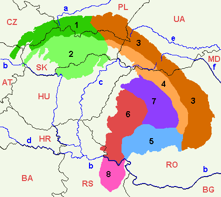
Serbian Carpathians ( sr, / ) is a mountain range in eastern Central Serbia, located in Central Europe. It presents an extension of proper Carpathian Mountains across the Danube, connecting them with the Balkan Mountains in the southeast. They stretch in north-south direction in eastern Serbia, east of the Great Morava valley and west of the White Timok Valley and north of the Nišava Valley. The mountains are 800–1500 m high, and dominated by karst limestone geologic features, the highest one being Rtanj Mountain (1,565 m). Definitions Under the strict definition (as defined by the Serbian Academy of Sciences and Arts and adopted by the Carpathian Convention), Serbian part of the Carpathian Mountains covers only 732 km², or less than 1% of the total Carpathian area. That part encompasses the southern bank of the Iron Gate and the area of Đerdap National Park. The extreme points of so defined Carpathian area in Serbia are Tekija in the north, in the south, ... [...More Info...] [...Related Items...] OR: [Wikipedia] [Google] [Baidu] |
Serbian Cyrillic
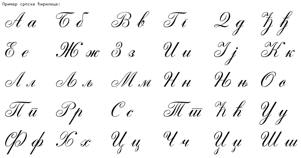
The Serbian Cyrillic alphabet ( sr, / , ) is a variation of the Cyrillic script used to write the Serbian language, updated in 1818 by Serbian linguist Vuk Karadžić. It is one of the two alphabets used to write standard modern Serbian, the other being Gaj's Latin alphabet. Karadžić based his alphabet on the previous Slavonic-Serbian script, following the principle of "write as you speak and read as it is written", removing obsolete letters and letters representing iotified vowels, introducing from the Latin alphabet instead, and adding several consonant letters for sounds specific to Serbian phonology. During the same period, linguists led by Ljudevit Gaj adapted the Latin alphabet, in use in western South Slavic areas, using the same principles. As a result of this joint effort, Serbian Cyrillic and Gaj's Latin alphabets for Serbian-Croatian have a complete one-to-one congruence, with the Latin digraphs Lj, Nj, and Dž counting as single letters. Karadžić's Cyril ... [...More Info...] [...Related Items...] OR: [Wikipedia] [Google] [Baidu] |
Mountains Of Serbia
Serbia is mountainous, with complex geology and parts of several mountain ranges: Dinaric Alps in the southwest, the northwestern corner of the Rila-Rhodope Mountains in the southeast of the country, Carpathian Mountains in the northeast, and Balkan Mountains and the easternmost section of Srednogorie mountain chain system in the east, separated by a group of dome mountains along the Morava river valley. The northern province of Vojvodina lies in the Pannonian plain, with several Pannonian island mountains. Mountains of Kosovo are listed in a separate article. List This is the list of mountains and their highest peaks in Serbia, excluding Kosovo. When a mountain has several major peaks, they are listed separately.http://solair.eunet.rs/~s.ilic/planine.txt (Adopted with author's permission.) Peaks over 2,000 meters The following lists only those mountain peaks which reach over 2,000 meters in height.Statistical Yearbook of Serbia 2007; chapter 1. titled ''Geog ... [...More Info...] [...Related Items...] OR: [Wikipedia] [Google] [Baidu] |
Bor, Serbia
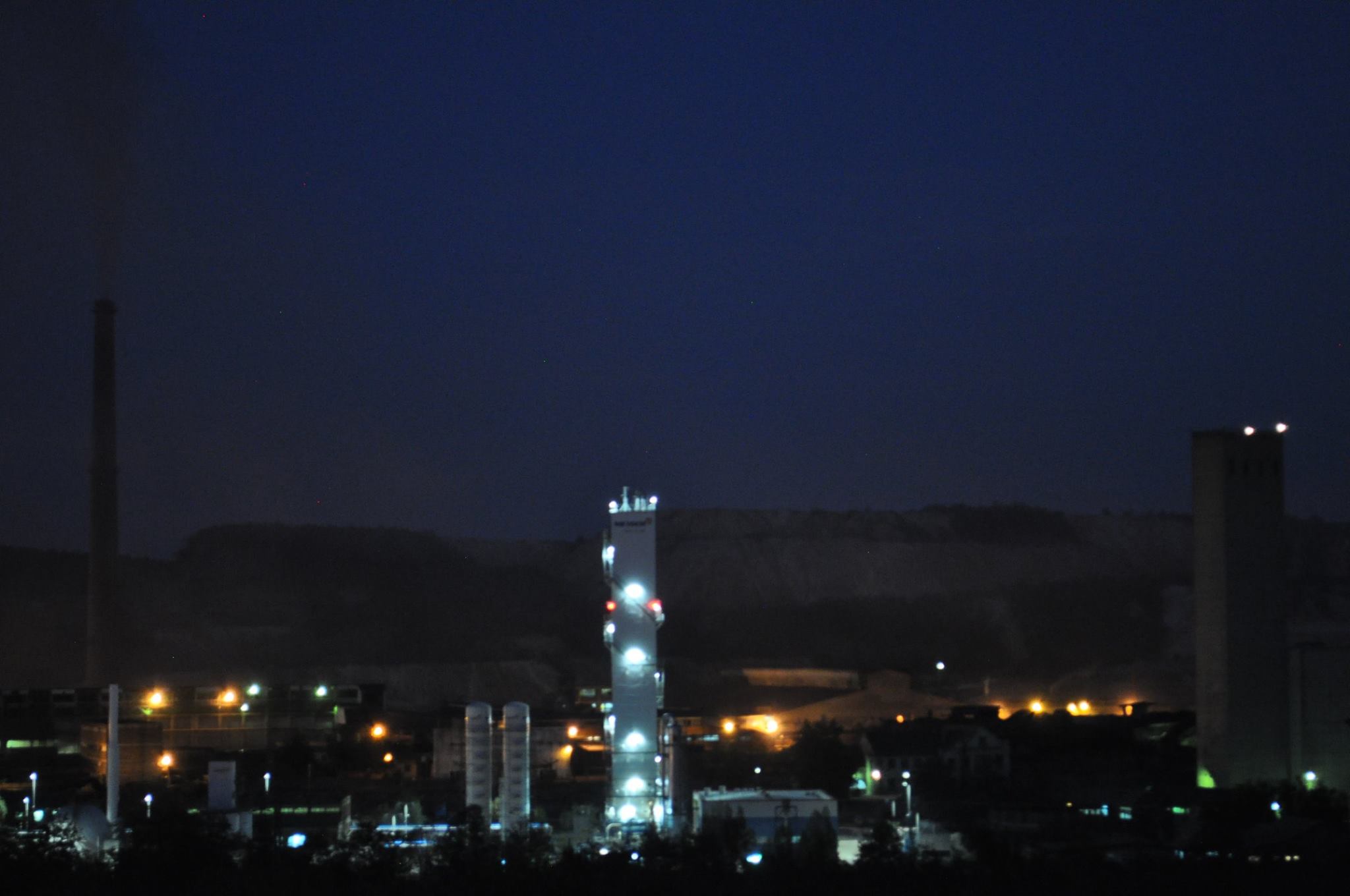
Bor ( sr-cyr, Бор; ro, Bor) is a city and the administrative center of the Bor District in eastern Serbia. According to the 2011 census, the city administrative area has a population of 48,615 inhabitants. It has one of the largest copper mines in Europe – RTB Bor. It has been a mining center since 1904, when a French company began operations there. With 760 residential buildings it presents the most urban area due to number of citizens in country, and one of top-five cities in Serbia by number of buildings. Name The name is derived from the Serbian word ''Bor'' (Бор), meaning "pine". Geography Bor is surrounded by many locations such as Banjsko Polje, Brestovačka Banja spa, Borsko Jezero lake, and Stol mountain, and is close to Mount Crni Vrh. Climate Bor has a humid continental climate (Köppen climate classification: ''Dfb'') with pleasantly warm summers, cold winters and uniformly distributed precipitation throughout the year. Flora and fauna The Lazar's ... [...More Info...] [...Related Items...] OR: [Wikipedia] [Google] [Baidu] |
Mali Krš
Mali Krš (Serbian Cyrillic: Мали крш) is a mountain in eastern Serbia. Its highest peak, Garvan, has an elevation of 929 metres above sea level. While not particularly rugged, Mali Krš is remote, hidden between nearby mountains of Liškovac, Veliki Krš Veliki Krš (Serbian Cyrillic: Велики крш) is a mountain in eastern Serbia Serbia (, ; Serbian: , , ), officially the Republic of Serbia (Serbian: , , ), is a landlocked country in Southeastern and Central Europe, situated at the ... and Homolje mountains. Like nearby Veliki Krš and Stol, Mali Krš is dominated by karst formations, and they are collectively known as "Gornjanski kras". Mali Krš has an elongated karst ridge at the top section. References External linksSpecies of Mali krš [...More Info...] [...Related Items...] OR: [Wikipedia] [Google] [Baidu] |
Stol (Serbia)
Stol (Serbian Cyrillic: Стол) is a mountain in eastern Serbia Serbia (, ; Serbian: , , ), officially the Republic of Serbia (Serbian: , , ), is a landlocked country in Southeastern and Central Europe, situated at the crossroads of the Pannonian Basin and the Balkans. It shares land borders with Hungar ..., near the town of Bor. Its highest peak has an elevation of 1,156 meters above sea level. Like nearby Veliki Krš and Mali Krš, Stol has a number of pronounced karst formations. There is a mountain hut with around 35 beds, maintained by the mountaineering society "Crni vrh" from Bor. Rock climbing on Stol Stol is a developed climbing spot, with 68 bolted routes, difficulties from 4c to 8a+. References External links Tamo gde se Boru vraća oduzeto TK Info Bor, Serbia Mountains of Serbia Serbian Carpathians {{serbia-geo-stub ... [...More Info...] [...Related Items...] OR: [Wikipedia] [Google] [Baidu] |
Karst
Karst is a topography formed from the dissolution of soluble rocks such as limestone, dolomite, and gypsum. It is characterized by underground drainage systems with sinkholes and caves. It has also been documented for more weathering-resistant rocks, such as quartzite, given the right conditions. Subterranean drainage may limit surface water, with few to no rivers or lakes. However, in regions where the dissolved bedrock is covered (perhaps by debris) or confined by one or more superimposed non-soluble rock strata, distinctive karst features may occur only at subsurface levels and can be totally missing above ground. The study of ''paleokarst'' (buried karst in the stratigraphic column) is important in petroleum geology because as much as 50% of the world's hydrocarbon reserves are hosted in carbonate rock, and much of this is found in porous karst systems. Etymology The English word ''karst'' was borrowed from German in the late 19th century, which entered German much earlier ... [...More Info...] [...Related Items...] OR: [Wikipedia] [Google] [Baidu] |
Mountains Of Serbia
Serbia is mountainous, with complex geology and parts of several mountain ranges: Dinaric Alps in the southwest, the northwestern corner of the Rila-Rhodope Mountains in the southeast of the country, Carpathian Mountains in the northeast, and Balkan Mountains and the easternmost section of Srednogorie mountain chain system in the east, separated by a group of dome mountains along the Morava river valley. The northern province of Vojvodina lies in the Pannonian plain, with several Pannonian island mountains. Mountains of Kosovo are listed in a separate article. List This is the list of mountains and their highest peaks in Serbia, excluding Kosovo. When a mountain has several major peaks, they are listed separately.http://solair.eunet.rs/~s.ilic/planine.txt (Adopted with author's permission.) Peaks over 2,000 meters The following lists only those mountain peaks which reach over 2,000 meters in height.Statistical Yearbook of Serbia 2007; chapter 1. titled ''Geog ... [...More Info...] [...Related Items...] OR: [Wikipedia] [Google] [Baidu] |


.jpg)