|
Vechur
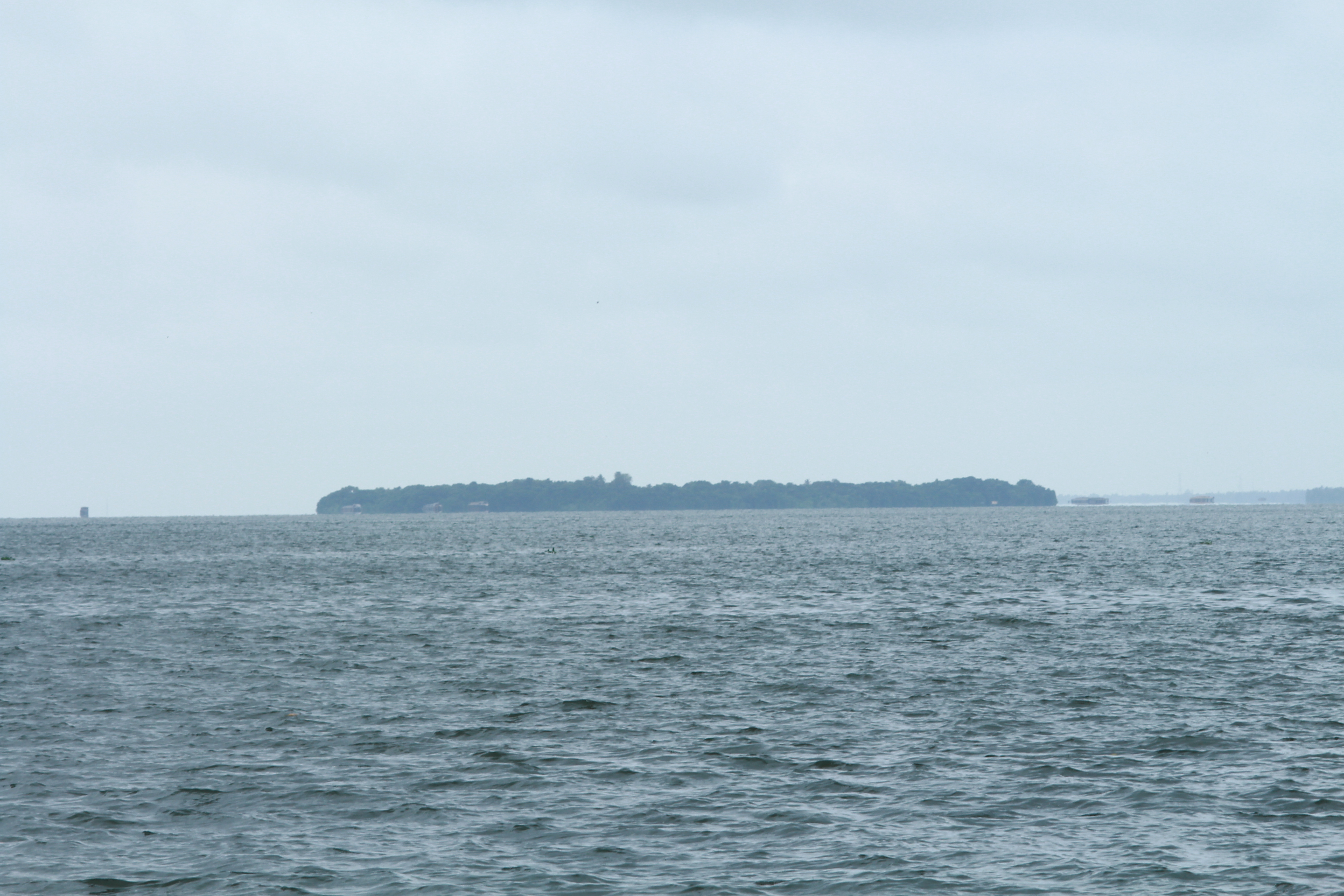
Vechoor is a village in Vaikom taluk, Kottayam district in the state of Kerala, India. Vechoor is a short drive away from one of Kerala's tourist destinations, Kumarakom. The Vechur Cow breed of cattle is named after this village. Geography Vechoor village covers a total area of 2,913 hectares. Vechoor is bordered by Vembanattu lake on the west and Kaipuzha river on south. Thanneermukkom Bund starts from Vechoor. The eastern part of Vechoor is majorly covered by paddy fields. There are many natural and man made canals in Vechoor which were used for water transport and irrigation. Transport links Until 1985, road connectivity to Vechoor was limited and bus services from Vaikom used to stop at Vechoor. A road bridge alongside Thanneermukkom Bund connected Vechoor to Alleppey district in 1985. In 2003, Vechoor got connected directly to Kottayam via Kumarakom. Renovation of Kallara - Vechoor road added further connectivity. Vechoor is about 10 km from both the towns Vaikom ... [...More Info...] [...Related Items...] OR: [Wikipedia] [Google] [Baidu] |
Vechur Cow
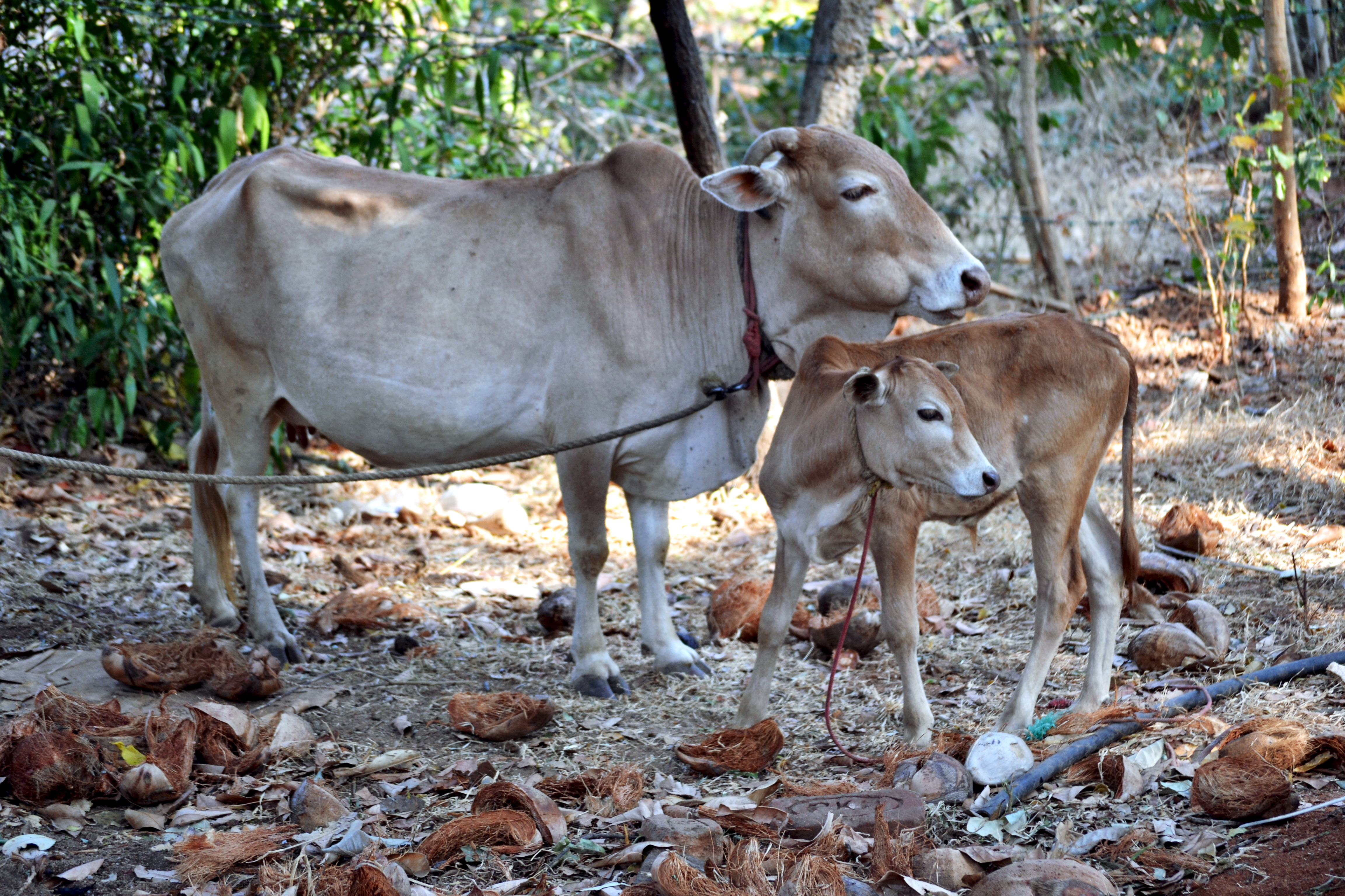
The Vechur Cow ( ml, വെച്ചൂര് പശു ) is a rare breed of ''Bos indicus'' cattle named after the village Vechoor in Vaikom Taluk, Kottayam district of the state of Kerala in India. With an average length of 124 cm (about 4 feet and 1 inch) and height of 87 cm (about 2 feet and 10 inches), it is the smallest cattle breed in the world according to the Guinness Book of Records, and is valued for the larger amount of milk it produces relative to the amount of food it requires.Krishnakumar, R. (9 April 1999).A cow and controversy, ''Frontline''. The Vechur animals were saved from extinction due to conservation efforts by Sosamma Iype, a Professor of Animal breeding and Genetics along with a team of her students. In 1989, a conservation unit was started. A Conservation trust was formed in 1998 to continue the work with farmer participation. The Vechur cow was popular in Kerala until the 1960s, but became rare when native cattle were crossbred with ex ... [...More Info...] [...Related Items...] OR: [Wikipedia] [Google] [Baidu] |
Vechoor Church 20120908 161620
Vechoor is a village in Vaikom taluk, Kottayam district in the state of Kerala, India. Vechoor is a short drive away from one of Kerala's tourist destinations, Kumarakom. The Vechur Cow breed of cattle is named after this village. Geography Vechoor village covers a total area of 2,913 hectares. Vechoor is bordered by Vembanattu lake on the west and Kaipuzha river on south. Thanneermukkom Bund starts from Vechoor. The eastern part of Vechoor is majorly covered by paddy fields. There are many natural and man made canals in Vechoor which were used for water transport and irrigation. Transport links Until 1985, road connectivity to Vechoor was limited and bus services from Vaikom used to stop at Vechoor. A road bridge alongside Thanneermukkom Bund connected Vechoor to Alleppey district in 1985. In 2003, Vechoor got connected directly to Kottayam via Kumarakom. Renovation of Kallara - Vechoor road added further connectivity. Vechoor is about 10 km from both the towns Vai ... [...More Info...] [...Related Items...] OR: [Wikipedia] [Google] [Baidu] |
Vechoor Muthi 07-09-2012 3-31-55 PM
Vechoor is a village in Vaikom taluk, Kottayam district in the state of Kerala, India. Vechoor is a short drive away from one of Kerala's tourist destinations, Kumarakom. The Vechur Cow breed of cattle is named after this village. Geography Vechoor village covers a total area of 2,913 hectares. Vechoor is bordered by Vembanattu lake on the west and Kaipuzha river on south. Thanneermukkom Bund starts from Vechoor. The eastern part of Vechoor is majorly covered by paddy fields. There are many natural and man made canals in Vechoor which were used for water transport and irrigation. Transport links Until 1985, road connectivity to Vechoor was limited and bus services from Vaikom used to stop at Vechoor. A road bridge alongside Thanneermukkom Bund connected Vechoor to Alleppey district in 1985. In 2003, Vechoor got connected directly to Kottayam via Kumarakom. Renovation of Kallara - Vechoor road added further connectivity. Vechoor is about 10 km from both the towns Vai ... [...More Info...] [...Related Items...] OR: [Wikipedia] [Google] [Baidu] |
Thanneermukkom Bund
The Thanneermukkom Bund (Thannermukkom Salt Water Barrier) was constructed as a part of the Kuttanad Development Scheme to prevent tidal action and intrusion of salt water into the Kuttanad low-lands across Vembanad Lake between Thannermukkom on west and Vechur on east. Thanneermukkom Bund was constructed in 1974 and is functional since 1976. It is the largest mud regulator in India. This barrier essentially divides the lake into two parts - one with brackish water perennially and the other half with fresh water fed by the rivers draining into the lake. Geography The bund is in Kuttanad, Kerala, India, located at . The barrier has divided the Vembanad lake into two parts converting the upstream part in to a fresh water coastal reservoir. It is presently the only one coastal reservoir in India. Location It has been built across Lake Vembanad. It connects Vechoor of Vaikom taluk of Kottayam district and Thanneermukkom of Cherthala taluk Alappuzha district. It can be reached by ... [...More Info...] [...Related Items...] OR: [Wikipedia] [Google] [Baidu] |
Ernakulam
Ernakulam () is the Central Business District of the city of Kochi in Kerala, India and has lent its name to the Ernakulam district. Many major establishments, including the Kerala High Court, the office of the Kochi Municipal Corporation and the Cochin Shipyard are situated here. History Classical history The region can claim to have played a significant part in fostering the trade relations between Kerala and the outside world in the ancient and medieval period. The early political history of Ernakulam is interlinked with that of the Chera Dynasty of the Sangam age, who ruled over vast portions of Kerala and Tamil Nadu. After the Cheras, the place was later ruled by the Kingdom of Cochin (Perumpadapu Swaroopam). Princely State of Cochin Although under British suzerainty (specifically the East India Company) since the Anglo-Dutch Treaty of 1814, Rama Varma XII of the Kingdom of Cochin moved his capital from Mattancherry to Tripunithura in about 1840. Fort Cochin Munic ... [...More Info...] [...Related Items...] OR: [Wikipedia] [Google] [Baidu] |
Cherthala
Cherthala, , (formerly Shertalai, Shertallai or Shertallay) is a Municipal town and a Taluk located at National highway 66 in the district of Alappuzha, in the state of Kerala, India. Cherthala is the satellite town and industrial hub of Alappuzha. In the local administration, Cherthala is a municipality, while in the state administrative structure Cherthala is a taluk and its headquarters are in the district of Alappuzha. Etymology According to local legend, Vilwamangalam Swamiyar, the Kerala Hindu saint, while travelling through Cherthala, found an idol of the Devi with its head immersed in a muddy pond. The swami understood the divinity of the idol, took it out of the mud, cleaned it and consecrated it in a temple near the pond. Thus the place is believed to have gotten its name as ''cher'' meaning "mud" and ''thala'' meaning "head" in Malayalam. The deity of the temple has the name ''Cherthala Karthiyayani''. Climate Demographics According to 2011 census report, Chert ... [...More Info...] [...Related Items...] OR: [Wikipedia] [Google] [Baidu] |
Kottayam
Kottayam () is a municipal town in the Indian state of Kerala. Flanked by the Western Ghats on the east and the Vembanad Lake and paddy fields of Kuttanad on the west. It is the district headquarters of Kottayam district, located in south-west Kerala. Kottayam is located in the basin of the Meenachil River at an average elevation of above sea level, and has a moderate climate. It is located approximately north of the state capital Thiruvananthapuram. Kottayam is also referred to as "The City of Letters" as many of the first Malayalam daily newspapers, like '' Deepika,'' ''Malayala Manorama,'' and ''Mangalam,'' were started and are headquartered in Kottayam, as are a number of publishing houses. Etymology The royal palace of the Thekkumkur ruler was protected by a fort called ''Thaliyilkotta''. It is believed that the name ''Kottayam'' is derived from a combination of the Malayalam words ''kotta'' which means fort (''Thaliyilkotta'') and ''akam'' which means inside. The com ... [...More Info...] [...Related Items...] OR: [Wikipedia] [Google] [Baidu] |
Alappuzha
Alappuzha or Alleppey () is the administrative headquarters of Alappuzha district in States and territories of India, state of Kerala, India. The Kerala Backwaters, Backwaters of Alappuzha are one of the most popular tourist attractions in India which attracts millions of domestic and international tourists. Alleppey is a city and a municipality in Kerala with an urban population of 174,164 and ranks third among the districts in literacy rate in the state. In 2016, the Centre for Science and Environment rated Alappuzha as the cleanest town in India. Alappuzha is considered to be the oldest planned city in this region and the lighthouse built on the coast of the city is the first of its kind along the Laccadive Sea coast. The city is 55 km from Kochi and 155 km north of Thiruvananthapuram district, Thiruvananthapuram. A town with canals, Kerala Backwaters, backwaters, Alappuzha Beach, beaches, and lagoons, Alappuzha was described by George Curzon, 1st Marquess Curzon o ... [...More Info...] [...Related Items...] OR: [Wikipedia] [Google] [Baidu] |
States And Territories Of India
India is a federal union comprising 28 states and 8 union territories, with a total of 36 entities. The states and union territories are further subdivided into districts and smaller administrative divisions. History Pre-independence The Indian subcontinent has been ruled by many different ethnic groups throughout its history, each instituting their own policies of administrative division in the region. The British Raj mostly retained the administrative structure of the preceding Mughal Empire. India was divided into provinces (also called Presidencies), directly governed by the British, and princely states, which were nominally controlled by a local prince or raja loyal to the British Empire, which held ''de facto'' sovereignty ( suzerainty) over the princely states. 1947–1950 Between 1947 and 1950 the territories of the princely states were politically integrated into the Indian union. Most were merged into existing provinces; others were organised into ... [...More Info...] [...Related Items...] OR: [Wikipedia] [Google] [Baidu] |
Vembanattu
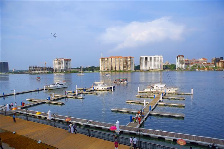
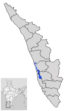
Vembanad is the longest lake in India, as well as the largest lake in the state of Kerala. The lake has an area of 230 square kilometers and a maximum length of 96.5 km. Spanning several districts in the state of Kerala, it is known as Vembanadu Lake in Kottayam, Vaikom, Changanassery, Punnamada Lake in Alappuzha, Punnappra, Kuttanadu and Kochi Lake in Kochi. Several groups of small islands including Vypin, Mulavukad, Maradu, Udayamperoor, Vallarpadam, Willingdon Island are located in the Kochi Lake portion. Kochi Port is built around the Willingdon Island and the Vallarpadam island. Kuttanad, also known as ''The Rice Bowl of Kerala'', has the lowest altitude in India, and is also one of the few places in world where cultivation takes place below sea level. Kuttanad lies on the southern portion of Vembanad. The Nehru Trophy Boat Race is conducted in a portion of the lake. High levels of pollution have been noticed at certain hotspots of the Vembanad backwaters. The ... [...More Info...] [...Related Items...] OR: [Wikipedia] [Google] [Baidu] |
Cochin International Airport
Cochin International Airport is an International airport serving the city of Kochi, in the state of Kerala, India. Located at Nedumbassery, about northeast of the city centre, Cochin International Airport is first of its kind which is developed under a public-private partnership (PPP) model in India. This project was funded by nearly 10,000 non-resident Indians from 32 countries. It is the busiest and largest airport in the state of Kerala and 4th biggest airport in South India. , the Cochin International Airport caters to 61.8% of the total air passenger movement in Kerala. It is the third busiest airport in India in terms of international traffic and also ninth busiest overall. In fiscal year 2018–19, the airport handled more than 10.2 million passengers with a total of 71,871 aircraft movements. The airport operates three passenger terminals and one cargo terminal with a total area of over . In 2015, Cochin International Airport became the world's first fully sol ... [...More Info...] [...Related Items...] OR: [Wikipedia] [Google] [Baidu] |
Carnatic Music
Carnatic music, known as or in the Dravidian languages, South Indian languages, is a system of music commonly associated with South India, including the modern Indian states of Karnataka, Andhra Pradesh, Telangana, Kerala and Tamil Nadu, and Sri Lanka. It is one of two main subgenres of Indian classical music that evolved from ancient Hindu Texts and traditions, particularly the Samaveda. The other subgenre being Hindustani music, which emerged as a distinct form because of Persian or Islamic influences from Northern India. The main emphasis in Carnatic music is on vocal music; most compositions are written to be sung, and even when played on instruments, they are meant to be performed in ''gāyaki'' (singing) style. Although there are stylistic differences, the basic elements of (the relative musical pitch), (the musical sound of a single note), (the mode or melodic formulæ), and (the rhythmic cycles) form the foundation of improvisation and composition in both Carnati ... [...More Info...] [...Related Items...] OR: [Wikipedia] [Google] [Baidu] |


_22-Mar-2007_10-12-15_AM.jpg)


