|
Valle Mesolcina
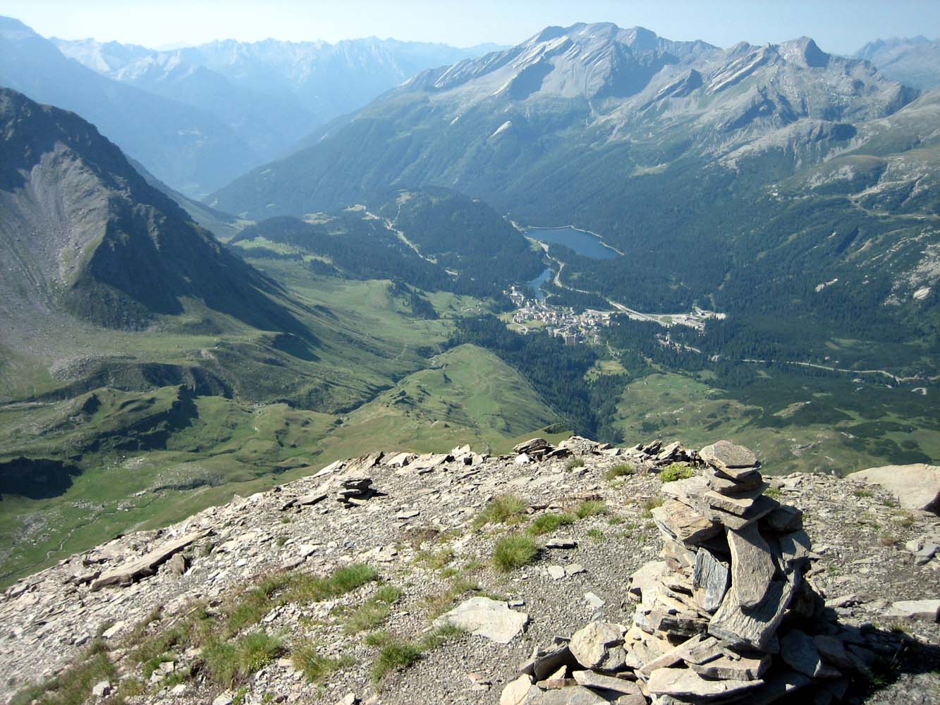
The ''Valle Mesolcina'', also known as the ''Val Mesolcina'' or ''Misox'' (German), is an alpine valley of the Grisons, Switzerland, stretching from the San Bernardino Pass to Grono where it joins the Calanca Valley. It is the valley formed by the river Moesa. Like the Val Bregaglia or the Val Poschiavo, the Valle Mesolcina is a valley lying south of the main ridge of the Alps. Although politically the Valle Mesolcina belongs to the Grisons, its population is predominantly Italian-speaking and culturally oriented towards the Ticino. The valley includes the Mesocco and Roveredo of the Moesa district, including: * Mesocco * Soazza * Lostallo * Verdabbio * Cama * Leggia * Grono * Roveredo Roveredo is a municipality in the Moesa Region in the canton of Graubünden in Switzerland. Geography Roveredo has an area, , of . Of this area, 8.6% is used for agricultural purposes, while 75% is forested. Of the rest of the land, 3.1% is ... * San Vittore External links * {{ ... [...More Info...] [...Related Items...] OR: [Wikipedia] [Google] [Baidu] |
Uccello
Uccello () is an Italian surname. Notable people with the surname include: * Antonina Uccello (born 1922), American politician * Julian Uccello (born 1986), Canadian soccer player * Luca Uccello (born 1997), Canadian soccer player *Paolo Uccello Paolo Uccello ( , ; 1397 – 10 December 1475), born Paolo di Dono, was an Italian (Florentine) painter and mathematician who was notable for his pioneering work on visual perspective in art. In his book ''Lives of the Most Excellent Painters, S ... (1397–1475), Italian painter and mathematician Italian-language surnames {{Bird-surname ... [...More Info...] [...Related Items...] OR: [Wikipedia] [Google] [Baidu] |
Moesa District
Moesa District, often referred to as Moesano, is a former Districts of Switzerland, administrative district in the Cantons of Switzerland, canton of Graubünden, Switzerland. It had an area of corresponding to the Val Mesolcina, the valley of the eponymous Moesa River. It was replaced with the Moesa Region on 1 January 2017 as part of a reorganization of the Canton. accessed 16 February 2017 It had a population of 8,125 in 2015. The official language is Italian. It consisted of three ''Circle (country subdivision), Kreise'' (circles) and fourteen Municipalities of Switzerland, municipalities: |
San Vittore GR
San Vittore is a municipality in the Moesa Region in the Swiss canton of Grisons (Graubünden). Geography San Vittore is situated in the lower part of the valley of the Moesa river, just over upstream of the border with the canton of Ticino, and upstream of Arbedo-Castione, where the Moesa river joins the Ticino river. At above sea level, it is the lowest-lying community in Graubünden. San Vittore has an area, , of . Of this area, 15.5% is used for agricultural purposes, while 66.7% is forested. Of the rest of the land, 2.8% is settled (buildings or roads) and the remainder (15%) is non-productive (rivers, glaciers or mountains). Demographics San Vittore has a population (as of ) of . , 14.2% of the population was made up of foreign nationals. Over the last 10 years the population has grown at a rate of 16.2%. Most of the population () speaks Italian (88.7%), with German being second most common ( 7.6%) and French being third ( 1.1%). [...More Info...] [...Related Items...] OR: [Wikipedia] [Google] [Baidu] |
Roveredo GR
Roveredo is a municipality in the Moesa Region in the canton of Graubünden in Switzerland. Geography Roveredo has an area, , of . Of this area, 8.6% is used for agricultural purposes, while 75% is forested. Of the rest of the land, 3.1% is settled (buildings or roads) and the remainder (13.4%) is non-productive (rivers, glaciers or mountains). Before 2017, the municipality was located in the Roveredo sub-district of the Moesa district on the right bank of the Moesa river, after 2017 it was in the Moesa Region. Demographics Roveredo has a population (as of ) of . , 16.8% of the population was made up of foreign nationals. Over the last 10 years the population has grown at a rate of 6.4%. Most of the population () speaks Italian (93.0%), with German being second most common ( 3.2%) and French being third ( 0.7%). [...More Info...] [...Related Items...] OR: [Wikipedia] [Google] [Baidu] |
Leggia
Leggia is a former municipality in the district of Moesa in the Swiss canton of Graubünden. On 1 January 2017 the former municipalities of Leggia and Verdabbio merged into the municipality of Grono. published by the Swiss Federal Statistical Office accessed 27 April 2016 History Leggia is first mentioned in 1295 as ''de Legia''.Geography Leggia had an area, , of . Of this area, 8.6% is used for agricultural purposes, while 63.9% is forested. Of the rest of the land, 2.7% is settled (buildings or roads) and the remainder (24.7%) is non-productive (rivers, glaciers or mountains). The former municipality is located in the Roveredo sub-district of the Moesa ...[...More Info...] [...Related Items...] OR: [Wikipedia] [Google] [Baidu] |
Cama GR
Cama is a municipality in the Moesa Region in the Swiss canton of Graubünden. History Cama is first mentioned in 1219 as ''Camma''. Between 1907 and 1978, Mesocco was linked to Bellinzona and the Gotthard railway to the south, and Mesocco to the north, by the Bellinzona–Mesocco railway. The section between Cama and Castione-Arbedo station, on the Gotthard line, remained open for freight until 2003, and is now operated as a tourist railway. Geography Cama has an area, , of . Of this area, 4.2% is used for agricultural purposes, while 60.1% is forested. Of the rest of the land, 2.7% is settled (buildings or roads) and the remainder (33.1%) is non-productive (rivers, glaciers or mountains). Before 2017, the municipality was located in the Moesa district in the Roveredo sub-district, along both banks of the Moesa river. It consists of the village of Cama and the sections of Al Pont and Norantola. Lago di Cama is located in the municipality. Demographics Cama has a popu ... [...More Info...] [...Related Items...] OR: [Wikipedia] [Google] [Baidu] |
Verdabbio
Verdabbio is a former municipality in the district of Moesa in the Swiss canton of Graubünden. On 1 January 2017 the former municipalities of Leggia and Verdabbio merged into the municipality of Grono. published by the Swiss Federal Statistical Office accessed 27 April 2016 History Verdabbio is first mentioned in 1203 as ''Vertabio''.Geography Verdabbio had an area, , of . Of this area, 4.9% is used for agricultural purposes, while 62.1% is forested. Of the rest of the land, 1.1% is settled (buildings or roads) and the remainder (31.9%) is non-productive (rivers, glaciers or mountains). The former municipality is located in the Roveredo sub-district of t ...[...More Info...] [...Related Items...] OR: [Wikipedia] [Google] [Baidu] |
Lostallo
Lostallo is a municipality in the Moesa Region in the Swiss canton of Graubünden. History Lostallo is first mentioned in 1219. Geography Lostallo has an area, , of . Of this area, 6.8% is used for agricultural purposes, while 59% is forested. Of the rest of the land, 1.8% is settled (buildings or roads) and the remainder (32.3%) is non-productive (rivers, glaciers or mountains). Before 2017, the municipality was located in the Mesocco sub-district of the Moesa district on the right bank of the Moesa river. It consists of the village of Lostallo and the hamlets of Cabbiolo to the north and Sorte to the south. Demographics Lostallo has a population (as of ) of . , 11.7% of the population was made up of foreign nationals. Over the last 10 years the population has grown at a rate of 5%. Most of the population () speaks Italian (81.4%), with German being second most common (13.4%) and Portuguese being third ( 2.0%). [...More Info...] [...Related Items...] OR: [Wikipedia] [Google] [Baidu] |
Soazza
Soazza is a municipality in the Moesa Region in the Swiss canton of Graubünden. History Soazza is first mentioned in 1203 as ''Soaza''. Geography Soazza has an area, , of . Of this area, 7.2% is used for agricultural purposes, while 53.7% is forested. Of the rest of the land, 1.5% is settled (buildings or roads) and the remainder (37.7%) is non-productive (rivers, glaciers or mountains). Demographics Soazza has a population (as of ) of . , 11.9% of the population was made up of foreign nationals. Over the last 10 years the population has decreased at a rate of -6.9%. Most of the population () speaks Italian (91.9%), with German being second most common ( 3.3%) and Serbo-Croatian being third ( 2.2%).Swiss Federal Statistical Office accessed 22-Oct-2009 , the gender distribution of the popu ... [...More Info...] [...Related Items...] OR: [Wikipedia] [Google] [Baidu] |
Mesocco
Mesocco ( Lombard: ''Mesòch'') is a municipality in the Moesa Region in the Swiss canton of Graubünden. History The first human settlement in the area dates back to the Mesolithic era. Stone tools dating to about 6000 BC have been found in the Silex section of the municipality. At the same site, Neolithic fire pits and ceramics (5000 BC) were also discovered. The first permanent settlements in the area date to the Bronze Age (about 1400-1200 BC) and the pre-Roman Iron Age. A notable necropolis from the early Iron Age (600-500 BC) and traces of a Roman settlement were discovered on Gorda hill near the village. Additionally, an Early Middle Ages grave (6th century AD) was also discovered on the same hill. The castle was built in the 12th century and is first mentioned in 1219. The village of Mesocco is first mentioned in 1203 as ''Mesoco''. In 1383 it was mentioned as ''Misogg''. In 1480 Mesocco and Soazza willingly joined the Gray League. Between 1907 and 1978, Mesocco was l ... [...More Info...] [...Related Items...] OR: [Wikipedia] [Google] [Baidu] |
Ticino
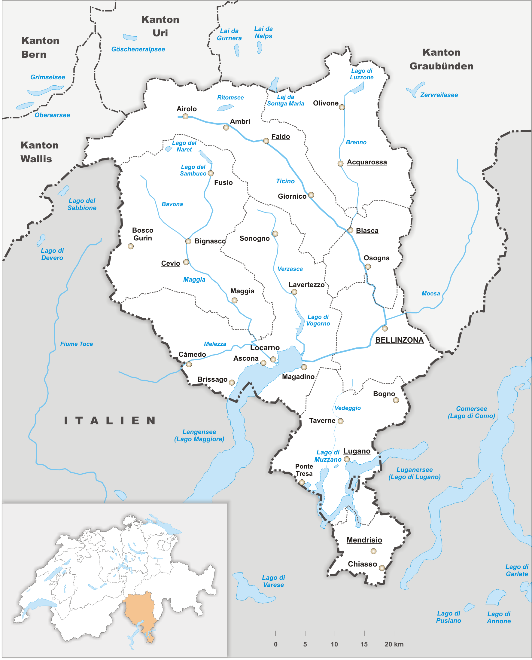
Ticino (), sometimes Tessin (), officially the Republic and Canton of Ticino or less formally the Canton of Ticino,, informally ''Canton Ticino'' ; lmo, Canton Tesin ; german: Kanton Tessin ; french: Canton du Tessin ; rm, Chantun dal Tessin . is one of the 26 cantons forming the Swiss Confederation. It is composed of eight districts and its capital city is Bellinzona. It is also traditionally divided into the Sopraceneri and the Sottoceneri, respectively north and south of Monte Ceneri. Red and blue are the colours of its flag. Ticino is the southernmost canton of Switzerland. It is one of the three large southern Alpine cantons, along with Valais and the Grisons. However, unlike all other cantons, it lies almost entirely south of the Alps, and has no natural access to the Swiss Plateau. Through the main crest of the Gotthard and adjacent mountain ranges, it borders the canton of Valais to the northwest, the canton of Uri to the north and the canton of Grisons to the northea ... [...More Info...] [...Related Items...] OR: [Wikipedia] [Google] [Baidu] |
Swiss Alps
The Alpine region of Switzerland, conventionally referred to as the Swiss Alps (german: Schweizer Alpen, french: Alpes suisses, it, Alpi svizzere, rm, Alps svizras), represents a major natural feature of the country and is, along with the Swiss Plateau and the Swiss portion of the Jura Mountains, one of its three main physiographic regions. The Swiss Alps extend over both the Western Alps and the Eastern Alps, encompassing an area sometimes called Central Alps. While the northern ranges from the Bernese Alps to the Appenzell Alps are entirely in Switzerland, the southern ranges from the Mont Blanc massif to the Bernina massif are shared with other countries such as France, Italy, Austria and Liechtenstein. The Swiss Alps comprise almost all the highest mountains of the Alps, such as Dufourspitze (4,634 m), the Dom (4,545 m), the Liskamm (4,527 m), the Weisshorn (4,506 m) and the Matterhorn (4,478 m). The other following major summits can be found in this list of mountains of S ... [...More Info...] [...Related Items...] OR: [Wikipedia] [Google] [Baidu] |


