|
Vector Tiles
Vector tiles, tiled vectors or vectiles are packets of geographic data, packaged into pre-defined roughly-square shaped "tiles" for transfer over the web. This is an emerging method for delivering styled web maps, combining certain benefits of pre-rendered raster map tiles with vector map data. As with the widely used raster tiled web maps, map data is requested by a client as a set of "tiles" corresponding to square areas of land of a pre-defined size and location. Unlike raster tiled web maps, however, the server returns vector map data, which has been clipped to the boundaries of each tile, instead of a pre-rendered map image. There are several major advantages of this hybrid approach. Compared to an un-tiled vector map, the data transfer is reduced, because only data within the current viewport, and at the current zoom level needs to be transferred. The GIS clipping operations can all be performed in advance, as the tile boundaries are pre-defined. This in turn means that tiled ... [...More Info...] [...Related Items...] OR: [Wikipedia] [Google] [Baidu] |
Web Mapping
Web mapping or an online mapping is the process of using maps, usually created through geographic information systems (GIS), on the Internet, more specifically in the World Wide Web (WWW). A web map or an online map is both served and consumed, thus web mapping is more than just web cartography, it is a service by which consumers may choose what the map will show. Web GIS emphasizes geodata processing aspects more involved with design aspects such as data acquisition and server software architecture such as data storage and algorithms, than it does the end-user reports themselves. The terms ''web GIS'' and ''web mapping ''remain somewhat synonymous. Web GIS uses web maps, and end users who are ''web mapping'' are gaining analytical capabilities. The term ''location-based services'' refers to ''web mapping'' consumer goods and services. Web mapping usually involves a web browser or other user agent capable of client-server interactions. Questions of quality, usability, social ben ... [...More Info...] [...Related Items...] OR: [Wikipedia] [Google] [Baidu] |
Esri
Esri (; Environmental Systems Research Institute) is an American multinational geographic information system (GIS) software company. It is best known for its ArcGIS products. With a 43% market share, Esri is the world's leading supplier of GIS software, web GIS and geodatabase management applications. The company is headquartered in Redlands, California. Founded as the Environmental Systems Research Institute in 1969 as a land-use consulting firm, Esri currently has 49 offices worldwide including 11 research and development centers in the United States, Europe, the Middle East and Africa and Asia Pacific. There are 10 regional U.S. offices and over 3,000 partners globally, with users in every country and a total of over a million active users in 350,000 organizations. These include Fortune 500 companies, most national governments, 20,000 cities, all 50 US States and 7,000+ universities. The firm has 4,000 total employees, and is privately held by its founders. In a 2016 Invest ... [...More Info...] [...Related Items...] OR: [Wikipedia] [Google] [Baidu] |
Vector Tiles
Vector tiles, tiled vectors or vectiles are packets of geographic data, packaged into pre-defined roughly-square shaped "tiles" for transfer over the web. This is an emerging method for delivering styled web maps, combining certain benefits of pre-rendered raster map tiles with vector map data. As with the widely used raster tiled web maps, map data is requested by a client as a set of "tiles" corresponding to square areas of land of a pre-defined size and location. Unlike raster tiled web maps, however, the server returns vector map data, which has been clipped to the boundaries of each tile, instead of a pre-rendered map image. There are several major advantages of this hybrid approach. Compared to an un-tiled vector map, the data transfer is reduced, because only data within the current viewport, and at the current zoom level needs to be transferred. The GIS clipping operations can all be performed in advance, as the tile boundaries are pre-defined. This in turn means that tiled ... [...More Info...] [...Related Items...] OR: [Wikipedia] [Google] [Baidu] |
Golang
Go is a statically typed, compiled programming language designed at Google by Robert Griesemer, Rob Pike, and Ken Thompson. It is syntactically similar to C, but with memory safety, garbage collection, structural typing, and CSP-style concurrency. It is often referred to as Golang because of its former domain name, golang.org, but its proper name is Go. There are two major implementations: * Google's self-hosting "gc" compiler toolchain, targeting multiple operating systems and WebAssembly. * gofrontend, a frontend to other compilers, with the ''libgo'' library. With GCC the combination is gccgo; with LLVM the combination is gollvm. A third-party source-to-source compiler, GopherJS, compiles Go to JavaScript for front-end web development. History Go was designed at Google in 2007 to improve programming productivity in an era of multicore, networked machines and large codebases. The designers wanted to address criticism of other languages in use at Google, but keep ... [...More Info...] [...Related Items...] OR: [Wikipedia] [Google] [Baidu] |
TopoJSON
GeoJSON is an open standard format designed for representing simple geographical features, along with their non-spatial attributes. It is based on the JSON format. The features include points (therefore addresses and locations), line strings (therefore streets, highways and boundaries), polygons (countries, provinces, tracts of land), and multi-part collections of these types. GeoJSON features need not represent entities of the physical world only; mobile routing and navigation apps, for example, might describe their service coverage using GeoJSON. The GeoJSON format differs from other GIS standards in that it was written and is maintained not by a formal standards organization, but by an Internet working group of developers. A notable offspring of GeoJSON is TopoJSON, an extension of GeoJSON that encodes geospatial topology and that typically provides smaller file sizes. History The GeoJSON format working group and discussion were begun in March 2007 and the format spec ... [...More Info...] [...Related Items...] OR: [Wikipedia] [Google] [Baidu] |
PostGIS
PostGIS ( ) is an open source software program that adds support for geographic objects to the PostgreSQL object-relational database. PostGIS follows the Simple Features for SQL specification from the Open Geospatial Consortium (OGC). Technically PostGIS was implemented as a ''PostgreSQL external extension''. Features * Geometry types for Points, LineStrings, Polygons, MultiPoints, MultiLineStrings, MultiPolygons, GeometryCollections, 3D types TINS and polyhedral surfaces, including solids. * Spheroidal types under the geography datatype Points, LineStrings, Polygons, MultiPoints, MultiLineStrings, MultiPolygons and GeometryCollections. * raster type - supports various pixel types and more than 1000 bands per raster. Since PostGIS 3, is a separate PostgreSQL extension called postgis_raster. * SQL/MM Topology support - via PostgreSQL extension postgis_topology. * Spatial predicates for determining the interactions of geometries using the 3x3 DE-9IM (provided by the GEOS software ... [...More Info...] [...Related Items...] OR: [Wikipedia] [Google] [Baidu] |
OsmAnd
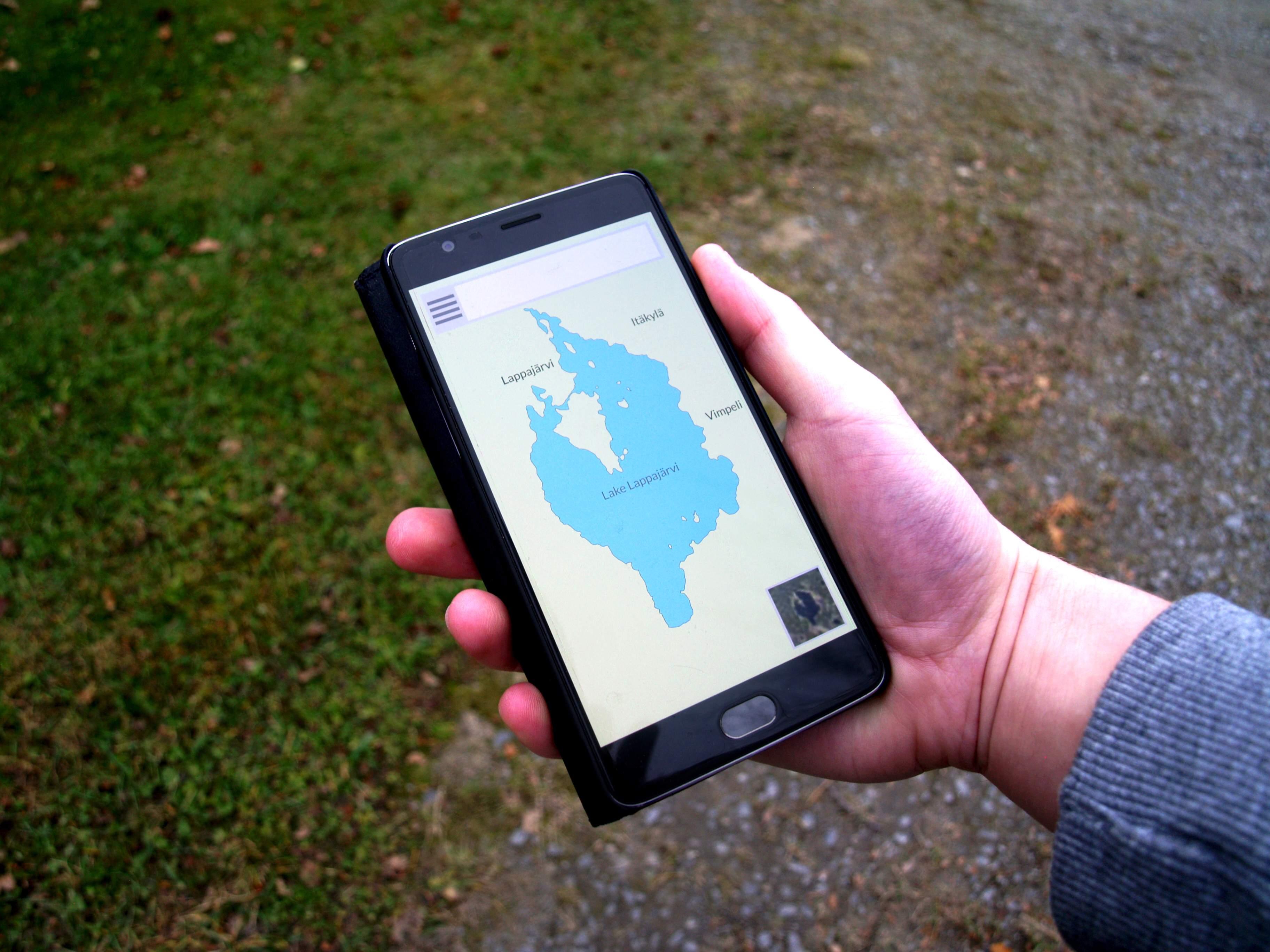
OsmAnd (; OpenStreetMap Automated Navigation Directions) is a map and navigation app for Android and iOS. It uses the OpenStreetMap (OSM) map database for its primary displays, but is an independent app not endorsed by the OpenStreetMap Foundation. It is available in both free and paid versions; the latter unlocks the download limit for offline maps and provides access to Wikipedia points of interest (POIs) and their descriptions from within the app. Map data can be stored on the device for offline use. Using the device's GPS capabilities, OsmAnd offers routing, with visual and voice guidance, for car, bike, and pedestrian. All of the main functionalities work both online and offline. Features Navigation Navigation provides turn-by-turn voice guidance for driving, walking, biking and public transport with route calculation made on the device. Typical features like estimated time of arrival and automatic rerouting are supported. Traffic aware routing and real-time arrival fo ... [...More Info...] [...Related Items...] OR: [Wikipedia] [Google] [Baidu] |
Mapnik
Mapnik is an open-source mapping toolkit for desktop and server based map rendering, written in C++. Artem Pavlenko, the original developer of Mapnik, set out with the explicit goal of creating beautiful maps by employing the sub-pixel anti-aliasing of the Anti-Grain Geometry (AGG) library. Mapnik now also has a Cairo rendering backend. For handling common software tasks such as memory management, file system access, regular expressions, and XML parsing, Mapnik utilizes the Boost C++ libraries. An XML file can be used to define a collection of mapping objects that determine the appearance of a map, or objects can be constructed programmatically in C++, Python, and Node.js. Data format A number of data formats are supported in Mapnik using a plugin framework. Current plugins exist that utilize OGR and GDAL to read a range of vector and raster datasets. Mapnik also has custom Shapefile, PostGIS and GeoTIFF readers. There is also an osm2pgsql utility, that converts OpenStreetMap d ... [...More Info...] [...Related Items...] OR: [Wikipedia] [Google] [Baidu] |
Vector Map
The Vector Map (VMAP), also called Vector Smart Map, is a vector-based collection of geographic information system (GIS) data about Earth at various levels of detail. Level 0 (low resolution) coverage is global and entirely in the public domain. Level 1 (global coverage at medium resolution) is only partly in the public domain. There are ongoing discussions about making most of the information available in the public domain. Description *Coordinate reference system: Geographic coordinates stored in decimal degrees with southern and western hemispheres using negative values for latitude and longitude, respectively. *Horizontal Datum: World Geodetic System 1984 (WGS 84). *Vertical Datum: Mean Sea Level. Thematic data layers Features and data attributes are tagged utilizing the international Feature and Attribute Coding Catalogue (FACC). #major road networks #railroad networks #hydrologic drainage systems #utility networks (cross-country pipelines and communication lines) #major a ... [...More Info...] [...Related Items...] OR: [Wikipedia] [Google] [Baidu] |
Web Mercator
Web Mercator, Google Web Mercator, Spherical Mercator, WGS 84 Web Mercator or WGS 84/Pseudo-Mercator is a variant of the Mercator map projection and is the de facto standard for Web mapping applications. It rose to prominence when Google Maps adopted it in 2005. It is used by virtually all major online map providers, including Google Maps, CARTO, Mapbox, Bing Maps, OpenStreetMap, Mapquest, Esri, and many others. Its official EPSG identifier is EPSG:3857, although others have been used historically. Properties Web Mercator is a slight variant of the Mercator projection, one used primarily in Web-based mapping programs. It uses the same formulas as the standard Mercator as used for small-scale maps. However, the Web Mercator uses the spherical formulas at all scales whereas large-scale Mercator maps normally use the ellipsoidal form of the projection. The discrepancy is imperceptible at the global scale but causes maps of local areas to deviate slightly from true ellipsoidal M ... [...More Info...] [...Related Items...] OR: [Wikipedia] [Google] [Baidu] |
Google Protocol Buffers
Protocol Buffers (Protobuf) is a free and open-source cross-platform data format used to serialize structured data. It is useful in developing programs to communicate with each other over a network or for storing data. The method involves an interface description language that describes the structure of some data and a program that generates source code from that description for generating or parsing a stream of bytes that represents the structured data. Overview Google developed Protocol Buffers for internal use and provided a code generator for multiple languages under an open-source license (see below). The design goals for Protocol Buffers emphasized simplicity and performance. In particular, it was designed to be smaller and faster than XML. Protocol Buffers are widely used at Google for storing and interchanging all kinds of structured information. The method serves as a basis for a custom remote procedure call (RPC) system that is used for nearly all inter-machine c ... [...More Info...] [...Related Items...] OR: [Wikipedia] [Google] [Baidu] |


