|
Utah State Route 270
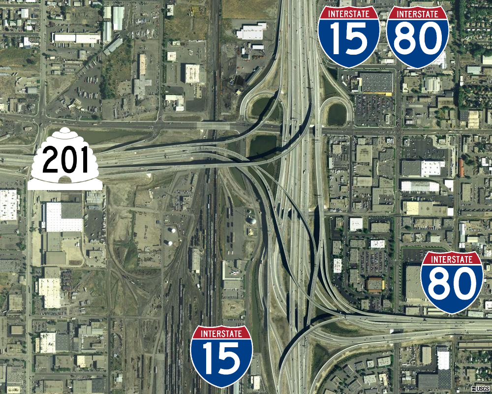
State Route 270 is a short north–south thoroughfare that sits completely within Salt Lake City in Salt Lake County, entirely along South West Temple Street. The southern terminus is at West 900 South, with ramps to and from I-15/I-80 at exit 305D; its northern terminus is at US-89 (West 400 South, formerly SR-186). Route description After its southern terminus, SR-270 heads north for its entire course, having a dual intersection with SR-269, one eastbound and one westbound. Afterwards it terminates at US-89. History The State Road Commission (now known as the Utah Department of Transportation The Utah Department of Transportation (UDOT) is an agency of the state government of Utah, United States; it is usually referred to by its initials UDOT (pronounced "you-dot"). UDOT is charged with maintaining the more than of roadway that co ...) designated SR-270 in 1960 as a branch from proposed I-15 to former SR-176 (West 900 South) at South West Temple Street. In 1969, ... [...More Info...] [...Related Items...] OR: [Wikipedia] [Google] [Baidu] |
Utah Department Of Transportation
The Utah Department of Transportation (UDOT) is an agency of the state government of Utah, United States; it is usually referred to by its initials UDOT (pronounced "you-dot"). UDOT is charged with maintaining the more than of roadway that constitute the network of state highways in Utah. The agency is headquartered in the Cal Rampton, Calvin L. Rampton state office complex in Taylorsville, Utah, Taylorsville, Utah. The executive director is Carlos Braceras with Lisa Wilson and Teri Newell as Deputy Directors. Project priorities are set forth by the independent Utah Transportation Commission, which coordinates directly with the UDOT. Structure UDOT maintains over of highways. The department is divided into four geographically defined regions and 10 functional groups: project development; operations; program development; technology and innovation; employee development; communications; policy and legislative services; audit; and finance. While the agency has maintenance stati ... [...More Info...] [...Related Items...] OR: [Wikipedia] [Google] [Baidu] |
Salt Lake City
Salt Lake City (often shortened to Salt Lake and abbreviated as SLC) is the Capital (political), capital and List of cities and towns in Utah, most populous city of Utah, United States. It is the county seat, seat of Salt Lake County, Utah, Salt Lake County, the most populous county in Utah. With a population of 200,133 in 2020, the city is the core of the Salt Lake City metropolitan area, which had a population of 1,257,936 at the 2020 census. Salt Lake City is further situated within a larger metropolis known as the Salt Lake City–Provo–Orem Combined Statistical Area, Salt Lake City–Ogden–Provo Combined Statistical Area, a corridor of contiguous urban and suburban development stretched along a segment of the Wasatch Front, comprising a population of 2,746,164 (as of 2021 estimates), making it the 22nd largest in the nation. It is also the central core of the larger of only two major urban areas located within the Great Basin (the other being Reno, Nevada). Salt Lake C ... [...More Info...] [...Related Items...] OR: [Wikipedia] [Google] [Baidu] |
Salt Lake County, Utah
Salt Lake County is located in the U.S. state of Utah. As of the 2020 United States Census, the population was 1,185,238, making it the most populous county in Utah. Its county seat and largest city is Salt Lake City, the state capital. The county was created in 1850. Salt Lake County is the 37th most populated county in the United States and is one of four counties in the Rocky Mountains to make it into the top 100. (Others being Denver County and El Paso County, Colorado and Clark County, Nevada.) Salt Lake County is the only county of the first class in Utah - under the Utah Code (Title 17, Chapter 50, Part 5) is a county with a population of 700,000 or greater. Salt Lake County occupies the Salt Lake Valley, as well as parts of the surrounding mountains, the Oquirrh Mountains to the west and the Wasatch Range to the east (essentially the entire Jordan River watershed north of the Traverse Mountains). In addition, the northwestern section of the county includes part of th ... [...More Info...] [...Related Items...] OR: [Wikipedia] [Google] [Baidu] |
Interstate 15 In Utah
Interstate 15 (I-15) runs north–south in the U.S. state of Utah through the southwestern and central portions of the state, passing through most of the state's population centers, including St. George and those comprising the Wasatch Front: Provo–Orem, Salt Lake City, and Ogden–Clearfield. It is Utah's primary north–south highway, as the vast majority of the state's population lives along its corridor; the Logan metropolitan area is the state's only Metropolitan Statistical Area through which I-15 does not pass. In 1998, the Utah State Legislature designated Utah's entire portion of the road as the Veterans Memorial Highway. Route description The Interstate passes through the fast-growing Dixie region, which includes St. George and Cedar City, and eventually most of the major cities and suburbs along the Wasatch Front, including Provo, Orem, Sandy, West Jordan, Salt Lake City, Layton, and Ogden. Around Cove Fort, I-70 begins its journey eastward across the co ... [...More Info...] [...Related Items...] OR: [Wikipedia] [Google] [Baidu] |
Interstate 80 In Utah
Interstate 80 (I-80) is a part of the Interstate Highway System that runs from San Francisco, California, to Teaneck, New Jersey. The portion of the highway in the US state of Utah is long through the northern part of the state. From west to east, I-80 crosses the state line from Nevada in Tooele County and traverses the Bonneville Salt Flats—which are a part of the larger Great Salt Lake Desert. It continues alongside the Wendover Cut-off—the corridor of the former Victory Highway— US Route 40 (US-40) and the Western Pacific Railroad Feather River Route. After passing the Oquirrh Mountains, I-80 enters the Salt Lake Valley and Salt Lake County. A short portion of the freeway is concurrent with I-15 through Downtown Salt Lake City. At the Spaghetti Bowl, I-80 turns east again into the mouth of Parleys Canyon and Summit County, travels through the mountain range, and intersects the eastern end of I-84 near Echo Reservoir before turning northeast toward the Wyo ... [...More Info...] [...Related Items...] OR: [Wikipedia] [Google] [Baidu] |
Utah State Route 186
State Route 186 (SR-186) is a state highway entirely within Salt Lake City, capital of the U.S. state of Utah. It forms a quarter-beltway connecting US-89 and I-15 leading north from Salt Lake City to I-80 leading east; as such, it effectively forms the missing (non-freeway) quarter of the I-215 belt route around the city, though it does not directly connect to I-215 at the north end. Despite this beltway role, the route passes through downtown Salt Lake City because downtown is built right up to the northern mountains surrounding City Creek Canyon. The portion of the route connecting downtown to I-80 is a high-capacity street heavily used by commuters, especially those travelling to the University of Utah or between downtown and eastern neighborhoods, but the portion on Capitol Hill north of downtown is much narrower and has sharp turns around the Capitol grounds. The roadway runs along Victory Road, Columbus Street, 300 North, State Street, 400 South, 500 South, and Foothill D ... [...More Info...] [...Related Items...] OR: [Wikipedia] [Google] [Baidu] |
Utah State Routes 270 And 269
Utah ( , ) is a state in the Mountain West subregion of the Western United States. Utah is a landlocked U.S. state bordered to its east by Colorado, to its northeast by Wyoming, to its north by Idaho, to its south by Arizona, and to its west by Nevada. Utah also touches a corner of New Mexico in the southeast. Of the fifty U.S. states, Utah is the 13th-largest by area; with a population over three million, it is the 30th-most-populous and 11th-least-densely populated. Urban development is mostly concentrated in two areas: the Wasatch Front in the north-central part of the state, which is home to roughly two-thirds of the population and includes the capital city, Salt Lake City; and Washington County in the southwest, with more than 180,000 residents. Most of the western half of Utah lies in the Great Basin. Utah has been inhabited for thousands of years by various indigenous groups such as the ancient Puebloans, Navajo and Ute. The Spanish were the first Europeans to ... [...More Info...] [...Related Items...] OR: [Wikipedia] [Google] [Baidu] |
Utah State Route 269
State Route 269 (SR-269) is a state highway in the U.S. state of Utah that sits completely within Salt Lake City in Salt Lake County. It consists entirely of a one-way pair of 500 South and 600 South, two parallel one-way streets that connect I-15 and I-80 to downtown Salt Lake City. SR-269 was designated in 1960 and constructed later that decade, coinciding with the construction of I-15 in the area. Prior to 2000, SR-269 began and ended with viaducts that were longer than they are now. From the western terminus, the viaduct extended from I-15/I-80 to 200 West, two blocks east of where the viaduct ends presently. The other segment's viaduct began at 300 West (also two blocks east of where it begins now) and extended to I-15/I-80. As a part of I-15's reconstruction and then-Salt Lake City Mayor Deedee Corradini's project that included The Gateway, the viaducts were drastically shortened. This was possible primarily because the Union Pacific Railroad was making much less use of t ... [...More Info...] [...Related Items...] OR: [Wikipedia] [Google] [Baidu] |
Utah State Route 270 Northbound At 269 Westbound
Utah ( , ) is a U.S. state, state in the Mountain states, Mountain West subregion of the Western United States. Utah is a landlocked U.S. state bordered to its east by Colorado, to its northeast by Wyoming, to its north by Idaho, to its south by Arizona, and to its west by Nevada. Utah also touches Four Corners, a corner of New Mexico in the southeast. Of the List of states and territories of the United States, fifty U.S. states, Utah is the List of U.S. states and territories by area, 13th-largest by area; with a population over three million, it is the List of U.S. states and territories by population, 30th-most-populous and List of U.S. states by population density, 11th-least-densely populated. Urban development is mostly concentrated in two areas: the Wasatch Front in the north-central part of the state, which is home to roughly two-thirds of the population and includes the capital city, Salt Lake City; and Washington County, Utah, Washington County in the southwest, wi ... [...More Info...] [...Related Items...] OR: [Wikipedia] [Google] [Baidu] |


