|
Utah State Route 201
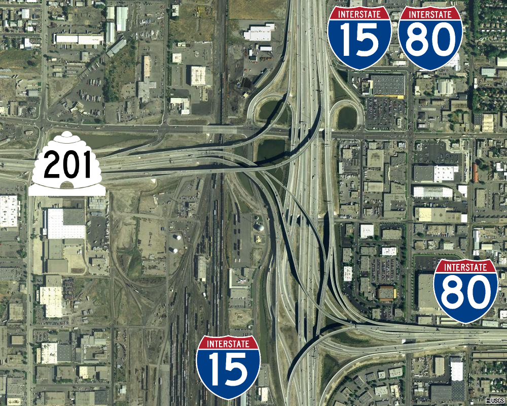
State Route 201 (SR-201) is an east–west expressway and freeway located in Salt Lake County in the U.S. state of Utah. Colloquially known by some as the ''21st South Freeway'', the route serves as an alternative to Interstate 80 (I-80) through Salt Lake City. From the western terminus of the route west of Magna, the highway heads east through Kennecott Copper property as an expressway before running through the western suburbs of Salt Lake City as a freeway. Shortly after the route returns on a surface route, SR-201 terminates on its eastern end at State Street (U.S. Route 89). The history of the route predates the invention of the automobile; the Donner Party, California Trail and Pony Express all followed the present-day path of the highway. During the 1910s, the route was designated a state highway and, in 1939, State Route 201 was officially written into law, running from Magna east to the mouth of Parley's Canyon. At one point, the highway carried US-50 Alternate w ... [...More Info...] [...Related Items...] OR: [Wikipedia] [Google] [Baidu] |
Utah Department Of Transportation
The Utah Department of Transportation (UDOT) is an agency of the state government of Utah, United States; it is usually referred to by its initials UDOT (pronounced "you-dot"). UDOT is charged with maintaining the more than of roadway that constitute the network of state highways in Utah. The agency is headquartered in the Cal Rampton, Calvin L. Rampton state office complex in Taylorsville, Utah, Taylorsville, Utah. The executive director is Carlos Braceras with Lisa Wilson and Teri Newell as Deputy Directors. Project priorities are set forth by the independent Utah Transportation Commission, which coordinates directly with the UDOT. Structure UDOT maintains over of highways. The department is divided into four geographically defined regions and 10 functional groups: project development; operations; program development; technology and innovation; employee development; communications; policy and legislative services; audit; and finance. While the agency has maintenance stati ... [...More Info...] [...Related Items...] OR: [Wikipedia] [Google] [Baidu] |
Parley's Canyon
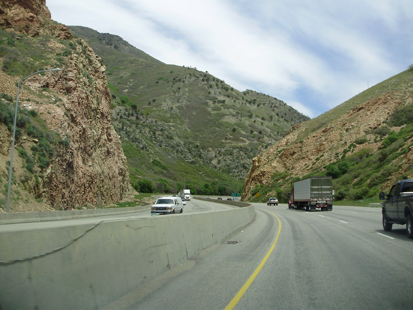
Parleys Canyon is a canyon located in the U.S. state of Utah. The canyon provides the route of Interstate 80 (I-80) (and previously the Lincoln Highway, U.S. Route 40, and a railroad) up the western slope of the Wasatch Mountains and is a relatively wide, straight canyon other than near its mouth. The mountain pass at the top of the canyon is known as Parleys Summit. With an elevation of , the pass is the highest point along I-80 in the state of Utah. Both features are named for Parley P. Pratt, an early settler of the Salt Lake Valley and leader of the Church of Jesus Christ of Latter-day Saints who surveyed the area to find a better transportation route through the Wasatch Mountains than the previous route which traversed Emigration Canyon. Description Parleys Canyon begins where I-215 merges into I-80 in Salt Lake City and ends at Parleys Summit. The lower part of the canyon is relatively twisty and narrow and had to be dynamited to make way for I-80. Despite this, the int ... [...More Info...] [...Related Items...] OR: [Wikipedia] [Google] [Baidu] |
Utah State Route 68
State Route 68 (SR-68) is a state highway in the U.S. state of Utah. It is a major thoroughfare throughout the Wasatch Front as it runs north–south for , linking US-6 near Elberta to US-89 in Woods Cross. The route intersects several major freeways and highways in the Salt Lake City metropolitan area including I-215, I-80, and I-15. The route is more commonly referred to as Redwood Road, after the street it is routed along throughout Salt Lake County. The highway is also routed for a short distance along 500 South and 200 West in Bountiful and Camp Williams Road in Utah County. The route is a surface street for its entire length. SR-68 became a state highway in 1931, at which time the route ran from then–US-40 (North Temple Street) in Salt Lake City to present-day US-89 in Lehi. In 1933, the route was extended north to US-89 at Beck's Hot Springs. SR-68 was routed onto Redwood Road in 1943, taking over what had been designated SR-153. In 1960, SR-68 switched ... [...More Info...] [...Related Items...] OR: [Wikipedia] [Google] [Baidu] |
Cloverleaf Interchange
A cloverleaf interchange is a two-level interchange in which all turns are handled by slip roads. To go left (in right-hand traffic; reverse directions in left-driving regions), vehicles first continue as one road passes over or under the other, then exit right onto a one-way three-fourths loop ramp (270°) and merge onto the intersecting road. The objective of a cloverleaf is to allow two highways to cross without the need for any traffic to be stopped by traffic lights. The limiting factor in the capacity of a cloverleaf interchange is traffic weaving. Overview Cloverleaf interchanges, viewed from overhead or on maps, resemble the leaves of a four-leaf clover or less often a 3-leaf clover. In the United States, cloverleaf interchanges existed long before the Interstate system. They were originally created for busier interchanges that the original diamond interchange system could not handle. Their chief advantage was that they were free-flowing and did not require t ... [...More Info...] [...Related Items...] OR: [Wikipedia] [Google] [Baidu] |
Interstate 215 (Utah)
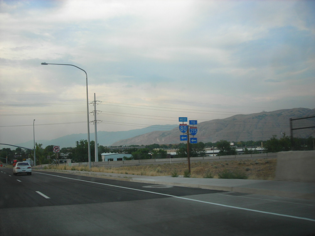
Interstate 215 (I-215), also known locally as the Belt Route, is an auxiliary Interstate in the U.S. state of Utah that forms a three-quarters loop around Salt Lake City and many of its suburbs. The route begins at the mouth of Parley's Canyon at a junction with I-80 east of the city center, and heads south through the edge of the Salt Lake City metropolitan area's eastern suburbs of Millcreek, Holladay, and Cottonwood Heights. It continues west through Murray before turning north again, passing through the city's first-ring western suburbs of Taylorsville and West Valley City. It then enters North Salt Lake and Davis County for a short distance before reaching I-15 northwest of the city center. The Interstate was proposed in the mid-1950s, along with I-15 and I-80 through Salt Lake City. At the time, only the western portion of the belt route was assigned as I-215. The eastern portion of the belt route was designated ''Interstate 415''. However, the I-415 designatio ... [...More Info...] [...Related Items...] OR: [Wikipedia] [Google] [Baidu] |
Single-point Urban Interchange
A single-point urban interchange (SPUI, or ), also called a single-point interchange (SPI) or single-point diamond interchange (SPDI), is a type of highway interchange. The design was created in order to help move large volumes of traffic through limited amounts of space safely and efficiently. Description A SPUI is similar in form to a diamond interchange but has the advantage of allowing opposing left turns to proceed simultaneously by compressing the two intersections of a diamond into one single intersection over or under the free-flowing road. The term "single-point" refers to the fact that all through traffic on the arterial street, as well as the traffic turning left onto or off the interchange, can be controlled from a single set of traffic signals. Due to the space efficiency of SPUIs relative to the volume of traffic they can handle, the interchange design is being used extensively in the reconstruction of existing freeways as well as constructing new freeways, p ... [...More Info...] [...Related Items...] OR: [Wikipedia] [Google] [Baidu] |
Utah State Route 154
State Route 154 (SR-154) or Bangerter Highway (named after former Utah Governor Norman H. Bangerter) is a partial expressway running west and then north from Draper through western Salt Lake County, eventually reaching the Salt Lake City International Airport in Salt Lake City. Construction began in 1988 after planning for the highway began more than two decades prior. For the next ten years, portions of the highway opened as constructed, with the entire route finished by 1998. Original plans for the six-lane expressway running through the western suburbs of Salt Lake City placed Bangerter Highway running further north past the Salt Lake City International Airport into Davis County. However, any route north of the airport never reached fruition, whereas the original southerly end of the route was extended from Redwood Road to I-15. Route description State Route 154 (Bangerter Highway) begins just southeast of a single-point urban interchange at I-15 at the intersection of 13800 ... [...More Info...] [...Related Items...] OR: [Wikipedia] [Google] [Baidu] |
Utah State Route 172
State Route 172 (SR-172) is a state highway in the U.S. state of Utah connecting 6200 South and West Valley City to SR-201 and I-80 via 5600 West in a span of . The highway was formed in 1985. Route description The route begins at the junction of 6200 South and 5600 West and heads due north on the latter as a two-lane undivided highway, with wide shoulders on each side. Past the intersection of SR-173, the road widens to four lanes. Past the diamond interchange at SR-201, the route loses two lanes in each direction. The highway continues in this manner until it terminates at the diamond interchange at I-80. All of SR-172 has been included in the National Highway System. History State Route 172 was formed in 1985 by the Utah Transportation Commission. Since the route's formation, it has not been changed.Utah Department of TransportationHighway Resolutions , updated November 2007, accessed July 2008 Major intersections References {{DEFAULTSORT:State Route 1 ... [...More Info...] [...Related Items...] OR: [Wikipedia] [Google] [Baidu] |
Diamond Interchange
A diamond interchange is a common type of road junction, used where a controlled-access highway crosses a minor road. Design The freeway itself is grade-separated from the minor road, one crossing the other over a bridge. Approaching the interchange from either direction, an off-ramp diverges only slightly from the freeway and runs directly across the minor road, becoming an on-ramp that returns to the freeway in similar fashion. The two places where the ramps meet the road are treated as conventional intersections. In the United States, where this form of interchange is very common, particularly in rural areas, traffic on the off-ramp typically faces a stop sign at the minor road, while traffic turning onto the freeway is unrestricted. The diamond interchange uses less space than most types of freeway interchange, and avoids the interweaving traffic flows that occur in interchanges such as the cloverleaf. Thus, diamond interchanges are most effective in areas where ... [...More Info...] [...Related Items...] OR: [Wikipedia] [Google] [Baidu] |
Wasatch Front
The Wasatch Front is a metropolitan region in the north-central part of the U.S. state of Utah. It consists of a chain of contiguous cities and towns stretched along the Wasatch Range from approximately Provo in the south to Logan in the north, and containing the cities of Salt Lake City, Bountiful, Layton, and Ogden. Geography The Wasatch Front is long and narrow. To the east, the Wasatch Mountains rise abruptly several thousand feet above the valley floors, climbing to their highest elevation of at Mount Nebo (bordering southern Utah Valley). The area's western boundary is formed by Utah Lake in Utah County, the Oquirrh Mountains in Salt Lake County, and the Great Salt Lake in northwestern Salt Lake, Davis, Weber, southeastern Box Elder, and Cache counties. Though most residents of the area live between Ogden and Provo (a distance of ), which includes Salt Lake City proper, the fullest built-out extent of the Wasatch Front is long and an average of wide. Along its ... [...More Info...] [...Related Items...] OR: [Wikipedia] [Google] [Baidu] |


