|
Utah State Route 154
State Route 154 (SR-154) or Bangerter Highway (named after former Utah Governor Norman H. Bangerter) is a partial expressway running west and then north from Draper through western Salt Lake County, eventually reaching the Salt Lake City International Airport in Salt Lake City. Construction began in 1988 after planning for the highway began more than two decades prior. For the next ten years, portions of the highway opened as constructed, with the entire route finished by 1998. Original plans for the six-lane expressway running through the western suburbs of Salt Lake City placed Bangerter Highway running further north past the Salt Lake City International Airport into Davis County. However, any route north of the airport never reached fruition, whereas the original southerly end of the route was extended from Redwood Road to I-15. Route description State Route 154 (Bangerter Highway) begins just southeast of a single-point urban interchange at I-15 at the intersection of 13800 ... [...More Info...] [...Related Items...] OR: [Wikipedia] [Google] [Baidu] |
Utah Department Of Transportation
The Utah Department of Transportation (UDOT) is an agency of the state government of Utah, United States; it is usually referred to by its initials UDOT (pronounced "you-dot"). UDOT is charged with maintaining the more than of roadway that constitute the network of state highways in Utah. The agency is headquartered in the Cal Rampton, Calvin L. Rampton state office complex in Taylorsville, Utah, Taylorsville, Utah. The executive director is Carlos Braceras with Lisa Wilson and Teri Newell as Deputy Directors. Project priorities are set forth by the independent Utah Transportation Commission, which coordinates directly with the UDOT. Structure UDOT maintains over of highways. The department is divided into four geographically defined regions and 10 functional groups: project development; operations; program development; technology and innovation; employee development; communications; policy and legislative services; audit; and finance. While the agency has maintenance stati ... [...More Info...] [...Related Items...] OR: [Wikipedia] [Google] [Baidu] |
Utah State Route 68
State Route 68 (SR-68) is a state highway in the U.S. state of Utah. It is a major thoroughfare throughout the Wasatch Front as it runs north–south for , linking US-6 near Elberta to US-89 in Woods Cross. The route intersects several major freeways and highways in the Salt Lake City metropolitan area including I-215, I-80, and I-15. The route is more commonly referred to as Redwood Road, after the street it is routed along throughout Salt Lake County. The highway is also routed for a short distance along 500 South and 200 West in Bountiful and Camp Williams Road in Utah County. The route is a surface street for its entire length. SR-68 became a state highway in 1931, at which time the route ran from then–US-40 (North Temple Street) in Salt Lake City to present-day US-89 in Lehi. In 1933, the route was extended north to US-89 at Beck's Hot Springs. SR-68 was routed onto Redwood Road in 1943, taking over what had been designated SR-153. In 1960, SR-68 switched ... [...More Info...] [...Related Items...] OR: [Wikipedia] [Google] [Baidu] |
Utah State Route 201
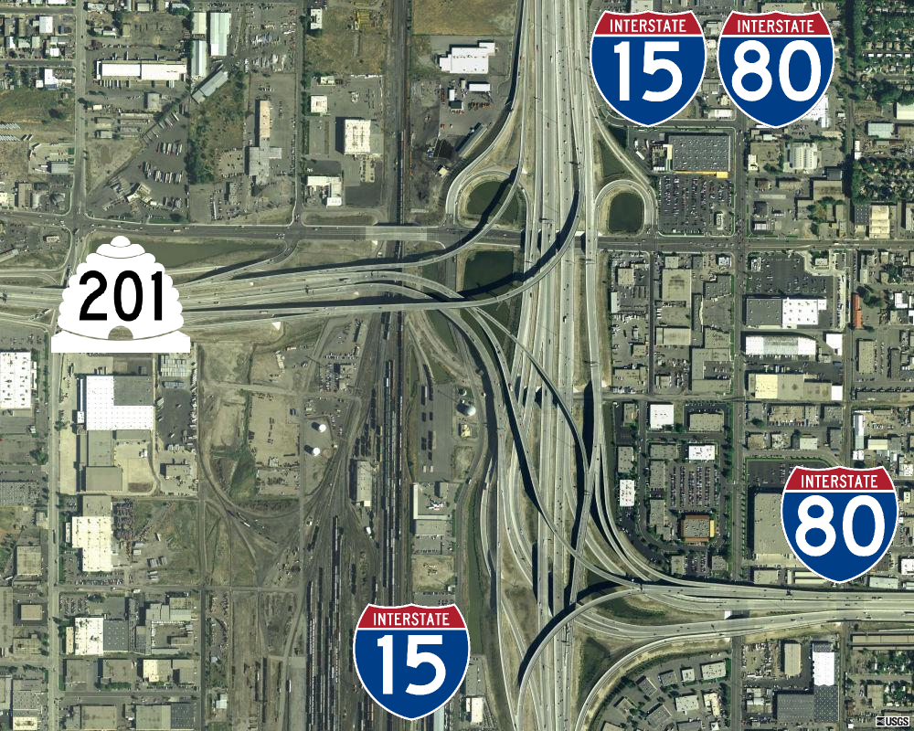
State Route 201 (SR-201) is an east–west expressway and freeway located in Salt Lake County in the U.S. state of Utah. Colloquially known by some as the ''21st South Freeway'', the route serves as an alternative to Interstate 80 (I-80) through Salt Lake City. From the western terminus of the route west of Magna, the highway heads east through Kennecott Copper property as an expressway before running through the western suburbs of Salt Lake City as a freeway. Shortly after the route returns on a surface route, SR-201 terminates on its eastern end at State Street (U.S. Route 89). The history of the route predates the invention of the automobile; the Donner Party, California Trail and Pony Express all followed the present-day path of the highway. During the 1910s, the route was designated a state highway and, in 1939, State Route 201 was officially written into law, running from Magna east to the mouth of Parley's Canyon. At one point, the highway carried US-50 Alternate w ... [...More Info...] [...Related Items...] OR: [Wikipedia] [Google] [Baidu] |
Utah State Route 171
State Route 171 (SR-171) is a state highway in the Salt Lake City metropolitan area in northern Utah that runs from SR-111 in Magna in the west side of the city to Interstate 215 in the city of Millcreek in the eastern part valley. In its sixteen-mile span, the route is named 3500 South and 3300 South. Route description From SR-111 in Magna, the highway (known as 3500 South) runs due east with between one and four general-purpose lanes in each direction until its junction with Redwood Road ( SR-68), where it veers to the northeast before again straightening out to the east. Other than the west end, this portion is entirely within West Valley City. The route passes through the former towns (now neighborhoods) of Hunter and Granger as well as West Valley City's modern downtown area near I-215 (which overlaps with historic Granger). The intersection with Bangerter Highway ( SR-154) was the first continuous flow intersection built in Utah. At the intersection with 2700 West just ... [...More Info...] [...Related Items...] OR: [Wikipedia] [Google] [Baidu] |
Utah State Route 173
State Route 173 is a major east–west thoroughfare completely within Salt Lake County in northern Utah. From its western terminus at SR-111 it passes through the growing west side of Salt Lake County, eventually reaching US-89 in Murray. Route description Starting at its western terminus in West Valley City, SR-173 (which is routed on 5400 South) heads east through West Valley City, passing by the USANA Amphitheatre. Continuing east, the route enters Kearns, passing by the Utah Olympic Oval and Kearns High School before entering Taylorsville and crossing the Bangerter Highway. Shortly thereafter, the route crosses under I-215 and passes Taylorsville High School at the Redwood Road ( SR-68) continuous flow intersection. The route continues eastward, crossing a canal before descending a steep hill to the Jordan River as it enters Murray and shifts slightly to the north (taking the name 5300 South). East of its single-point urban interchange with I-15, the route passe ... [...More Info...] [...Related Items...] OR: [Wikipedia] [Google] [Baidu] |
Jordan Landing
Jordan Landing is a master-planned development located in the center of West Jordan, Utah, adjacent to South Valley Regional Airport, also known as Airport 2. Its size, containing of retail space, 1,200 residential units, and of office space, places it as a focal point of West Jordan's booming economy. It is one of the largest mixed-use developments in the Intermountain West. Built on former corn fields (these fields were silage corn) and next to Bangerter Highway, with the first phase having its groundbreaking in 1999, Jordan Landing has been criticized for drawing traffic from across the Salt Lake Valley to a formerly rural area, overwhelming infrastructure, and acting as a catalyst for urban sprawl. However, many developers have cited Jordan Landing's success and positive impact on population growth, with some calling it a catalyst, in their decision to begin construction on their own nearby large mixed-use developments. Among them are Utah's Boyer Company, America's la ... [...More Info...] [...Related Items...] OR: [Wikipedia] [Google] [Baidu] |
South Valley Regional Airport
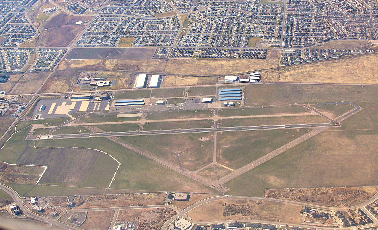
South Valley Regional Airport is a public airport located in West Jordan, southwest of Salt Lake City, Utah, United States. Established as a Utah World War II army airfield, it is the primary general aviation airport in the area and is a Utah Army National Guard training base with Apache and Blackhawk helicopters. Leading Edge Aviation is the single fixed-base operator (FBO) onsite; the FBO and Alta Aircraft Maintenance operate maintenance facilities, and the FBO and Utah Helicopter Flight Academy operate flight schools. History On 10 February 1942, the United States district engineer (Colonel E. G. Thomas) recommended a "5,450-acre dry farming area in Kearns" for an inland Army training site. For one of "the eight new technical training installations rushed into operation" during 1942–3, a Kearns, Utah "plot of 1,405 acres was purchased". The Kearns Center military unit was activated (designated) 1 May 1942, and "a contract for a theater of operations cantonment was let ... [...More Info...] [...Related Items...] OR: [Wikipedia] [Google] [Baidu] |
Utah State Route 48
State Route 48 (SR-48) is a highway completely within Salt Lake County in northern Utah Utah ( , ) is a state in the Mountain West subregion of the Western United States. Utah is a landlocked U.S. state bordered to its east by Colorado, to its northeast by Wyoming, to its north by Idaho, to its south by Arizona, and to it ... that connects Bangerter Highway with Interstate 15 in Utah, I-15 and US-89 (UT), US-89. The route is laid on portions of 7800 South, Redwood Road, and 7200 South. When the route was formed in 1927, it passed through the center of Midvale, Utah, Midvale on Center Street. However, it was moved north onto 7200 South in 1965 to serve an exit of I-15. Route description The road begins at a single-point urban interchange on Bangerter Highway at exit 13 and heads east on 7800 South. After approximately 2 miles, the route turns north onto a concurrency with SR-68 (UT), SR-68 for eight blocks before turning east onto 7000 South. The route turns southeas ... [...More Info...] [...Related Items...] OR: [Wikipedia] [Google] [Baidu] |
Utah State Route 151
State Route 151 (SR-151), sometimes known as the South Jordan Parkway, is a state highway in the U.S. state of Utah connecting SR-154 (Bangerter Highway) in South Jordan to Interstate 15 (I-15) in Sandy. The route spans in southern Salt Lake County. Route description The highway begins at the intersection of SR-154 (Bangerter Highway) and West 10400 South in South Jordan. Heading east on the latter, a four-lane road, the road shifts slightly to the north immediately past the intersection. At South 3200 West the road loses one lane in each direction. The route continues east and intersects with several local roads before reaching SR-68 (Redwood Road), where the route widens to four lanes again. Past South 1300 West, the highway begins to dip southeast and gains a fixed center median. After passing Mulligan's South golf course and crossing the Jordan River and Jordan River Parkway trail, it straightens out to the east and becomes West 10600 South while entering Sandy. Right ... [...More Info...] [...Related Items...] OR: [Wikipedia] [Google] [Baidu] |
Oquirrh Mountain Utah Temple
The Oquirrh Mountain Utah Temple is a temple of the Church of Jesus Christ of Latter-day Saints located in South Jordan, Utah, a suburb of Salt Lake City. South Jordan was the first city in the world to have two temples (it also has the Jordan River Temple). The temple was the fourth in the Salt Lake Valley and the 13th in the state of Utah. The Oquirrh Mountain Utah Temple serves approximately 83,000 Latter-day Saints living in the western Salt Lake Valley. The building is faced with light beige granite quarried and milled in China. History The Oquirrh Mountain Utah Temple was built on a bluff on the edge of the Daybreak Community; the property was donated to the church by Kennecott Land, a portion of a company that mines copper and precious minerals from the Oquirrh Mountains, just a few miles west of the temple. The edifice features a single stone spire high, topped by a statue of the angel Moroni. Ground was broken for construction on December 16, 2006. At the groundbrea ... [...More Info...] [...Related Items...] OR: [Wikipedia] [Google] [Baidu] |
Daybreak Community
Daybreak is a master-planned community over 4,000 acres (16 km²) in size that began construction in 2004 under the direction of land development company Kennecott Land (a subsidiary of Rio Tinto Group) in South Jordan, Utah. In 2016, the balance of the land holding was sold to Minneapolis-based investment firm Värde Partners, and a new development company called Daybreak Communities was formed to continue development of the project. On April 12, 2021, it was announced that the remaining 1,300 undeveloped acres were sold to Larry H. Miller Real Estate. The community is expected to continue building for the next 18 to 20 years. When completed, it could contain more than 20,000 residential units and approximately 9.1 million square feet (850,000 m²) of commercial space. Description All homes in the community are Energy Star certified. Daybreak was the first community of its size in the region to adhere to Energy Star standards, and the entire community has been designed and ... [...More Info...] [...Related Items...] OR: [Wikipedia] [Google] [Baidu] |
Utah State Route 175
State Route 175 (SR-175) is a state highway in the U.S. state of Utah. Also known as 11400 South, it spans in southern Salt Lake County, connecting two major north-south transportation corridors in the area: the Bangerter Highway ( SR-154) to the west in South Jordan, and Interstate 15 and State Street to the east. Route description State Route 175 begins in the city of South Jordan classified as a minor arterial road, providing access to the Daybreak Community and the Oquirrh Mountain Utah Temple from the Bangerter Highway. From here, it travels east, crossing SR-68 (Redwood Road) and the Jordan River. After crossing the river, it leaves South Jordan and continues east along the border between Sandy to the north and Draper to the south, travelling under Interstate 15 via a diamond interchange and ending less than later at US-89 (State Street). History The combination of the construction of the Daybreak Community and Oquirrh Mountain Utah Temple near the west end of 11400 S ... [...More Info...] [...Related Items...] OR: [Wikipedia] [Google] [Baidu] |


