|
Urswick
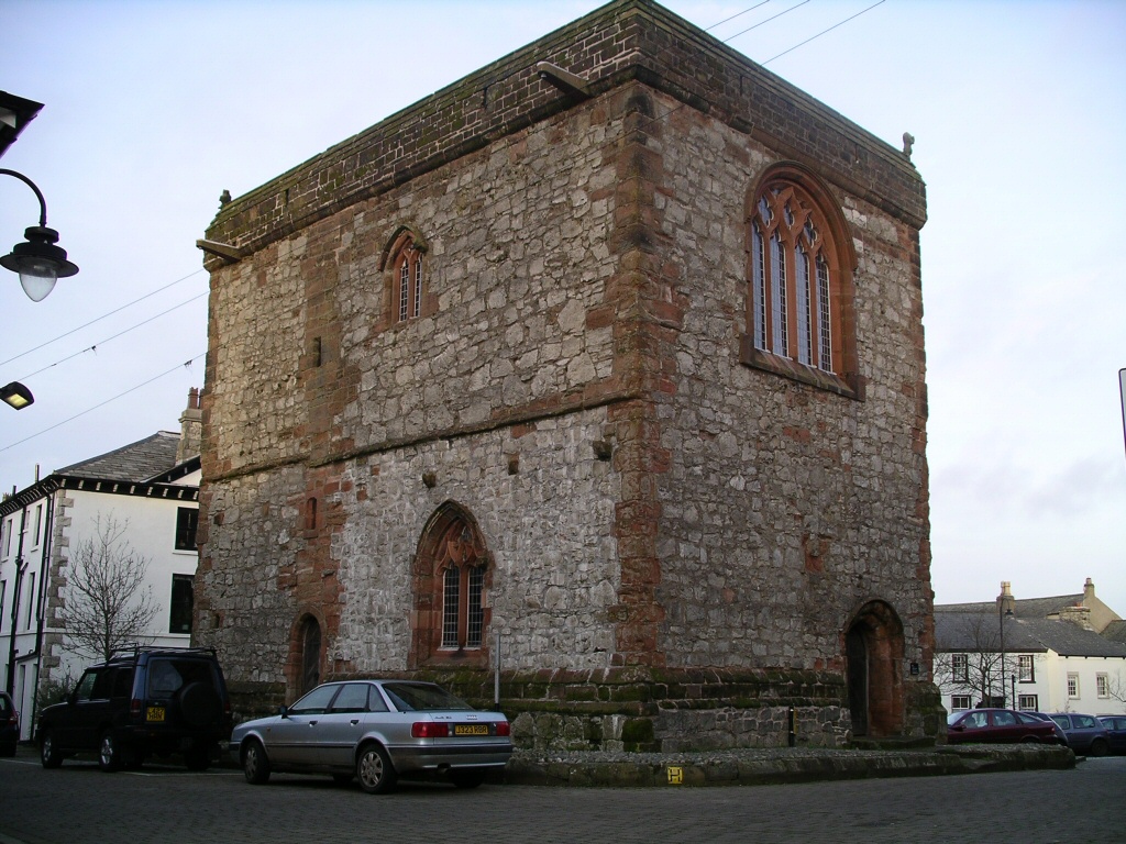
Urswick is a civil parish that includes the villages of Great Urswick and Little Urswick. It is located in the Furness area of Cumbria, England. The villages are situated to the south-west of the town of Ulverston. In the 2001 census the parish had a population of 351, decreasing at the 2011 census to 1,397. Great Urswick is situated along the north and west sides of Urswick Tarn, a small body of water (c. 1100 feet by 600), although the largest such natural body in Low Furness. The tarn is fed from the surrounding hills and feeds Gleaston Beck to the south, the water is said to have a red hue due to the iron content of the surrounding land. Little Urswick, the smaller of the two settlements, stands further south on the lower slopes of a limestone outcrop known as Bolton Heads. Toponymy A number of explanations have been suggested for Urswick's name. The '-wick' element is perhaps from the Old English ''wic'' meaning 'farm' or 'trading centre', an element commonly found in ... [...More Info...] [...Related Items...] OR: [Wikipedia] [Google] [Baidu] |
Muchland
Muchland is a medieval manor in Low Furness in the county of Cumbria in northern England. The manor was the seat of the Lords of Aldingham, and included at its peak the villages of Bardsea, Urswick, Scales, Stainton, Sunbrick, Baycliff, Gleaston, Aldingham, Dendron, Leece and Newbiggin. The area also features the historic remains of Gleaston Castle, Aldingham Castle, Gleaston Water Mill, the Druids' Temple at Birkrigg, plus many prehistoric remains around Urswick and Scales. The Place The area that became Muchland in the Middle Ages is situated on the eastern side of the Furness Peninsula in southwest Cumbria. On its eastern side, it is bounded for its entire length by the sands of Morecambe Bay, the shore of which has eroded considerably since the manor was created. Along the coast lie the villages, from north to south, of: *Bardsea *Baycliff *Aldingham * Newbiggin *Goadsbarrow Muchland derives its name from Michael's Land after Michael le Fleming who was granted ... [...More Info...] [...Related Items...] OR: [Wikipedia] [Google] [Baidu] |
St Mary And St Michael's Church, Great Urswick
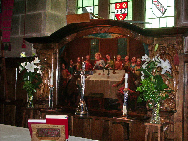
St Mary and St Michael's Church is in the village of Great Urswick, Cumbria, England. It is an active Anglican parish church in the deanery of Furness, the archdeaconry of Westmorland and Furness, and the diocese of Carlisle. Its benefice is united with those of St Cuthbert, Aldingham, St Matthew, Dendron, and St Michael, Rampside. These churches are part of a group known as the Low Furness Group of Parishes. The church is recorded in the National Heritage List for England as a designated Grade I listed building. History There is evidence that a church existed on the site before the Norman conquest, but the earliest parts of the present church are found in the lower part of the tower and in the chancel and date from the 13th century. The chancel was lengthened in the 14th century, and the nave and north vestry date from this period. The tower was also heightened around this time, and the interior of the roof is dated 1598. A west gallery w ... [...More Info...] [...Related Items...] OR: [Wikipedia] [Google] [Baidu] |
Listed Buildings In Urswick
Urswick is a civil parish in the South Lakeland District of Cumbria, England. It contains eleven listed buildings that are recorded in the National Heritage List for England The National Heritage List for England (NHLE) is England's official database of protected heritage assets. It includes details of all English listed buildings, scheduled monuments, register of historic parks and gardens, protected shipwrecks, a .... Of these, one is listed at Grade I, the highest of the three grades, and the others are at Grade II, the lowest grade. The parish contains the villages of Great Urswick, Little Urswick, Bardsea, and Stainton with Adgarley, and is otherwise rural. The listed buildings consist of houses, two churches, a monument and a sundial in a churchyard, and a monument on a hilltop, __NOTOC__ Key Buildings References Citations Sources * * * * * * * * * * * * * {{DEFAULTSORT:Urswick Lists of listed buildings in Cumbria ... [...More Info...] [...Related Items...] OR: [Wikipedia] [Google] [Baidu] |
Urswick Grammar School
Urswick Grammar School was located in Little Urswick, Cumbria, England. The school was founded in 1585 as the result of a royal charter granted by Queen Elizabeth I. For the first few years, boys were educated by the minister in the church. Subsequently, the school building was built in Little Urswick. Amalgamation This building, with various extensions, remained in use until the late 1990s, when the school was amalgamated with two other local primary schools to form Low Furness Primary School, which is located in Great Urswick. The disused school buildings have been converted into housing. Visit of Queen Elizabeth II In 1985, the school celebrated its quatercentenary. In celebration of this fact the Queen Queen or QUEEN may refer to: Monarchy * Queen regnant, a female monarch of a Kingdom ** List of queens regnant * Queen consort, the wife of a reigning king * Queen dowager, the widow of a king * Queen mother, a queen dowager who is the mother ... visited the sch ... [...More Info...] [...Related Items...] OR: [Wikipedia] [Google] [Baidu] |
Civil Parishes In Cumbria
A civil parish in England is the lowest unit of local government. There are 284 civil parishes in the ceremonial county of Cumbria, with most of the county being parished, and Allerdale, Copeland, Eden and South Lakeland being entirely parished. At the 2001 census, there were 359,692 people living in those 284 parishes, accounting for 73.8 per cent of the county's population. The extent of modern Civil parishes are largely geographically based on historic Church of England parish boundaries, which were ecclesiastical divisions that had acquired civil administration powers managed by the Vestry committee.Angus Winchester, 2000, ''Discovering Parish Boundaries''. Shire Publications. Princes Risborough, 96 pages History The Highways Act 1555 made parishes responsible for the upkeep of roads. Every adult inhabitant of the parish was obliged to work four days a year on the roads, providing their own tools, carts and horses; the work was overseen by an unpaid local appointee, ... [...More Info...] [...Related Items...] OR: [Wikipedia] [Google] [Baidu] |
South Lakeland
South Lakeland is a local government district in Cumbria, England. The population of the non-metropolitan district was 102,301 according to the 2001 census, increasing to 103,658 at the 2011 Census. Its council is based in Kendal. It includes much of the Lake District as well as northwestern parts of the Yorkshire Dales. The district was created on 1 April 1974 under the Local Government Act 1972. It was formed from the Kendal borough, Windermere urban district, most of Lakes urban district, South Westmorland Rural District, from Westmorland, Grange and Ulverston urban districts and North Lonsdale Rural District from Lancashire, and Sedbergh Rural District from the West Riding of Yorkshire. In July 2021 the Ministry of Housing, Communities and Local Government announced that in April 2023, Cumbria will be reorganised into two unitary authorities. South Lakeland District Council is to be abolished and its functions transferred to a new authority, to be known as W ... [...More Info...] [...Related Items...] OR: [Wikipedia] [Google] [Baidu] |
Sub-Roman Britain
Sub-Roman Britain is the period of late antiquity in Great Britain between the end of Roman rule and the Anglo-Saxon settlement. The term was originally used to describe archaeological remains found in 5th- and 6th-century AD sites that hinted at the decay of locally made wares from a previous higher standard under the Roman Empire. It is now used to describe the period that commenced with the evacuation of Roman troops to Gaul by Constantine III in 407 and to have concluded with the Battle of Deorham in 577. Meaning of terms The period of sub-Roman Britain traditionally covers the history of the area which subsequently became England from the end of Roman imperial rule, traditionally dated to be in 410, to the arrival of Saint Augustine in 597. The date taken for the end of this period is arbitrary in that the sub-Roman culture continued in northern England until the merger of Rheged (the kingdom of the Brigantes) with Northumbria by dynastic marriage in 633, and longe ... [...More Info...] [...Related Items...] OR: [Wikipedia] [Google] [Baidu] |
The Meaning Of Liff
''The Meaning of Liff'' (UK Edition: , US Edition: ) is a humorous dictionary of toponymy and etymology, written by Douglas Adams and John Lloyd, published in the United Kingdom in 1983 and the United States in 1984. Content The book is a "dictionary of things that there aren't any words for yet".Gartner, Michael (15 March 1987)Words ''Newsday'' Rather than inventing new words, Adams and Lloyd picked a number of existing place-names and assigned interesting meanings to them, meanings that can be regarded as on the verge of social existence and ready to become recognisable entities. All the words listed are toponyms and describe common feelings and objects for which there is no current English word. Examples are ''Shoeburyness'' ("The vague uncomfortable feeling you get when sitting on a seat that is still warm from somebody else's bottom") and ''Plymouth'' ("To relate an amusing story to someone without remembering that it was they who told it to you in the first place"). T ... [...More Info...] [...Related Items...] OR: [Wikipedia] [Google] [Baidu] |
Barrow-in-Furness
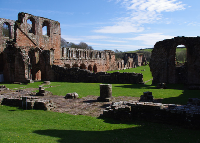
Barrow-in-Furness is a port town in Cumbria, England. Historic counties of England, Historically in Lancashire, it was incorporated as a municipal borough in 1867 and merged with Dalton-in-Furness Urban District in 1974 to form the Borough of Barrow-in-Furness. In 2023 the borough will merge with Eden and South Lakeland districts to form a new unitary authority; Westmorland and Furness. At the tip of the Furness, Furness peninsula, close to the Lake District, it is bordered by Morecambe Bay, the Duddon Estuary and the Irish Sea. In 2011, Barrow's population was 56,745, making it the second largest urban area in Cumbria after Carlisle, Cumbria, Carlisle. Natives of Barrow, as well as the local dialect, are known as Barrovian. In the Middle Ages, Barrow was a small hamlet (place), hamlet within the parish of Dalton-in-Furness with Furness Abbey, now on the outskirts of the town, controlling the local economy before its Dissolution of the Monasteries, dissolution in 1537. The iron ... [...More Info...] [...Related Items...] OR: [Wikipedia] [Google] [Baidu] |
Great Urswick War Memorial
Great may refer to: Descriptions or measurements * Great, a relative measurement in physical space, see Size * Greatness, being divine, majestic, superior, majestic, or transcendent People * List of people known as "the Great" *Artel Great (born 1981), American actor Other uses * ''Great'' (1975 film), a British animated short about Isambard Kingdom Brunel * ''Great'' (2013 film), a German short film * Great (supermarket), a supermarket in Hong Kong * GReAT, Graph Rewriting and Transformation, a Model Transformation Language * Gang Resistance Education and Training Gang Resistance Education And Training, abbreviated G.R.E.A.T., provides a school-based, police officer instructed program that includes classroom instruction and various learning activities. Their intention is to teach the students to avoid gan ..., or GREAT, a school-based and police officer-instructed program * Global Research and Analysis Team (GReAT), a cybersecurity team at Kaspersky Lab *'' Great!'', a 20 ... [...More Info...] [...Related Items...] OR: [Wikipedia] [Google] [Baidu] |
Dalton-in-Furness
Dalton-in-Furness is a town and former civil parish in the Borough of Barrow-in-Furness, Cumbria, England. In 2011 it had a population of 7,827. It is located north east of Barrow-in-Furness. History Dalton is mentioned in the Domesday Book, written as "Daltune" as one of the townships forming the Manor of Hougun held by Tostig Godwinson, Earl of Northumbria. Historically, it was the capital of Furness. The ancient parish of Dalton covered the area which is now occupied by the borough of Barrow-in-Furness. The town is now in the civil parish of Dalton Town with Newton. Historically a part of Lancashire, the town is associated with a number of famous artists, including George Romney. In 1961 the parish had a population of 10,316. Dalton in Furness was formerly a civil parish, it was abolished in 1974 and became an unparished area, on 1 April 1987 the unparished area was abolished to form the parishes of " Askam and Ireleth", "Dalton Town with Newton" and " Lindal and Marton ... [...More Info...] [...Related Items...] OR: [Wikipedia] [Google] [Baidu] |


