|
Uribia
Uribia is town and municipality of the La Guajira department of Colombia. It is the youngest municipality of this Department since the year 2000. Northern Zone of the Cerrejón coal mines are located in this municipality. The municipality also contains the Serranía de Macuira mountain range which is an isolated low altitude mountain range in the middle of La Guajira Desert. One third of this mountain range is also a National Natural Park of Colombia. Geography and climate The Municipality of Uribia covers most of the northern area of the Guajira Peninsula, the northernmost part of South America. Uribia borders to the north and west with the Caribbean Sea which surround more than half the municipality; to the east Uribia has a short border with the Bolivarian Republic of Venezuela; to the south its borders the municipality of Maicao and southwest the municipality of Riohacha. The Upper Guajira is arid, presenting clay formations with scarce vegetation of cactus and other xero ... [...More Info...] [...Related Items...] OR: [Wikipedia] [Google] [Baidu] |
La Guajira Department
La Guajira () is a department of Colombia. It occupies most of the Guajira Peninsula in the northeast region of the country, on the Caribbean Sea and bordering Venezuela, at the northernmost tip of South America. The capital city of the department is Riohacha. Various indigenous tribes have populated the arid plains of the region long before the Spanish expeditions reached the Americas. In 1498, Alonso de Ojeda sailed around the peninsula of La Guajira, but the first European to set foot in what is known today as La Guajira was the Spanish explorer Juan de la Cosa in 1499. During the colonial era, the territory of La Guajira was disputed by the governors of Santa Marta and Venezuela, owing to deposits of pearls. English pirates, Frenchmen, and Germans also fought for control of the territory. Martin Fernandez de Enciso founded Nuestra Señora Santa María de los Remedios del Cabo de la Vela, the first colonial village in the territory. In 1535, Nicolás de Federmán refounded ... [...More Info...] [...Related Items...] OR: [Wikipedia] [Google] [Baidu] |
Maicao
Maicao (Wayuu: ) is a city and municipality in the Department of La Guajira, northern Republic of Colombia. It is located 76 km from Riohacha, the capital of the department and is the second largest urban center near the border with Venezuela, after the city of Cúcuta. The city was founded on June 27, 1927 by Colonel Rodolfo Morales and Tomás Curvelo Iguarán, on behalf of the Department of Magdalena in the middle of the Wayuu people territory. During the 1970s Maicao became a commercial hub due to an oil boom in Venezuela and the flow of contraband present in the Guajira peninsula. Etymology The name of Maicao comes from the Wayunaiki: ''mai-ka-u'' which means "Land of the Maize. Geography Maicao is located in the Guajira Peninsula, the northernmost part of South America and within the Guajira desert. The municipality of Maicao borders to the north with the municipalities of Uribia and Manaure; to the east with the Venezuela; to the south with the municipality of A ... [...More Info...] [...Related Items...] OR: [Wikipedia] [Google] [Baidu] |
Serranía De Macuira
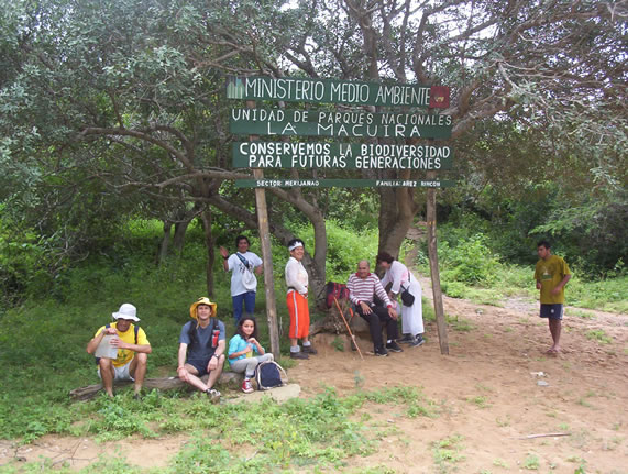
Serranía de Macuira is a mountain range in northern Colombia located in the municipality of Uribia, La Guajira. The Serrania de Macuira stands in the middle of the La Guajira Desert at isolated from the Sierra Nevada de Santa Marta and the Eastern Ranges of the Colombian Andes. The range is a protected area; National Natural Park Macuira. The Serranía de Macuira measures around in length and is circa wide, at approximately from the Caribbean sea. The range is composed of three mountain massifs that are interconnected; the highest being Cerro Paluou (), Cerro de Jibome () covering a total area of . The area is home to numerous species of fauna and flora and due to its relatively high humidity caused by the trade wind The trade winds or easterlies are the permanent east-to-west prevailing winds that flow in the Earth's equatorial region. The trade winds blow mainly from the northeast in the Northern Hemisphere and from the southeast in the Southern Hemisph ...s and it ... [...More Info...] [...Related Items...] OR: [Wikipedia] [Google] [Baidu] |
Wayuu
The Wayuu (also Wayu, Wayúu, Guajiro, Wahiro) are an Amerindian ethnic group of the Guajira Peninsula in northernmost part of Colombia and northwest Venezuela. The Wayuu language is part of the Maipuran (Arawak) language family. Geography The Wayúu inhabit the arid Guajira Peninsula straddling the Venezuela-Colombia border, on the Caribbean Sea coast. Two major rivers flow through this mostly harsh environment: the Rancheria River in Colombia and the El Limón River in Venezuela representing the main source of water, along with artificial ponds designed to hold rain water during the rain season. The territory has equatorial weather seasons: a rainy season from September to December, which they call ''Juyapu''; a dry season, known by them as ''Jemial'', from December to April; a second rainy season called ''Iwa'' from April to May; and a long second dry season from May to September. History Guajira rebellion Although the Wayuu were never subjugated by the Spanish, the ... [...More Info...] [...Related Items...] OR: [Wikipedia] [Google] [Baidu] |
Caribbean Region, Colombia
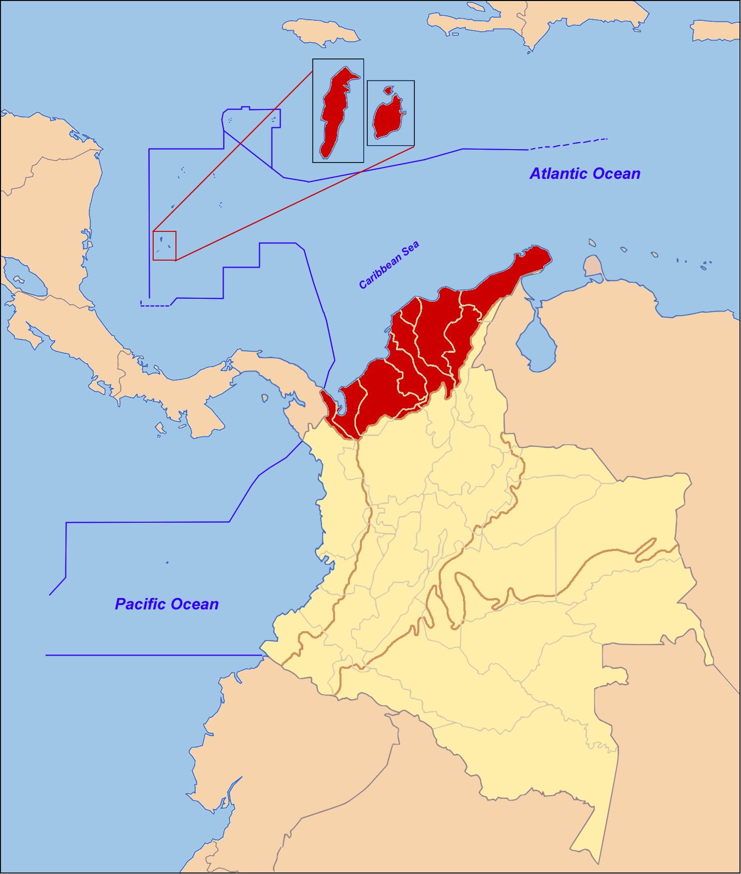
The Caribbean region of Colombia or Caribbean coast region is in the north of Colombia and is mainly composed of 8 departments located contiguous to the Caribbean. MEMO: Natural Regions of Colombia Memo.com.co Accessed 22 August 2007. The area covers a total land area of , including the in the and corresponding to approximately 1/10 of the total territory of Colombia. The Caribbean region of Colomb ... [...More Info...] [...Related Items...] OR: [Wikipedia] [Google] [Baidu] |
Arid Climate
The desert climate or arid climate (in the Köppen climate classification ''BWh'' and ''BWk''), is a dry climate sub-type in which there is a severe excess of evaporation over precipitation. The typically bald, rocky, or sandy surfaces in desert climates are dry and hold little moisture, quickly evaporating the already little rainfall they receive. Covering 14.2% of earth's land area, hot deserts are the second most common type of climate on earth after the polar climate. There are two variations of a desert climate according to the Köppen climate classification: a hot desert climate (''BWh''), and a cold desert climate (''BWk''). To delineate "hot desert climates" from "cold desert climates", there are three widely used isotherms: most commonly a mean annual temperature of , or sometimes the coldest month's mean temperature of , so that a location with a ''BW'' type climate with the appropriate temperature above whichever isotherm is being used is classified as "hot arid subtyp ... [...More Info...] [...Related Items...] OR: [Wikipedia] [Google] [Baidu] |
Francisco De Paula Santander
Francisco José de Paula Santander y Omaña (Villa del Rosario, Norte de Santander, Colombia, April 2, 1792 – Santafé de Bogotá, Colombia, May 6, 1840), was a Colombian military and political leader during the 1810–1819 independence war of the United Provinces of New Granada (present-day Colombia). He was the acting President of Gran Colombia between 1819 and 1826, and later elected by Congress as the President of the Republic of New Granada between 1832 and 1837. Santander came to be known as "The Man of the Laws" (''"El Hombre de las Leyes"'').Arismendi Posada, Ignacio; ''Gobernantes Colombianos''; trans. Colombian Presidents; Interprint Editors Ltd.; Italgraf; Segunda Edición; Page 21; Bogotá, Colombia; 1983 Biography Santander was born in Villa del Rosario, not far from Cúcuta, on April 2, 1792. His parents were Juan Agustín Santander Colmenares who was governor of the rural province of San Faustino de los Ríos as well as a cocoa grower, and his mother; ... [...More Info...] [...Related Items...] OR: [Wikipedia] [Google] [Baidu] |
Wayuu Language
Wayuu ( guc, Wayuunaiki ), or Guajiro, is a major Arawakan language spoken by 305,000 indigenous Wayuu people in northwestern Venezuela and northeastern Colombia on the Guajira Peninsula. There are 200,000 speakers of Wayuu in Venezuela and 120,000 in Colombia. Smith (1995) reports that a mixed Guajiro–Spanish language is replacing Wayuu in both countries. However, Campbell (1997) could find no information on this. Recent developments To promote bilingual education among Wayuu and other Colombians, the Kamusuchiwo’u Ethno-educative Center () came up with the initiative of creating the first illustrated Wayuunaiki–Spanish, Spanish–Wayuunaiki dictionary. In December 2011, the Wayuu Tayá Foundation and Microsoft presented the first ever dictionary of technology terms in the Wayuu language, after having developed it for three years with a team of technology professionals and linguists. Dialects The two main dialects are Wüinpümüin and Wopumüin, spoken in the northeast ... [...More Info...] [...Related Items...] OR: [Wikipedia] [Google] [Baidu] |
Rafael Uribe Uribe
Rafael Victor Zenón Uribe Uribe (born April 12, 1859 – died October 15, 1914, in Bogotá) was a Colombian lawyer, journalist, and general in the liberal party rebel army. Uribe Uribe is best known for his political ideas in favor of the establishment of Guild socialism and trade unions in Colombia, his diplomatic work and his support of Colombian coffee growers in fighting diseases such as rust. One of his greatest contributions was, along with Benjamin Herrera, the founding of the Republican University that later became the Free University of Colombia. The Rafael Uribe Uribe Palace of Culture in Medellín is named after him. Early years Rafael Uribe Uribe was born in the small town of Valparaíso, in the Sovereign State of Antioquia (Present day Department of Antioquia) at his family's country estate of El Palmar on April 12, 1859. His mother educated him at home and he was reportedly a shy boy. In 1871 Uribe was accepted to the University of Antioquia, then attended a mi ... [...More Info...] [...Related Items...] OR: [Wikipedia] [Google] [Baidu] |
Foundation Of Uribia, La Guajira 1935
Foundation may refer to: * Foundation (nonprofit), a type of charitable organization ** Foundation (United States law), a type of charitable organization in the U.S. ** Private foundation, a charitable organization that, while serving a good cause, might not qualify as a public charity by government standards * Foundation (cosmetics), a multi-coloured makeup applied to the face * Foundation (evidence), a legal term * Foundation (engineering), the element of a structure which connects it to the ground, and transfers loads from the structure to the ground Arts, entertainment, and media Film and TV * ''The Foundation'', a film about 1960s-1970s Aboriginal history in Sydney, featuring Gary Foley * ''Foundation'' (TV series), an Apple TV+ series adapted from Isaac Asimov's novels * "The Foundation" (''Seinfeld''), an episode * ''The Foundation'' (1984 TV series), a Hong Kong series * ''The Foundation'' (Canadian TV series), a 2009–2010 Canadian sitcom Games * ''Foundation'' ... [...More Info...] [...Related Items...] OR: [Wikipedia] [Google] [Baidu] |
Ranchería
The Spanish word ranchería, or rancherío, refers to a small, rural settlement. In the Americas the term was applied to native villages or bunkhouses. Anglo-Americans adopted the term with both these meanings, usually to designate the residential area of a rancho in the American Southwest, housing aboriginal ranch hands and their families. The term is still used in other parts of Spanish America; for example, the Wayuu tribes in northern Colombia call their villages ''rancherías''. The ''Columbia Encyclopedia'' describes it as: :a type of communal settlement formerly characteristic of the Yaqui Indians of Sonora, Tepehuanes of Durango, Mexico, and of various small Native American groups of the Southwestern U.S., especially in California. These clusters of dwellings were less permanent than the pueblos (see Pueblo) but more so than the camps of the migratory Native Americans. [...More Info...] [...Related Items...] OR: [Wikipedia] [Google] [Baidu] |


