|
Upper Bay Bridge
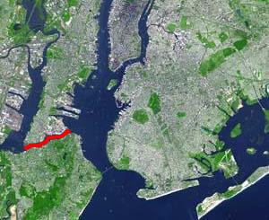
The Upper Bay Bridge, or the Lehigh Valley Railroad Bridge, is a vertical lift bridge spanning the Newark Bay in northeastern New Jersey. It is used by CSX Transportation travelling through the North Jersey Shared Assets Area of the United States rail network along the National Docks Secondary line. The bridge is just north and parallel to the New Jersey Turnpike's Newark Bay Bridge. A notable train using the bridge is the Juice Train, which originates in Florida. Description The western end of the bridge is near Oak Island Yard north of Port Newark-Elizabeth Marine Terminal and Newark International Airport in an industrial area of Ironbound Newark. Its eastern end is in Bayonne, where rail lines continue east across Bergen Hill to maritime, industrial, distribution complexes at Port Jersey, Greenville Yards, Constable Hook, and others along the shores of the Upper New York Bay and Kill Van Kull. New York New Jersey Rail, LLC operates a carfloat at this end with trans ... [...More Info...] [...Related Items...] OR: [Wikipedia] [Google] [Baidu] |
Conrail
Conrail , formally the Consolidated Rail Corporation, was the primary Class I railroad in the Northeastern United States between 1976 and 1999. The trade name Conrail is a portmanteau based on the company's legal name. It continues to do business as an asset management and network services provider in three Shared Assets Areas that were excluded from the division of its operations during its acquisition by CSX Corporation and the Norfolk Southern Railway. The federal government created Conrail to take over the potentially-profitable lines of multiple bankrupt carriers, including the Penn Central Transportation Company and Erie Lackawanna Railway. After railroad regulations were lifted by the 4R Act and the Staggers Act, Conrail began to turn a profit in the 1980s and was privatized in 1987. The two remaining Class I railroads in the East, CSX Transportation and the Norfolk Southern Railway (NS), agreed in 1997 to acquire the system and split it into two roughly-equal parts (a ... [...More Info...] [...Related Items...] OR: [Wikipedia] [Google] [Baidu] |
Florida
Florida is a state located in the Southeastern region of the United States. Florida is bordered to the west by the Gulf of Mexico, to the northwest by Alabama, to the north by Georgia, to the east by the Bahamas and Atlantic Ocean, and to the south by the Straits of Florida and Cuba; it is the only state that borders both the Gulf of Mexico and the Atlantic Ocean. Spanning , Florida ranks 22nd in area among the 50 states, and with a population of over 21 million, it is the third-most populous. The state capital is Tallahassee, and the most populous city is Jacksonville. The Miami metropolitan area, with a population of almost 6.2 million, is the most populous urban area in Florida and the ninth-most populous in the United States; other urban conurbations with over one million people are Tampa Bay, Orlando, and Jacksonville. Various Native American groups have inhabited Florida for at least 14,000 years. In 1513, Spanish explorer Juan Ponce de León became the first k ... [...More Info...] [...Related Items...] OR: [Wikipedia] [Google] [Baidu] |
Bush Terminal Yard
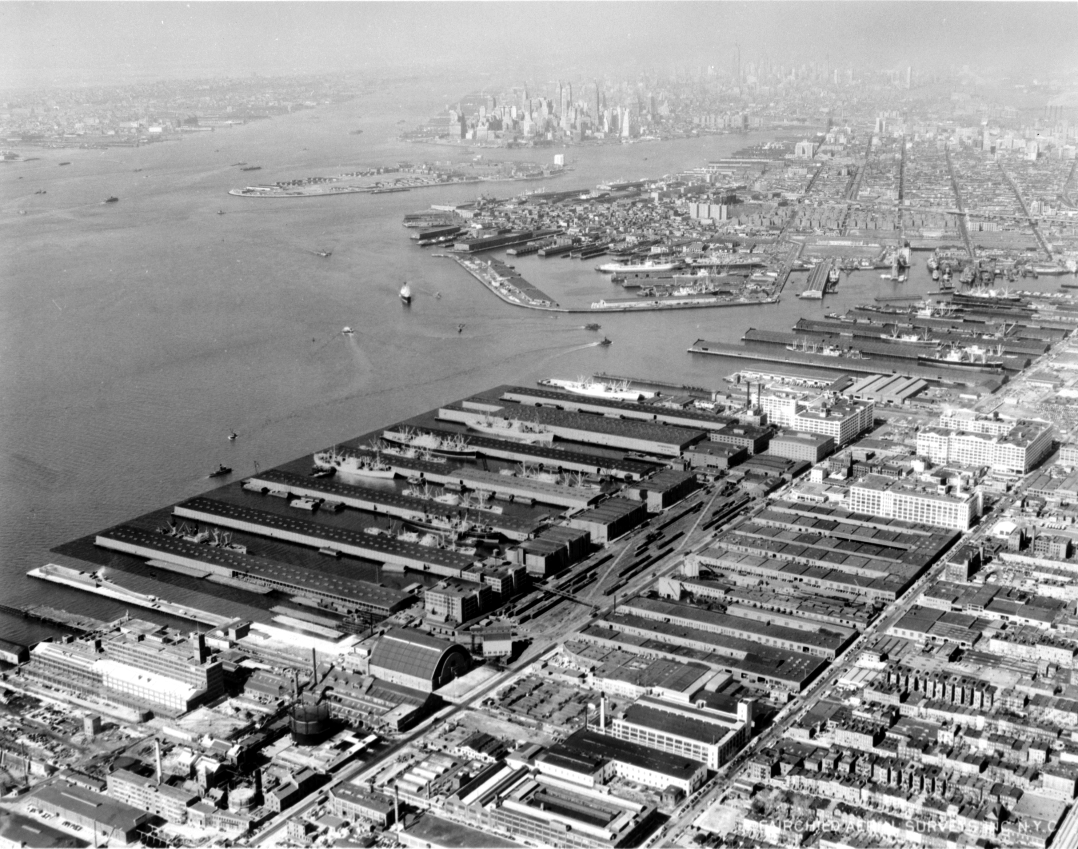
Industry City (also Bush Terminal) is a historic Intermodal freight transport, intermodal shipping, warehousing, and manufacturing complex on the Upper New York Bay waterfront in the Sunset Park, Brooklyn, Sunset Park neighborhood of Brooklyn, New York City. The northern portion, commonly called "Industry City" on its own, hosts commercial light manufacturing tenants across of space between 32nd and 41st Streets, and is operated by a private consortium. The southern portion, known as "Bush Terminal", is located between 40th and 51st Streets and is operated by the New York City Economic Development Corporation (NYCEDC) as a garment manufacturing complex. Founded by Bush Terminal Company head Irving T. Bush in the early 20th century, Bush Terminal was the first facility of its kind in New York City and the largest multi-tenant industrial property in the United States. The warehouses were built circa 1892–1910, the railroad from 1896 to 1915, and the factory lofts between 1905 ... [...More Info...] [...Related Items...] OR: [Wikipedia] [Google] [Baidu] |
Carfloat
A railroad car float or rail barge is a specialised form of lighter with railway tracks mounted on its deck used to move rolling stock across water obstacles, or to locations they could not otherwise go. An unpowered barge, it is towed by a tugboat or pushed by a towboat. This is distinguished from a train ferry, which is self-powered. Historical operations U.S. East Coast During the Civil War, Union general Herman Haupt, a civil engineer, used huge barges fitted with tracks to enable military trains to cross the Rappahannock River in support of the Army of the Potomac. Beginning in the 1830s, the Baltimore and Ohio Railroad (B&O) operated a car float across the Potomac River, just south of Washington, D.C., between Shepherds Landing on the east shore, and Alexandria, Virginia on the west. The ferry operation ended in 1906. The B&O operated a car float across the Baltimore Inner Harbor until the mid-1890s. It connected trains from Philadelphia to Washington, D.C. and po ... [...More Info...] [...Related Items...] OR: [Wikipedia] [Google] [Baidu] |
New York New Jersey Rail, LLC
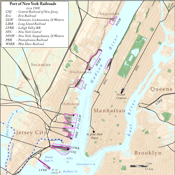
New York New Jersey Rail, LLC is a switching and terminal railroad that operates the only car float operation across Upper New York Bay between Jersey City, New Jersey and Brooklyn, New York. Since mid-November 2008, it has been owned by the Port Authority of New York and New Jersey, which acquired it for about $16 million as a step in a process that might see a Cross-Harbor Rail Tunnel completed. Since freight trains are not allowed in Amtrak's North River Tunnels, and the Poughkeepsie Bridge was closed in 1974, the ferry is the only freight crossing of the Hudson River south of the Alfred H. Smith Memorial Bridge, to the north of New York City, in a process known as the Selkirk hurdle. It is the last remaining car float operation in the Port of New York and New Jersey. Operations The Port Authority owns Greenville Yard in Greenville, Jersey City, where it connects with Class I railroads CSX Transportation and Norfolk Southern Railway, which jointly operate Conrail Share ... [...More Info...] [...Related Items...] OR: [Wikipedia] [Google] [Baidu] |
Kill Van Kull
__NOTOC__ The Kill Van Kull is a tidal strait between Staten Island, New York and Bayonne, New Jersey in the United States. It is approximately long and wide and connects Newark Bay with Upper New York Bay. The Robbins Reef Light marks the eastern end of the Kill, Bergen Point its western end. It is spanned by the Bayonne Bridge and is one of the most heavily traveled waterways in the Port of New York and New Jersey. Historically, it has been one of the most important channels for the commerce of the region, providing a passage for marine traffic between Upper New York Bay and the industrial towns of northeastern New Jersey. During the colonial era, it played a significant role in travel between New York and the southern colonies, with passengers changing from ferries to coaches at Elizabethtown (now Elizabeth). Since the final third of the 20th century, it has provided the principal access for oceangoing container ships to Port Newark-Elizabeth Marine Terminal, the bus ... [...More Info...] [...Related Items...] OR: [Wikipedia] [Google] [Baidu] |
Upper New York Bay
New York Harbor is at the mouth of the Hudson River where it empties into New York Bay near the East River tidal estuary, and then into the Atlantic Ocean on the east coast of the United States. It is one of the largest natural harbors in the world, and is frequently named the best natural harbor in the world. It is also known as Upper New York Bay, which is enclosed by the New York City boroughs of Manhattan, Brooklyn, and Staten Island and the Hudson County, New Jersey municipalities of Jersey City and Bayonne. The name may also refer to the entirety of New York Bay including Lower New York Bay. Although the United States Board on Geographic Names does not use the term, ''New York Harbor'' has important historical, governmental, commercial, and ecological usages. Overview The harbor is fed by the waters of the Hudson River (historically called the North River as it passes Manhattan), as well as the Gowanus Canal. It is connected to Lower New York Bay by the Narrows, to ... [...More Info...] [...Related Items...] OR: [Wikipedia] [Google] [Baidu] |
Constable Hook
Constable Hook is a cape located on the north side of the outlet of Kill van Kull into Upper New York Bay in Bayonne, New Jersey. The cape has long been an important site of marine transfer operations in the Port of New York and New Jersey. Just offshore, Robbins Reef Light serves to guide harbor traffic. Since the late 20th century, brownfields have been repurposed for recreational and commercial uses. Historically the term Constable Hook was used more broadly to be synonymous with Bergen Point as defining the southern extent of Bergen Neck and of Bergen Township when established in 1693. On March 15, 1861, the New Jersey Legislature approved unification of Constable Hook along with Bergen Point, Centerville and Salterville into the Township of Bayonne. Three weeks later the Charter for the City of Bayonne was signed by Governor Charles S. Olden. History Van Buskirk family In 1646, the Dutch West India Company, under the leadership of Director-General William Kieft, gave a la ... [...More Info...] [...Related Items...] OR: [Wikipedia] [Google] [Baidu] |
Port Jersey
Port Jersey, officially the Port Jersey Port Authority Marine Terminal and referred to as the Port Jersey Marine Terminal, is an intermodal freight transport facility that includes a container terminal located on the Upper New York Bay in the Port of New York and New Jersey. The municipal border of the Hudson County cities of Jersey City and Bayonne runs along the long pier extending into the bay. The facility was created between 1972 and 1976 and acquired by the Port Authority of New York and New Jersey in July 2010. Its major tenant is GCT Bayonne, a post-panamax shipping facility operated by Global Container Terminals. GCT Bayonne has been modernized. In May 2013 a 900 foot (270m) berth extension was completed, increasing the total dock face to 2,700 feet (820m) of contiguous berth, allowing the facility to handle the latest Suez Max vessels. Much of Port Jersey is part of United States Foreign-Trade Zone 49. Most of the area in and around the facility is restricted, thoug ... [...More Info...] [...Related Items...] OR: [Wikipedia] [Google] [Baidu] |
Bergen Hill
Bergen Hill refers to the lower Hudson Palisades in New Jersey, where they emerge on Bergen Neck, which in turn is the peninsula between the Hackensack and Hudson Rivers, and their bays. In Hudson County, it reaches a height of 260 feet. Rail Defining features of Bergen Hill include the 19th century and early 20th century railroad rights-of-way. Cuts and tunnels created to provide access to the terminals and ferries on the North River (Hudson River) and Upper New York Bay, and eventually under the river. From south to north they are: * The Central Railroad of New Jersey lines traveled on the CRRNJ Newark Bay Bridge across Newark Bay and through Bayonne and Greenville to its Communipaw Terminal. Portions are used by the Hudson Bergen Light Rail. * The Jersey City, Newark and Western Railway (later the Lehigh Valley Terminal Railway) freight line on the bridge over Newark Bay and across Pamrapo is now used by CSX Transportation as the National Docks Secondary to Port Jersey a ... [...More Info...] [...Related Items...] OR: [Wikipedia] [Google] [Baidu] |
Ironbound
The Ironbound is a neighborhood in the city of Newark in Essex County, New Jersey, United States. It is a large working-class multi-ethnic community, covering approximately of well maintained streets and homes. Historically, the area was called "Dutch Neck," "Down Neck," or simply "the Neck," due to the appearance of the curve of the Passaic River.Lawlor, Julia"If You're Thinking of Living In/The Ironbound; A Home Away From Home for Immigrants" ''The New York Times'', January 11, 2004. Accessed June 26, 2013. The Ironbound is part of Newark's East Ward and is directly east of Newark Penn Station and Downtown Newark, and south and west of the river, over which passes the Jackson Street Bridge, connecting to Harrison and Kearny. The area became a major transmission "hotspot" of the COVID-19 pandemic in late 2020. Early history The name "The Ironbound" is said to derive from the large metalworking industry in the area or from the network of railroad tracks that surrounded the ne ... [...More Info...] [...Related Items...] OR: [Wikipedia] [Google] [Baidu] |
Newark International Airport
Newark Liberty International Airport , originally Newark Metropolitan Airport and later Newark International Airport, is an international airport straddling the boundary between the cities of Newark, New Jersey, Newark in Essex County, New Jersey, Essex County and Elizabeth, New Jersey, Elizabeth in Union County, New Jersey, Union County, New Jersey. Located about south of downtown Newark, it is a major gateway to points in Europe, South America, Asia, and Oceania. It is jointly owned by the cities and leased to its operator, the Port Authority of New York and New Jersey. It is the second-busiest airport in the Aviation in the New York metropolitan area, New York airport system, behind John F. Kennedy International Airport. The airport is located south of Downtown Newark and west-southwest of Manhattan in New York City. It is near the Newark Airport Interchange, the junction between Interstate 95 in New Jersey, Interstate 95 and Interstate 78 in New Jersey, Interstate 78 (both ... [...More Info...] [...Related Items...] OR: [Wikipedia] [Google] [Baidu] |


