|
Ulchi
Ulchsky District (russian: У́льчский райо́н) is an administrativeResolution #143-pr and municipalLaw #194 district (raion), one of the seventeen in Khabarovsk Krai, Russia. It is located in the east of the krai and named after the indigenous Ulch people. The area of the district is . Its administrative center is the rural locality (a '' selo'') of Bogorodskoye. Population: The population of Bogorodskoye accounts for 20.8% of the district's total population. History A number of interesting Yuan and Ming Dynasty archaeological monuments have been found on the Tyr Cliff near the village of Tyr in this district. Demographics Over 90% of the Russian population of Ulch people The Ulch people, also known as Ulch or Ulchi, (russian: ульчи, obsolete ольчи; Ulch: , nani) are an indigenous people of the Russian Far East, who speak a Tungusic language known as Ulch. Over 90% of Ulchis live in Ulchsky District ... live in Ulchsky District. References No ... [...More Info...] [...Related Items...] OR: [Wikipedia] [Google] [Baidu] |
Ulch People
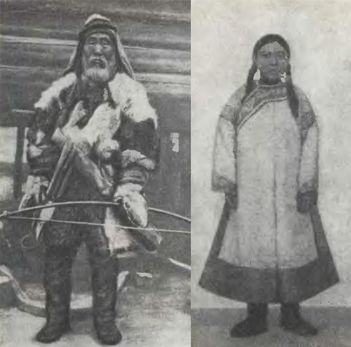
The Ulch people, also known as Ulch or Ulchi, (russian: ульчи, obsolete ольчи; Ulch: , nani) are an indigenous people of the Russian Far East, who speak a Tungusic language known as Ulch. Over 90% of Ulchis live in Ulchsky District of Khabarovsk Krai, Russia. According to the 2002 Census, there were 2,913 Ulchs living in Russia — down from 3,173 recorded in the 1989 Census, but up from 2,494 recorded in the 1979 Census, and 2,410 recorded in the 1970 Census. According to the 2010 Census there were 2,765 Ulchs in Russia. History The Ulch people descend from the autochthonous Paleolithic population of coastal Northeast Asia and were found to be very similar to ancient samples found in this region from about 8000 years ago. The Ulch people are often classified as one of the ancient Paleosiberian peoples, which is however not an ethno-linguistic group but a term applied to various ethnic groups of Siberia which do not belong to the bigger Northeast Asian po ... [...More Info...] [...Related Items...] OR: [Wikipedia] [Google] [Baidu] |
Khabarovsk Krai
Khabarovsk Krai ( rus, Хабаровский край, r=Khabarovsky kray, p=xɐˈbarəfskʲɪj kraj) is a federal subject (a krai) of Russia. It is geographically located in the Russian Far East and is a part of the Far Eastern Federal District. The administrative centre of the krai is the city of Khabarovsk, which is home to roughly half of the krai's population and the largest city in the Russian Far East (just ahead of Vladivostok). Khabarovsk Krai is the fourth-largest federal subject by area, and has a population of 1,343,869 as of 2010. The southern region lies mostly in the basin of the lower Amur River, with the mouth of the river located at Nikolaevsk-on-Amur draining into the Strait of Tartary, which separates Khabarovsk Krai from the island of Sakhalin. The north occupies a vast mountainous area along the coastline of the Sea of Okhotsk, a marginal sea of the Pacific Ocean. Khabarovsk Krai is bordered by Magadan Oblast to the north, Amur Oblast, Jewish Au ... [...More Info...] [...Related Items...] OR: [Wikipedia] [Google] [Baidu] |
Yuan Dynasty
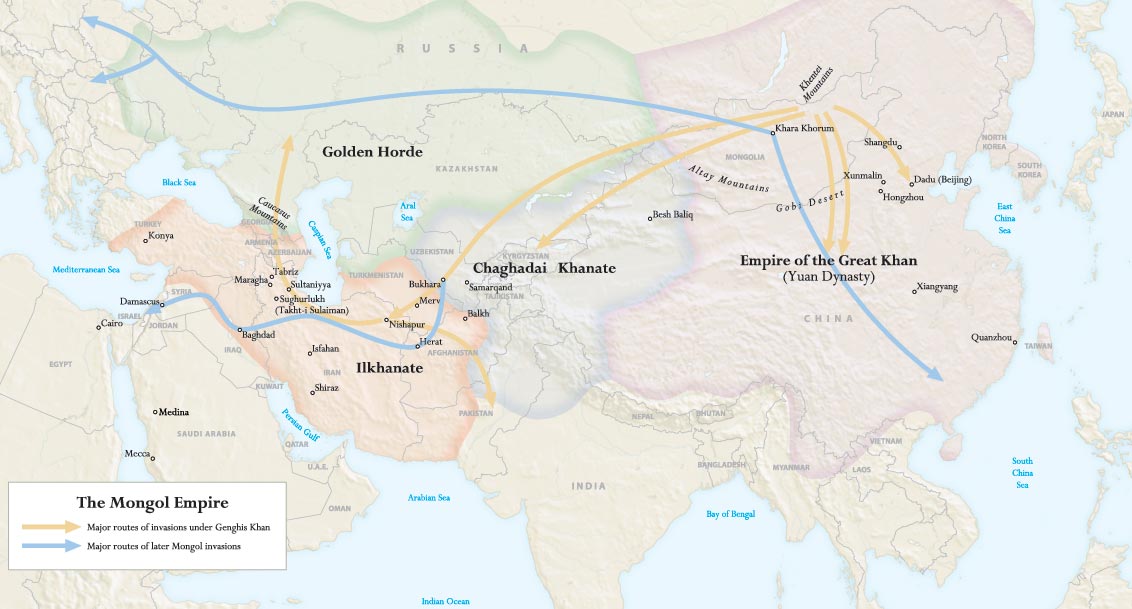
The Yuan dynasty (), officially the Great Yuan (; xng, , , literally "Great Yuan State"), was a Mongol-led imperial dynasty of China and a successor state to the Mongol Empire after its division. It was established by Kublai, the fifth khagan-emperor of the Mongol Empire from the Borjigin clan, and lasted from 1271 to 1368. In orthodox Chinese historiography, the Yuan dynasty followed the Song dynasty and preceded the Ming dynasty. Although Genghis Khan had been enthroned with the Han-style title of Emperor in 1206 and the Mongol Empire had ruled territories including modern-day northern China for decades, it was not until 1271 that Kublai Khan officially proclaimed the dynasty in the traditional Han style, and the conquest was not complete until 1279 when the Southern Song dynasty was defeated in the Battle of Yamen. His realm was, by this point, isolated from the other Mongol-led khanates and controlled most of modern-day China and its surrounding areas, including ... [...More Info...] [...Related Items...] OR: [Wikipedia] [Google] [Baidu] |
Solnechny District
Solnechny District (russian: Со́лнечный райо́н) is an administrativeResolution #143-pr and municipalLaw #194 district (raion), one of the seventeen in Khabarovsk Krai, Russia. It is located in the center of the krai. The area of the district is . Its administrative center An administrative center is a seat of regional administration or local government, or a county town, or the place where the central administration of a commune A commune is an alternative term for an intentional community. Commune or comună or ... is the urban locality (a work settlement) of Solnechny. Population: The population of the administrative center accounts for 39.5% of the district's total population. Tin mining The district owes its origins to tin exploration and mining and the subsequent Solnechny Processing ComplexSolnechny GOK Academia Ru: http://dic.academic.ru/dic.nsf/enc_geolog/4759/%D0%A1%D0%BE%D0%BB%D0%BD%D0%B5%D1%87%D0%BD%D1%8B%D0%B9 which sourced its ore from Solnech ... [...More Info...] [...Related Items...] OR: [Wikipedia] [Google] [Baidu] |
Komsomolsky District, Khabarovsk Krai
Komsomolsky District (russian: Комсомо́льский райо́н) is an administrativeResolution #143-pr and municipalLaw #194 district (raion), one of the seventeen in Khabarovsk Krai, Russia. It is located in the southern central part of the krai. The area of the district is . Its administrative center is the city of Komsomolsk-on-Amur (which is not administratively a part of the district). Population: Geography The Amur river flows by the city. Lake Khummi is located to the southeast of the city.Google Earth Administrative and municipal status Within the framework of administrative divisions, Komsomolsky District is one of the seventeen in the krai. The city of Komsomolsk-on-Amur serves as its administrative center An administrative center is a seat of regional administration or local government, or a county town, or the place where the central administration of a commune A commune is an alternative term for an intentional community. Commune or comună or ..., ... [...More Info...] [...Related Items...] OR: [Wikipedia] [Google] [Baidu] |
Vaninsky District
Vaninsky District (russian: Ва́нинский райо́н) is an administrativeResolution #143-pr and municipalLaw #194 district (raion), one of the seventeen in Khabarovsk Krai, Russia. It is located in the east of the krai. The area of the district is . Its administrative center An administrative center is a seat of regional administration or local government, or a county town, or the place where the central administration of a commune A commune is an alternative term for an intentional community. Commune or comună or ... is the urban locality (a work settlement) of Vanino. Population: The population of Vanino accounts for 45.6% of the district's total population. References Notes Sources * * * * {{coord, 49, 05, N, 140, 16, E, region:RU_type:adm3rd_source:kolossus-itwiki, display=title Districts of Khabarovsk Krai ... [...More Info...] [...Related Items...] OR: [Wikipedia] [Google] [Baidu] |
Sea Of Japan
The Sea of Japan is the marginal sea between the Japanese archipelago, Sakhalin, the Korean Peninsula, and the mainland of the Russian Far East. The Japanese archipelago separates the sea from the Pacific Ocean. Like the Mediterranean Sea, it has almost no tides due to its nearly complete enclosure from the Pacific Ocean. This isolation also affects faunal diversity and salinity, both of which are lower than in the open ocean. The sea has no large islands, bays or capes. Its water balance is mostly determined by the inflow and outflow through the straits connecting it to the neighboring seas and the Pacific Ocean. Few rivers discharge into the sea and their total contribution to the water exchange is within 1%. The seawater has an elevated concentration of dissolved oxygen that results in high biological productivity. Therefore, fishing is the dominant economic activity in the region. The intensity of shipments across the sea has been moderate owing to political issues, but it ... [...More Info...] [...Related Items...] OR: [Wikipedia] [Google] [Baidu] |
Nikolayevsky District, Khabarovsk Krai
Nikolayevsky District (russian: Никола́евский райо́н) is an administrativeResolution #143-pr and municipalLaw #194 district (raion), one of the seventeen in Khabarovsk Krai, Russia. It is located in the east of the krai. The area of the district is . Its administrative center is the town of Nikolayevsk-on-Amur (which is not administratively a part of the district). Population: Administrative and municipal status Within the framework of administrative divisions, Nikolayevsky District is one of the seventeen in the krai. The town of Nikolayevsk-on-Amur serves as its administrative center An administrative center is a seat of regional administration or local government, or a county town, or the place where the central administration of a commune A commune is an alternative term for an intentional community. Commune or comună or ..., despite being incorporated separately as a town of krai significance—an administrative unit with the status equal to that o ... [...More Info...] [...Related Items...] OR: [Wikipedia] [Google] [Baidu] |
Tuguro-Chumikansky District
Tuguro-Chumikansky District (russian: Тугу́ро-Чумика́нский райо́н) is an administrativeResolution #143-pr and municipalLaw #194 district (raion), one of the seventeen in Khabarovsk Krai, Russia. It is located in the center of the krai. The area of the district is . Its administrative center is the rural locality (a '' selo'') of Chumikan. Population: The population of Chumikan accounts for 47.0% of the district's total population. Geography The district is located in the basin of the Uda and Tugur rivers. In the northeast it has a stretch of coastline of the Sea of Okhotsk indented by numerous bays. The district includes the Shantar Islands. The relief is dominated by the mountains of the Pribrezhny Range and the Taikan Range, among others. Bokon is the largest freshwater lake in the district. - |
Tyr, Russia
Tyr (russian: Тыр) is a settlement in Ulchsky District of Khabarovsk Krai, Russia, located on the right bank of the Amur River, near the mouth of the Amgun River, about upstream from Nikolayevsk-on-Amur. Tyr has been known as a historically Nivkh ("Gilyak") village, since no later than the mid-19th century.E. G. Ravenstein. The Russians on the Amur'. London, 1861. ( E. G. Ravenstein did not visit the area himself, but compiled his book based on the accounts of mostly Russian expeditions in the area from the 1850s) Tyr's main claim to fame is that its location had been visited by both Yuan and Ming Dynasty expeditions, which sailed down the Sungari and Amur Rivers to establish a foothold in this region. Both times the visitors built temples and monuments on the spectacular Tyr Cliff south of today's settlement. The remains of the Yuan era temple unearthed at the site by modern archaeologists date to the 1260s, while the two Ming temples, built during ... [...More Info...] [...Related Items...] OR: [Wikipedia] [Google] [Baidu] |
Ming Dynasty
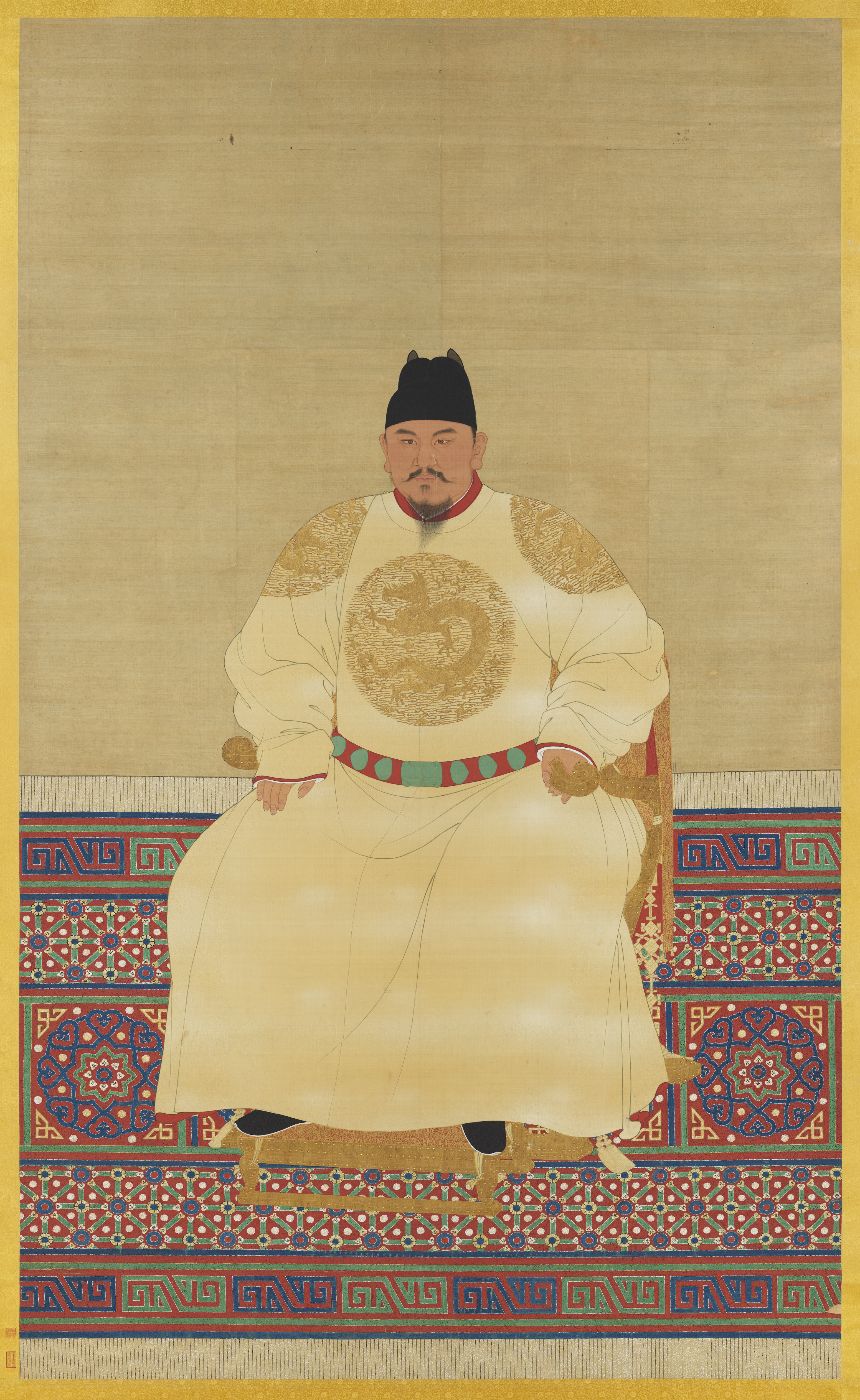
The Ming dynasty (), officially the Great Ming, was an Dynasties in Chinese history, imperial dynasty of China, ruling from 1368 to 1644 following the collapse of the Mongol Empire, Mongol-led Yuan dynasty. The Ming dynasty was the last orthodox dynasty of China ruled by the Han Chinese, Han people, the majority ethnic group in China. Although the primary capital of Beijing fell in 1644 to a rebellion led by Li Zicheng (who established the short-lived Shun dynasty), numerous rump state, rump regimes ruled by remnants of the House of Zhu, Ming imperial family—collectively called the Southern Ming—survived until 1662. The Ming dynasty's founder, the Hongwu Emperor (r. 1368–1398), attempted to create a society of self-sufficient rural communities ordered in a rigid, immobile system that would guarantee and support a permanent class of soldiers for his dynasty: the empire's standing army exceeded one million troops and the naval history of China, navy's dockyards in Nanjin ... [...More Info...] [...Related Items...] OR: [Wikipedia] [Google] [Baidu] |
Types Of Inhabited Localities In Russia
The classification system of inhabited localities in Russia and some other post-Soviet states has certain peculiarities compared with those in other countries. Classes During the Soviet time, each of the republics of the Soviet Union, including the Russian SFSR, had its own legislative documents dealing with classification of inhabited localities. After the dissolution of the Soviet Union, the task of developing and maintaining such classification in Russia was delegated to the federal subjects.Articles 71 and 72 of the Constitution of Russia do not name issues of the administrative and territorial structure among the tasks handled on the federal level or jointly with the governments of the federal subjects. As such, all federal subjects pass their own laws establishing the system of the administrative-territorial divisions on their territories. While currently there are certain peculiarities to classifications used in many federal subjects, they are all still largely ba ... [...More Info...] [...Related Items...] OR: [Wikipedia] [Google] [Baidu] |


