|
USS Serpens (AK-97)
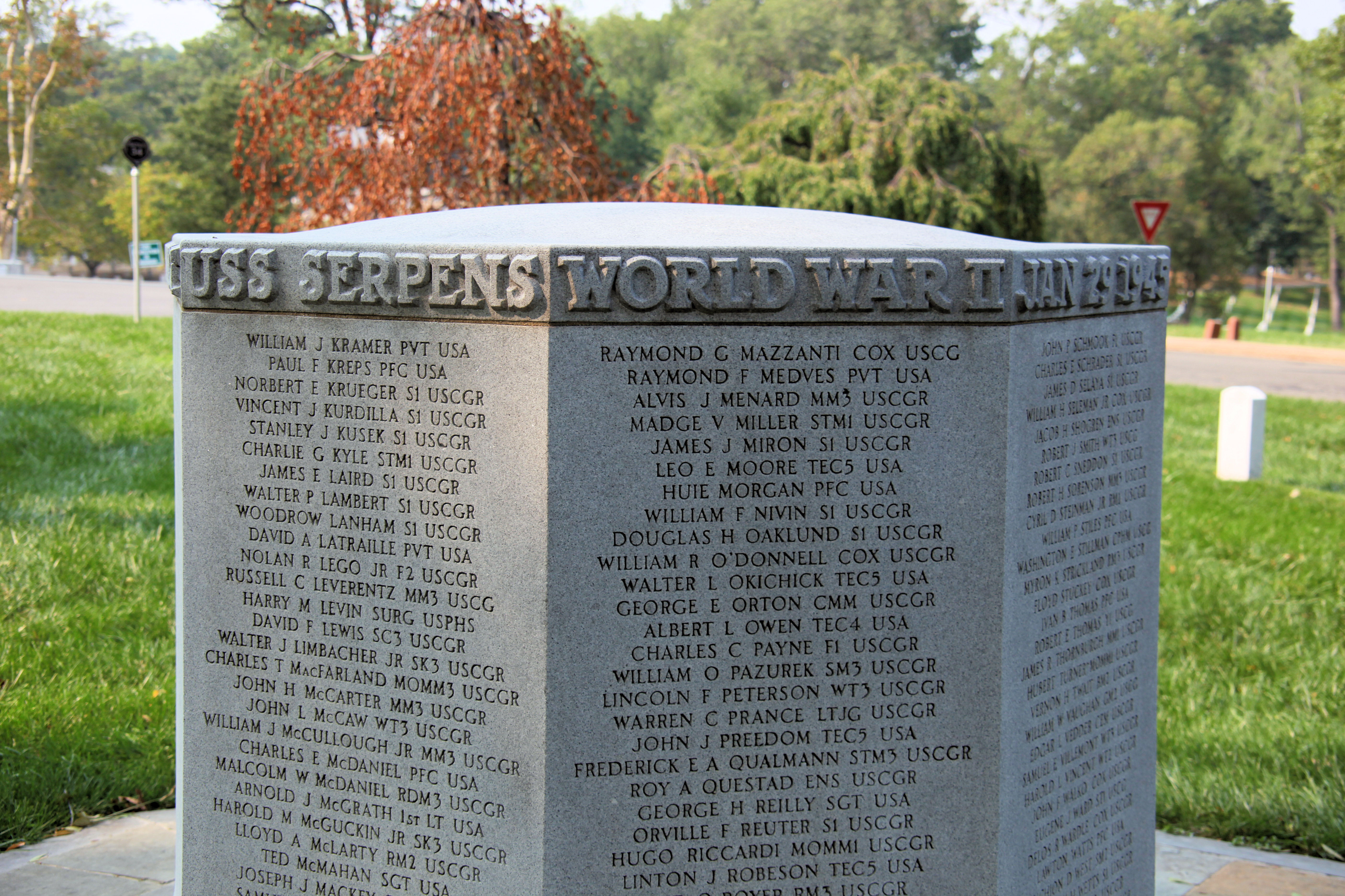
USS ''Serpens'' (AK-97) was a commissioned by the United States Navy for service in World War II. She was the first ship of the US Navy to have this name: she is named after Serpens, a constellation in the northern hemisphere. ''Serpens'' was crewed by United States Coast Guard personnel and was responsible for delivering troops, goods and equipment to locations in the Asiatic-Pacific Theater. Construction ''Serpens'' was laid down on 10 March 1943, under a Maritime Commission (MARCOM) contract, MC hull 739, as the Liberty ship SS ''Benjamin N. Cardozo'', by California Shipbuilding Corporation, Terminal Island, Los Angeles, California; launched on 5 April 1943; sponsored by Mrs. H.P. Needham; transferred to the Navy on 19 April 1943; renamed ''Serpens'' and designated AK-97; and commissioned at San Diego, California on 28 May 1943. Service history Following shakedown off southern California, ''Serpens'' loaded general cargo at Alameda and, on 24 June, sailed west to assume ... [...More Info...] [...Related Items...] OR: [Wikipedia] [Google] [Baidu] |
Benjamin N
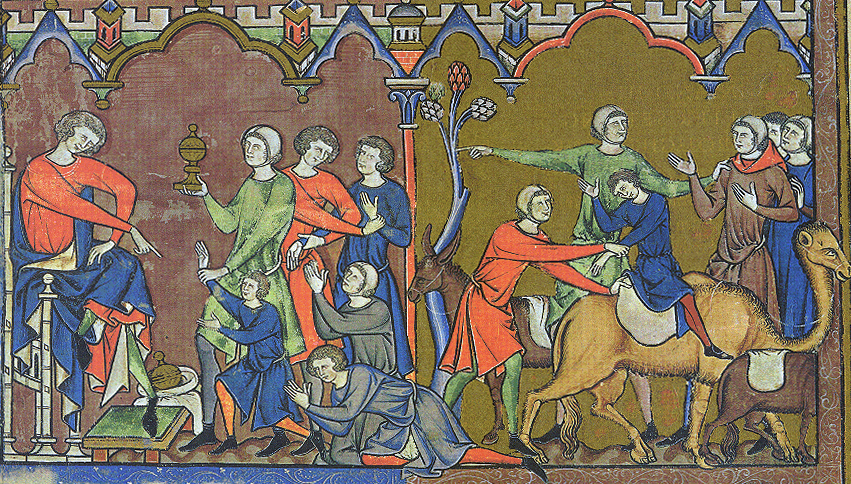
Benjamin ( he, ''Bīnyāmīn''; "Son of (the) right") blue letter bible: https://www.blueletterbible.org/lexicon/h3225/kjv/wlc/0-1/ H3225 - yāmîn - Strong's Hebrew Lexicon (kjv) was the last of the two sons of Jacob and Rachel (Jacob's thirteenth child and twelfth and youngest son) in Jewish, Christian and Islamic tradition. He was also the progenitor of the Israelite Tribe of Benjamin. Unlike Rachel's first son, Joseph, Benjamin was born in Canaan according to biblical narrative. In the Samaritan Pentateuch, Benjamin's name appears as "Binyamēm" ( Samaritan Hebrew: , "son of days"). In the Quran, Benjamin is referred to as a righteous young child, who remained with Jacob when the older brothers plotted against Joseph. Later rabbinic traditions name him as one of four ancient Israelites who died without sin, the other three being Chileab, Jesse and Amram. Name The name is first mentioned in letters from King Sîn-kāšid of Uruk (1801–1771 BC), who called himself “K ... [...More Info...] [...Related Items...] OR: [Wikipedia] [Google] [Baidu] |
Shakedown Cruise
Shakedown cruise is a nautical term in which the performance of a ship is tested. Generally, shakedown cruises are performed before a ship enters service or after major changes such as a crew change, repair or overhaul. The shakedown cruise simulates working conditions for the vessel, for various reasons. For most new ships, the major reasons are to familiarise a crew with a new vessel and to ensure all of the ship's systems are functional. Overview If the ship is the first of its class, it will likely also be performing its sea trials, a test of its performance. In this context, 'shakedown cruise' and 'sea trials' may be used interchangeably, though each has a slightly different meaning. In such a case, it is likely that the ship's systems will be pushed to redline, or maximum capacity, to demonstrate the class's speed and other important traits. Until bested by another ship of the same class, this shakedown performance will be the standard of the class's capabilities, a ... [...More Info...] [...Related Items...] OR: [Wikipedia] [Google] [Baidu] |
Florida Island
The Nggela Islands, also known as the Florida Islands, are a small island group in the Central Province of Solomon Islands, a sovereign state (since 1978) in the southwest Pacific Ocean. The chain is composed of four larger islands and about 50 smaller islands. The two main islands, Nggela Sule and Nggela Pile to its southeast, are separated by a channel, Mboli Passage. The name Florida Island is sometimes also used to refer to Nggela Sule. The other two large islands lie northwest of Nggela Sule; Sandfly (also known as Mobokonimbeti or Olevugha) and, further northwest, Buenavista (also known as Vatilau). Many of the smaller islands have white coral beaches. North of Nggela Sule is Anuha (), and just off the southwest coast of Nggela Sule is Tulagi. the capital of Central Province. Other islands include Gavutu and Tanambogo. History The first recorded sighting by Europeans was by the Spanish expedition of Álvaro de Mendaña on 16 April 1568. More precisely the sighting was ... [...More Info...] [...Related Items...] OR: [Wikipedia] [Google] [Baidu] |
Tongatapu
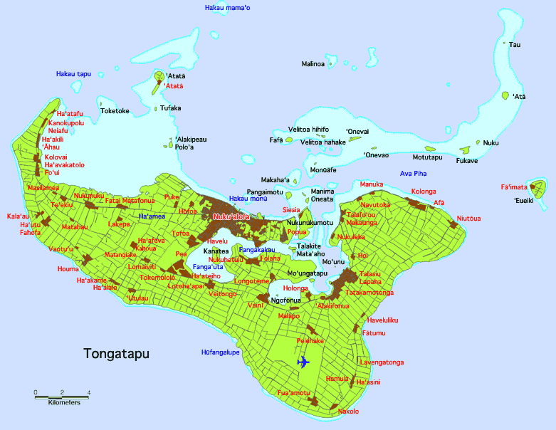
Tongatapu is the main island of Tonga and the site of its capital, Nukualofa. It is located in Tonga's southern island group, to which it gives its name, and is the country's most populous island, with 74,611 residents (2016), 70.5% of the national population, on . Based on Google Earth Pro, its maximum elevation is at least above sea level along Liku Road at 21 degrees 15 minutes and 55.7 seconds south 175 degrees 08 minutes 06.4 seconds west, but could be even higher somewhere else. Tongatapu is Tonga's centre of government and the seat of its monarchy. Tongatapu has experienced more rapid economic development than the other islands of Tonga, and has thus attracted many internal migrants from them. Geography The island is (or including neighbouring islands) and rather flat, as it is built of coral limestone. The island is covered with thick fertile soil consisting of volcanic ash from neighbouring volcanoes. At the steep coast of the south, heights reach an average of , a ... [...More Info...] [...Related Items...] OR: [Wikipedia] [Google] [Baidu] |
Aitutaki
Aitutaki, also traditionally known as Araura and Utataki, is the second most-populated island in the Cook Islands, after Rarotonga. It is an "almost atoll", with fifteen islets in a lagoon adjacent to the main island. Total land area is , and the lagoon has an area of between . A major tourist destination, Aitutaki is the second most visited island of the Cook Islands. Aitutaki had a population of 1,712 in 2016. The main village is Arutanga (Arutunga) on the west side. Geography Aitutaki is sometimes described as an "almost atoll", for it consists of a lagoon within an encircling atoll, with a significant area of high land on one side. It has a maximum elevation of approximately with the hill known as Maunga Pu close to its northernmost point. The land area of the atoll is , of which the main island occupies . The Ootu Peninsula, protruding east from the main island in a southerly direction along the eastern rim of the reef, takes up out of the main island. For the lagoon, are ... [...More Info...] [...Related Items...] OR: [Wikipedia] [Google] [Baidu] |
Bora Bora
Bora Bora ( French: ''Bora-Bora''; Tahitian: ''Pora Pora'') is an island group in the Leeward Islands. The Leeward Islands comprise the western part of the Society Islands of French Polynesia, which is an overseas collectivity of the French Republic in the Pacific Ocean. Bora Bora has a total land area of . The main island, located about northwest of Papeete, is surrounded by a lagoon and a barrier reef. In the center of the island are the remnants of an extinct volcano, rising to two peaks, Mount Pahia and Mount Otemanu; the highest point is at . Bora Bora is part of the Commune of Bora-Bora, which also includes the atoll of Tūpai. The languages spoken in Bora Bora are Tahitian and French. However, due to the high tourism population, many natives of Bora Bora have learned to speak English. Bora Bora is a major international tourist destination, famous for its seaside (and even offshore) luxury resorts. The major settlement, Vaitape, is on the western side of the mai ... [...More Info...] [...Related Items...] OR: [Wikipedia] [Google] [Baidu] |
Penrhyn Island
Penrhyn (also called Tongareva, Māngarongaro, Hararanga, and Te Pitaka) is an atoll in the northern group of the Cook Islands in the south Pacific Ocean. The northernmost island in the group, it is located at north-north-east of the capital island of Rarotonga, 9 degrees south of the equator. Its nearest neighbours are Rakahanga and Manihiki, approximately to the southwest. Once one of the most heavily populated atolls, it was almost completely depopulated by Peruvian slavers in 1864. Geography Penrhyn is a roughly circular coral atoll with a circumference of approximately , enclosing a lagoon with an area of . The atoll is atop the highest submarine volcano in the Cook Islands, rising from the ocean floor. The atoll is low-lying, with a maximum elevation of less than . The total land area is . The atoll rim consists of 18 major islets. Clockwise, from the Northwest, these are: * Tokerau * Painko * Ruahara * Takuua * Veseru * Tuirai * Pokerekere Islet * Kavea * Te ... [...More Info...] [...Related Items...] OR: [Wikipedia] [Google] [Baidu] |
Tutuila
Tutuila is the main island of American Samoa (and its largest), and is part of the archipelago of Samoan Islands. It is the third largest island in the Samoan Islands chain of the Central Pacific. It is located roughly northeast of Brisbane, Australia and lies over to the northeast of Fiji. It contains a large, natural harbor, Pago Pago Harbor, where Pago Pago, the capital of American Samoa, is situated. Pago Pago International Airport is also located on Tutuila. The island’s land expanse is about 68% of the total land area of American Samoa. With 56,000 inhabitants, it is also home to 95% of the population of American Samoa. The island has six terrestrial and three marine ecosystems. Tutuila has mountainous regions, the highest point of which is ). The island is attractive to tourists because of its beaches, coral reefs, and World War II relics, as well as its suitability for sporting activities such as scuba diving, snorkeling, and hiking. Etymology It is said that the nam ... [...More Info...] [...Related Items...] OR: [Wikipedia] [Google] [Baidu] |
Viti Levu
Viti Levu (pronounced ) is the largest island in the Republic of Fiji. It is the site of the nation's capital, Suva, and home to a large majority of Fiji's population. Geology Fiji lies in a tectonically complex area between the Australian Plate and the Pacific Plate. The Fiji Platform lies in a zone bordered by active extension fault lines, around which most of the shallow earthquakes in the area have been centred. These fault lines are: the Fiji Fracture Zone (FFZ) to the north; the 176° Extension Zone (176°E EZ) to the west; and the Hunter Fracture Zone (HFZ) and Lau Ridge to the east. The oldest rocks on the island are those formed during the Eocene and Lower Miocene epochs that belong to the Wainimala group. The lower portion of the group is made up of volcanic flows and volcanoclastics, which grade from basalt to trachyte and rhyolite. Geographically, this group is found south of Nadi, including on the peaks of Koromba (at 3528 feet high) and Natambumgguto (at 1242 ... [...More Info...] [...Related Items...] OR: [Wikipedia] [Google] [Baidu] |
Wellington
Wellington ( mi, Te Whanganui-a-Tara or ) is the capital city of New Zealand. It is located at the south-western tip of the North Island, between Cook Strait and the Remutaka Range. Wellington is the second-largest city in New Zealand by metro area, and is the administrative centre of the Wellington Region. It is the world's southernmost capital of a sovereign state. Wellington features a temperate maritime climate, and is the world's windiest city by average wind speed. Legends recount that Kupe discovered and explored the region in about the 10th century, with initial settlement by Māori iwi such as Rangitāne and Muaūpoko. The disruptions of the Musket Wars led to them being overwhelmed by northern iwi such as Te Āti Awa by the early 19th century. Wellington's current form was originally designed by Captain William Mein Smith, the first Surveyor General for Edward Wakefield's New Zealand Company, in 1840. The Wellington urban area, which only includes urbanised ar ... [...More Info...] [...Related Items...] OR: [Wikipedia] [Google] [Baidu] |
New Zealand
New Zealand ( mi, Aotearoa ) is an island country in the southwestern Pacific Ocean. It consists of two main landmasses—the North Island () and the South Island ()—and over 700 smaller islands. It is the sixth-largest island country by area, covering . New Zealand is about east of Australia across the Tasman Sea and south of the islands of New Caledonia, Fiji, and Tonga. The country's varied topography and sharp mountain peaks, including the Southern Alps, owe much to tectonic uplift and volcanic eruptions. New Zealand's capital city is Wellington, and its most populous city is Auckland. The islands of New Zealand were the last large habitable land to be settled by humans. Between about 1280 and 1350, Polynesians began to settle in the islands and then developed a distinctive Māori culture. In 1642, the Dutch explorer Abel Tasman became the first European to sight and record New Zealand. In 1840, representatives of the United Kingdom and Māori chiefs ... [...More Info...] [...Related Items...] OR: [Wikipedia] [Google] [Baidu] |
New Caledonia
) , anthem = "" , image_map = New Caledonia on the globe (small islands magnified) (Polynesia centered).svg , map_alt = Location of New Caledonia , map_caption = Location of New Caledonia , mapsize = 290px , subdivision_type = Sovereign state , subdivision_name = , established_title = Annexed by France , established_date = 24 September 1853 , established_title2 = Overseas territory , established_date2 = 1946 , established_title3 = Nouméa Accord , established_date3 = 5 May 1998 , official_languages = French , regional_languages = , capital = Nouméa , coordinates = , largest_city = capital , demonym = New Caledonian , government_type = Devolved parliamentary dependency , leader_title1 = President of France , leader_name1 = Emmanuel Macron , leader_title2 = President of the Government , leader_name2 = Louis Mapou , leader_title3 = President of the Congress , leader_name3 = Roch Wamytan , leader_title4 = High Commissioner , leader_name4 = Patrice ... [...More Info...] [...Related Items...] OR: [Wikipedia] [Google] [Baidu] |


_during_shakedown_cruise_1959.jpg)


