|
USS Lansdowne (DD-486)
USS ''Lansdowne'' (DD-486), a , is the only ship of the United States Navy to be named for Lieutenant Commander Zachary Lansdowne. ''Lansdowne'' was laid down on 31 July 1941 by Federal Shipbuilding & Dry Dock Company of Kearny, New Jersey and launched on 20 February 1942, sponsored by Miss Peggy Lansdowne, daughter of Lt.Cmdr. Lansdowne. The ship was commissioned on 29 April 1942, Lt. Cmdr. William R. Smedberg III in command. Service history 1942 ''Lansdowne'' first operated along the Atlantic seaboard on shakedown, antisubmarine, and escort duty, and attacked an enemy submarine off Cape Hatteras on 3 July. Following a severe depth charge attack, large quantities of oil bubbled to the surface and it was presumed the submarine had been sunk. Arriving at Cristobal, Panama Canal Zone, 13 July, the destroyer was sent to a position where '' PC-458'' had located an enemy submarine. Upon arrival, ''Lansdowne'' launched a depth charge attack. Large quantities of oil rose to t ... [...More Info...] [...Related Items...] OR: [Wikipedia] [Google] [Baidu] |
Kearny, New Jersey
Kearny ( ) is a town in the western part of Hudson County, New Jersey, United States and a suburb of Newark. As of the 2010 United States Census, the town's population was 40,684,DP-1 – Profile of General Population and Housing Characteristics: 2010 for Kearny town, Hudson County, New Jersey , . Accessed December 15, 2011. [...More Info...] [...Related Items...] OR: [Wikipedia] [Google] [Baidu] |
South Pacific Area
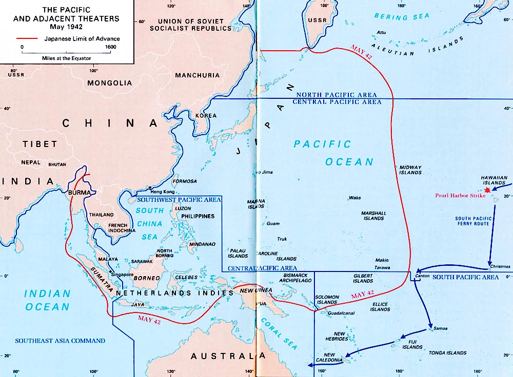
The South Pacific Area (SOPAC) was a multinational U.S.-led military command active during World War II. It was a part of the U.S. Pacific Ocean Areas under Admiral Chester Nimitz. The delineation and establishment of the Pacific Ocean Areas was negotiated by the Allied governments of the United States, the United Kingdom, Australia, New Zealand, and the Kingdom of the Netherlands in March–April 1942 in response to the Japanese attacks in Southeast Asia and the Pacific. The South Pacific Area was bounded on the west by the Southwest Pacific Area, on the north by the Central Pacific Area, and on the east by the Southeast Pacific Area. It originally encompassed the Ellice, Phoenix, Marquesas, Tuamotu, Samoa, Fiji, and New Hebrides island groups plus New Caledonia and New Zealand. Its western boundary was shifted to just west of Guadalcanal on 1 August 1942 to facilitate operations against that island. Background The assignment orders for Major General Millard Harmon as the Comman ... [...More Info...] [...Related Items...] OR: [Wikipedia] [Google] [Baidu] |
Panama Canal
The Panama Canal ( es, Canal de Panamá, link=no) is an artificial waterway in Panama that connects the Atlantic Ocean with the Pacific Ocean and divides North and South America. The canal cuts across the Isthmus of Panama and is a conduit for maritime trade. One of the largest and most difficult engineering projects ever undertaken, the Panama Canal shortcut greatly reduces the time for ships to travel between the Atlantic and Pacific oceans, enabling them to avoid the lengthy, hazardous Cape Horn route around the southernmost tip of South America via the Drake Passage or Strait of Magellan and the even less popular route through the Arctic Archipelago and the Bering Strait. Colombia, France, and later the United States controlled the territory surrounding the canal during construction. France began work on the canal in 1881, but stopped because of lack of investors' confidence due to engineering problems and a high worker mortality rate. The United States took over the ... [...More Info...] [...Related Items...] OR: [Wikipedia] [Google] [Baidu] |
Panama Canal Zone
The Panama Canal Zone ( es, Zona del Canal de Panamá), also simply known as the Canal Zone, was an unincorporated territory of the United States, located in the Isthmus of Panama, that existed from 1903 to 1979. It was located within the territory of Panama, consisting of the Panama Canal and an area generally extending on each side of the centerline, but excluding Panama City and Colón. Its capital was Balboa. The Panama Canal Zone was created on November 18, 1903 from the territory of Panama; established with the signing of the Hay–Bunau-Varilla Treaty, which allowed for the construction of the Panama Canal within the territory by the United States. The zone existed until October 1, 1979, when it was incorporated back into Panama. In 1904, the Isthmian Canal Convention was proclaimed. In it, the Republic of Panama granted to the United States in perpetuity the use, occupation, and control of a zone of land and land underwater for the construction, maintenance, opera ... [...More Info...] [...Related Items...] OR: [Wikipedia] [Google] [Baidu] |
Depth Charge
A depth charge is an anti-submarine warfare (ASW) weapon. It is intended to destroy a submarine by being dropped into the water nearby and detonating, subjecting the target to a powerful and destructive Shock factor, hydraulic shock. Most depth charges use explosive, high explosive charges and a fuze set to detonate the charge, typically at a specific depth. Depth charges can be dropped by ships, patrol aircraft, and helicopters. Depth charges were developed during World War I, and were one of the first viable methods of attacking a submarine underwater. They were widely used in World War I and World War II, and remained part of the anti-submarine arsenals of many navies during the Cold War, during which they were supplemented, and later largely replaced, by anti-submarine homing torpedoes. A depth charge fitted with a nuclear warhead is also known as a "nuclear depth bomb". These were designed to be dropped from a patrol plane or deployed by an anti-submarine missile from a s ... [...More Info...] [...Related Items...] OR: [Wikipedia] [Google] [Baidu] |
Cape Hatteras
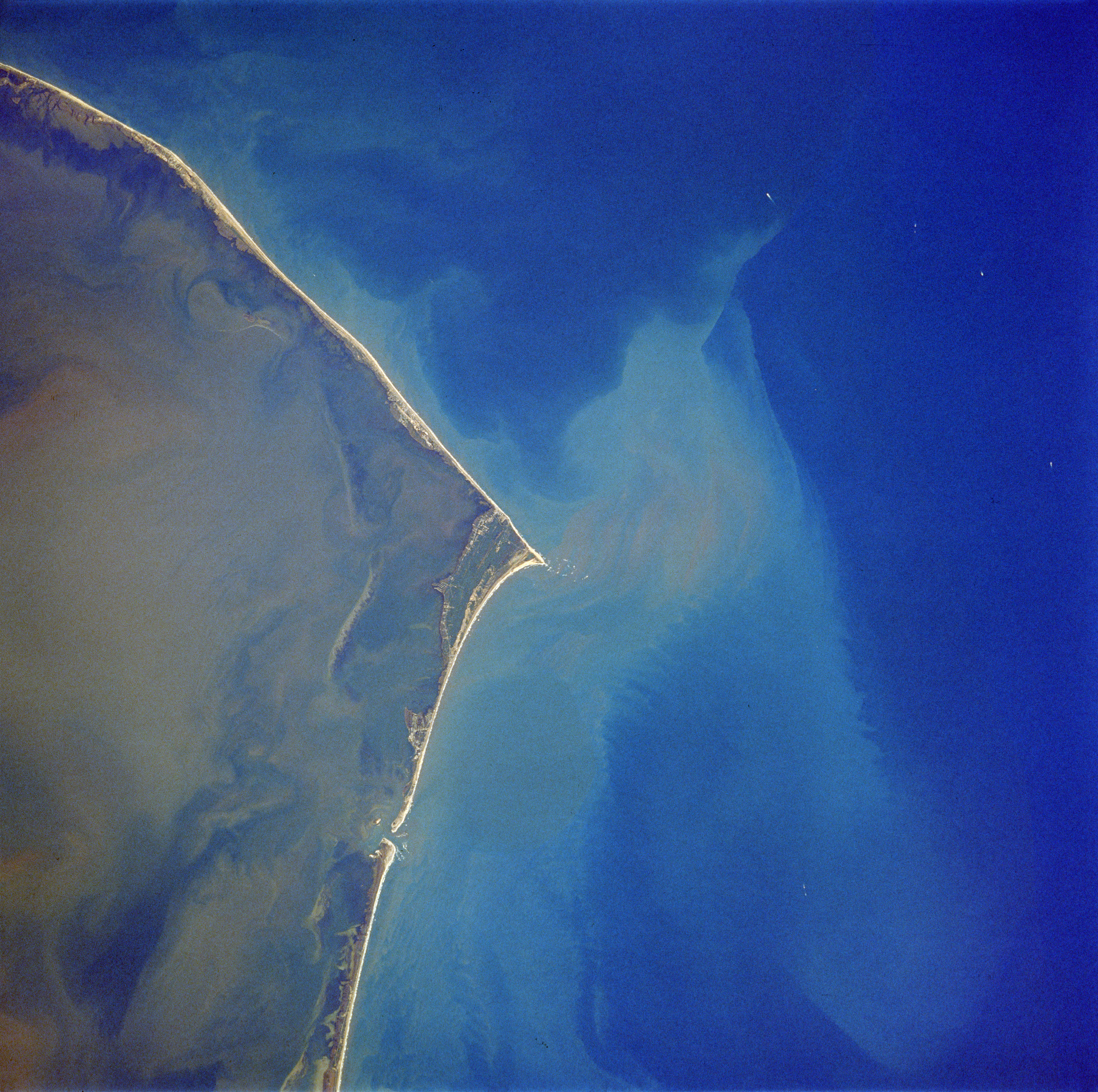
Cape Hatteras is a cape located at a pronounced bend in Hatteras Island, one of the barrier islands of North Carolina. Long stretches of beach, sand dunes, marshes, and maritime forests create a unique environment where wind and waves shape the topography. A large area of the Outer Banks is part of a National Park, called the Cape Hatteras National Seashore. It is also the nearest landmass on the North American mainland to Bermuda, which is about to the east-southeast. The treacherous waters off the coast of the Outer Banks are known as the Graveyard of the Atlantic, Over 600 ships wrecked here as victims of shallow shoals, storms, and war. Diamond Shoals, a bank of shifting sand ridges hidden beneath the turbulent sea off Cape Hatteras, has never promised safe passage for ships. In the past 400 years, the graveyard has claimed many lives, but island villagers saved many. As early as the 1870s, villagers served in the United States Life-Saving Service. Others staffed lightho ... [...More Info...] [...Related Items...] OR: [Wikipedia] [Google] [Baidu] |
Submarine
A submarine (or sub) is a watercraft capable of independent operation underwater. It differs from a submersible, which has more limited underwater capability. The term is also sometimes used historically or colloquially to refer to remotely operated vehicles and Autonomous underwater vehicle, robots, as well as medium-sized or smaller vessels, such as the midget submarine and the wet sub. Submarines are referred to as ''boats'' rather than ''ships'' irrespective of their size. Although experimental submarines had been built earlier, submarine design took off during the 19th century, and they were adopted by several navies. They were first widely used during World War I (1914–1918), and are now used in many navy, navies, large and small. Military uses include attacking enemy surface ships (merchant and military) or other submarines, and for aircraft carrier protection, Blockade runner, blockade running, Ballistic missile submarine, nuclear deterrence, reconnaissance, conventio ... [...More Info...] [...Related Items...] OR: [Wikipedia] [Google] [Baidu] |
Shakedown Cruise
Shakedown cruise is a nautical term in which the performance of a ship is tested. Generally, shakedown cruises are performed before a ship enters service or after major changes such as a crew change, repair or overhaul. The shakedown cruise simulates working conditions for the vessel, for various reasons. For most new ships, the major reasons are to familiarise a crew with a new vessel and to ensure all of the ship's systems are functional. Overview If the ship is the first of its class, it will likely also be performing its sea trials, a test of its performance. In this context, 'shakedown cruise' and 'sea trials' may be used interchangeably, though each has a slightly different meaning. In such a case, it is likely that the ship's systems will be pushed to redline, or maximum capacity, to demonstrate the class's speed and other important traits. Until bested by another ship of the same class, this shakedown performance will be the standard of the class's capabilities, a ... [...More Info...] [...Related Items...] OR: [Wikipedia] [Google] [Baidu] |
Atlantic
The Atlantic Ocean is the second-largest of the world's five oceans, with an area of about . It covers approximately 20% of Earth's surface and about 29% of its water surface area. It is known to separate the " Old World" of Africa, Europe and Asia from the "New World" of the Americas in the European perception of the World. The Atlantic Ocean occupies an elongated, S-shaped basin extending longitudinally between Europe and Africa to the east, and North and South America to the west. As one component of the interconnected World Ocean, it is connected in the north to the Arctic Ocean, to the Pacific Ocean in the southwest, the Indian Ocean in the southeast, and the Southern Ocean in the south (other definitions describe the Atlantic as extending southward to Antarctica). The Atlantic Ocean is divided in two parts, by the Equatorial Counter Current, with the North(ern) Atlantic Ocean and the South(ern) Atlantic Ocean split at about 8°N. Scientific explorations of the Atlanti ... [...More Info...] [...Related Items...] OR: [Wikipedia] [Google] [Baidu] |


_during_shakedown_cruise_1959.jpg)
