|
USS Barbican (ACM-5)
USS ''Barbican'' (ACM-5) was a in the United States Navy. ''Barbican'' was later commissioned in U.S. Coast Guard as USCGC ''Ivy'' (WLB / WAGL-329). ''Barbican'' was constructed as the Army Mine planter USAMP '' Col. George Armistead'' (MP-3) by the Marietta Manufacturing Co. at Point Pleasant, West Virginia and delivered to the U.S. Army in December 1942. The ship was acquired by the U.S. Navy from the Army Coast Artillery at Charleston, South Carolina, on 6 January 1945; renamed ''Barbican'' and designated an auxiliary minelayer, ACM-5, on 19 January 1945; converted for naval service by the Charleston Navy Yard; and placed in commission there on 24 March 1945. Service history U.S. Navy Following shakedown training out of Charleston, South Carolina, between 31 March and 24 April 1945, ''Barbican'' arrived in the Pacific late in the summer of 1945 too late to participate in the war against Japan. In fact, ''Barbican'' did not depart Pearl Harbor and head for the western Pacific ... [...More Info...] [...Related Items...] OR: [Wikipedia] [Google] [Baidu] |
George Armistead
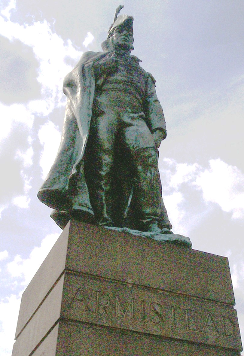
George Armistead (April 10, 1780 – April 25, 1818) was an American military officer who served as the commander of Fort McHenry during the Battle of Baltimore in the War of 1812. Life and career Armistead was born on the Newmarket Plantation in Caroline County, Virginia (now in Milford). His military career began during the Quasi War with France when he was commissioned as an ensign in the 7th U.S. Infantry Regiment on January 14, 1799. He was promoted to 2nd lieutenant on March 3 of the same year and to 1st lieutenant on May 14, 1800. With the reduction in the Army after the Quasi War, he was discharged from the Army on June 15, 1800. He re-entered the Army on February 16, 1801, when he was commissioned as a lieutenant in the 2nd Regiment of Artillerists and Engineers. He was promoted to captain on November 1, 1806. War of 1812 He was one of five brothers who served in the War of 1812, either in the regular army or militia. He was promoted to major of the 3rd Arti ... [...More Info...] [...Related Items...] OR: [Wikipedia] [Google] [Baidu] |
Sasebo
is a core city located in Nagasaki Prefecture, Japan. It is also the second largest city in Nagasaki Prefecture, after its capital, Nagasaki. On 1 June 2019, the city had an estimated population of 247,739 and a population density of 581 persons per km2 (1,505 persons per square mile). The total area is . The city includes a part of Saikai National Park. Located in the southern part of the city is the Dutch-styled theme park ''Huis Ten Bosch''. The island of Ukujima is also administered as part of Sasebo city. History The area of present-day Sasebo was a small fishing village under the control of nearby Hirado Domain until shortly after the start of the Meiji period. Imperial Japanese Navy Admiral Tōgō Heihachirō, when surveying the coasts of northwestern Kyūshū for the site of a navy base, selected his location based on its protected, deep-water harbor, geographic proximity to China and Korea, and the presence of nearby coal fields. Sasebo Naval District, founded in 1886, b ... [...More Info...] [...Related Items...] OR: [Wikipedia] [Google] [Baidu] |
Astoria, Oregon
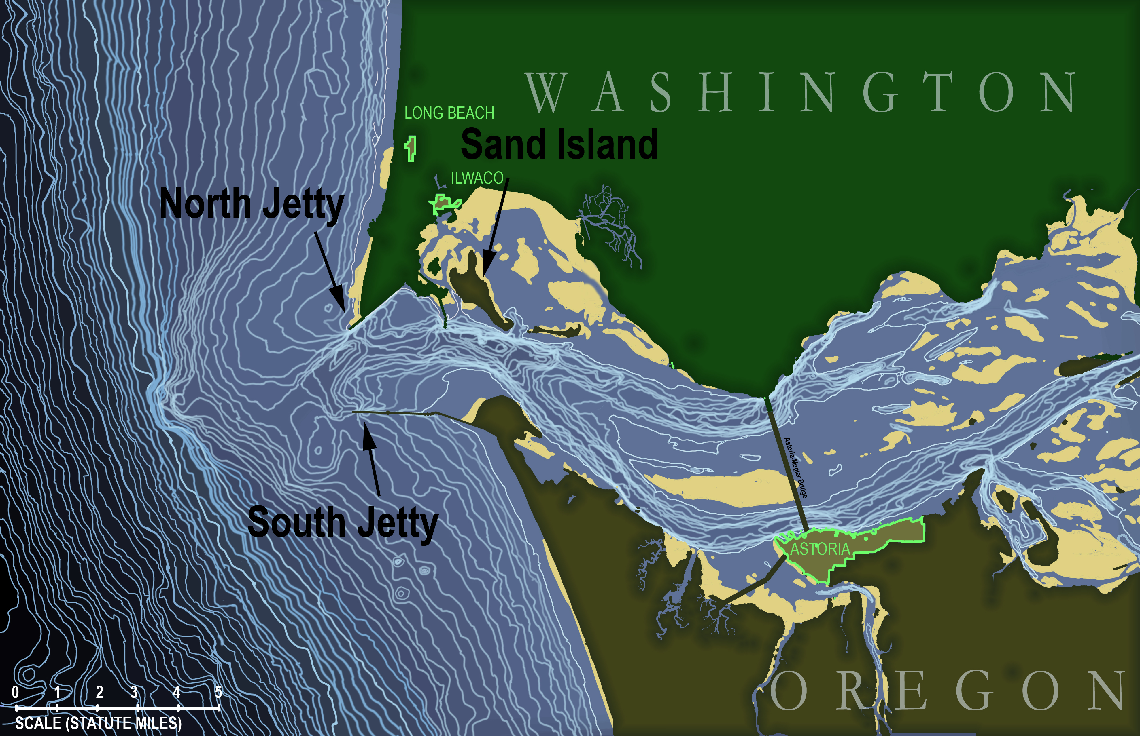
Astoria is a port city and the seat of Clatsop County, Oregon, United States. Founded in 1811, Astoria is the oldest city in the state and was the first permanent American settlement west of the Rocky Mountains. The county is the northwest corner of Oregon, and Astoria is located on the south shore of the Columbia River, where the river flows into the Pacific Ocean. The city is named for John Jacob Astor, an investor and entrepreneur from New York City, whose American Fur Company founded Fort Astoria at the site and established a monopoly in the fur trade in the early 19th century. Astoria was incorporated by the Oregon Legislative Assembly on October 20, 1876. The city is served by the deepwater Port of Astoria. Transportation includes the Astoria Regional Airport. U.S. Route 30 and U.S. Route 101 are the main highways, and the Astoria–Megler Bridge connects to neighboring Washington across the river. The population was 10,181 at the 2020 census. History Prehistoric sett ... [...More Info...] [...Related Items...] OR: [Wikipedia] [Google] [Baidu] |
USS Bagaduce (ATA-194)
The auxiliary ocean tug USS ''ATA-194'' was laid down on 7 November 1944 at Orange, Texas, by the Levingston Ship Building Co.; launched 4 December 1944; and commissioned at Orange on 14 February 1945. After her shakedown cruise, ''ATA-194'' sailed for the Pacific with equipment in tow. She transited the Panama Canal late in March and arrived at Pearl Harbor on 29 April 1945. After two berth shifting operations early in May 1945, the tug got underway on 23 May 1945 with a barracks ship in tow, bound for the western Pacific. Steaming by way of Eniwetok, Guam, and Saipan, ''ATA-194'' arrived at Leyte, Philippines, on 9 July 1945. The auxiliary tug operated in the central Pacific through September, towing equipment between Kwajalein, Eniwetok and Guam. ''ATA-194'' arrived at Buckner Bay, Okinawa, on 14 October 1945, just before Typhoon Louise struck the anchorage on 15 October 1945 and caused severe damage among the assembled ships. As a consequence, she spent the next mont ... [...More Info...] [...Related Items...] OR: [Wikipedia] [Google] [Baidu] |
Naptha
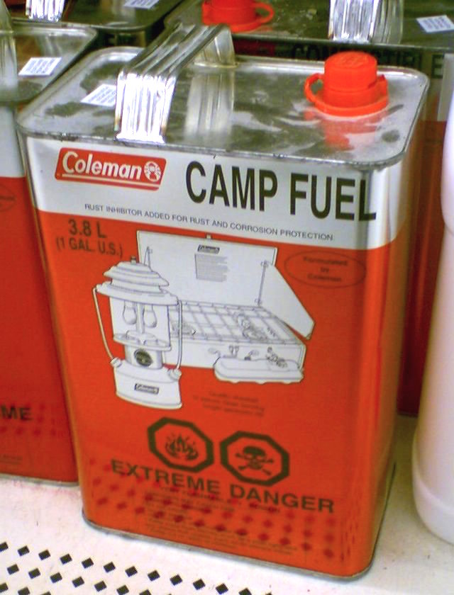
Naphtha ( or ) is a flammable liquid hydrocarbon mixture. Mixtures labelled ''naphtha'' have been produced from natural gas condensates, petroleum distillates, and the distillation of coal tar and peat. In different industries and regions ''naphtha'' may also be crude oil or refined products such as kerosene. ''Nephi'' and ''naphthar'' are sometimes used as synonyms. It is also known as Shellite in Australia. Etymology The word ''naphtha'' is from Latin and Ancient Greek (νάφθα), derived from Middle Persian ''naft'' ("wet", "naphtha"), the latter meaning of which was an assimilation from the Akkadian ''napṭu'' (see Semitic relatives such as Arabic ''nafṭ'' petroleum" Syriac ܢܰܦܬܳܐ ''naftā'') and Hebrew נֵפְט ''neft'' (meaning petroleum). In Ancient Greek, it was used to refer to any sort of petroleum or pitch. There is a hypothesis that the word is connected with the name of the Indo-Iranian god Apam Napat, which occurs in Vedic and in Avestic; ... [...More Info...] [...Related Items...] OR: [Wikipedia] [Google] [Baidu] |
Willapa Bay
Willapa Bay () is a bay located on the southwest Pacific coast of Washington state in the United States. The Long Beach Peninsula separates Willapa Bay from the greater expanse of the Pacific Ocean. With over of surface area Willapa Bay is the second-largest riverine estuary on the Pacific coast of the continental United States. Early settlers called the bay Shoalwater Bay and this name is found on old maps and charts of the region. Willapa Bay is fairly shallow: more than half of its surface area lies in the intertidal zone, and half of the volume of water inside it enters and leaves with every tide. The bay is an estuary formed when the Long Beach Peninsula, a long sand spit from the Columbia River to the south, partially enclosed the estuaries of several smaller rivers. It is a ria, which formed after the rise in sea level at the end of the last ice age flooded several small river valleys. [...More Info...] [...Related Items...] OR: [Wikipedia] [Google] [Baidu] |
Columbia River Bar
The Columbia Bar, also frequently called the Graveyard of the Pacific, is a system of bars and shoals at the mouth of the Columbia River spanning the U.S. states of Oregon and Washington. It is known as one of the most dangerous bar crossings in the world. The bar is about wide and long. Description The bar is where the river's current dissipates into the Pacific Ocean, often as large standing waves. The waves are partially caused by the deposition of sediment as the river slows, as well as mixing with ocean waves. The waves, wind, and current are hazardous for vessels of all sizes. The Columbia current varies from westward, and therefore into the predominantly westerly winds and ocean swells, creating significant surface conditions. Unlike other major rivers, the current is focused "like a fire hose" without the benefit of a river delta. Conditions can change from calm to life-threatening in as little as five minutes due to changes of direction of wind and ocean swell. Sin ... [...More Info...] [...Related Items...] OR: [Wikipedia] [Google] [Baidu] |
Puget Sound
Puget Sound ( ) is a sound of the Pacific Northwest, an inlet of the Pacific Ocean, and part of the Salish Sea. It is located along the northwestern coast of the U.S. state of Washington. It is a complex estuarine system of interconnected marine waterways and basins, with one major and two minor connections to the open Pacific Ocean via the Strait of Juan de Fuca—Admiralty Inlet being the major connection and Deception Pass and Swinomish Channel being the minor. Water flow through Deception Pass is approximately equal to 2% of the total tidal exchange between Puget Sound and the Strait of Juan de Fuca. Puget Sound extends approximately from Deception Pass in the north to Olympia in the south. Its average depth is and its maximum depth, off Jefferson Point between Indianola and Kingston, is . The depth of the main basin, between the southern tip of Whidbey Island and Tacoma, is approximately . In 2009, the term Salish Sea was established by the United States Board o ... [...More Info...] [...Related Items...] OR: [Wikipedia] [Google] [Baidu] |
Lake Washington
Lake Washington is a large freshwater lake adjacent to the city of Seattle. It is the largest lake in King County and the second largest natural lake in the state of Washington, after Lake Chelan. It borders the cities of Seattle on the west, Bellevue and Kirkland on the east, Renton on the south and Kenmore on the north, and encloses Mercer Island. The lake is fed by the Sammamish River at its north end and the Cedar River at its south. Lake Washington received its present name in 1854 after Thomas Mercer suggested it be named after George Washington, as the new Washington Territory had been named the year before. Earlier names for the lake include the Duwamish name ''Xacuabš'' (Lushootseed: literally "''xacu''" ''great-amount-of-water + "abš" people''), which referred to peoples who stayed along the coastline of Lake Washington, as well as Lake Geneva by Isaac N. Ebey; Lake Duwamish in railroad surveys under Governor Isaac Stevens; At-sar-kal in a map sketched by engin ... [...More Info...] [...Related Items...] OR: [Wikipedia] [Google] [Baidu] |
Columbia River
The Columbia River (Upper Chinook: ' or '; Sahaptin: ''Nch’i-Wàna'' or ''Nchi wana''; Sinixt dialect'' '') is the largest river in the Pacific Northwest region of North America. The river rises in the Rocky Mountains of British Columbia, Canada. It flows northwest and then south into the U.S. state of Washington, then turns west to form most of the border between Washington and the state of Oregon before emptying into the Pacific Ocean. The river is long, and its largest tributary is the Snake River. Its drainage basin is roughly the size of France and extends into seven US states and a Canadian province. The fourth-largest river in the United States by volume, the Columbia has the greatest flow of any North American river entering the Pacific. The Columbia has the 36th greatest discharge of any river in the world. The Columbia and its tributaries have been central to the region's culture and economy for thousands of years. They have been used for transportation since a ... [...More Info...] [...Related Items...] OR: [Wikipedia] [Google] [Baidu] |
Naval Air Station Tongue Point
Naval Air Station Tongue Point is a former United States Navy air station which was located within the former U.S. Naval Station Tongue Point, Astoria, Oregon. In 1919, the United States Congress approved the construction of a submarine and destroyer base on Tongue Point, a peninsula jutting into the Columbia River east of Astoria, Oregon. Construction was not started until 1921 and was completed in 1924. However, with the military downsizing following World War I, the base was never used. Prior to World War II, Tongue Point was designated as the site of a Naval Air Station (NAS). Ground breaking took place in 1939 but there were numerous delays until construction was finally completed in 1943. Hangars, an ordnance depot and fuel depot were constructed. PBY Catalina seaplanes then arrived and began coastal patrols. Tongue Point was also the location of the U.S. Naval Ship Yard Tongue Point for pre-commissioning and commissioning escort aircraft carriers built in shipyards in the ... [...More Info...] [...Related Items...] OR: [Wikipedia] [Google] [Baidu] |
Cape Flattery
Cape Flattery () is the northwesternmost point of the contiguous United States. It is in Clallam County, Washington on the Olympic Peninsula, where the Strait of Juan de Fuca joins the Pacific Ocean. It is also part of the Makah Reservation, and is the northern boundary of the Olympic Coast National Marine Sanctuary. Cape Flattery can be reached from a short hike, most of which is boardwalked. Cape Flattery Trail, with photographs. The westernmost point in the contiguous United States is at Cape Alava, south of Cape Flattery in Olympic National Park. However, the westernmost tip of Cape Flattery is almost exactly as far west as Cape Alava, the difference being approximately 5 seconds of longitude, about , at high tide and somewhat more at low tide. The Cape Flattery Lighthouse is on Tatoosh Island, just off the cape. Makah Bay and Neah Bay are on either side of the cape. Neah Bay, Washington is the closest town to the cape. History James Cook Cape Flattery is the oldest perm ... [...More Info...] [...Related Items...] OR: [Wikipedia] [Google] [Baidu] |


