|
Upperthorpe And Killamarsh Railway Station
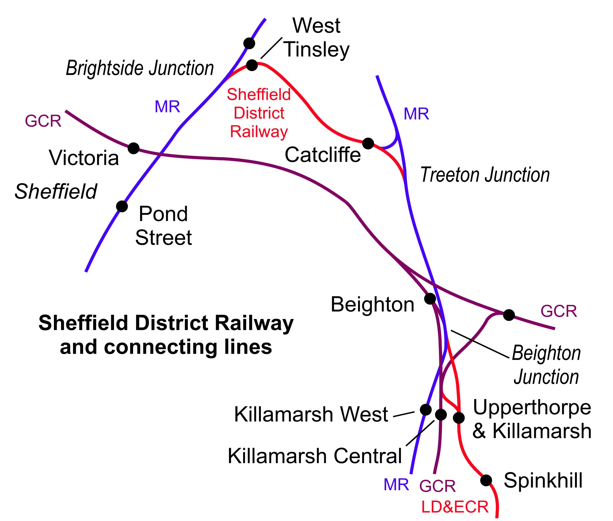
Upperthorpe and Killamarsh was a railway station that served the villages of Killamarsh and Upperthorpe in Derbyshire, England. It was one of three stations serving Killamarsh. The station was on the Sheffield District Railway which ran between Sheffield Victoria and Shirebrook North on the Lancashire, Derbyshire and East Coast Railways network of lines in the region. History Opening and operation The station was opened on the Beighton Branch of the Lancashire, Derbyshire and East Coast Railway (LD&ECR) in 1898. The LD&ECR wished to extend into Sheffield using the MS&LR's lines but was rebuffed, and instead joined the Midland's line at Beighton Junction. From there it went on to join the Sheffield District Railway at Treeton Junction and thereby gain access to goods traffic in central Sheffield and to the Midland Railway's station. Closure The station closed in 1930. The line itself closed to stopping passenger services on the outbreak of World War II in 1939. In the late ... [...More Info...] [...Related Items...] OR: [Wikipedia] [Google] [Baidu] |
Killamarsh
Killamarsh is a village and civil parish in North East Derbyshire, England, bordering Rotherham to the north and Sheffield to the north-west. Killamarsh is surrounded by, in a clockwise direction from the north, Rother Valley Country Park, the village of Wales, South Yorkshire, Kiveton, Woodall, Harthill, Barlborough, Spinkhill, Renishaw, Eckington, and the (former Derbyshire) Sheffield suburbs of Oxclose, Halfway and Holbrook. The name 'Killamarsh' is first attested in the Domesday Book of 1086, where it appears as ''Chinewoldemaresc''.''Domesday Book: A Complete Translation''. London: Penguin, 2003. p.753 and 1365 It appears as ''Kinewaldesmers'' in the Charter Roll for 1249. The name means 'Cynewald's marsh'. History Domesday records Killamarsh as belonging to Hascoit Musard and being valued at 12 pence. The Grade II* listed parish church of St Giles was built between the 12th and 15th centuries using sandstone. Additions were made in 1895 by J. M. Brooks in mag ... [...More Info...] [...Related Items...] OR: [Wikipedia] [Google] [Baidu] |
Lancashire, Derbyshire And East Coast Railway Beighton Branch
The Beighton Branch was a railway branch line built by the Lancashire, Derbyshire and East Coast Railway (LD&ECR) in north eastern Derbyshire, England. History The line was a little over 12 miles long and ran from Langwith Junction in Derbyshire to Beighton Junction which is now in South Yorkshire. Building started in 1892. The line opened in stages up to 1900. The branch was occasionally referred to as the "Sheffield Branch", but the name "Beighton Branch" stuck and was widely used. A sparse and circuitous stopping passenger service used the route to connect with , this was withdrawn on the outbreak of World War II World War II or the Second World War, often abbreviated as WWII or WW2, was a world war that lasted from 1939 to 1945. It involved the vast majority of the world's countries—including all of the great powers—forming two opposin .... The line closed in stages: * 1967, middle section closed and lifted * 1974, southern end closed and lifted * ... [...More Info...] [...Related Items...] OR: [Wikipedia] [Google] [Baidu] |
Former Lancashire, Derbyshire And East Coast Railway Stations
A former is an object, such as a template, gauge or cutting die, which is used to form something such as a boat's hull. Typically, a former gives shape to a structure that may have complex curvature. A former may become an integral part of the finished structure, as in an aircraft fuselage, or it may be removable, being using in the construction process and then discarded or re-used. Aircraft formers Formers are used in the construction of aircraft fuselage, of which a typical fuselage has a series from the nose to the empennage, typically perpendicular to the longitudinal axis of the aircraft. The primary purpose of formers is to establish the shape of the fuselage and reduce the column length of stringers to prevent instability. Formers are typically attached to longerons, which support the skin of the aircraft. The "former-and-longeron" technique (also called stations and stringers) was adopted from boat construction, and was typical of light aircraft built until the ad ... [...More Info...] [...Related Items...] OR: [Wikipedia] [Google] [Baidu] |
Newark-upon-Trent
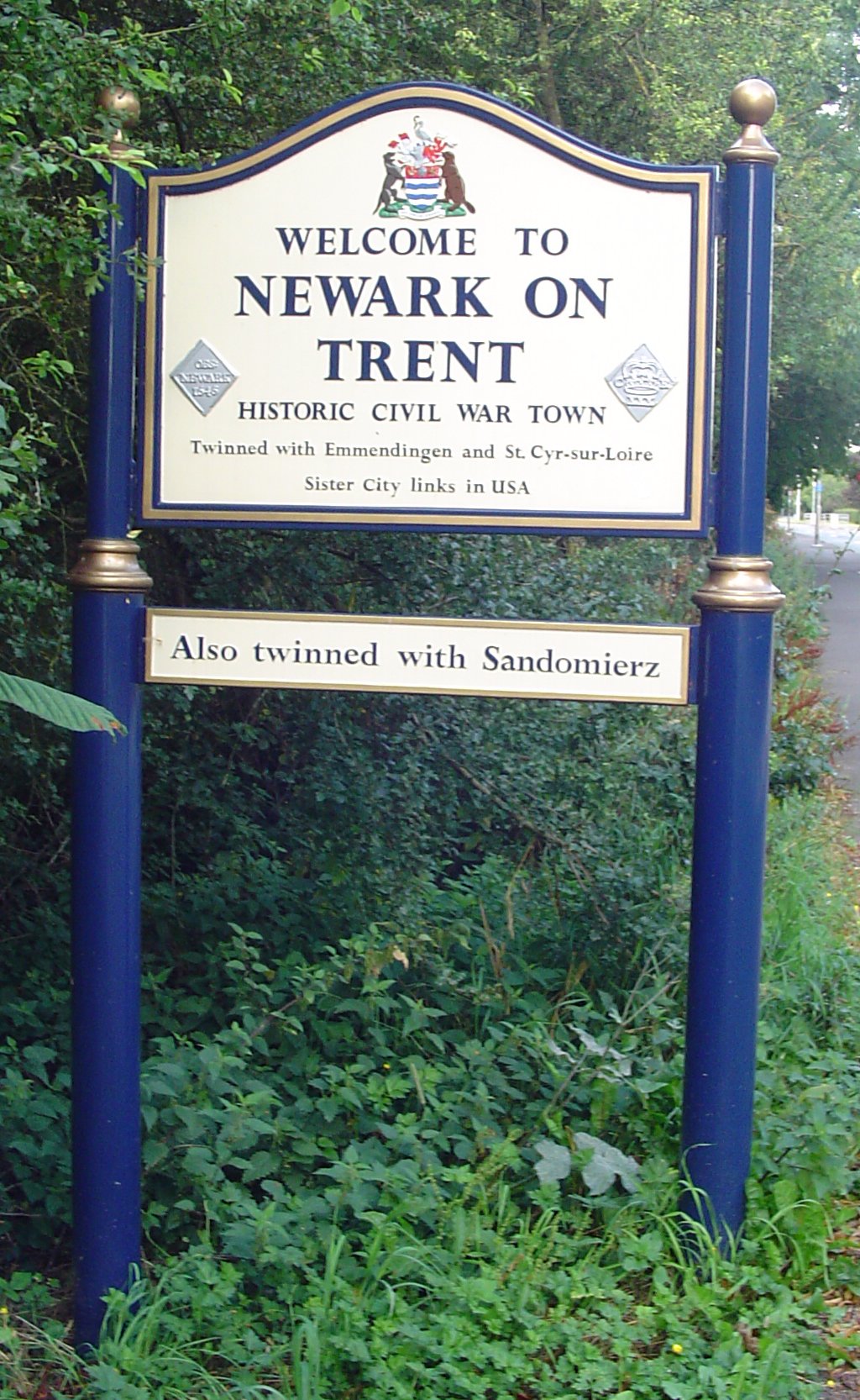
Newark-on-Trent or Newark () is a market town and civil parish in the Newark and Sherwood district in Nottinghamshire, England. It is on the River Trent, and was historically a major inland port. The A1 road bypasses the town on the line of the ancient Great North Road. The town's origins are likely to be Roman, as it lies on a major Roman road, the Fosse Way. It grew up round Newark Castle and as a centre for the wool and cloth trades. In the English Civil War, it was besieged by Parliamentary forces and relieved by Royalist forces under Prince Rupert. Newark has a market place lined with many historical buildings and one of its most notable landmark is St Mary Magdalene church with its towering spire at high and the highest structure in the town. The church is the tallest church in Nottinghamshire and can be seen when entering Newark or bypassing it. History Early history The place-name Newark is first attested in the cartulary of Eynsham Abbey in Oxfordshire, where ... [...More Info...] [...Related Items...] OR: [Wikipedia] [Google] [Baidu] |
Headington
Headington is an eastern suburb of Oxford, England. It is at the top of Headington Hill overlooking the city in the Thames valley below, and bordering Marston to the north-west, Cowley to the south, and Barton and Risinghurst to the east. The life of the large residential area is centred upon London Road, the main road between London and Oxford. History The site of Headington shows evidence of continued occupation from the Stone Age, as the 2001 field excavations in Barton Lane found, suggesting a date in the 11th century BC. Pottery was found on the Manor Ground, suggesting an Iron Age settlement there in the 7th century BC. Roman kilns from about 300 have been found, including one now on display at the Museum of Oxford. Anglo-Saxon burial remains from about 500 have also been discovered. Headington's toponym is derived from the Old English ''Hedena's dun'', meaning "Hedena's hill", when it was the site of a palace or hunting lodge of the Kings of Mercia. In a charter of 1 ... [...More Info...] [...Related Items...] OR: [Wikipedia] [Google] [Baidu] |
Cleethorpes Coast Light Railway
The Cleethorpes Coast Light Railway is a minimum-gauge railway that primarily serves holidaymakers in Cleethorpes, North East Lincolnshire, England. It operates from near the Cleethorpes Leisure Centre, running to the mouth of the Buck Beck. History The CCLR began as the ''Cleethorpes Miniature Railway'' in 1948, and ran for a distance of near the sea front in Cleethorpes. The line was relocated and extended the following year, and between 1949 and 1971 ran southwards for from ''Cleethorpes Town'' to ''Thrunscoe'' (near the current ''Discovery Halt''). The line was extended at both ends in 1972: the northern terminus was relocated slightly closer to the town centre, while at its southern end it now ran as far as the Zoo. It became the Cleethorpes Coast Light Railway when it was privatised in 1991, and the new company renamed the termini ''Kingsway'' and ''Witts End''. ''Witts End'' (located at zoo, which by this time had closed to visitors) was abandoned in 1994, and a ne ... [...More Info...] [...Related Items...] OR: [Wikipedia] [Google] [Baidu] |
Rother Valley Railway
The Rother Valley Railway (RVR) is a heritage railway project based at Robertsbridge in East Sussex, England. It takes its name from the original name for what later became the Kent and East Sussex Railway, running from Robertsbridge through to Headcorn in Kent, via Tenterden. The project is to replace the ‘missing link’ between Robertsbridge, a station on the Tonbridge to Hastings mainline, and Bodiam on the Kent and East Sussex Railway, a heritage railway which operates from Bodiam to Tenterden. A charity, supported by a society of volunteers, is attempting to re-establish the railway link. The RVR began by reinstating the first few hundred yards of line eastwards from Robertsbridge, and also a short stretch westwards from Bodiam. In 2010, the latter section was further extended to reach Junction Road. In summer 2011 work began at Robertsbridge to extend further eastwards to Northbridge Street, which entailed the rebuilding of five bridges. By June 2012, this further exte ... [...More Info...] [...Related Items...] OR: [Wikipedia] [Google] [Baidu] |
World War II
World War II or the Second World War, often abbreviated as WWII or WW2, was a world war that lasted from 1939 to 1945. It involved the vast majority of the world's countries—including all of the great powers—forming two opposing military alliances: the Allies and the Axis powers. World War II was a total war that directly involved more than 100 million personnel from more than 30 countries. The major participants in the war threw their entire economic, industrial, and scientific capabilities behind the war effort, blurring the distinction between civilian and military resources. Aircraft played a major role in the conflict, enabling the strategic bombing of population centres and deploying the only two nuclear weapons ever used in war. World War II was by far the deadliest conflict in human history; it resulted in 70 to 85 million fatalities, mostly among civilians. Tens of millions died due to genocides (including the Holocaust), starvation, ma ... [...More Info...] [...Related Items...] OR: [Wikipedia] [Google] [Baidu] |


