|
USS Spitfire (1776 Gunboat)
USS ''Spitfire'' was an American gundalow that operated as a gunboat in 1776 on Lake Champlain. She was part of Benedict Arnold's small, hastily built fleet of ships whose purpose was to counter any British invasion forces passing through the lake from Canada. Her service life was brief; after only a few months patrolling the lake she was lost in the aftermath of the Battle of Valcour Island. The gunboat's wreck was located and documented in the 1990s by the Lake Champlain Maritime Museum. Prelude American militia under Benedict Arnold and Ethan Allen had captured Fort Ticonderoga in 1775. Later that year these forces were involved in the invasion of Canada, but poor weather and timely arrival of British reinforcements caused the Americans to fall back to Fort Ticonderoga in May 1776. There they proceeded to build a gunboat fleet to help repel an expected British invasion. The British, under the command of General Guy Carleton, realized that they needed to control Lake Champ ... [...More Info...] [...Related Items...] OR: [Wikipedia] [Google] [Baidu] |
Gundalow
A gundalow (also known in period accounts as a "gondola") is a type of flat-bottomed sailing barge once common in Maine and New Hampshire rivers. It first appeared in the mid-1600s, reached maturity of design in the 1700 and 1800s, and lingered into the early 1900s before nearly vanishing as a commercial watercraft. Characteristics A form of sailing barge similar to a scow, gundalows characteristically employed tidal currents for propulsion, but shipped a single lateen sail brailed to a heavy yard to harness winds. The yard was attached to a stump mast and heavily counterweighted, pivoting down while still under sail to shoot under bridges while maintaining the boat's way. Up to long, gundalows were fitted with a pivoting leeboard in lieu of a fixed keel, giving them an exceptionally shallow draft and allowing them to "take the hard" (settle into sand, ledge, or mudflats) both for loading and unloading cargoes and maintenance. Cargoes Common cargoes were bricks, timber, cattle, ... [...More Info...] [...Related Items...] OR: [Wikipedia] [Google] [Baidu] |
Stern
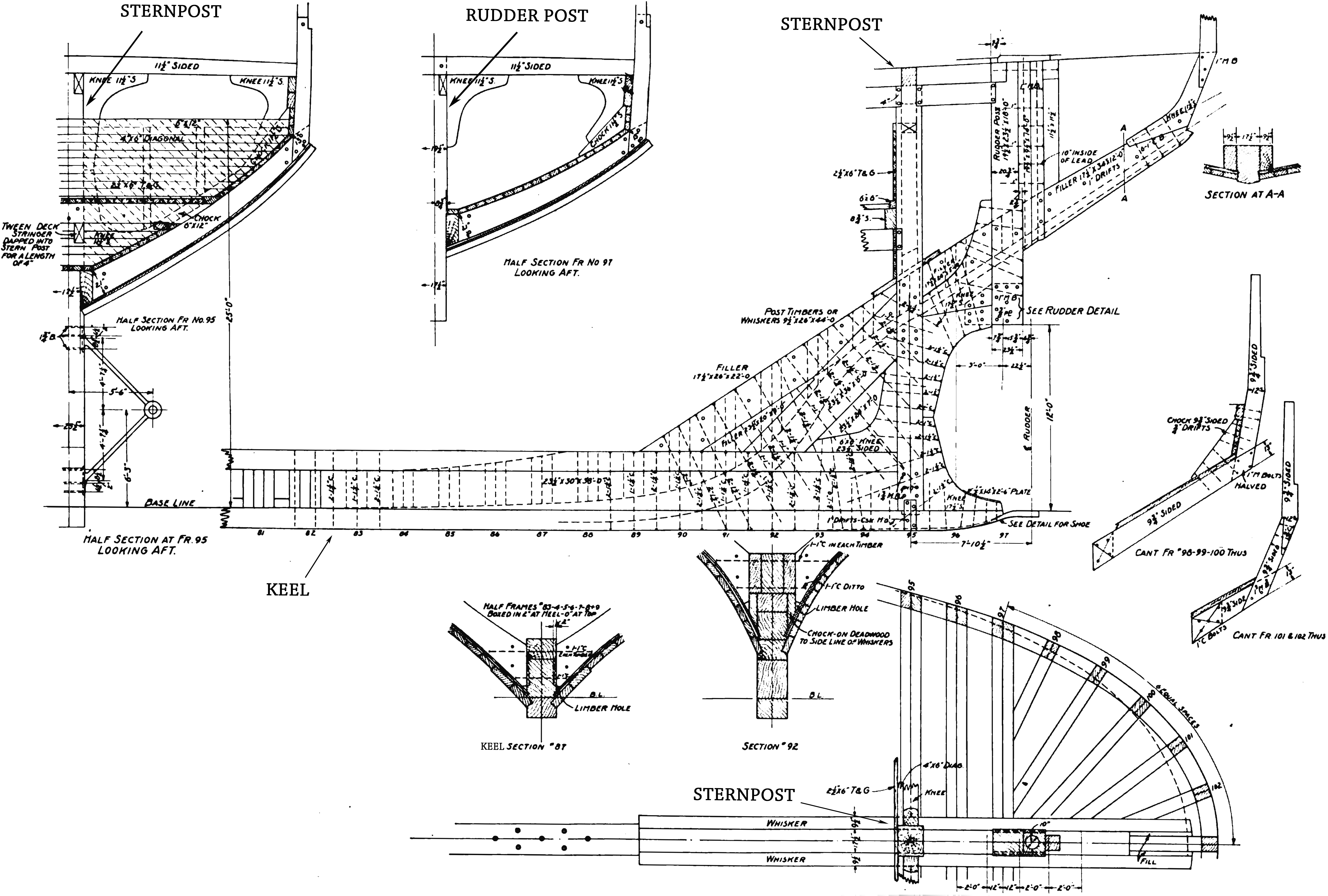
The stern is the back or aft-most part of a ship or boat, technically defined as the area built up over the sternpost, extending upwards from the counter rail to the taffrail. The stern lies opposite the bow, the foremost part of a ship. Originally, the term only referred to the aft port section of the ship, but eventually came to refer to the entire back of a vessel. The stern end of a ship is indicated with a white navigation light at night. Sterns on European and American wooden sailing ships began with two principal forms: the ''square'' or ''transom'' stern and the ''elliptical'', ''fantail'', or ''merchant'' stern, and were developed in that order. The hull sections of a sailing ship located before the stern were composed of a series of U-shaped rib-like frames set in a sloped or "cant" arrangement, with the last frame before the stern being called the ''fashion timber(s)'' or ''fashion piece(s)'', so called for "fashioning" the after part of the ship. This frame is d ... [...More Info...] [...Related Items...] OR: [Wikipedia] [Google] [Baidu] |
National Register Of Historic Places
The National Register of Historic Places (NRHP) is the United States federal government's official list of districts, sites, buildings, structures and objects deemed worthy of preservation for their historical significance or "great artistic value". A property listed in the National Register, or located within a National Register Historic District, may qualify for tax incentives derived from the total value of expenses incurred in preserving the property. The passage of the National Historic Preservation Act (NHPA) in 1966 established the National Register and the process for adding properties to it. Of the more than one and a half million properties on the National Register, 95,000 are listed individually. The remainder are contributing resources within historic districts. For most of its history, the National Register has been administered by the National Park Service (NPS), an agency within the U.S. Department of the Interior. Its goals are to help property owners and inte ... [...More Info...] [...Related Items...] OR: [Wikipedia] [Google] [Baidu] |
Schuyler Island
Schuyler Island, also known as Schuylers Island or Whitney Island, is a uninhabited island in Lake Champlain. It is a part of the Chesterfield, New York, Town of Chesterfield in Essex County, New York, Essex County, New York (state), New York, located between Port Kent, New York and Willsboro Bay, opposite Burlington, Vermont, Burlington, Vermont. Schuyler Island was involved in the 1776 Battle of Valcour during the American Revolutionary War, and is today managed as part of Adirondack Park, with several unimproved campsites available. History The island played a brief role during the American Revolutionary War. Following the Battle of Valcour on October 11, 1776, the fleet of American General Benedict Arnold used the island as a location to regroup and commence repairs. Two small ships of the fleet that were deemed beyond repair were sunk near the island at this time. The island passed through a series of private owners during the 19th and early to mid 20th centuries, during whi ... [...More Info...] [...Related Items...] OR: [Wikipedia] [Google] [Baidu] |
Battles Of Saratoga
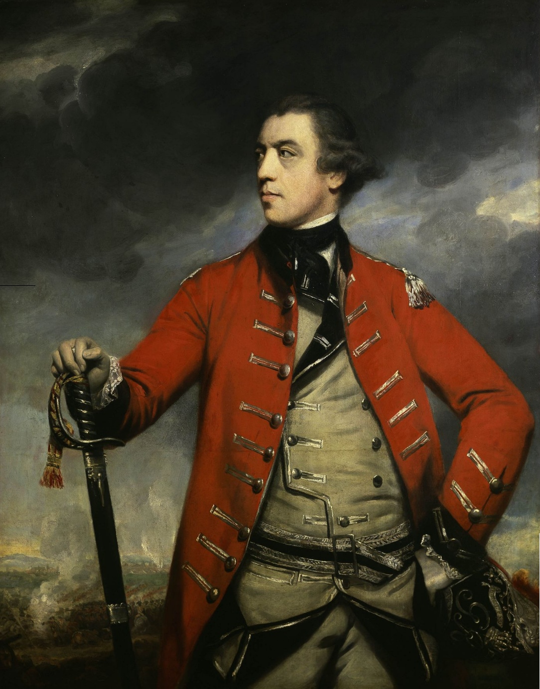
The Battles of Saratoga (September 19 and October 7, 1777) marked the climax of the Saratoga campaign, giving a decisive victory to the Americans over the British in the American Revolutionary War. British General John Burgoyne led an invasion army of 7,200–8,000 men southward from Canada in the Champlain Valley, hoping to meet a similar British force marching northward from New York City and another British force marching eastward from Lake Ontario; the goal was to take Albany, New York. The southern and western forces never arrived, and Burgoyne was surrounded by American forces in upstate New York short of his goal. He fought two battles which took place 18 days apart on the same ground south of Saratoga, New York. He gained a victory in the first battle despite being outnumbered, but lost the second battle after the Americans returned with an even larger force. Burgoyne found himself trapped by much larger American forces with no relief, so he retreated to Saratoga (now ... [...More Info...] [...Related Items...] OR: [Wikipedia] [Google] [Baidu] |
Valcour Bay
Valcour Bay is actually a strait or sound, located between Valcour Island and the west side of Lake Champlain, four miles south of Plattsburgh, New York. It was the site of the Battle of Valcour Island during the American Revolutionary War. It was declared a National Historic Landmark in 1961 because of this association. and Valcour Bay is located in the Towns of Peru and Plattsburgh, both in Clinton County, New York. Description Valcour Island, located in Lake Champlain, is roughly rectangular in shape, extending from its northern to southern tips. It is located about east of the New York state shoreline to the west. Valcour Bay is the body of water between the island and the mainland, with the landmarked area of the bay consisting of about . Both the island and the mainland shore have seen relatively little development since the area was of military importance in 1776. In 1776, Benedict Arnold was placed in command of a Continental Navy fleet on the lake, co ... [...More Info...] [...Related Items...] OR: [Wikipedia] [Google] [Baidu] |
Bateau
A bateau or batteau is a shallow-draft, flat-bottomed boat which was used extensively across North America, especially in the colonial period and in the fur trade. It was traditionally pointed at both ends but came in a wide variety of sizes. The name derives from the French word, ''bateau'', which is simply the word for boat and the plural, bateaux, follows the French, an unusual construction for an English plural. In the southern United States, the term is still used to refer to flat-bottomed boats, including those elsewhere called jon boats. Construction Bateaux were flat-bottomed and double-ended. They were built with heavy stems at bow and stern and a series of frames amidships, likely from natural oak crooks when available, and planked with sawn boards, likely pine although builders would have used whatever material was available. These boats would have varied from place to place, from builder to builder and also evolved over time, however in general, they were long and ... [...More Info...] [...Related Items...] OR: [Wikipedia] [Google] [Baidu] |
Ship Sloop
In the 18th century and most of the 19th, a sloop-of-war in the Royal Navy was a warship with a single gun deck that carried up to eighteen guns. The rating system covered all vessels with 20 guns and above; thus, the term ''sloop-of-war'' encompassed all the unrated combat vessels, including the very small gun-brigs and cutters. In technical terms, even the more specialised bomb vessels and fireships were classed as sloops-of-war, and in practice these were employed in the sloop role when not carrying out their specialised functions. In World War I and World War II, the Royal Navy reused the term "sloop" for specialised convoy-defence vessels, including the of World War I and the highly successful of World War II, with anti-aircraft and anti-submarine capability. They performed similar duties to the American destroyer escort class ships, and also performed similar duties to the smaller corvettes of the Royal Navy. Rigging A sloop-of-war was quite different from a civilian ... [...More Info...] [...Related Items...] OR: [Wikipedia] [Google] [Baidu] |
Isle La Motte
Isle La Motte is an island in Lake Champlain in northwestern Vermont, United States. At 7 mi (11 km) by 2 mi (3 km), it lies close to the place that the lake empties into the Richelieu River. It is incorporated as a New England town in Grand Isle County. Its population was 488 at the 2020 census. The island is named after a French soldier, Pierre La Motte, who built a military outpost on the island in 1666. The island's population significantly increases in the summer months. The island is the site of Fort Sainte Anne, Saint Anne's Shrine, the Methodist Episcopal Church of Isle La Motte, the Fisk Quarry and Goodsell Ridge Preserves, the Isle La Motte Elementary School, and the Isle La Motte Lighthouse. History On 9 July 1609, Samuel de Champlain debarked on the island. In 1665, the French began building a series of forts along the Richelieu River to protect New France from the Iroquois. From north to south these were Fort Richelieu, Fort Chambly, and Fort Sainte Thé ... [...More Info...] [...Related Items...] OR: [Wikipedia] [Google] [Baidu] |
Buttonmold Bay
Button Bay, previously known as Button Mould Bay or Buttonmold Bay, is an area of shallow water on the east shore of Lake Champlain. It is located in the town of Ferrisburgh (near Vergennes), in Addison County. It is situated between the Green Mountains of Vermont and the Adirondack Mountains in New York. The Bay's name is from the clay concretion A concretion is a hard, compact mass of matter formed by the precipitation of mineral cement within the spaces between particles, and is found in sedimentary rock or soil. Concretions are often ovoid or spherical in shape, although irregular ...s found on its shores which looked either like actual clay buttons or the moulds used in button making. Button Bay State Park has been a state park since 1964. References Ferrisburgh, Vermont Bodies of water of Vermont Landforms of Addison County, Vermont Bays of the United States {{Vermont-geo-stub ... [...More Info...] [...Related Items...] OR: [Wikipedia] [Google] [Baidu] |


.jpg)