|
U.S. Route 70 In Arkansas
U.S. Highway 70 (US 70) runs east–west through across the heart of Arkansas for . US 70 enters the state from Oklahoma west of De Queen, and exits to Tennessee at Memphis, running concurrently with Interstate 55 (I-55), US 61, US 64, and US 79. The highway passes through the major cities of Hot Springs, Little Rock, North Little Rock, and West Memphis. Between Oklahoma and Hot Springs National Park, US 70 is largely rural and two-lane. The route bypasses much of the city to the south and then serves as the arterial road between Hot Springs National Park and Little Rock. The highway runs concurrently with I-30 between a place north of Haskell to southwestern Little Rock, where it splits to traverse through downtown Little Rock and North Little Rock. Between North Little Rock and its merge into I-55 at West Memphis, the route is principally two-lane and has been supplanted by I-40 Interstate 40 (I-40) is a major east–west Int ... [...More Info...] [...Related Items...] OR: [Wikipedia] [Google] [Baidu] |
Oklahoma
Oklahoma (; Choctaw language, Choctaw: ; chr, ᎣᎧᎳᎰᎹ, ''Okalahoma'' ) is a U.S. state, state in the South Central United States, South Central region of the United States, bordered by Texas on the south and west, Kansas on the north, Missouri on the northeast, Arkansas on the east, New Mexico on the west, and Colorado on the northwest. Partially in the western extreme of the Upland South, it is the List of U.S. states and territories by area, 20th-most extensive and the List of U.S. states and territories by population, 28th-most populous of the 50 United States. Its residents are known as Oklahomans and its capital and largest city is Oklahoma City. The state's name is derived from the Choctaw language, Choctaw words , 'people' and , which translates as 'red'. Oklahoma is also known informally by its List of U.S. state and territory nicknames, nickname, "Sooners, The Sooner State", in reference to the settlers who staked their claims on land before the official op ... [...More Info...] [...Related Items...] OR: [Wikipedia] [Google] [Baidu] |
Garland County, Arkansas
Garland County is located in the U.S. state of Arkansas. As of the 2020 census, the population was 100,180. The county seat is Hot Springs. Garland County comprises the Hot Springs, AR Metropolitan Statistical Area. The county includes Hot Springs National Park, the only national park in the state of Arkansas as well as the first property to be protected under federal legislation. A law was passed in 1832 supported by President Andrew Jackson to preserve this area, even before Arkansas was admitted as a state. History This area was occupied by the historic Natchitoches people, who frequented the hot springs for their healing powers. Their ancestors among regional indigenous peoples had been coming to this area for thousands of years before their time. After acquiring the Louisiana Territory in 1803, which had been controlled by French and Spanish officials, President Thomas Jefferson requested William Dunbar, a planter and amateur scientist of Natchez, Mississippi, to exp ... [...More Info...] [...Related Items...] OR: [Wikipedia] [Google] [Baidu] |
Arkansas Department Of Transportation
The Arkansas Department of Transportation (ArDOT), formerly the Arkansas Highway and Transportation Department, is a government department in the U.S. state of Arkansas. Its mission is to provide a safe, efficient, aesthetically pleasing and environmentally sound intermodal transportation system for the user. The department is responsible for implementing policy made by the Arkansas State Highway Commission, a board of officials appointed by the Governor of Arkansas to direct transportation policy in the state. The department's director is appointed by the commission to hire staff and manage construction and maintenance on Arkansas's highways. The primary duty of ArDOT is the maintenance and management of the over Arkansas Highway System. The department also conducts planning, public transportation, the State Aid County Road Program, the Arkansas Highway Police, and Federal-Aid project administration. Its headquarters are in Little Rock. History Central control of highway tr ... [...More Info...] [...Related Items...] OR: [Wikipedia] [Google] [Baidu] |
Interstate 40 In Arkansas
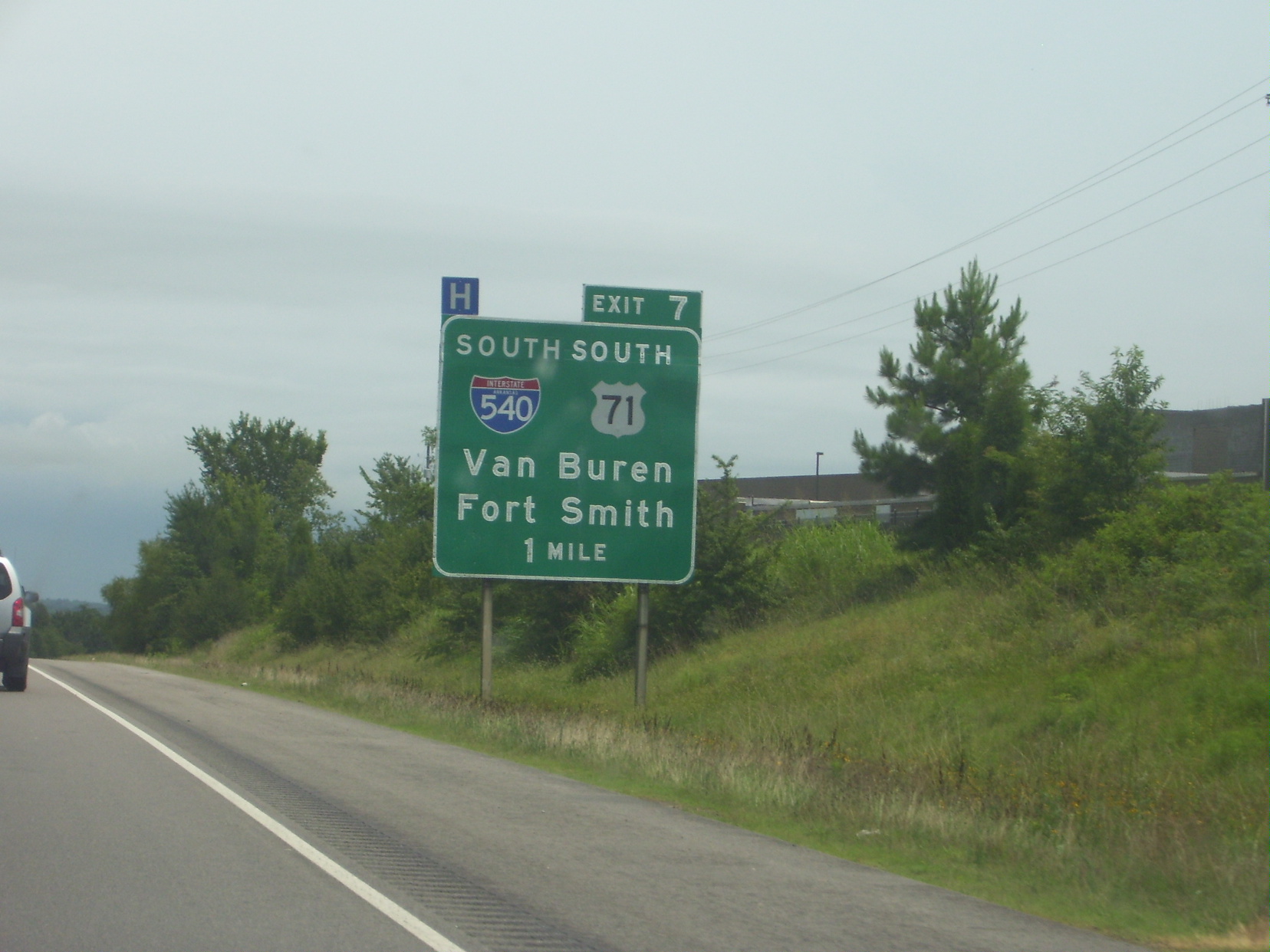
Interstate 40 (I-40) is an east–west Interstate Highway that has a section in the U.S. state of Arkansas, connecting Oklahoma to Tennessee. The route enters Arkansas from the west just north of the Arkansas River near Dora. It travels eastward across the northern portion of the state, connecting the cities of Fort Smith, Clarksville, Russellville, Morrilton, Conway, North Little Rock, Forrest City, and West Memphis. I-40 continues into Tennessee, heading through Memphis. The highway has major junctions with I-540 at Van Buren (the main highway connecting to Fort Smith), I-49 at Alma (the main highway connecting to Fayetteville and Bentonville), I-30 in North Little Rock (the Interstate linking south to Texarkana and Dallas, Texas), and I-55 to Blytheville. For the majority of its routing through Arkansas, I-40 follows the historic alignment of two separate U.S. Highways. From Oklahoma to Little Rock, I-40 generally follows U.S. Highway 64 through the Oza ... [...More Info...] [...Related Items...] OR: [Wikipedia] [Google] [Baidu] |
Interstate 30 In Arkansas
Interstate 30 (I-30) is a Interstate Highway in the southern states of Texas and Arkansas in the United States. I-30 travels from I-20 west of Fort Worth, Texas, northeast via Dallas, and Texarkana, Texas, to I-40 in North Little Rock, Arkansas. The highway parallels U.S. Highway 67 (US 67) except for the portion west of downtown Dallas (which was once part of I-20). Between the termini, I-30 has interchanges with I-35W, I-35E, and I-45. I-30 is known as the Tom Landry Freeway between I-35W and I-35E, within the core of the Dallas–Fort Worth metroplex. Route description , - , Texas , , , - , Arkansas , , , - , Total , , I-30 is the shortest two-digit Interstate with a number ending in zero in the Interstate System. The Interstates ending in zero are generally the longest east–west Interstates. The largest metropolitan areas that I-30 travels through include the Dallas–Fort Worth metroplex, the Texarkana metropolitan area, and the Little Rock metropolit ... [...More Info...] [...Related Items...] OR: [Wikipedia] [Google] [Baidu] |
Arterial Road
An arterial road or arterial thoroughfare is a high-capacity urban road that sits below freeways/motorways on the road hierarchy in terms of traffic flow and speed. The primary function of an arterial road is to deliver traffic from collector roads to freeways or expressways, and between urban centres at the highest level of service possible. As such, many arteries are limited-access roads, or feature restrictions on private access. Because of their relatively high accessibility, many major roads face large amounts of land use and urban development, making them significant urban places. In traffic engineering hierarchy, an arterial road delivers traffic between collector roads and freeways. For new arterial roads, intersections are often reduced to increase traffic flow. In California, arterial roads are usually spaced every half mile, and have intersecting collector(s) and streets. Some arterial roads, characterized by a small fraction of intersections and driveways compared to ... [...More Info...] [...Related Items...] OR: [Wikipedia] [Google] [Baidu] |
Interstate 55 In Arkansas
Interstate 55 (I-55) is a north–south Interstate Highway that has a section in the US state of Arkansas connecting sections in Tennessee and Missouri. The route enters Arkansas on the Memphis & Arkansas Bridge over the Mississippi River from Memphis. It travels northward through northeast Arkansas, connecting the cities of West Memphis and Blytheville. I-55 continues into Missouri heading to St. Louis, Missouri. The highway overlaps I-40 in West Memphis and has a junction with I-555, a spur route to Jonesboro, in Turrell. For the majority of its routing through Arkansas, I-55 generally follows U.S. Highway 61 (US 61). Route description I-55 enters Arkansas from Memphis, Tennessee, on the Memphis & Arkansas Bridge over the Mississippi River, sharing the bridge with US 61/ US 64/ US 70/ US 79. Shortly after entering the state, the highway enters West Memphis, where US 70 exits the route and becomes Broadway Avenue. I-55/US 61/ ... [...More Info...] [...Related Items...] OR: [Wikipedia] [Google] [Baidu] |
Concurrency (road)
A concurrency in a road network is an instance of one physical roadway bearing two or more different route numbers. When two roadways share the same right-of-way, it is sometimes called a common section or commons. Other terminology for a concurrency includes overlap, coincidence, duplex (two concurrent routes), triplex (three concurrent routes), multiplex (any number of concurrent routes), dual routing or triple routing. Concurrent numbering can become very common in jurisdictions that allow it. Where multiple routes must pass between a single mountain crossing or over a bridge, or through a major city, it is often economically and practically advantageous for them all to be accommodated on a single physical roadway. In some jurisdictions, however, concurrent numbering is avoided by posting only one route number on highway signs; these routes disappear at the start of the concurrency and reappear when it ends. However, any route that becomes unsigned in the middle of the concurren ... [...More Info...] [...Related Items...] OR: [Wikipedia] [Google] [Baidu] |
Arkansas
Arkansas ( ) is a landlocked state in the South Central United States. It is bordered by Missouri to the north, Tennessee and Mississippi to the east, Louisiana to the south, and Texas and Oklahoma to the west. Its name is from the Osage language, a Dhegiha Siouan language, and referred to their relatives, the Quapaw people. The state's diverse geography ranges from the mountainous regions of the Ozark and Ouachita Mountains, which make up the U.S. Interior Highlands, to the densely forested land in the south known as the Arkansas Timberlands, to the eastern lowlands along the Mississippi River and the Arkansas Delta. Arkansas is the 29th largest by area and the 34th most populous state, with a population of just over 3 million at the 2020 census. The capital and most populous city is Little Rock, in the central part of the state, a hub for transportation, business, culture, and government. The northwestern corner of the state, including the Fayetteville–Springdale� ... [...More Info...] [...Related Items...] OR: [Wikipedia] [Google] [Baidu] |
Crittenden County, Arkansas
Crittenden County is a county located in the U.S. state of Arkansas. As of the 2010 census, the population was 50,902. The county seat is Marion, and the largest city is West Memphis. Located in the Arkansas Delta, Crittenden County is Arkansas's 12th county, formed October 22, 1825, and named for Robert Crittenden, the first Secretary of the Arkansas Territory. Crittenden County is part of the Memphis, TN-MS-AR Metropolitan Statistical Area. Most of the county's media comes from Memphis, although some Little Rock TV (Arkansas Educational Television Network, KATV) is imported by Comcast Cable. It lies within Arkansas's 1st congressional district. Geography According to the U.S. Census Bureau, the county has a total area of , of which is land and (4.2%) is water. Adjacent counties * Mississippi County (northeast) * Tipton County, Tennessee (east) * Shelby County, Tennessee (east) * DeSoto County, Mississippi (southeast) * Tunica County, Mississippi (south) * Lee County ... [...More Info...] [...Related Items...] OR: [Wikipedia] [Google] [Baidu] |
Monroe County, Arkansas
Monroe County is located in the Arkansas Delta in the U.S. state of Arkansas. The County (United States), county is named for James Monroe, the fifth President of the United States. Created as Arkansas's 20th county on November 2, 1829, Monroe County is home to two incorporated towns and three incorporated cities, including Clarendon, Arkansas, Clarendon, the county seat, and Brinkley, Arkansas, Brinkley, the most populous city. The county is also the site of numerous unincorporated communities and ghost towns. Occupying only , Monroe County is the 22nd smallest county in Arkansas. As of the 2010 United States Census, 2010 Census, the county's population is 8,149 people in 4,455 households. Based on population, the county is the fifth-smallest county of the 75 in Arkansas. Located in the Arkansas Delta, the county is largely flat with fertile soils. Historically covered in forest, bayous, swamps, and grasslands, the area was cleared for agriculture by early European-American sett ... [...More Info...] [...Related Items...] OR: [Wikipedia] [Google] [Baidu] |
Prairie County, Arkansas
Prairie County is in the Central Arkansas region of the U.S. state of Arkansas. The county is named for the Grand Prairie, a subregion of the Arkansas Delta known for rice cultivation and aquaculture that runs through the county. Created as Arkansas's 54th county in 1846, Prairie County is home to four incorporated towns, including DeValls Bluff, the southern district county seat, and two incorporated cities, including Des Arc, the northern district county seat. The county is also the site of numerous unincorporated communities and ghost towns. Occupying , Prairie County is the median-sized county in Arkansas. As of the 2010 Census, the county's population is 8,715 people in 4,503 households. Based on population, the county is the ninth-smallest county of the 75 in Arkansas. The county is crossed by Interstate 40 (I-40), a major east–west Interstate highway running from California to North Carolina, as well as four United States highways ( U.S. Route 63 S 63 US 70, US 79, a ... [...More Info...] [...Related Items...] OR: [Wikipedia] [Google] [Baidu] |


