|
U.S. Route 431 In Tennessee
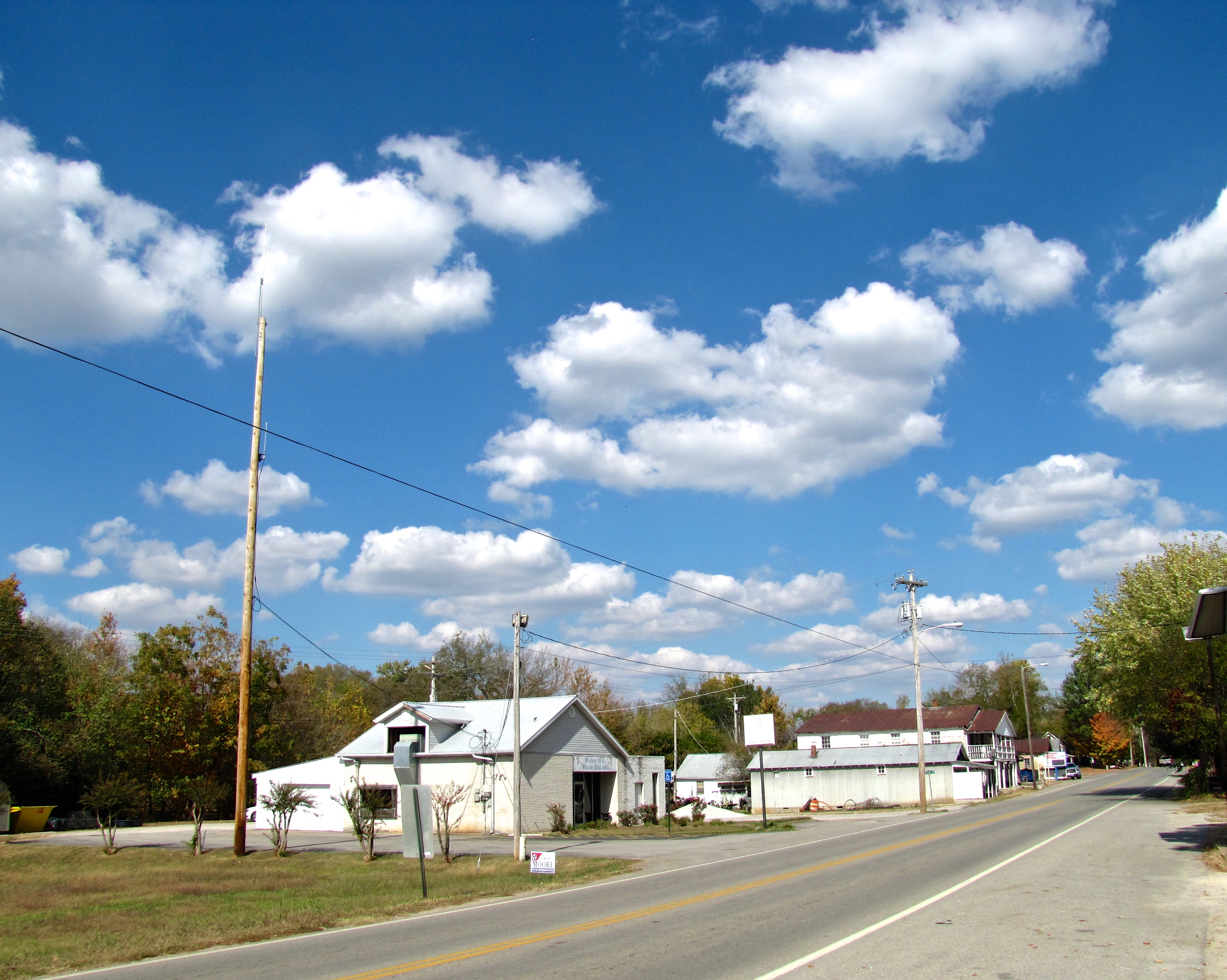
U.S. Route 431 (US 431) in Tennessee totals an estimated through Lincoln, Marshall, Maury, Williamson, Davidson, and Robertson Counties in Middle Tennessee. Route description Alabama state line to Nashville US 431 runs concurrently with US 231 upon entry into Tennessee from Madison County, Alabama, where the concurrency begins. The state line also marks the beginning of a secret concurrency with, and the southern terminus of unsigned Tennessee State Route 10. The two U.S. routes plus SR 10 do not split until they reach downtown Fayetteville. While US 231 goes into a north-northeasterly path, US 431 turns northwest into Marshall County, bypassing around Lewisburg, and later into northeastern Maury and into Williamson County. It traverses the city of Franklin, Tennessee before entering the Metropolitan Nashville and Davidson County area. In Nashville, US 431, being known as Hillsboro Pike, traverses the Exit 3 interchange of I-440, and eventually merging into US 70/ SR ... [...More Info...] [...Related Items...] OR: [Wikipedia] [Google] [Baidu] |
Tennessee Department Of Transportation
The Tennessee Department of Transportation (TDOT) is a multimodal agency with statewide responsibilities in roadways, aviation, public transit, waterways, and railroads. The mission of TDOT is to provide a safe and reliable transportation system for people, goods, and services that supports economic prosperity in Tennessee. Since 1998, TDOT has been ranked amongst the top five in the nation for quality highway infrastructure. It is primarily headquartered in downtown Nashville and operates four regional offices in Chattanooga, Jackson, Knoxville, and Nashville. Major responsibilities The major duties and responsibilities of TDOT are to: * plan, build, and maintain the state-owned highway and Interstate system of over ; * administer funding and provide technical assistance in the planning and construction of state and federal aid road programs for cities and counties; * provide incident management on Tennessee's Interstate system through TDOT SmartWay, an intelligent transport ... [...More Info...] [...Related Items...] OR: [Wikipedia] [Google] [Baidu] |
Middle Tennessee
Middle Tennessee is one of the three Grand Divisions of the U.S. state of Tennessee that composes roughly the central portion of the state. It is delineated according to state law as 41 of the state's 95 counties. Middle Tennessee contains the state's capital and largest city, Nashville, as well as Clarksville, the state's fifth largest city, and Murfreesboro, the state's sixth largest city and largest suburb of Nashville. The Nashville metropolitan area, located entirely within the region, is the most populous metropolitan area in the state, and the Clarksville metropolitan area is the state's sixth most populous. Middle Tennessee is both the largest, in terms of land area, and the most populous of the state's three Grand Divisions. Geographically, Middle Tennessee is composed of the Highland Rim, which completely surrounds the Nashville Basin. The Cumberland Plateau is located in the eastern part of the region. Culturally, Middle Tennessee is considered part of the Uplan ... [...More Info...] [...Related Items...] OR: [Wikipedia] [Google] [Baidu] |
Tennessee State Route 155
State Route 155 (SR 155), mostly designated as Briley Parkway, is a major freeway and parkway beltway around Nashville, Tennessee. It is long. Briley Parkway, named in honor of former Nashville mayor Beverly Briley, passes the Grand Ole Opry House, Opry Mills, and the Opryland Hotel east of Nashville. It crosses the Cumberland River twice, once near Madison, and again on the west side of Nashville, near the Riverbend Maximum Security Institution and John C. Tune Airport. On the southeast portion of the loop, Briley Parkway crosses Interstate 40 and passes Nashville International Airport. Route description Briley Parkway Briley Parkway consists of the northern loop of SR 155 from I-40 on the west side of Nashville to I-24 southeast of downtown Nashville, which makes up about two thirds of the length of the highway. The entirety of Briley Parkway is a controlled access highway, except for the segment between I-24 and I-40, including the interchange with US 41/70S (Murfreesbor ... [...More Info...] [...Related Items...] OR: [Wikipedia] [Google] [Baidu] |
Interstate 65
Interstate 65 (I-65) is a major north–south Interstate Highway in the central United States. As with most primary Interstates ending in 5, it is a major crosscountry, north–south route, connecting between the Great Lakes and the Gulf of Mexico. Its southern terminus is located at an interchange with I-10 in Mobile, Alabama, and its northern terminus is at an interchange with I-90, U.S. Route 12 (US 12), and US 20 (the Dunes Highway) in Gary, Indiana, just southeast of Chicago. I-65 connects several major metropolitan areas in the Midwest and Southern US. It connects the four largest cities in Alabama: Mobile, Montgomery, Birmingham, and Huntsville. It also serves as one of the main north–south routes through Nashville, Tennessee; Louisville, Kentucky; and Indianapolis, Indiana, each a major metropolitan area in its respective state. Route description , - , AL , 366.22 , 590.63 , - , TN , 121.71 , 195.87 , - , KY , 137.32 , 221.0 ... [...More Info...] [...Related Items...] OR: [Wikipedia] [Google] [Baidu] |
Tennessee State Route 65
Tennessee ( , ), officially the State of Tennessee, is a landlocked state in the Southeastern region of the United States. Tennessee is the 36th-largest by area and the 15th-most populous of the 50 states. It is bordered by Kentucky to the north, Virginia to the northeast, North Carolina to the east, Georgia, Alabama, and Mississippi to the south, Arkansas to the southwest, and Missouri to the northwest. Tennessee is geographically, culturally, and legally divided into three Grand Divisions of East, Middle, and West Tennessee. Nashville is the state's capital and largest city, and anchors its largest metropolitan area. Other major cities include Memphis, Knoxville, Chattanooga, and Clarksville. Tennessee's population as of the 2020 United States census is approximately 6.9 million. Tennessee is rooted in the Watauga Association, a 1772 frontier pact generally regarded as the first constitutional government west of the Appalachian Mountains. Its name derives from "Tanasi ... [...More Info...] [...Related Items...] OR: [Wikipedia] [Google] [Baidu] |
Tennessee State Route 11
State Route 11 (SR 11) is a mostly unsigned south–north highway that goes from the Alabama border in Giles County, Tennessee to the Kentucky border in Montgomery County. Route description SR 11 begins as a signed primary highway in Giles County at the Alabama state line. It passes through rolling hills and farmland to pass through Minor Hill and Goodspring before entering the Pulaski city limits at an intersection with US 64. It then becomes concurrent with SR 166 before passing through neighborhoods and crossing a bridge over Richland Creek to enter downtown. They then come to an intersection with SR 15, where SR 11 splits from SR 166 and follows SR 15 east. They then come to an intersection with US 31 ( SR 7), where SR 11 becomes unsigned and it follows US 31/SR 7 north to US 31A. State Route 11 is mostly a primary highway, except for in Pulaski, where it turns secondary between US 64 and US 31. SR 11 is also secondary through the entirety of Rutherford County ... [...More Info...] [...Related Items...] OR: [Wikipedia] [Google] [Baidu] |
Interstate 24 In Tennessee
Interstate 24 (I-24) is an Interstate Highway in the Midwestern and Southeastern United States. It runs diagonally from I-57, south of Marion, Illinois, to Chattanooga, Tennessee, at I-75. It travels through Illinois, Kentucky, Tennessee, and Georgia. As an even-numbered Interstate, it is signed as an east–west route, though the route follows a more southeast–northwest routing, passing through Nashville, Tennessee. The numbering deviates from the standard Interstate Highway System grid, lying further north than its number would indicate west of Nashville. I-24 between Nashville and Chattanooga is part of a longer north–south freight corridor which runs between Chicago and Atlanta. The interstate has facilitated the rapid growth of the largest suburban corridor in the Nashville metropolitan area, which runs for more than southeast of the city and is considered the most congested stretch of highway in the state. The stretch through Chattanooga also experiences seve ... [...More Info...] [...Related Items...] OR: [Wikipedia] [Google] [Baidu] |
James Robertson Parkway
James Robertson Parkway is a four-lane major thoroughfare in Nashville, Tennessee. It is a bypass route within the downtown Nashville area that includes portions of the alignments of three U.S. Highways, two of them with unsigned Tennessee state highway designations. Since all parts of the street includes alignments of U.S. and state routes, the road is maintained by the Tennessee Department of Transportation (TDOT). Route description The street is a four-lane divided street that begins at a crossroad intersection that involves Church Street and 8th Avenue. From there, it travels to an intersection with Rosa L. Parks Boulevard (8th Avenue North / U.S. Route 41A / US 41A). It turns to an easterly course and then crosses the Cumberland River and meets Interstate 24 (I-24). After this point, the parkway ends at the intersection of Spring Street and Main Street near the southern end of the Ellington Parkway. [...More Info...] [...Related Items...] OR: [Wikipedia] [Google] [Baidu] |
Tennessee State Route 1
State Route 1 (SR 1), known as the Memphis to Bristol Highway, is a mostly- unsigned state highway in the U.S. state of Tennessee. It stretches all the way from the Arkansas state line at Memphis in the southwest corner of the state to Bristol in the northeast part. Most of the route travels concurrently with U.S. Route 70 (US 70) and US 11W. It is the longest highway of any kind in the state of Tennessee. The route is signed as both in the state of Tennessee, a Primary and Secondary Highway (at different times throughout its designation) In 2015, the Tennessee Department of Transportation erected signs along SR 1 showing motorists they are traveling on the Memphis to Bristol Highway, Tennessee's first state road. TDOT installed the signs at every county line while it celebrated its 100th anniversary. Route description Memphis Area SR 1 begins as a primary route on Interstate 55 (I-55) in the middle of the Memphis & Arkansas Bridge at the Arkansas–Tennessee state line. ... [...More Info...] [...Related Items...] OR: [Wikipedia] [Google] [Baidu] |
Interstate 440 (Tennessee)
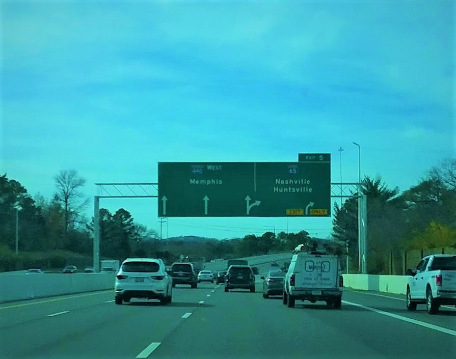
Interstate 440 (I-440) is an east–west auxiliary Interstate Highway that runs through Nashville, Tennessee. It serves as a southern bypass around downtown Nashville, and is located on average about from the center of the city. I-440 is also known locally as the Four-Forty Parkway, and is designated as the Debra K. Johnson Memorial Parkway. At a length of , I-440 runs between I-40 and I-24, and connects to I-65 and multiple U.S. Routes. Combined, I-440 and Briley Parkway, a controlled-access segment of State Route 155 (SR 155), form a noncontiguous inner beltway around downtown Nashville. Originally proposed in the 1950s, I-440 was the subject of much controversy related to its location and design, which resulted in multiple design changes and delayed the highway's completion for many years. As a result, it was the last segment of Interstate Highway planned for Tennessee in the Interstate Highway Act of 1956 to be constructed. After its completion in 198 ... [...More Info...] [...Related Items...] OR: [Wikipedia] [Google] [Baidu] |
Lewisburg, Tennessee
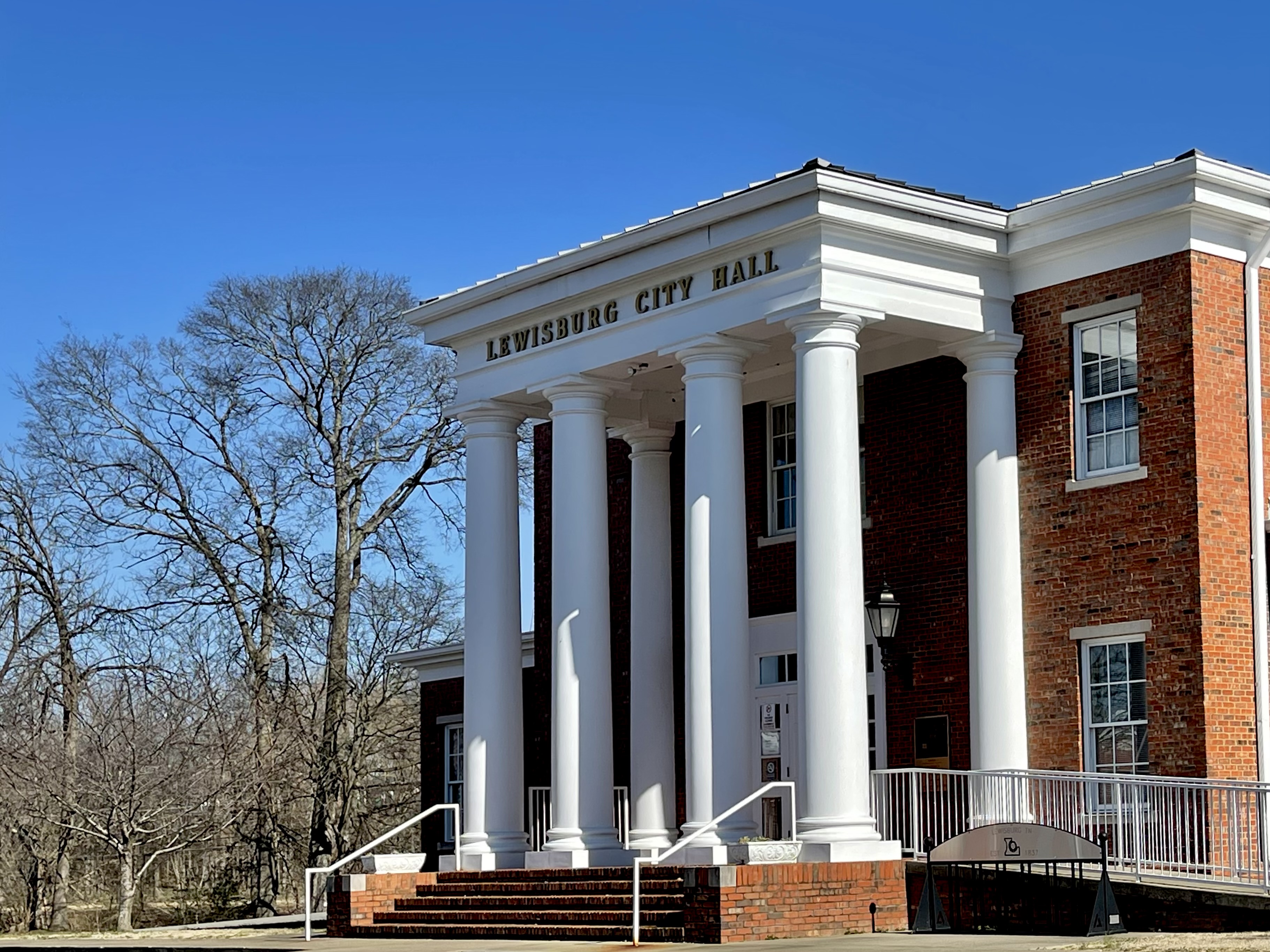
Lewisburg is a city in, and the county seat of Marshall County, Tennessee, United States. The population was 12,288 in 2020. Lewisburg is located in Middle Tennessee, fifty miles south of Nashville and fifty-two miles north of Huntsville, Alabama. Residents have access to the larger cities via nearby I-65. Located among rolling hills, Lewisburg was named for the explorer Meriwether Lewis. By 1838, the town was supporting a newspaper and a bank. The downtown area is similar to many other small southern towns, with a courthouse on a square, surrounded by retail and commercial businesses. Shopping centers are located on the east and west ends of town. Geography Lewisburg is located at (35.449034, -86.793112). According to the United States Census Bureau, the city has a total area of , almost all of which is land (0.09% is water). Climate Demographics 2020 census As of the 2020 United States census, there were 12,288 people, 4,394 households, and 2,758 families residing in ... [...More Info...] [...Related Items...] OR: [Wikipedia] [Google] [Baidu] |
Marshall County, TN
Marshall County is a county located in the U.S. state of Tennessee. As of the 2020 census, the population was 34,318. Its county seat is Lewisburg. Marshall County comprises the Lewisburg Micropolitan Statistical Area, which is also included in the Nashville-Davidson–Murfreesboro–Franklin, TN Metropolitan Statistical Area. It is in Middle Tennessee, one of the three Grand Divisions of the state. The Tennessee Walking Horse Breeders' and Exhibitors' Association is based here. In addition, the fainting goat is another animal breed developed here. To celebrate this unique breed, the county holds an annual festival known as "Goats, Music and More," drawing visitors from around the world. History Marshall County was created in 1836 from parts of Giles, Bedford, Lincoln and Maury counties. Marshall County was originally to be named Cannon County. Due to a clerical error at the time of formation in 1836 the names of Marshall and Cannon Counties, both formed in 1836, were ac ... [...More Info...] [...Related Items...] OR: [Wikipedia] [Google] [Baidu] |


