|
U.S. Highway 9
U.S. Route 9 (US 9) is a north–south United States highway in the states of Delaware, New Jersey, and New York in the Northeastern United States. It is one of only two U.S. Highways with a ferry connection (the Cape May–Lewes Ferry, between Lewes, Delaware, and North Cape May, New Jersey); the other is US 10. US 9 is signed east–west in Delaware and north–south on the rest of its route. The southern terminus of the route is in Laurel, Delaware, at an intersection with US 13, while the highway's northern terminus is at a junction with Interstate 87 (I-87) in Champlain, New York, where the roadway continues north as the unsigned NY 971B, which ends in a cul-de-sac just short of the Canadian border. Route description Much of US 9 is a two-lane road, with some expansions near more populous areas. The major exception to this is central and northern New Jersey, where it is a wide four-lane (or six-lane) divided strip, especially during much of its concurrency with U ... [...More Info...] [...Related Items...] OR: [Wikipedia] [Google] [Baidu] |
Laurel, Delaware
Laurel is a town in Sussex County, Delaware, United States. The population was 3,708 at the time of the 2010 census. Laurel is part of the Salisbury, Maryland-Delaware Metropolitan Statistical Area. It once hosted the Laurel Blue Hens of the Eastern Shore Baseball League. History The site of the town of Laurel was a Nanticoke Indian settlement known as Broad Creek Town during most of the eighteenth century. Its Nanticoke name is unknown. The Indian settlement was created on tracts known as Bachelor's Delight and Greenland in 1711 when the government of Maryland, who originally claimed this part of Delaware, set aside land for the Nanticoke Indians. Nearly all the Indian settlers left within 50 years, relocating to western Pennsylvania. The present town was laid out along the Broad Creek in the 1790s and was named for the laurel bushes that grew alongside the creek. The Chipman Potato House, Chipman's Mill, Collins Potato House, Hearn Potato House, E. L. Hitch Potato House, L ... [...More Info...] [...Related Items...] OR: [Wikipedia] [Google] [Baidu] |
Northeastern United States
The Northeastern United States, also referred to as the Northeast, the East Coast, or the American Northeast, is a geographic region of the United States. It is located on the Atlantic coast of North America, with Canada to its north, the Southern United States to its south, and the Midwestern United States to its west. The Northeast is one of the four regions defined by the U.S. Census Bureau for the collection and analysis of statistics. The region is usually defined as including nine U.S. states: Connecticut, Maine, Massachusetts, New Hampshire, New Jersey, New York, Pennsylvania, Rhode Island, and Vermont. The U.S. Census Bureau–defined region of the Northeastern United States has a total area of with of that being land mass, making it the smallest region of the United States by both land mass and total area. The Northeastern region is the nation's most economically developed, densely populated, and culturally diverse region. Of the nation's four census regions, the No ... [...More Info...] [...Related Items...] OR: [Wikipedia] [Google] [Baidu] |
The Philadelphia Inquirer
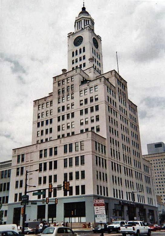
''The Philadelphia Inquirer'' is a daily newspaper headquartered in Philadelphia, Pennsylvania. The newspaper's circulation is the largest in both the U.S. state of Pennsylvania and the Delaware Valley metropolitan region of Southeastern Pennsylvania, South Jersey, Delaware, and the northern Eastern Shore of Maryland, and the 17th largest in the United States as of 2017. Founded on June 1, 1829 as ''The Pennsylvania Inquirer'', the newspaper is the third longest continuously operating daily newspaper in the nation. It has won 20 Pulitzer Prizes . ''The Inquirer'' first became a major newspaper during the American Civil War. The paper's circulation dropped after the Civil War's conclusion but then rose again by the end of the 19th century. Originally supportive of the Democratic Party, ''The Inquirers political orientation eventually shifted toward the Whig Party and then the Republican Party before officially becoming politically independent in the middle of the 20th cen ... [...More Info...] [...Related Items...] OR: [Wikipedia] [Google] [Baidu] |
Delaware Bay
Delaware Bay is the estuary outlet of the Delaware River on the northeast seaboard of the United States. It is approximately in area, the bay's freshwater mixes for many miles with the saltwater of the Atlantic Ocean. The bay is bordered inland by the states of Delaware and New Jersey, and the Delaware Capes, Cape Henlopen and Cape May, on the Atlantic. Delaware Bay is bordered by six counties: Sussex, Kent, and New Castle in Delaware, along with Cape May, Cumberland, and Salem in New Jersey. The Cape May–Lewes Ferry crosses Delaware Bay from Cape May, New Jersey, to Lewes, Delaware. The bay's ports are managed by the Delaware River and Bay Authority. The shores of the bay are largely composed of salt marshes and mudflats, with only small communities inhabiting the shore of the lower bay. Several of the rivers hold protected status for their salt marsh wetlands bordering the bay, which serves as a breeding ground for many aquatic species, including horseshoe crabs. The bay ... [...More Info...] [...Related Items...] OR: [Wikipedia] [Google] [Baidu] |
Georgetown, Delaware
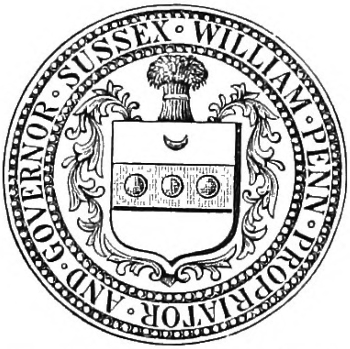
Georgetown is a town and the county seat of Sussex County, Delaware, United States. According to the 2010 census, the population of the town is 6,422, an increase of 38.3% over the previous decade. Georgetown is part of the Salisbury, Maryland-Delaware Metropolitan Statistical Area. History Second county seat Lewes, sited on the Delaware Bay, was designated as the first county seat. It was the first colony in Delaware, founded by the Dutch in 1631, and it remained the only significant European settlement in the region for some time. When English colonist William Penn organized the three southern counties of Pennsylvania, which are now Delaware, Lewes was the natural choice for the location of the Sussex County's Seat of Justice. Sussex County was not well defined until after 1760, following resolution of a dispute between William Penn's family and Frederick Calvert, 6th Baron Baltimore after intervention from the Crown. This dispute over borders had delayed discussion over t ... [...More Info...] [...Related Items...] OR: [Wikipedia] [Google] [Baidu] |
Sussex County, Delaware
Sussex County is located in the southern part of the U.S. state of Delaware, on the Delmarva Peninsula. As of the 2020 census, the population was 237,378. The county seat is Georgetown. The first European settlement in the state of Delaware was founded by the Dutch in 1631 near the present-day town of Lewes on the Atlantic Coast. However, Sussex County was not organized until 1683 under English colonial rule. Sussex County is included in the Salisbury, MD-DE Metropolitan Statistical Area which encompasses much of central Delmarva. History Beginnings Archaeologists estimate that the first inhabitants of Sussex County, the southernmost county in Delaware, arrived between 10,000 and 14,000 years ago. Various indigenous cultures occupied the area, especially along the river and the coast, often having seasonal fishing villages. Historic Native Americans in Sussex County were members of Algonquian-speaking tribes, as were most coastal peoples along the Atlantic Coast. By the ... [...More Info...] [...Related Items...] OR: [Wikipedia] [Google] [Baidu] |
2022-07-07 19 40 39 View West At The End Of U
The hyphen-minus is the most commonly used type of hyphen, widely used in digital documents. It is the only character that looks like a minus sign or a dash in many character sets such as ASCII or on most keyboards, so it is also used as such. The name "hyphen-minus" derives from the original ASCII standard, where it was called "hyphen(minus)". The character is referred to as a "hyphen", a "minus sign", or a "dash" according to the context where it is being used. Description In early monospaced font typewriters and character encodings, a single key/code was almost always used for hyphen, minus, various dashes, and strikethrough, since they all have a roughly similar appearance. The current Unicode Standard specifies distinct characters for a number of different dashes, an unambiguous minus sign ("Unicode minus") at code point U+2212, and various types of hyphen including the unambiguous "Unicode hyphen" at U+2010 and the hyphen-minus at U+002D. When a hyphen is call ... [...More Info...] [...Related Items...] OR: [Wikipedia] [Google] [Baidu] |
Garden State Parkway
The Garden State Parkway (GSP) is a controlled-access toll road that stretches the north–south length of eastern New Jersey from the state's southernmost tip near Cape May to the New York state line at Montvale. Its name refers to New Jersey's nickname, the "Garden State". The parkway is designated by the New Jersey Department of Transportation (NJDOT) as Route 444, although this designation is unsigned. At its north end, the road becomes the Garden State Parkway Connector, a component of the New York State Thruway system that connects to the Thruway mainline in Ramapo. The parkway is the longest highway in the state at approximately , and, according to the International Bridge, Tunnel and Turnpike Association, was the busiest toll road in the United States in 2006. Most of the highway north of the Raritan River runs through heavily populated areas. Between the Raritan River and the township of Toms River, the highway passes through lighter suburban development, whil ... [...More Info...] [...Related Items...] OR: [Wikipedia] [Google] [Baidu] |
North Jersey
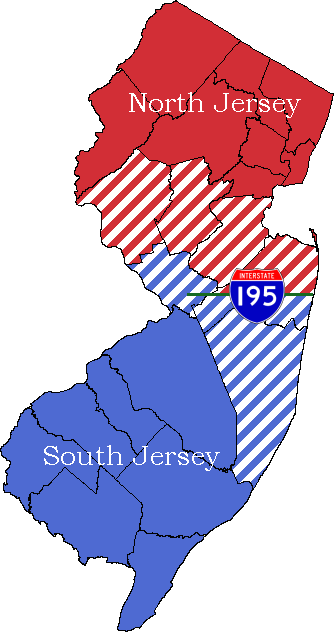
North Jersey comprises the northern portions of the U.S. state of New Jersey between the upper Delaware River and the Atlantic Ocean. The designation of northern New Jersey with a distinct toponym is a colloquial one rather than an administrative one, reflecting not only geographical but also perceived cultural differences from the southern part of the state, with no official definition.("Of course, part of the problem with understanding New Jersey's enduring regional tension is that few residents can agree on where the northern half of the state end and the southern half begins.") North Jersey is characterized by its position, both geographically and culturally, within the greater New York City metropolitan area and its high level of economic output, emanating from economic engines including Paramus in Bergen County, which has become the top retail ZIP Code (07652) in the United States, with the municipality generating over US$6 billion in annual retail sales; Jersey City, who ... [...More Info...] [...Related Items...] OR: [Wikipedia] [Google] [Baidu] |
Central Jersey
Central Jersey is the central region of the U.S. state of New Jersey New Jersey is a state in the Mid-Atlantic and Northeastern regions of the United States. It is bordered on the north and east by the state of New York; on the east, southeast, and south by the Atlantic Ocean; on the west by the Delaware .... The designation of Central New Jersey is a distinct administrative division, administrative toponymy, toponym. Geographic area and descriptions While the State of New Jersey is often divided into North Jersey, North and South Jersey some residents, including the governor recognize Central Jersey as a distinct entity. All descriptions of Central Jersey include Middlesex County, New Jersey, Middlesex County, the center of population of New Jersey, and tend to include much of nearby Monmouth County, New Jersey, Monmouth, Mercer County, New Jersey, Mercer, Somerset County, New Jersey, Somerset, and Hunterdon County, Hunterdon counties. The inclusion of adjacent a ... [...More Info...] [...Related Items...] OR: [Wikipedia] [Google] [Baidu] |
Canada–United States Border
The border between Canada and the United States is the longest international border in the world. The terrestrial boundary (including boundaries in the Great Lakes, Atlantic, and Pacific coasts) is long. The land border has two sections: Canada's border with the contiguous United States to its south, and with the U.S. state of Alaska to its west. The bi-national International Boundary Commission deals with matters relating to marking and maintaining the boundary, and the International Joint Commission deals with issues concerning boundary waters. The agencies currently responsible for facilitating legal passage through the international boundary are the Canada Border Services Agency (CBSA) and U.S. Customs and Border Protection (CBP). History 18th century The Treaty of Paris of 1783 ended the American Revolutionary War between Great Britain and the United States. In the second article of the Treaty, the parties agreed on all boundaries of the United States, including, but ... [...More Info...] [...Related Items...] OR: [Wikipedia] [Google] [Baidu] |
Interstate 87 (New York)
Interstate 87 (I-87) is a north–south Interstate Highway located entirely within the US state of New York. It is most of the main highway between New York City and Montreal. The highway begins at exit 47 off I-278 in the New York City borough of the Bronx, just north of the Robert F. Kennedy Bridge and Grand Central Parkway. From there, the route runs northward through the Hudson Valley, the Capital District, and the easternmost part of the North Country to the Canadian border in the town of Champlain. At its north end, I-87 continues into Quebec as Autoroute 15 (A-15). I-87 connects with several regionally important roads: I-95 in New York City, New York State Route 17 (NY 17; future I-86) near Harriman, I-84 near Newburgh, and I-90 in Albany. The highway is not contiguous with I-87 in North Carolina. I-87 was assigned in 1957 as part of the establishment of the Interstate Highway System. The portion of I-87 south of Albany follows two contr ... [...More Info...] [...Related Items...] OR: [Wikipedia] [Google] [Baidu] |

.jpg)


