|
Tāwharanui Peninsula
Tāwharanui Peninsula is a finger of land projecting into the Hauraki Gulf from the east coast of the much larger North Auckland Peninsula of New Zealand. It separates Omaha Bay to the north from Kawau Bay and Kawau Island to the south. The nearest sizable town is Warkworth. Tāwharanui Regional Park covers 588 hectares of the peninsula's land and Tāwharanui Marine Reserve covers the northern coastal sea. Both are administered by Auckland CouncilTāwharanui Marine Reserve Department of Conservation. which also owns the regional park. Geologically the peninsula consists of Waitemata Sandstone on top of folded and uplifted . ... [...More Info...] [...Related Items...] OR: [Wikipedia] [Google] [Baidu] |
Hauraki Gulf
The Hauraki Gulf / Tīkapa Moana is a coastal feature of the North Island of New Zealand. It has an area of 4000 km2, Zeldisl, J. R. et al. (1995) Salp grazing: effects on phytoplankton abundance, vertical distribution and taxonomic composition in a coastal habitat. Marine Ecology Progress Series, Vol. 126, p 267-283 and lies between, in anticlockwise order, the , the Hauraki Plains, the , and [...More Info...] [...Related Items...] OR: [Wikipedia] [Google] [Baidu] |
List Of Marine Reserves In New Zealand
New Zealand has 44 marine reserves (as of August 2020) spread around the North, the South Island, and neighbouring islands, and on outlying island groups. They are governed by the Marine Reserves Act 1971 and administered by the Department of Conservation with assistance from the Ministry of Fisheries, New Zealand Customs and the New Zealand Defence Forces. History The Marine Reserves Act was passed by the Parliament of New Zealand in 1971. In 2000 the Department of Conservation started a review of the Act resulting in a draft Marine Reserves Bill that was introduced into Parliament in June 2002, but has not yet been voted on. The first marine reserve to be created was the Cape Rodney-Okakari Point Marine Reserve. The Poor Knights Islands Marine Reserve was established next, although with only a partial ban on fishing; a full ban was implemented in 1998. The first two marine reserves in Fiordland were established at the request of New Zealand Federation of Commercial Fisherme ... [...More Info...] [...Related Items...] OR: [Wikipedia] [Google] [Baidu] |
Māori Religion
Māori religion encompasses the various religious beliefs and practices of the Māori, the Polynesian indigenous people of New Zealand. Traditional Māori religion Traditional Māori religion, that is, the pre-European belief-system of the Māori, differed little from that of their tropical Eastern Polynesian homeland ( Hawaiki Nui), conceiving of everything - including natural elements and all living things - as connected by common descent through whakapapa or genealogy. Accordingly, Māori regarded all things as possessing a life force or mauri. Illustrating this concept of connectedness through genealogy are the major personifications dating from before the period of European contact: * Tangaroa was the personification of the ocean and the ancestor or origin of all fish. * Tāne was the personification of the forest and the origin of all birds. * Rongo was the personification of peaceful activities and agriculture and the ancestor of cultivated plants. (Some sources ref ... [...More Info...] [...Related Items...] OR: [Wikipedia] [Google] [Baidu] |
2006 New Zealand Census
The New Zealand Census of Population and Dwellings ( mi, Te Tatauranga o ngā Tāngata Huri Noa i Aotearoa me ō rātou Whare Noho) is a national population and housing census conducted by government department Statistics New Zealand every five years. There have been 34 censuses since 1851. In addition to providing detailed information about national demographics, the results of the census play an important part in the calculation of resource allocation to local service providers. The 2018 census took place on Tuesday 6 March 2018. The next census is expected in March 2023. Census date Since 1926, the census has always been held on a Tuesday and since 1966, the census always occurs in March. These are statistically the month and weekday on which New Zealanders are least likely to be travelling. The census forms have to be returned by midnight on census day for them to be valid. Conducting the census Until 2018, census forms were hand-delivered by census workers during the lead ... [...More Info...] [...Related Items...] OR: [Wikipedia] [Google] [Baidu] |
2013 New Zealand Census
The 2013 New Zealand census was the thirty-third national census. "The National Census Day" used for the census was on Tuesday, 5 March 2013. The population of New Zealand was counted as 4,242,048, – an increase of 214,101 or 5.3% over the 2006 census. The 2013 census forms were the same as the forms developed for the 2011 census which was cancelled due to the February 2011 major earthquake in Christchurch. There were no new topics or questions. New Zealand's next census was conducted in March 2018. Collection methods The results from the post-enumeration survey showed that the 2013 census recorded 97.6 percent of the residents in New Zealand on census night. However, the overall response rate was 92.9 percent, with a non-response rate of 7.1 percent made up of the net undercount and people who were counted in the census but had not received a form. Results Population and dwellings Population counts for New Zealand regions. Note: All figures are for the census usually r ... [...More Info...] [...Related Items...] OR: [Wikipedia] [Google] [Baidu] |
2018 New Zealand Census
Eighteen or 18 may refer to: * 18 (number), the natural number following 17 and preceding 19 * one of the years 18 BC, AD 18, 1918, 2018 Film, television and entertainment * ''18'' (film), a 1993 Taiwanese experimental film based on the short story ''God's Dice'' * ''Eighteen'' (film), a 2005 Canadian dramatic feature film * 18 (British Board of Film Classification), a film rating in the United Kingdom, also used in Ireland by the Irish Film Classification Office * 18 (''Dragon Ball''), a character in the ''Dragon Ball'' franchise * "Eighteen", a 2006 episode of the animated television series ''12 oz. Mouse'' Music Albums * ''18'' (Moby album), 2002 * ''18'' (Nana Kitade album), 2005 * '' 18...'', 2009 debut album by G.E.M. Songs * "18" (5 Seconds of Summer song), from their 2014 eponymous debut album * "18" (One Direction song), from their 2014 studio album ''Four'' * "18", by Anarbor from their 2013 studio album '' Burnout'' * "I'm Eighteen", by Alice Cooper commo ... [...More Info...] [...Related Items...] OR: [Wikipedia] [Google] [Baidu] |
Baddeleys Beach-Campbells Beach
Baddeleys Beach and Campbells Beach are a contiguous settlement on adjacent beaches on the southern side of Tāwharanui Peninsula in the Auckland Region of New Zealand. The beaches are on Millon Bay, which is a part of Kawau Bay. The land around Millon Bay was originally covered by kauri and other native trees, which were the focus for logging by early European settlers. Once the land was cleared it was used for dairy farming by the Baddeley and Campbell families. In the mid-1960s, with farming proving financially marginal, blocks were sold off for the building of baches. These subsequently were upgraded to or replaced by permanent dwellings. Baddeleys Beach Reserve and Campbells Beach Reserve give public access to the beaches at each end of the settlement and provide basic amenities. Demographics Statistics New Zealand describes Baddeleys Beach-Campbells Beach as a rural settlement, which covers and had an estimated population of as of with a population density of peop ... [...More Info...] [...Related Items...] OR: [Wikipedia] [Google] [Baidu] |
Point Wells
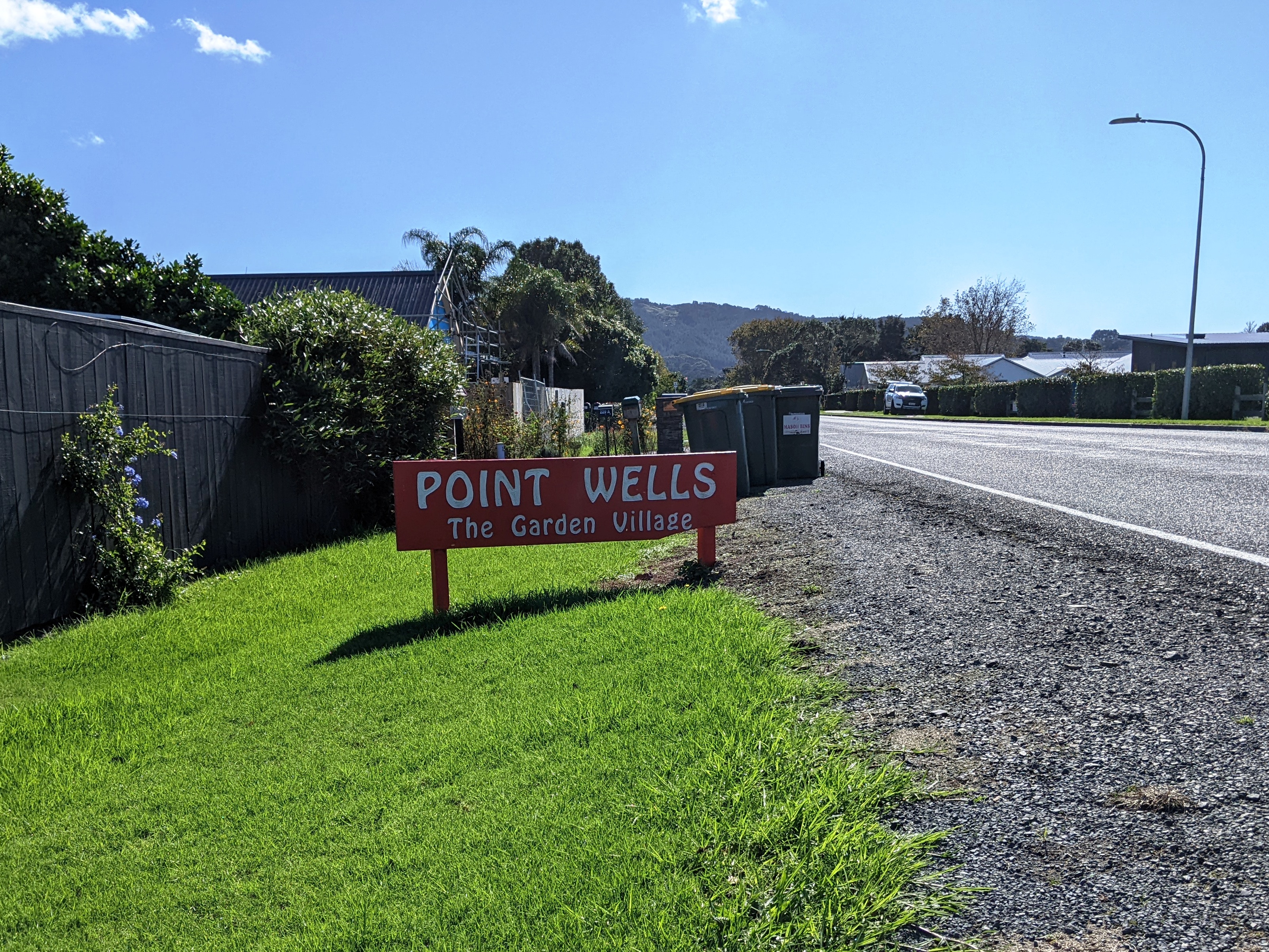
Point Wells is a rural settlement in the Auckland Region of New Zealand, at the tip of a peninsula between the Omaha River and Whangateau Harbour. Omaha is across the harbour but accessible by a causeway. Point Wells was divided into sections in 1947 when a local farmer sold off some of his land. It grew slowly, and in the late 1960s the development of Omaha drew most of the new builds away. Point Wells Hall was built in 1956 on donated land. It included a community library for many years. In 2008, the community gave control of running the hall to Rodney District Council, and two years later when Auckland Council was established it took the responsibility. In 2018, Auckland Council handed back the management to a subcommittee of the Point Wells Community and Ratepayers Association. Demographics Statistics New Zealand describes Point Wells as a rural settlement, which covers . Point Wells is part of the larger Tawharanui Peninsula statistical area. Port Wells, comprising ... [...More Info...] [...Related Items...] OR: [Wikipedia] [Google] [Baidu] |
Omaha, New Zealand
Omaha is a small beach town on Omaha Bay in the Rodney District, in the north of New Zealand. It is located 74.7 km north of Auckland. It is on a sandspit that adjoins Tawharanui Peninsula and separates Whangateau Harbour from Omaha Bay. The nearest sizable town is Warkworth which is situated 16.8 km south west of Omaha. History Omaha was a Marutūāhu settlement until 1841, when it was bought by the Crown. Early European settlement took place at Sandspit. Omaha means 'bountiful food' or 'great resources' in Māori. Nearby Leigh was historically named Omaha by Māori, and Omaha Beach was called Mangatawhiri by Ngāti Manuhiri. Geography The sandspit of Omaha was formed during the last glacial period, approximately 5000 to 6000 years BP. The beach sediment composition is over 70% quartz sand, which gifted Omaha the natural "white" appearance. There are three artificial groynes had been placed at northern part of the sandspit, to accumulate sediment from longshor ... [...More Info...] [...Related Items...] OR: [Wikipedia] [Google] [Baidu] |
Leptospermum Scoparium
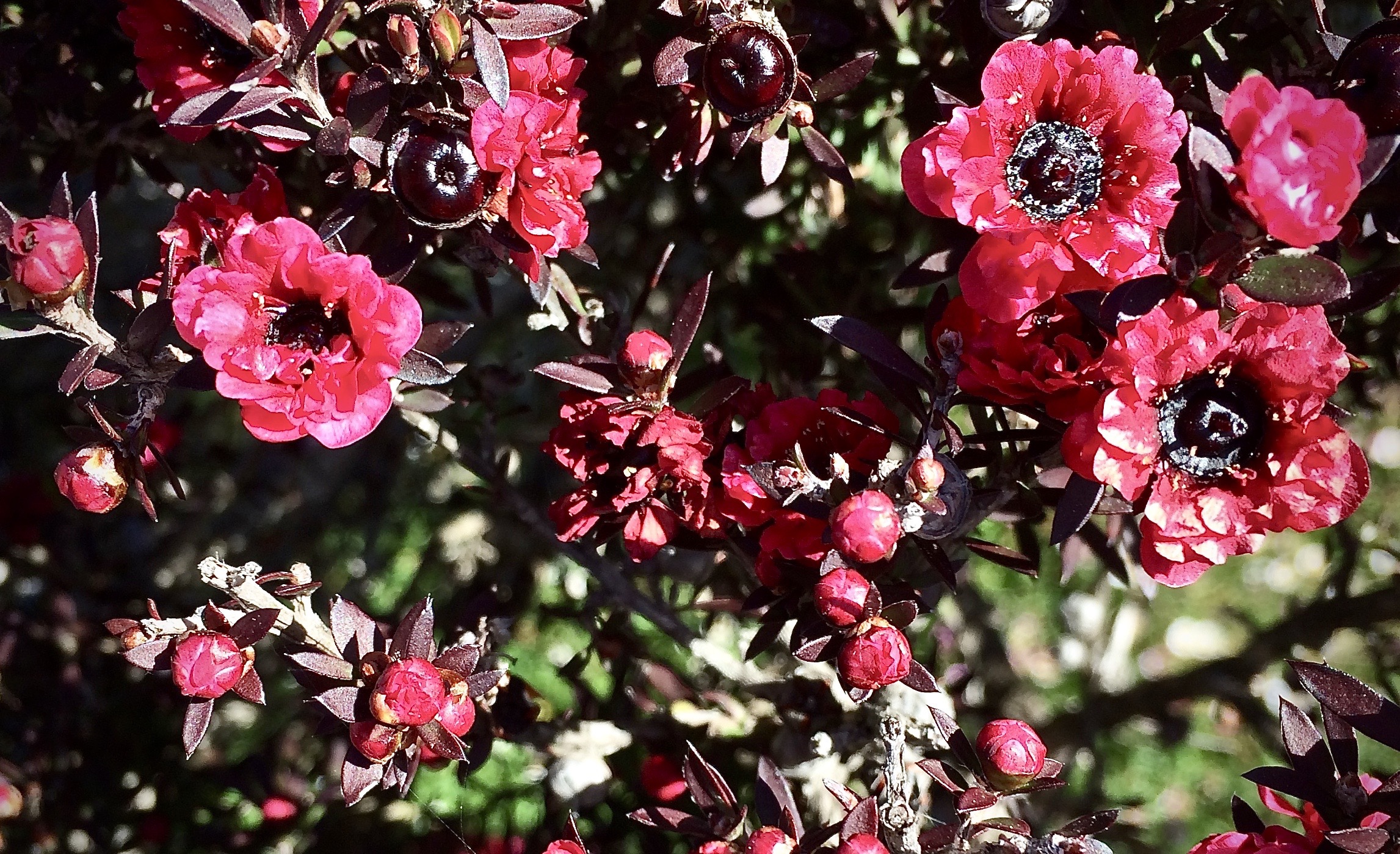
''Leptospermum scoparium'', commonly called mānuka, () mānuka myrtle, New Zealand teatree, broom tea-tree, or just tea tree, is a species of flowering plant in the myrtle family Myrtaceae, native to New Zealand (including the Chatham Islands) and south-east Australia. Its nectar produces Mānuka honey. Description Mānuka is a prolific shrub-type tree and is often one of the first species to regenerate on cleared land. It is typically a shrub growing to tall, but can grow into a moderately sized tree, up to or so in height. It is evergreen, with dense branching and small leaves long and broad, with a short spine tip. The flowers are white, occasionally pink, – rarely up to – in diameter, with five petals. The wood is tough and hard. Mānuka is often confused with the related species kānuka (''Kunzea ericoides'') – the easiest way to tell the difference between the two species in the field is to feel their foliage – mānuka leaves are prickly, while kānuka lea ... [...More Info...] [...Related Items...] OR: [Wikipedia] [Google] [Baidu] |
Kauri
''Agathis'', commonly known as kauri or dammara, is a genus of 22 species of evergreen tree. The genus is part of the ancient conifer family Araucariaceae, a group once widespread during the Jurassic and Cretaceous periods, but now largely restricted to the Southern Hemisphere except for a number of extant Malesian ''Agathis''.de Laubenfels, David J. 1988. Coniferales. P. 337–453 in Flora Malesiana, Series I, Vol. 10. Dordrecht: Kluwer Academic. Description Mature kauri trees have characteristically large trunks, with little or no branching below the crown. In contrast, young trees are normally conical in shape, forming a more rounded or irregularly shaped crown as they achieve maturity.Whitmore, T.C. 1977. ''A first look at Agathis''. Tropical Forestry Papers No. 11. University of Oxford Commonwealth Forestry Institute. The bark is smooth and light grey to grey-brown, usually peeling into irregular flakes that become thicker on more mature trees. The branch structu ... [...More Info...] [...Related Items...] OR: [Wikipedia] [Google] [Baidu] |


