|
Typhoon Nuri (2014)
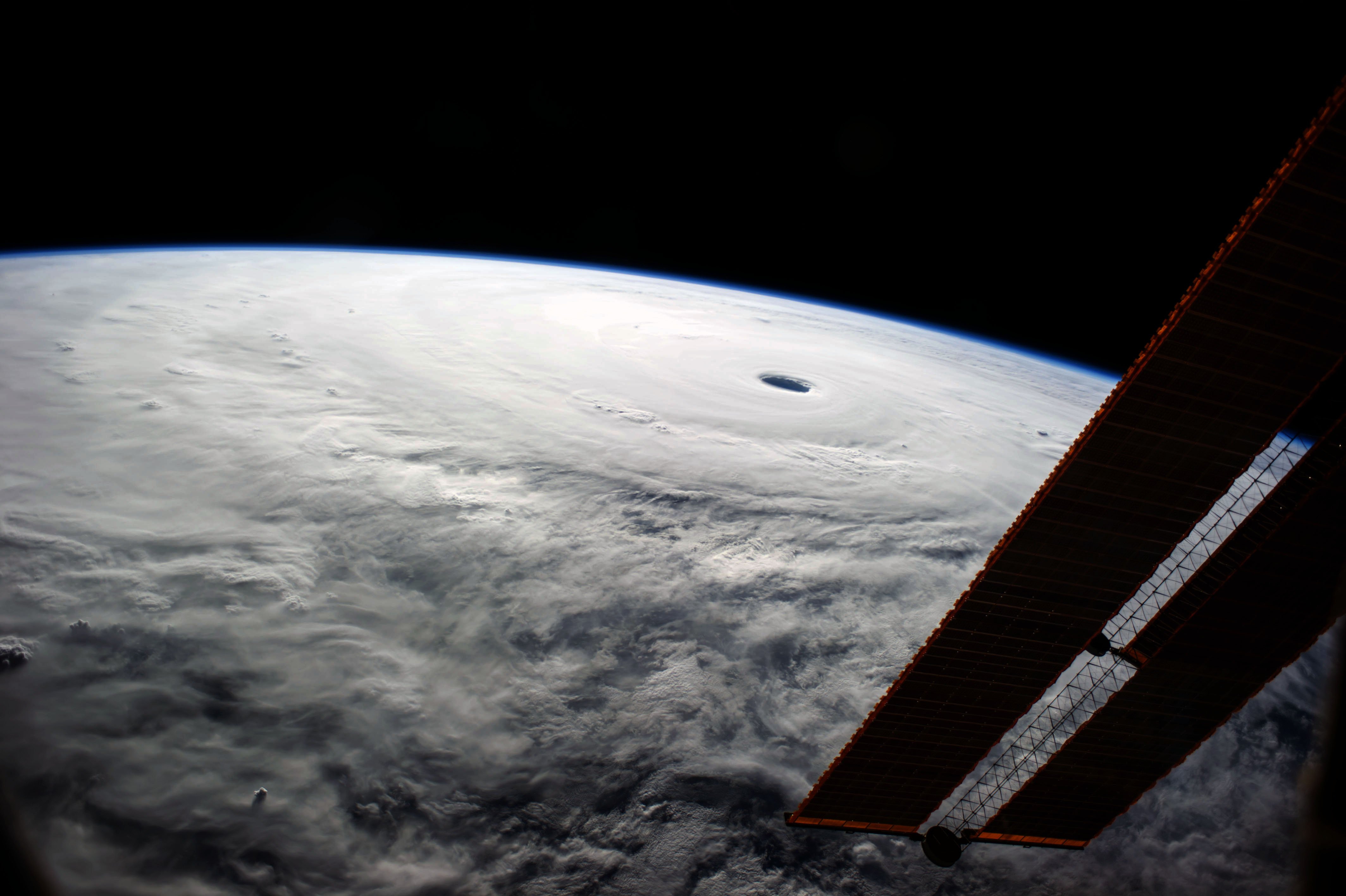
Typhoon Nuri, known in the Philippines as Typhoon Paeng, was the third most intense tropical cyclone worldwide in 2014. Nuri developed into a tropical storm and received the name ''Paeng'' from the PAGASA on October 31, before it intensified into a typhoon on the next day. Under excellent conditions, especially the synoptic scale outflow, Nuri underwent rapid deepening and reached its peak intensity on November 2, forming a round eye in a symmetric Central dense overcast (CDO). Having maintained the impressive structure for over one day, the typhoon began to weaken on November 4, with a cloud-filled eye. Because of increasing vertical wind shear from the mid-latitude westerlies, Nuri lost the eye on November 5, and deep convection continued to diminish. The storm accelerated northeastward and completely became extratropical on November 6. However, on November 7, Nuri's circulation split, and the new center absorbed the storm. Meteorological history A low-pressure area formed ... [...More Info...] [...Related Items...] OR: [Wikipedia] [Google] [Baidu] |
Japan
Japan ( ja, 日本, or , and formally , ''Nihonkoku'') is an island country in East Asia. It is situated in the northwest Pacific Ocean, and is bordered on the west by the Sea of Japan, while extending from the Sea of Okhotsk in the north toward the East China Sea, Philippine Sea, and Taiwan in the south. Japan is a part of the Ring of Fire, and spans Japanese archipelago, an archipelago of List of islands of Japan, 6852 islands covering ; the five main islands are Hokkaido, Honshu (the "mainland"), Shikoku, Kyushu, and Okinawa Island, Okinawa. Tokyo is the Capital of Japan, nation's capital and largest city, followed by Yokohama, Osaka, Nagoya, Sapporo, Fukuoka, Kobe, and Kyoto. Japan is the List of countries and dependencies by population, eleventh most populous country in the world, as well as one of the List of countries and dependencies by population density, most densely populated and Urbanization by country, urbanized. About three-fourths of Geography of Japan, the c ... [...More Info...] [...Related Items...] OR: [Wikipedia] [Google] [Baidu] |
Japan Meteorological Agency
The , abbreviated JMA, is an agency of the Ministry of Land, Infrastructure, Transport and Tourism. It is charged with gathering and providing results for the public in Japan that are obtained from data based on daily scientific observation and research into natural phenomena in the fields of meteorology, hydrology, seismology and volcanology, among other related scientific fields. Its headquarters is located in Minato, Tokyo. JMA is responsible for gathering and reporting weather data and forecasts for the general public, as well as providing aviation and marine weather. JMA other responsibilities include issuing warnings for volcanic eruptions, and the nationwide issuance of earthquake warnings of the Earthquake Early Warning (EEW) system. JMA is also designated one of the Regional Specialized Meteorological Centers of the World Meteorological Organization (WMO). It is responsible for forecasting, naming, and distributing warnings for tropical cyclones in the Northwestern ... [...More Info...] [...Related Items...] OR: [Wikipedia] [Google] [Baidu] |
Typhoon Vongfong (2014)
Typhoon Vongfong, known in the Philippines as Super Typhoon Ompong, was the most intense tropical cyclone worldwide in 2014, and struck Japan as a large tropical system. It also indirectly affected the Philippines and Taiwan. Vongfong was the nineteenth named storm and the ninth typhoon of the 2014 Pacific typhoon season. Estimates assess damage from Vongfong to have been over US$160 million, mainly for striking mainland Japan. At least 9 people were killed along the path of the typhoon in those countries. Both the JMA and the JTWC upgraded Vongfong to a tropical storm on October 3. Under low vertical wind shear and excellent outflow, Vongfong intensified into a typhoon east of Guam on October 5. Afterwards, subsidence and moderate to strong vertical wind shear caused the typhoon to struggle to intensify. On October 7, the PAGASA named the system ''Ompong'', while it underwent rapid deepening owing to a TUTT cell. The JTWC then classified Vongfong as the sixth super typhoon of ... [...More Info...] [...Related Items...] OR: [Wikipedia] [Google] [Baidu] |
Okinotorishima
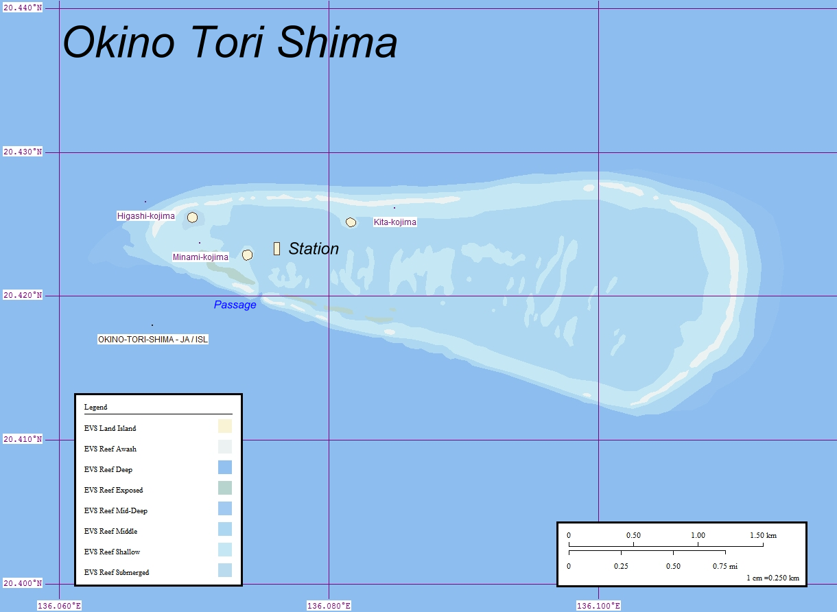
, or Parece Vela, is a coral reef with two rocks enlarged with tetrapod-cement structures. It is administered by Japan with a total shoal area of and land area . Its dry land area is mostly made up by three concrete encasings and there is a stilt platform in the lagoon housing a research station. There is a third completely artificial tetrapod-cement islet. It is located on the Palau–Kyushu Ridge in the Philippine Sea, southeast of Okidaitōjima and west-southwest of South Iwo Jima in the Bonin Islands or south of Tokyo, Japan. The atoll is the southernmost part of Japan and the only Japanese territory south of the Tropic of Cancer. Japan argues that the atoll is significant enough for it to claim a exclusive economic zone (EEZ) around it, but China, South Korea, and Taiwan dispute the Japanese EEZ, saying that the atoll does not meet the definition of an island under the United Nations Convention on the Law of the Sea. History The atoll may have been sighted first b ... [...More Info...] [...Related Items...] OR: [Wikipedia] [Google] [Baidu] |
InHg
Inch of mercury (inHg and ″Hg) is a non- SI unit of measurement for pressure. It is used for barometric pressure in weather reports, refrigeration and aviation in the United States. It is the pressure exerted by a column of mercury in height at the standard acceleration of gravity. Conversion to metric units depends on the temperature of mercury, and hence its density; typical conversion factors are: In older literature, an "inch of mercury" is based on the height of a column of mercury at .Barry N. Taylor, ''Guide for the Use of the International System of Units (SI),'' 1995, NIST Special Publication 811, Appendix /ref> :1 inHg60 °F = In Imperial units: 1 inHg60 °F = 0.489 771 Pounds per square inch, psi, or 2.041 771 inHg60 °F = 1 psi. Applications Aircraft and automobiles Aircraft altimeters measure the relative pressure difference between the lower ambient pressure at altitude and a calibrated reading on the ground. In ... [...More Info...] [...Related Items...] OR: [Wikipedia] [Google] [Baidu] |


