|
Tuli River
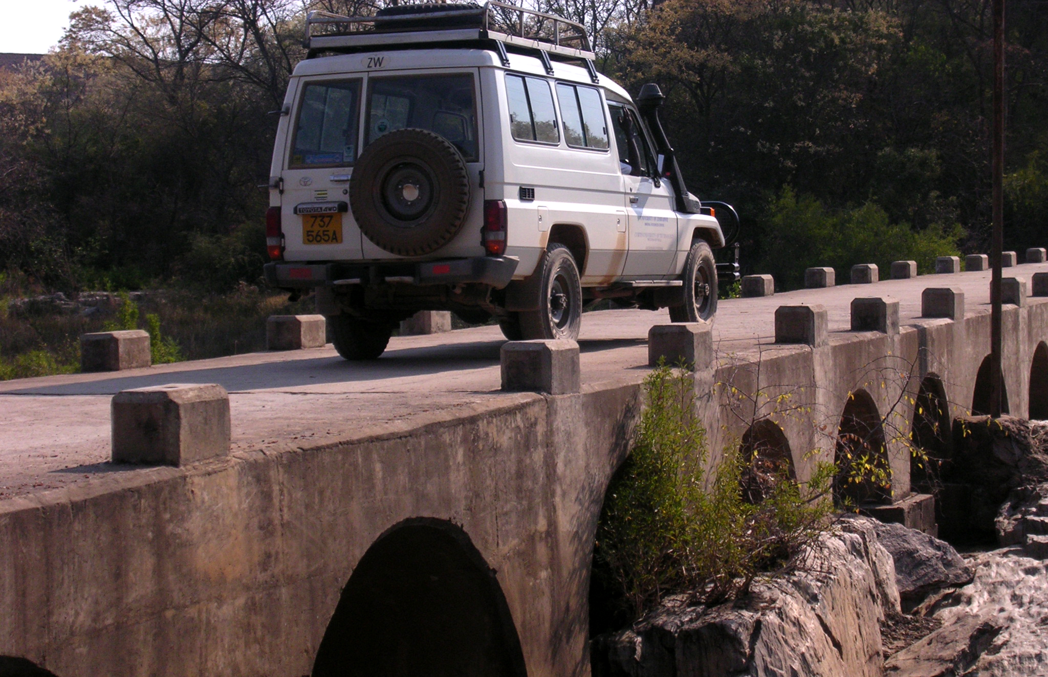
The Thuli River, former name Tuli River, is a major tributary of the Shashe River in Zimbabwe. It rises near Matopo Mission, Matobo District, and flows into the Shashe River near Tuli village. Hydrology The Thuli is an ephemeral river, with declining annual unit runoff. Major tributaries of the Thuli River include the Mtshabezi, Mtshelele, Sengezane river and Mwewe Rivers. The Thuli River below Thuli-Makwe Dam is a sand filled channel, with alluvial aquifers in the river channel.Görgens, A.H.M. and Boroto, R.A. 1997. Limpopo River: flow balance anomalies, surprises and implications for integrated water resources management. In: Proceedings of the 8th South African National Hydrology Symposium, Pretoria, South Africa. Towns along the river The Thuli River passes through no major settlements, only the following business centres: * Freda Mine * Guyu * Manama * Chelesa, Zimbabwe engezane Bridges and crossings There are five main bridges over the Mzingwane River: ... [...More Info...] [...Related Items...] OR: [Wikipedia] [Google] [Baidu] |
Gwanda
Gwanda is a town in Zimbabwe. It is the capital of the province of Matabeleland South, one of the ten administrative provinces in the country. It is also the district capital of Gwanda District, one of the seven administrative districts in the province. Location The town is located , by road, south east of the city of Bulawayo, Zimbabwe's second largest city. This location lies on the Bulawayo–Beitbridge Road and the Beitbridge Bulawayo Railway. The town of Beitbridge, at Zimbabwe's border with the Republic of South Africa, lies approximately , further southeast on Highway A-6. The coordinates of Gwanda, Zimbabwe are: 20°56'20.0"S, 29°01'07.0"E (Latitude:-20.938889; Longitude:29.018611). Gwanda sits at an average elevation of above mean sea level. Gwanda is known to have long, hot summers, and short, cool winters. Gwanda is also quite dry as compared to the rest of the country, and is therefore prone to drought. Overview Gwanda was founded in 1900 as a settlement of ... [...More Info...] [...Related Items...] OR: [Wikipedia] [Google] [Baidu] |
Kafusi
Kafusi is a ward in Gwanda District of Matabeleland South province in southern Zimbabwe Zimbabwe (), officially the Republic of Zimbabwe, is a landlocked country located in Southeast Africa, between the Zambezi and Limpopo Rivers, bordered by South Africa to the south, Botswana to the south-west, Zambia to the north, and .... Wards of Zimbabwe Gwanda District {{Zimbabwe-geo-stub ... [...More Info...] [...Related Items...] OR: [Wikipedia] [Google] [Baidu] |
Thuli River
The Thuli River, former name Tuli River, is a major tributary of the Shashe River in Zimbabwe. It rises near Matopo Mission, Matobo District, and flows into the Shashe River near Tuli village. Hydrology The Thuli is an ephemeral river, with declining annual unit runoff. Major tributaries of the Thuli River include the Mtshabezi, Mtshelele, Sengezane river and Mwewe Rivers. The Thuli River below Thuli-Makwe Dam is a sand filled channel, with alluvial aquifers in the river channel.Görgens, A.H.M. and Boroto, R.A. 1997. Limpopo River: flow balance anomalies, surprises and implications for integrated water resources management. In: Proceedings of the 8th South African National Hydrology Symposium, Pretoria, South Africa. Towns along the river The Thuli River passes through no major settlements, only the following business centres: * Freda Mine * Guyu * Manama * Chelesa, Zimbabwe engezane Bridges and crossings There are five main bridges over the Mzingwane River: ... [...More Info...] [...Related Items...] OR: [Wikipedia] [Google] [Baidu] |
Thuli–Manyange Dam
Thuli–Manyange (Elliot) Dam is proposed a reservoir on the Thuli River, south of Gwanda, Zimbabwe with a capacity of 33 million cubic metres. It is designed to be co-operated with Thuli–Moswa Dam Thuli–Moswa Dam is the name for a proposed reservoir on the Thuli River, south of Gwanda, Zimbabwe with a capacity of 419 million cubic metre The cubic metre (in Commonwealth English and international spelling as used by the International ...Chibi, T., Kandori, C. and Makone, B.F. 2005. Mzingwane Catchment Outline Plan. Zimbabwe National Water Authority, Bulawayo. References Thuli River Dams in Zimbabwe Shashe River Gwanda District Proposed infrastructure in Zimbabwe Proposed dams {{africa-dam-stub ... [...More Info...] [...Related Items...] OR: [Wikipedia] [Google] [Baidu] |
Thuli–Moswa Dam
Thuli–Moswa Dam is the name for a proposed reservoir on the Thuli River, south of Gwanda, Zimbabwe with a capacity of 419 million cubic metre The cubic metre (in Commonwealth English and international spelling as used by the International Bureau of Weights and Measures) or cubic meter (in American English) is the unit of volume in the International System of Units (SI). Its symbol is m ...s.Chibi, T., Kandori, C. and Makone, B.F. 2005. Mzingwane Catchment Outline Plan. Zimbabwe National Water Authority, Bulawayo. References Thuli River Dams in Zimbabwe Shashe River Proposed infrastructure in Zimbabwe Proposed dams {{Africa-dam-stub ... [...More Info...] [...Related Items...] OR: [Wikipedia] [Google] [Baidu] |
Vubachikwe
Vumbachigwe is a village and mine in the province of Matabeleland South, Zimbabwe. It is located about north-west of Gwanda. According to the 1982 Population Census, the village had a population of 2,077. The village grew up as the residential and commercial centre for the employees of the Vumbachigwegold Gold is a chemical element with the symbol Au (from la, aurum) and atomic number 79. This makes it one of the higher atomic number elements that occur naturally. It is a bright, slightly orange-yellow, dense, soft, malleable, and ductile met ... mine. Populated places in Matabeleland South Province Gold mines in Zimbabwe {{Zimbabwe-geo-stub ... [...More Info...] [...Related Items...] OR: [Wikipedia] [Google] [Baidu] |
Bulawayo
Bulawayo (, ; Ndebele: ''Bulawayo'') is the second largest city in Zimbabwe, and the largest city in the country's Matabeleland region. The city's population is disputed; the 2022 census listed it at 665,940, while the Bulawayo City Council claimed it to be about 1.2 million. Bulawayo covers an area of about in the western part of the country, along the Matsheumhlope River. Along with the capital Harare, Bulawayo is one of two cities in Zimbabwe that is also a province. Bulawayo was founded by a group led by Gundwane Ndiweni around 1840 as the kraal of Mzilikazi, the Ndebele king and was known as Gibixhegu. His son, Lobengula, succeeded him in the 1860s, and changed the name to kobulawayo and ruled from Bulawayo until 1893, when the settlement was captured by British South Africa Company soldiers during the First Matabele War. That year, the first white settlers arrived and rebuilt the town. The town was besieged by Ndebele warriors during the Second Matabele War. Bulawayo ... [...More Info...] [...Related Items...] OR: [Wikipedia] [Google] [Baidu] |
Mtshabezi Dam
Mtshabezi Dam is a reservoir on the Mtshabezi River, Zimbabwe, with a capacity of 11.4 million cubic metres. After the completion and commissioning of a pipeline linking it to Mzingwane Dam in 2013, Mtshabezi became the sixth dam supplying water to the city of Bulawayo Bulawayo (, ; Ndebele: ''Bulawayo'') is the second largest city in Zimbabwe, and the largest city in the country's Matabeleland region. The city's population is disputed; the 2022 census listed it at 665,940, while the Bulawayo City Council cl .... References Dams in Zimbabwe Shashe River {{Africa-dam-stub ... [...More Info...] [...Related Items...] OR: [Wikipedia] [Google] [Baidu] |
Thuli–Makwe Dam
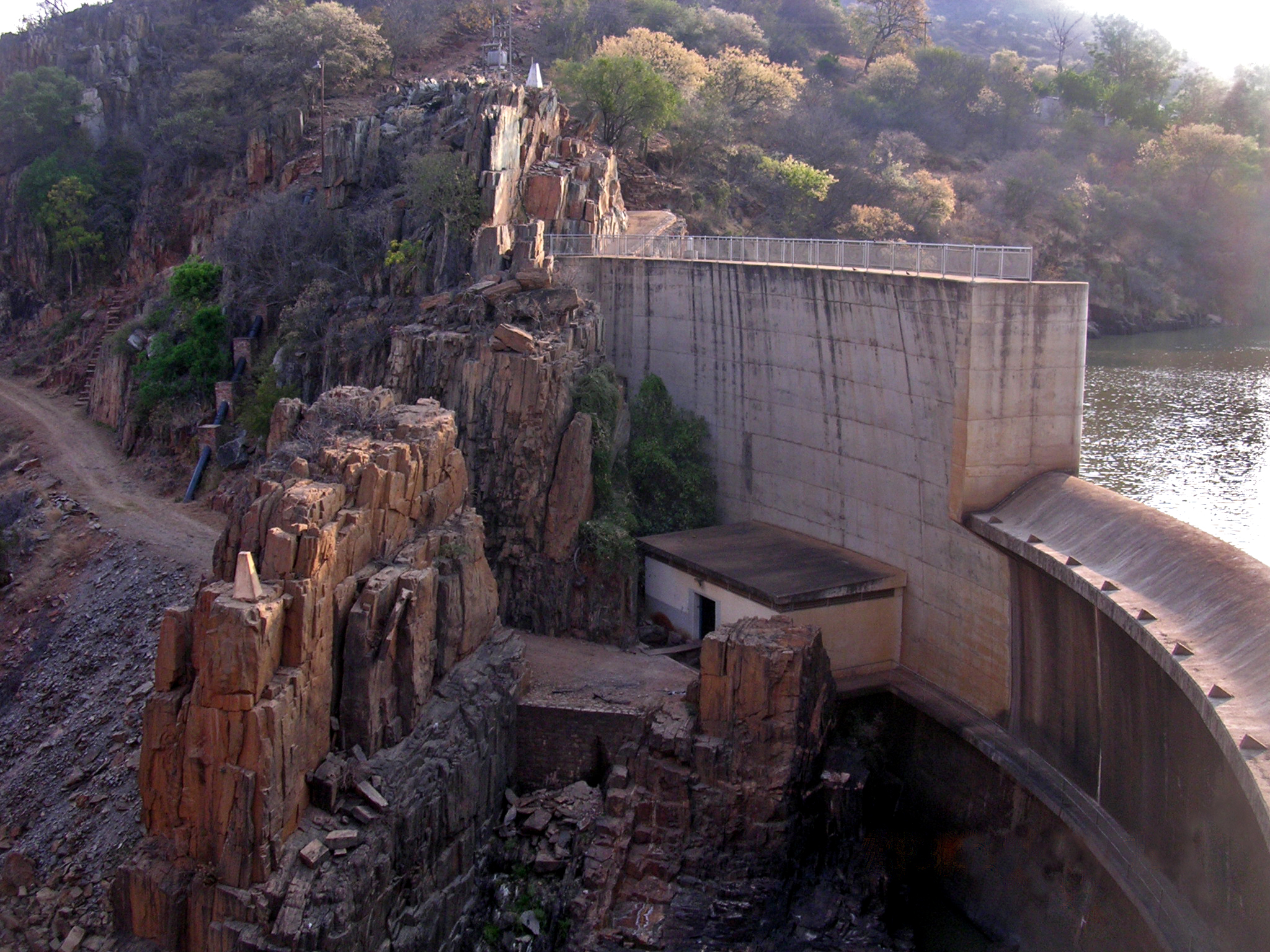
Thuli–Makwe Dam is a reservoir on the Thuli River, west of Gwanda, Zimbabwe with a capacity of 8.3 million cubic metre The cubic metre (in Commonwealth English and international spelling as used by the International Bureau of Weights and Measures) or cubic meter (in American English) is the unit of volume in the International System of Units (SI). Its symbol is m ...s.Chibi, T., Kandori, C. and Makone, B.F. 2005. Mzingwane Catchment Outline Plan. Zimbabwe National Water Authority, Bulawayo. References Thuli River Dams in Zimbabwe Shashe River Gwanda District Buildings and structures in Matabeleland South Province {{africa-dam-stub ... [...More Info...] [...Related Items...] OR: [Wikipedia] [Google] [Baidu] |
Weir
A weir or low head dam is a barrier across the width of a river that alters the flow characteristics of water and usually results in a change in the height of the river level. Weirs are also used to control the flow of water for outlets of lakes, ponds, and reservoirs. There are many weir designs, but commonly water flows freely over the top of the weir crest before cascading down to a lower level. Etymology There is no single definition as to what constitutes a weir and one English dictionary simply defines a weir as a small dam, likely originating from Middle English ''were'', Old English ''wer'', derivative of root of ''werian,'' meaning "to defend, dam". Function Commonly, weirs are used to prevent flooding, measure water discharge, and help render rivers more navigable by boat. In some locations, the terms dam and weir are synonymous, but normally there is a clear distinction made between the structures. Usually, a dam is designed specifically to impound water behind ... [...More Info...] [...Related Items...] OR: [Wikipedia] [Google] [Baidu] |
Cyclone Eline
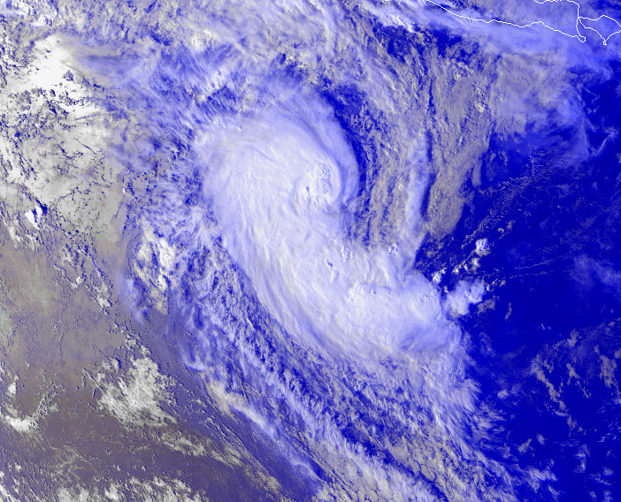
Intense Tropical Cyclone Leon–Eline was the second longest-lived cyclone in the Indian Ocean, behind Cyclone Freddy, traveling over during its 29-day track through the Indian Ocean, throughout the entire month of February. The cyclone formed on 1 February 2000, in the Australian basin as Tropical Cyclone Leon, and was tropical cyclone naming, renamed ''Eline'' after crossing 90th meridian east, 90° E into the South-West Indian Ocean tropical cyclone, South-West Indian Ocean; there, the Météo-France office in Réunion (MFR) tracked the storm's movement and intensity. Late on 17 February, Eline made landfall (meteorology), landfall near Mahanoro, Madagascar, with 10‑minute winds of . The storm rapidly weakened over land, but restrengthened in the Mozambique Channel to reach peak 10‑minute winds of , making it an Tropical cyclone scales#South-West Indian Ocean, intense tropical cyclone. On 22 February, Eline made landfall about south of Beira, Mozambique, near peak i ... [...More Info...] [...Related Items...] OR: [Wikipedia] [Google] [Baidu] |


