|
Tuggeranong Interchange
Tuggeranong Interchange is located in Tuggeranong Town Centre, Canberra. All services are operated by ACTION. It consists of 7 platforms and provides connections between bus routes servicing the District of Tuggeranong. The bus station is located next to South.Point Tuggeranong on a section of Pitman St between Holwell and Anketell Streets which is closed to regular vehicular traffic. History Tuggeranong bus station opened on 9 August 1991. In April 2019 it was renamed Tuggeranong Interchange. Services Tuggeranong Interchange is served by ACTION Action may refer to: * Action (narrative), a literary mode * Action fiction, a type of genre fiction * Action game, a genre of video game Film * Action film, a genre of film * ''Action'' (1921 film), a film by John Ford * ''Action'' (1980 fil ... services. References External links {{Canberra public transport, state=collapsed Bus stations in Australia Bus transport in Canberra Transport buildings and structures in the Au ... [...More Info...] [...Related Items...] OR: [Wikipedia] [Google] [Baidu] |
Tuggeranong Town Centre
Tuggeranong Town Centre services the southernmost Canberra district of Tuggeranong. It is located on the south-western side of Lake Tuggeranong and composed of a large two-storey mall called South.Point Tuggeranong, as well as smaller shopping complexes, the Homeworld, and Tuggeranong Shopping Square, and many other buildings and shops. It is also the location of the Tuggeranong Interchange, a youth centre, a bowling alley, Tuggeranong SkatePark, the Tuggeranong Arts Centre and Lake Tuggeranong College. History In the 1970s the National Capital Development Commission recommended that the service trades area of the Tuggeranong Town Centre and Mitchell be given priority over Jerrabomberra Jerrabomberra is a suburb of Queanbeyan in south eastern New South Wales, Australia. Jerrabomberra consists of three sections, The Park, The Heights, and Lakeview. The Park and the Heights are divided by Edwin Land Parkway. At the , it had 9, ... and West Belconnen. References Can ... [...More Info...] [...Related Items...] OR: [Wikipedia] [Google] [Baidu] |
Theodore, Australian Capital Territory
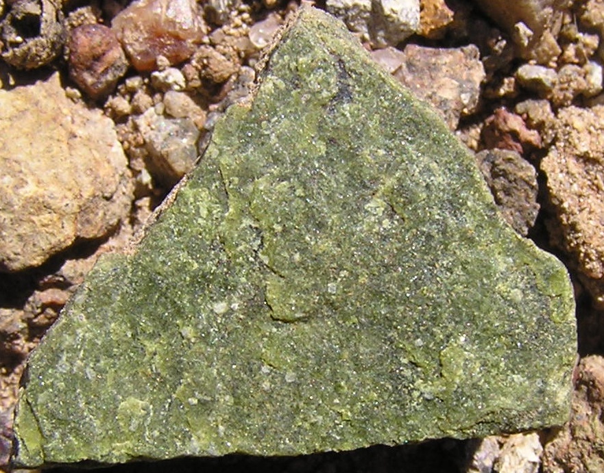
Theodore is a suburb in the Canberra, Australia district of Tuggeranong. The postcode is 2905. The suburb is named after Edward Granville Theodore (1884–1950), a Queensland premier and deputy Prime Minister. It was gazetted on 5 August 1975. Streets are named after people involved with the civilian war effort during the world wars. The main street through the suburb is named after Sir Lawrence Wackett KBE, DFC, AFC, who is widely regarded as the "father of the Australian aircraft industry". At the , Theodore had a population of 3,798 and had a median age of 36 compared to the Australian median age of 38. It is next to the suburbs of Conder and Calwell. It is bounded by the Monaro Highway and Tharwa drive. Located in the suburb is Theodore Primary School and a neighbourhood oval. It borders on Tuggeranong Hill and the Canberra Nature Park of Tuggeranong Hill nature reserve. Geology Deakin Volcanics of various kinds underlie the suburb. These are from the late Siluria ... [...More Info...] [...Related Items...] OR: [Wikipedia] [Google] [Baidu] |
Bus Stations In Australia
A bus (contracted from omnibus, with variants multibus, motorbus, autobus, etc.) is a road vehicle that carries significantly more passengers than an average car or van. It is most commonly used in public transport, but is also in use for charter purposes, or through private ownership. Although the average bus carries between 30 and 100 passengers, some buses have a capacity of up to 300 passengers. The most common type is the single-deck rigid bus, with double-decker and articulated buses carrying larger loads, and midibuses and minibuses carrying smaller loads. Coaches are used for longer-distance services. Many types of buses, such as city transit buses and inter-city coaches, charge a fare. Other types, such as elementary or secondary school buses or shuttle buses within a post-secondary education campus, are free. In many jurisdictions, bus drivers require a special large vehicle licence above and beyond a regular driving licence. Buses may be used for scheduled bus t ... [...More Info...] [...Related Items...] OR: [Wikipedia] [Google] [Baidu] |
City Interchange
City Interchange, formerly City Bus Station is located in the central business district of Canberra. It is a major connecting point for Transport Canberra services across the ACT, as well as commuter bus services to surrounding areas in New South Wales. Bus stands are located on Alinga Street, East Row and Mort Street, while light rail platforms are located in the median on Northbourne Avenue.City Interchange Transport Canberra The , which serves as a station for long-distance, interstate coach services is located to the west of Northbourne Avenue, within easy walking distance of all stands and platforms. History Cons ...[...More Info...] [...Related Items...] OR: [Wikipedia] [Google] [Baidu] |
Belconnen Town Centre
Belconnen Town Centre is located in the suburb of Belconnen on the south-western shore of Lake Ginninderra in Canberra, Australia. It is the town centre for the Belconnen district. Belconnen Town Centre contains several Federal and Territory government departments, as well as retail and commercial facilities. A large Westfield shopping mall is located within the centre as are many other smaller retail outlets including the Belconnen fresh food markets. The centre also contains several car dealerships. Residential apartments are located within the centre as well as in the surrounding parts of the suburb of Belconnen. The centre also contains a public library, health centre, town park, community facilities and a bus interchange. Belconnen Town Centre also offers events to local residents Government departments are housed in office buildings including the Benjamin Offices and award-winning Cameron Offices - an example of Brutalist architecture. These include the Department of Im ... [...More Info...] [...Related Items...] OR: [Wikipedia] [Google] [Baidu] |
R4 (Canberra)
Route R4 is a main cross-city bus route in Canberra, Australia operated by ACTION between Belconnen, City, Woden Town Centre and Tuggeranong.Route R4 Transport Canberra History The origins of the route can be traced back to the introduction by of bus services between and the growing |
Gowrie, Australian Capital Territory
Gowrie is a suburb of Canberra, Australia, located in the northern end of the Tuggeranong Valley. Tuggeranong suburbs are the southernmost of Australia's capital city. Gowrie is named after Brigadier-General Alexander Gore Arkwright Hore-Ruthven, 1st Earl of Gowrie (1872–1955), Governor-General of Australia from 1936 to 1944. Gowrie's streets are all named after members of the Australian Defence Force who won decorations, including the Victoria Cross. Gowrie is the former site of the Athllon Homestead. Demographics At the , Gowrie had a population of 3,140 people. The median age of people in Gowrie was 38 years, compared to a median age of 35 for Canberra. The median individual income for Gowrie in 2021 was $1,207, almost equal with the ACT median of $1,203, while the median household income was $2,228. In 2021, the median monthly housing loan repayment in Gowrie was $2,674. The residents of Gowrie are predominantly Australian born, with 77.4% being born in Australia. The m ... [...More Info...] [...Related Items...] OR: [Wikipedia] [Google] [Baidu] |
Richardson, Australian Capital Territory
Richardson is a suburb in the Canberra, Australia, district of Tuggeranong. The postcode is 2905. It was gazetted on 5 May 1975. Streets are named after writers, especially female writers. It is next to the suburbs of Calwell, Isabella Plains, Gowrie and Chisholm. It is bounded by Johnson Drive, Ashley Drive and Isabella Drive. This suburb is named after the novelist Ethel Florence Lindesay Richardson (1870–1946) who wrote under the pen name Henry Handel Richardson. Demographics At the , Richardson had a population of 3,058. The median age of people in Richardson was 36 years, compared to a median age of 35 for the ACT. The median weekly individual income for Richardson in 2021 was $1,012, compared to $1,203 for the ACT, while the median weekly household income was $2,043. In 2021, the median monthly housing loan repayment in Richardson was $2,000. The residents of Richardson are predominantly Australian born, with 75.6% being born in Australia. The three main countries of bi ... [...More Info...] [...Related Items...] OR: [Wikipedia] [Google] [Baidu] |
Chisholm, Australian Capital Territory
Chisholm () is a suburb in the Canberra, Australia district of Tuggeranong (district), Tuggeranong, named after Caroline Chisholm. It was gazetted on 5 August 1975, and streets are named after notable women. It is nearby suburbs of Gilmore, Australian Capital Territory, Gilmore, Fadden, Australian Capital Territory, Fadden, and Richardson, Australian Capital Territory, Richardson. It is bounded by Isabella Drive, and the Monaro Highway. Chisholm and Gilmore are separated by Simpsons Hill, which provides some wilderness with walking tracks over it, popular for walking dogs. Demographics At the , Chisholm had a population of 5,268 people. The median age of people in Chisholm was 37 years, compared to a median age of 35 for Canberra. The median weekly personal income for people aged 15 years and over in Chisholm in 2021 was $1,088, compared to the ACT median of $1,203, while the median weekly household income was $2,292. In 2021, the median monthly housing loan repayment in Chish ... [...More Info...] [...Related Items...] OR: [Wikipedia] [Google] [Baidu] |
Gordon, Australian Capital Territory
Gordon is a suburb in the Canberra, Australia district of Tuggeranong. The postcode is 2906. The suburb is named after the poet Adam Lindsay Gordon (1833–1870). It was gazetted on 12 March 1987. Streets are named after sportspersons, an example is Woodfull Loop, named after the captain of the Australia national cricket team during the Bodyline test series. It is next to the suburbs of Bonython, Conder and Banks. It is located on the west side of Tharwa Drive. Located in the suburb is the Point Hut Pond, with the Point Hut district park. Gordon has a primary school and neighbourhood oval. Geology Quaternary alluvium is found in south and center of Gordon. Deakin Volcanics rhyodacitic crystal tuff from the Silurian The Silurian ( ) is a geologic period and system spanning 24.6 million years from the end of the Ordovician Period, at million years ago ( Mya), to the beginning of the Devonian Period, Mya. The Silurian is the shortest period of the Paleozo ... age is ... [...More Info...] [...Related Items...] OR: [Wikipedia] [Google] [Baidu] |
Bonython, Australian Capital Territory
Bonython () is a suburb of Tuggeranong, a township in southern Canberra, capital city of Australia. History The suburb is named after Sir John Langdon Bonython, the owner of ''The Advertiser (Adelaide)'' who promoted Federation, and was a member of the first Australian parliament. Original concept plans for Tuggeranong indicate that the suburb was initially to be known as "Stranger". The name "Bonython" was declared when it was gazetted as a suburb of Canberra on 17 October 1986. Streets in Bonython are named after prominent South Australians, particularly journalists, and South Australian Districts and Rivers. Prior to 1986, the land upon which Bonython now sits was grazing land, mainly grassland with scattered eucalypt trees. By 1989 construction of houses and the Lower Stranger Pond water quality control pond began and Canberra’s newest suburb was born. On 18 January 2003 the disastrous Canberra bushfire reached Bonython late in the afternoon. By that time, the winds had ... [...More Info...] [...Related Items...] OR: [Wikipedia] [Google] [Baidu] |
Banks, Australian Capital Territory
Banks is a suburb in the Canberra, Australia district of Tuggeranong. It is the most southerly suburb of Canberra. The suburb is named after Sir Joseph Banks (1743–1820), the botanist who accompanied Captain James Cook to Botany Bay in 1770. The suburb was gazetted on 12 March 1987. The theme of the street names is botany or natural history. Banks is located adjacent to the suburbs of Conder and Gordon. It is bounded by Box Hill Avenue, Tom Roberts Avenue and Tharwa Drive. Located in the suburb is Beau and Jessi Park and the Banks Oval. The Rob Roy Nature Reserve, part of Canberra Nature Park, is a hilly region to the east of Banks that includes Mt Rob Roy. Nearer and also to the east of Banks is the smaller mountain Big Monks, accessible from Wollemi Place. Big Monks has a gliding stage near the top, allowing paragliders and hang-gliders to fly over the suburb of Banks. The suburb itself slopes gently to the west-northwest. There is a small shopping centre in the suburb, ... [...More Info...] [...Related Items...] OR: [Wikipedia] [Google] [Baidu] |


