|
Trout Lake (Colorado)
Trout Lake is a lake located in southeast San Miguel County, Colorado, in Uncompahgre National Forest. Trout Lake is a 15-minute drive from Ophir via Colorado State Highway 145 and a 30-minute drive from Telluride. History Trout Lake was originally explored by American fur-trappers and pioneers, who often used the lake as a stopping point for their expeditions. The population of Trout Lake grew after the construction of the Rio Grande Southern Railroad and the nearby Ames Hydroelectric Generating Plant in the 1890s. Early History While it is unknown if Spanish, Mexican, or Native American explorers reached Trout Lake previously, the first record of Trout Lake was taken by an American fur trapping expedition. In the spring of 1831, the St. Louis Fur Company employed a party of 60 men under the command of Colonel William G Walton to trap beavers and other fur-bearing animals along the headwaters of the San Juan River. The party spent the summer of 1833 in the valley of the ... [...More Info...] [...Related Items...] OR: [Wikipedia] [Google] [Baidu] |
United States
The United States of America (U.S.A. or USA), commonly known as the United States (U.S. or US) or America, is a country primarily located in North America. It consists of 50 states, a federal district, five major unincorporated territories, nine Minor Outlying Islands, and 326 Indian reservations. The United States is also in free association with three Pacific Island sovereign states: the Federated States of Micronesia, the Marshall Islands, and the Republic of Palau. It is the world's third-largest country by both land and total area. It shares land borders with Canada to its north and with Mexico to its south and has maritime borders with the Bahamas, Cuba, Russia, and other nations. With a population of over 333 million, it is the most populous country in the Americas and the third most populous in the world. The national capital of the United States is Washington, D.C. and its most populous city and principal financial center is New York City. Paleo-Americ ... [...More Info...] [...Related Items...] OR: [Wikipedia] [Google] [Baidu] |
San Juan River (Colorado River Tributary)
The San Juan River is a major tributary of the Colorado River in the Southwestern United States, providing the chief drainage for the Four Corners region of Colorado, New Mexico, Utah, and Arizona. Originating as snowmelt in the San Juan Mountains (part of the Rocky Mountains) of Colorado, it flows U.S. Geological Survey. National Hydrography Dataset high-resolution flowline dataThe National Map accessed March 21, 2011, through the deserts of northern New Mexico and southeastern Utah to join the Colorado River at Glen Canyon. The river drains a high, arid region of the Colorado Plateau. Along its length, it is often the only significant source of fresh water for many miles. The San Juan is also one of the muddiest rivers in North America, carrying an average of 25 million US tons (22.6 million t) of silt and sediment each year. Historically, the San Juan formed the border between the territory of the Navajo in the south and the Ute in the north. Although Europeans explored the Fo ... [...More Info...] [...Related Items...] OR: [Wikipedia] [Google] [Baidu] |
Acre-foot
The acre-foot is a non- SI unit of volume equal to about commonly used in the United States in reference to large-scale water resources, such as reservoirs, aqueducts, canals, sewer flow capacity, irrigation water, and river flows. An acre-foot equals approximately an eight-lane swimming pool, long, wide and deep. Definitions As the name suggests, an acre-foot is defined as the volume of one acre of surface area to a depth of one foot. Since an acre is defined as a chain by a furlong (i.e. ), an acre-foot is . There are two definitions of an acre-foot (differing by about 0.0006%), depending on whether the "foot" used is an "international foot" or a "U.S. survey foot". Application As a rule of thumb in US water management, one acre-foot is taken to be the planned annual water usage of a suburban family household. In some areas of the desert Southwest, where water conservation is followed and often enforced, a typical family uses only about 0.25 acre-foot of water ... [...More Info...] [...Related Items...] OR: [Wikipedia] [Google] [Baidu] |
Soil
Soil, also commonly referred to as earth or dirt, is a mixture of organic matter, minerals, gases, liquids, and organisms that together support life. Some scientific definitions distinguish ''dirt'' from ''soil'' by restricting the former term specifically to displaced soil. Soil consists of a solid phase of minerals and organic matter (the soil matrix), as well as a porous phase that holds gases (the soil atmosphere) and water (the soil solution). Accordingly, soil is a three-state system of solids, liquids, and gases. Soil is a product of several factors: the influence of climate, relief (elevation, orientation, and slope of terrain), organisms, and the soil's parent materials (original minerals) interacting over time. It continually undergoes development by way of numerous physical, chemical and biological processes, which include weathering with associated erosion. Given its complexity and strong internal connectedness, soil ecologists regard soil as an ecosystem. Most ... [...More Info...] [...Related Items...] OR: [Wikipedia] [Google] [Baidu] |
Dam Failure
A dam failure or dam burst is a catastrophic type of structural failure characterized by the sudden, rapid, and uncontrolled release of impounded water or the likelihood of such an uncontrolled release. Between the years 2000 and 2009 more than 200 notable dam failures happened worldwide. A dam is a barrier across flowing water that obstructs, that directs or slows down the flow, often creating a reservoir, lake or impoundments. Most dams have a section called a ''spillway or weir'' over or through which water flows, either intermittently or continuously, and some have hydroelectricity, hydroelectric power generation systems installed. Dams are considered "installations containing dangerous forces" under International humanitarian law due to the massive impact of a possible destruction on the civilian population and the environment. Dam failures are comparatively rare, but can cause immense damage and loss of life when they occur. In 1975 the 1975 Banqiao Dam failure, failure of ... [...More Info...] [...Related Items...] OR: [Wikipedia] [Google] [Baidu] |
Penstock
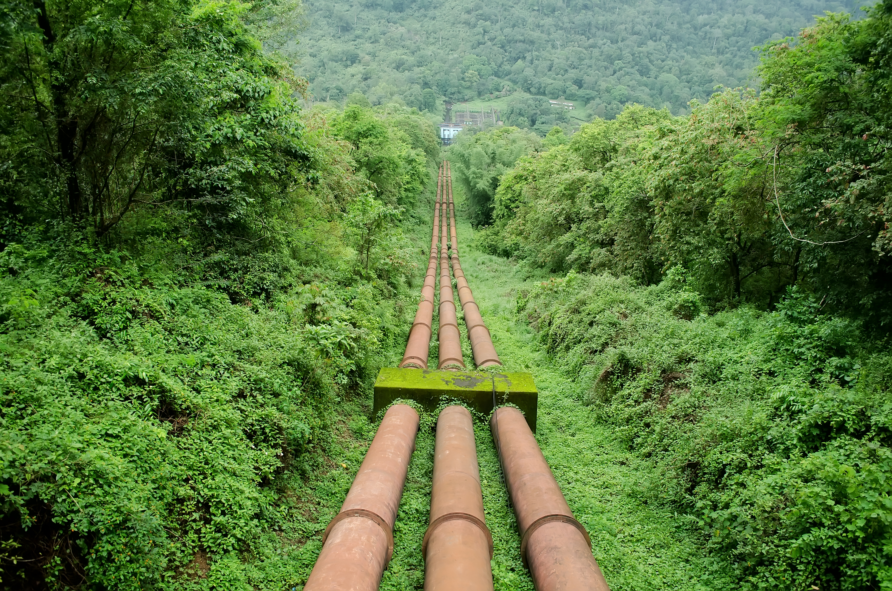
A penstock is a sluice or gate or intake structure that controls water flow, or an enclosed pipe that delivers water to hydro turbines and sewerage systems. The term is inherited from the earlier technology of mill ponds and watermills. Hydroelectric systems and dams Penstocks for hydroelectric installations are normally equipped with a gate system and a surge tank. They can be a combination of many components such as anchor block, drain valve, air bleed valve, and support piers depending on the application. Flow is regulated by turbine operation and is nil when turbines are not in service. Penstocks, particularly where used in polluted water systems, need to be maintained by hot water washing, manual cleaning, antifouling coatings, and desiccation. The term is also used in irrigation dams to refer to the channels leading to and from high-pressure sluice gates. Penstocks are also used in mine tailings dam construction. The penstock is usually situated fairly close to the ... [...More Info...] [...Related Items...] OR: [Wikipedia] [Google] [Baidu] |
Concrete
Concrete is a composite material composed of fine and coarse aggregate bonded together with a fluid cement (cement paste) that hardens (cures) over time. Concrete is the second-most-used substance in the world after water, and is the most widely used building material. Its usage worldwide, ton for ton, is twice that of steel, wood, plastics, and aluminum combined. Globally, the ready-mix concrete industry, the largest segment of the concrete market, is projected to exceed $600 billion in revenue by 2025. This widespread use results in a number of environmental impacts. Most notably, the production process for cement produces large volumes of greenhouse gas emissions, leading to net 8% of global emissions. Other environmental concerns include widespread illegal sand mining, impacts on the surrounding environment such as increased surface runoff or urban heat island effect, and potential public health implications from toxic ingredients. Significant research and development is ... [...More Info...] [...Related Items...] OR: [Wikipedia] [Google] [Baidu] |
San Juan National Forest
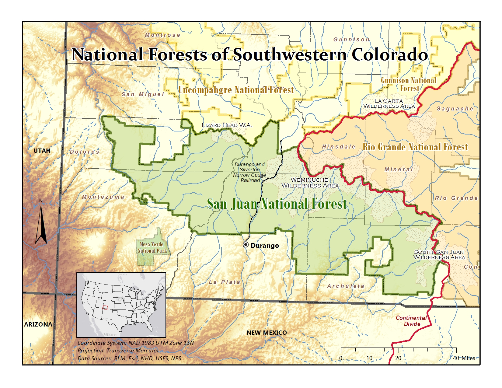
The San Juan National Forest is a U.S. National Forest covering over 1,878,846 acres (2,935.7 sq mi, or 7,603.42 km²) in western Colorado. The forest occupies land in Archuleta, Conejos, Dolores, Hinsdale, La Plata, Mineral, Montezuma, Rio Grande, San Miguel and San Juan Counties. It borders the Uncompahgre National Forest to the north and the Rio Grande National Forest to the east. The forest covers most of the southern portion of the San Juan Mountains west of the Continental Divide. The forest contains two alpine wilderness areas; the Weminuche and South San Juan, as well as the Piedra Area. The Durango and Silverton Narrow Gauge Railroad passes through the National Forest. The name of the forest comes from the San Juan River, which was originally called the Rio San Juan, after Saint John the Baptist (San Juan Bautista in Spanish). History Theodore Roosevelt created the forest by proclamation on June 3, 1905. Forest headquarters are located in Durango ... [...More Info...] [...Related Items...] OR: [Wikipedia] [Google] [Baidu] |
United States National Forest
In the United States, national forest is a classification of protected area, protected and managed federal lands. National forests are largely forest and woodland areas owned collectively by the American people through the Federal government of the United States, federal government, and managed by the United States Forest Service, a division of the United States Department of Agriculture. The U.S. Forest Service is also a forestry research organization who provides financial assistance to state and local forestry industry. As of 2020, there are List of U.S. National Forests, 154 national forests in the United States. History The National Forest System (NFS) was created by the Land Revision Act of 1891, which was enacted during the presidency of Benjamin Harrison. This act took land to form United States National Park, national parks in the West, including 15 reserves containing more than 13 million acres of land. At first one would be called a Forest Reserve; a later one w ... [...More Info...] [...Related Items...] OR: [Wikipedia] [Google] [Baidu] |
Theodore Roosevelt
Theodore Roosevelt Jr. ( ; October 27, 1858 – January 6, 1919), often referred to as Teddy or by his initials, T. R., was an American politician, statesman, soldier, conservationist, naturalist, historian, and writer who served as the 26th president of the United States from 1901 to 1909. He previously served as the 25th vice president of the United States, vice president under President William McKinley from March to September 1901 and as the 33rd governor of New York from 1899 to 1900. Assuming the presidency after Assassination of William McKinley, McKinley's assassination, Roosevelt emerged as a leader of the History of the Republican Party (United States), Republican Party and became a driving force for United States antitrust law, anti-trust and Progressive Era, Progressive policies. A sickly child with debilitating asthma, he overcame his health problems as he grew by embracing The Strenuous Life, a strenuous lifestyle. Roosevelt integrated his exuberant personalit ... [...More Info...] [...Related Items...] OR: [Wikipedia] [Google] [Baidu] |
Montezuma National Forest
Montezuma National Forest was established as the Montezuma Forest Reserve by the U.S. Forest Service in Colorado on June 13, 1905 with . It became a National Forest on March 4, 1907. On July 1, 1908 part of Ouray National Forest was added. On July 1, 1947 the entire forest was divided between San Juan National Forest and Uncompahgre National Forest and the name was discontinued. References External linksForest History Society (from the Forest History Society
The Forest History Society is an ...
[...More Info...] [...Related Items...] OR: [Wikipedia] [Google] [Baidu] |

_Teton_Dam_Flood_-_Newdale.jpg)


