|
Tropical Storm Ana (2015)
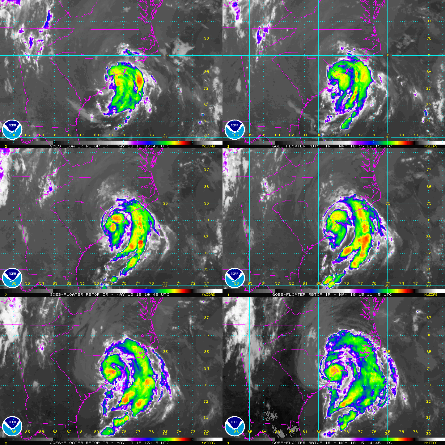
Tropical Storm Ana was the first named storm of the 2015 Atlantic hurricane season. A pre-season system, it became the earliest United States–landfalling tropical cyclone on record. It developed as a subtropical cyclone from a non-tropical low north of the Bahamas, and intensified to attain peak winds of before transitioning into a fully tropical cyclone early on May 9. Sustained in part by the warm waters of the Gulf Stream, Ana made landfall along the northeast coast of South Carolina early the next morning. Overall, damage from the storm was minor. Heavy rainfall and gusty winds affected parts of the Carolinas, and some vulnerable beaches endured coastal flooding and several feet of erosion. Gusty winds damaged trees and powerlines, causing sporadic power outages, and a weak tornado was reported in association with Ana. In North Carolina, two deaths—one direct and one indirect—were attributed to the storm. Meteorological history In the first week of May 2015 ... [...More Info...] [...Related Items...] OR: [Wikipedia] [Google] [Baidu] |
South Carolina
)''Animis opibusque parati'' ( for, , Latin, Prepared in mind and resources, links=no) , anthem = " Carolina";" South Carolina On My Mind" , Former = Province of South Carolina , seat = Columbia , LargestCity = Charleston , LargestMetro = Greenville (combined and metro) Columbia (urban) , BorderingStates = Georgia, North Carolina , OfficialLang = English , population_demonym = South Carolinian , Governor = , Lieutenant Governor = , Legislature = General Assembly , Upperhouse = Senate , Lowerhouse = House of Representatives , Judiciary = South Carolina Supreme Court , Senators = , Representative = 6 Republicans1 Democrat , postal_code = SC , TradAbbreviation = S.C. , area_rank = 40th , area_total_sq_mi = 32,020 , area_total_km2 = 82,932 , area_land_sq_mi = 30,109 , area_land_km2 = 77,982 , area_water_sq_mi = 1,911 , area_water_km2 = 4,949 , area_water_percent = 6 , population_rank = 23rd , population_as_of = 2022 , 2010Pop = 5282634 , population ... [...More Info...] [...Related Items...] OR: [Wikipedia] [Google] [Baidu] |
Cyclogenesis
Cyclogenesis is the development or strengthening of cyclonic circulation in the atmosphere (a low-pressure area). Cyclogenesis is an umbrella term for at least three different processes, all of which result in the development of some sort of cyclone, and at any size from the microscale to the synoptic scale. * Tropical cyclones form due to latent heat driven by significant thunderstorm activity, developing a warm core. * Extratropical cyclones form as waves along weather fronts before occluding later in their life cycle as cold core cyclones. * Mesocyclones form as warm core cyclones over land, and can lead to tornado formation. Waterspouts can also form from mesocyclones, but more often develop from environments of high instability and low vertical wind shear. The process in which an extratropical cyclone undergoes a rapid drop in atmospheric pressure (24 millibars or more) in a 24-hour period is referred to as explosive cyclogenesis, and is usually present during the formation ... [...More Info...] [...Related Items...] OR: [Wikipedia] [Google] [Baidu] |
North Myrtle Beach, South Carolina
North Myrtle Beach is a city in Horry County, South Carolina, United States. It was created in 1968 from four existing municipalities, and is located about northeast of Myrtle Beach. It serves as one of the primary tourist destinations along the Grand Strand. As of the 2010 census, the population was 13,752, and in 2019 the estimated population was 16,819. It is part of the Myrtle Beach–Conway–North Myrtle Beach Metropolitan Area, which had a combined population of 449,295 as of 2016. History In 1737, William Gause obtained a grant to of land near Windy Hill Beach. He farmed the area and also established a tavern for travelers along the Kings Highway. North Myrtle Beach was created in 1968 with the consolidation of Cherry Grove Beach, Crescent Beach, Ocean Drive Beach, and Windy Hill Beach. Geography North Myrtle Beach is located in eastern Horry County. It is bordered to the southwest by Briarcliffe Acres and to the northeast by Little River. Via U.S. Route 17, it ... [...More Info...] [...Related Items...] OR: [Wikipedia] [Google] [Baidu] |
Landfall (meteorology)
Landfall is the event of a storm moving over land after being over water. More broadly, and in relation to human travel, it refers to 'the first land that is reached or seen at the end of a journey across the sea or through the air, or the fact of arriving there. Tropical cyclone A tropical cyclone is classified as making landfall when the center of the storm moves across the coast; in a relatively strong tropical cyclone, this is when the eye moves over land. This is where most of the damage occurs within a mature tropical cyclone, such as a typhoon or hurricane, as most of the damaging aspects of these systems are concentrated near the eyewall. Such effects include the peaking of the storm surge, the core of strong winds coming ashore, and heavy flooding rains. These coupled with high surf can cause major beach erosion. When a tropical cyclone makes landfall, the eye usually closes in upon itself due to negative environmental factors over land, such as friction with th ... [...More Info...] [...Related Items...] OR: [Wikipedia] [Google] [Baidu] |
Continental Shelf
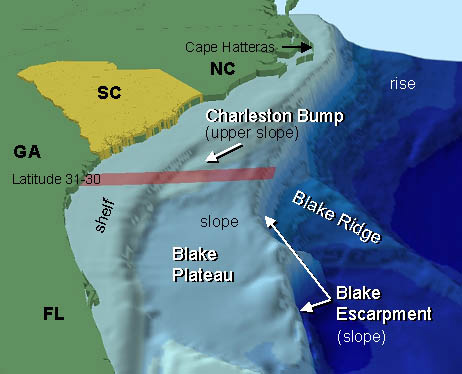
A continental shelf is a portion of a continent that is submerged under an area of relatively shallow water, known as a shelf sea. Much of these shelves were exposed by drops in sea level during glacial periods. The shelf surrounding an island is known as an ''insular shelf''. The continental margin, between the continental shelf and the abyssal plain, comprises a steep continental slope, surrounded by the flatter continental rise, in which sediment from the continent above cascades down the slope and accumulates as a pile of sediment at the base of the slope. Extending as far as 500 km (310 mi) from the slope, it consists of thick sediments deposited by turbidity currents from the shelf and slope. The continental rise's gradient is intermediate between the gradients of the slope and the shelf. Under the United Nations Convention on the Law of the Sea, the name continental shelf was given a legal definition as the stretch of the seabed adjacent to the shores of a par ... [...More Info...] [...Related Items...] OR: [Wikipedia] [Google] [Baidu] |
Weather Radar
Weather radar, also called weather surveillance radar (WSR) and Doppler weather radar, is a type of radar used to locate precipitation, calculate its motion, and estimate its type (rain, snow, hail etc.). Modern weather radars are mostly pulse-Doppler radars, capable of detecting the motion of rain droplets in addition to the intensity of the precipitation. Both types of data can be analyzed to determine the structure of storms and their potential to cause severe weather. During World War II, radar operators discovered that weather was causing echoes on their screen, masking potential enemy targets. Techniques were developed to filter them, but scientists began to study the phenomenon. Soon after the war, surplus radars were used to detect precipitation. Since then, weather radar has evolved on its own and is now used by national weather services, research departments in universities, and in television stations' weather departments. Raw images are routinely used and speciali ... [...More Info...] [...Related Items...] OR: [Wikipedia] [Google] [Baidu] |
Wind Shear
Wind shear (or windshear), sometimes referred to as wind gradient, is a difference in wind speed and/or direction over a relatively short distance in the atmosphere. Atmospheric wind shear is normally described as either vertical or horizontal wind shear. Vertical wind shear is a change in wind speed or direction with a change in altitude. Horizontal wind shear is a change in wind speed with a change in lateral position for a given altitude. Wind shear is a microscale meteorological phenomenon occurring over a very small distance, but it can be associated with mesoscale or synoptic scale weather features such as squall lines and cold fronts. It is commonly observed near microbursts and downbursts caused by thunderstorms, fronts, areas of locally higher low-level winds referred to as low-level jets, near mountains, radiation inversions that occur due to clear skies and calm winds, buildings, wind turbines, and sailboats. Wind shear has significant effects on the control of a ... [...More Info...] [...Related Items...] OR: [Wikipedia] [Google] [Baidu] |
Millibars
The bar is a metric unit of pressure, but not part of the International System of Units (SI). It is defined as exactly equal to 100,000 Pa (100 kPa), or slightly less than the current average atmospheric pressure on Earth at sea level (approximately 1.013 bar). By the barometric formula, 1 bar is roughly the atmospheric pressure on Earth at an altitude of 111 metres at 15 °C. The bar and the millibar were introduced by the Norwegian meteorologist Vilhelm Bjerknes, who was a founder of the modern practice of weather forecasting. The International System of Units, despite previously mentioning the bar, now omits any mention of it.. The bar has been legally recognised in countries of the European Union since 2004.British Standard BS 350:2004 ''Conversion Factors for Units''. The US National Institute of Standards and Technology (NIST) deprecates its use except for "limited use in meteorology" and lists it as one of several units that "must not be introduced ... [...More Info...] [...Related Items...] OR: [Wikipedia] [Google] [Baidu] |
Maximum Sustained Winds
The maximum sustained wind associated with a tropical cyclone is a common indicator of the intensity of the storm. Within a mature tropical cyclone, it is found within the eyewall at a distance defined as the radius of maximum wind, or RMW. Unlike gusts, the value of these winds are determined via their sampling and averaging the sampled results over a period of time. Wind measuring has been standardized globally to reflect the winds at above the Earth's surface, and the maximum sustained wind represents the highest average wind over either a one-minute (US) or ten-minute time span (see the definition, below), anywhere within the tropical cyclone. Surface winds are highly variable due to friction between the atmosphere and the Earth's surface, as well as near hills and mountains over land. Over the ocean, satellite imagery determines the value of the maximum sustained winds within a tropical cyclone. Land, ship, aircraft reconnaissance observations, and radar imagery can ... [...More Info...] [...Related Items...] OR: [Wikipedia] [Google] [Baidu] |
Rainband
A rainband is a cloud and precipitation structure associated with an area of rainfall which is significantly elongated. Rainbands can be stratiform or convective, and are generated by differences in temperature. When noted on weather radar imagery, this precipitation elongation is referred to as banded structure. Rainbands within tropical cyclones are curved in orientation. Rainbands of tropical cyclones contain showers and thunderstorms that, together with the eyewall and the eye, constitute a hurricane or tropical storm. The extent of rainbands around a tropical cyclone can help determine the cyclone's intensity. Rainbands spawned near and ahead of cold fronts can be squall lines which are able to produce tornadoes. Rainbands associated with cold fronts can be warped by mountain barriers perpendicular to the front's orientation due to the formation of a low-level barrier jet. Bands of thunderstorms can form with sea breeze and land breeze boundaries, if enough moisture ... [...More Info...] [...Related Items...] OR: [Wikipedia] [Google] [Baidu] |
Block (meteorology)
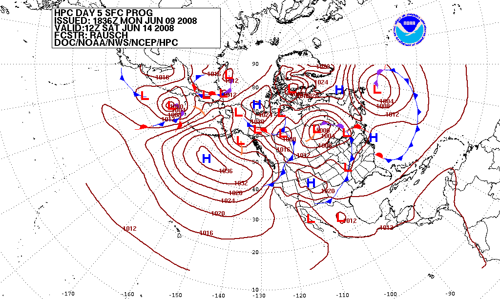
Blocks in meteorology are large-scale patterns in the atmospheric pressure field that are nearly stationary, effectively "blocking" or redirecting migratory cyclones. They are also known as blocking highs or blocking anticyclones.Glossary of Meteorology, Second Edition; American Meteorological Society, 2000; . These blocks can remain in place for several days or even weeks, causing the areas affected by them to have the same kind of weather for an extended period of time (e.g. precipitation for some areas, clear skies for others). In the Northern Hemisphere, extended blocking occurs most frequently in the spring over the eastern Pacific and Atlantic Oceans. Whilst these events are linked to the occurrence of extreme weather events such as heat waves, particularly the onset and decay of these events is still not well captured in numerical weather forecasts and remains an open area of research. Impact of the polar vortex Polar cyclones are climatological features which hover nea ... [...More Info...] [...Related Items...] OR: [Wikipedia] [Google] [Baidu] |


