|
Treaty Of Fort McIntosh
The Treaty of Fort McIntosh was a treaty between the United States government and representatives of the Wyandotte, Delaware, Chippewa and Ottawa nations of Native Americans. The treaty was signed at Fort McIntosh (present Beaver, Pennsylvania) on January 21, 1785. It contained 10 articles and an addendum. In a follow up to the Treaty of Fort Stanwix (1784), where the Seneca nation had given up claims in the eastern extension of Ohio Country in northern Pennsylvania, the American government sought a treaty with the remaining tribes having claims in the Ohio Country. The United States sent a team of diplomats including George Rogers Clark, Richard Butler, and Arthur Lee to negotiate a new treaty. In January 1785, the representatives of the two sides met at Fort McIntosh at the confluence of the Ohio and Beaver Rivers. Most of the Native Americans who signed the treaty were not given authority by their nations to make negotiations. Connecticut (Western Reserve in the northeas ... [...More Info...] [...Related Items...] OR: [Wikipedia] [Google] [Baidu] |
Wyandot People
The Wyandot people, or Wyandotte and Waⁿdát, are Indigenous peoples of the Northeastern Woodlands. The Wyandot are Iroquoian Indigenous peoples of North America who emerged as a confederacy of tribes around the north shore of Lake Ontario with their original homeland extending to Georgian Bay of Lake Huron and Lake Simcoe in Ontario, Canada and occupying some territory around the western part of the lake. The Wyandot, not to be mistaken for the Huron-Wendat, predominantly descend from the Tionontati tribe. The Tionontati (or Tobacco/Petun people) never belonged to the Huron (Wendat) Confederacy. However, the Wyandot(te) have connections to the Wendat-Huron through their lineage from the Attignawantan, the founding tribe of the Huron. The four Wyandot(te) Nations are descended from remnants of the Tionontati, Attignawantan and Wenrohronon (Wenro), that were "all unique independent tribes, who united in 1649-50 after being defeated by the Iroquois Confederacy." After thei ... [...More Info...] [...Related Items...] OR: [Wikipedia] [Google] [Baidu] |
Fort Laurens
Fort Laurens was an American Revolutionary War fort on a northern tributary of the Muskingum River in what would become Northeast Ohio, United States. The fort's location is in the present-day town of Bolivar, Ohio, along the Ohio and Erie Canal Towpath Trail. Overview The fort was built by General Lachlan McIntosh, in early December, 1778, on the west bank of the Tuscarawas River, now in Tuscarawas County near the town of Bolivar. It was named after Henry Laurens, a president of the Continental Congress from South Carolina. The fort was used as a reference point in defining the boundary line in Treaty of Greenville, although the text of the treaty misspells the name as "Fort Lawrence". The fort was intended to be a staging point for an attack against the British garrison at Detroit. However, the conditions at the fort were harsh during the winter, and McIntosh removed most of the American forces to Fort Pitt, leaving only about 150 men (from the 8th Pennsylvania Regimen ... [...More Info...] [...Related Items...] OR: [Wikipedia] [Google] [Baidu] |
Firelands
The Firelands, or Sufferers' Lands, tract was located at the western end of the Connecticut Western Reserve in what is now the U.S. state of Ohio. It was legislatively established in 1792, as the "Sufferers' Lands", and later became named "Fire Lands" because the resale of the land was intended as financial restitution for residents of the Connecticut towns of Danbury, Fairfield, Greenwich, Groton, New Haven, New London, Norwalk, and Ridgefield. Their homes had been burned in 1779 and 1781 by British forces during the American Revolutionary War. However, most of the settlement of the area did not occur until after the War of 1812. "Fire Lands" was later spelled as one word: "Firelands." History In 1792 the Connecticut legislature set aside 500,000 acres (2,000 km2), at the western end of the "Western Reserve" for the Connecticut "Sufferers". The area consisted of nearly all of the present-day Huron and Erie counties, as well as Danbury Township (Marblehead Peninsula) ... [...More Info...] [...Related Items...] OR: [Wikipedia] [Google] [Baidu] |
Treaty Of Fort Harmar
The Treaty of Fort Harmar (1789) was an agreement between the United States government and numerous Native American tribes with claims to the Northwest Territory. History The Treaty of Fort Harmar was signed at Fort Harmar, near present-day Marietta, Ohio, on January 9, 1789. Representatives of the Iroquois Six Nations and other groups, including the Wyandot, Delaware, Ottawa, Chippewa, Potawatomi and Sauk met with Arthur St. Clair, the governor of the Northwest Territory, and other American leaders such as Josiah Harmar and Richard Butler. The treaty was supposed to address issues remaining since the 1784 Treaty of Fort Stanwix and the 1785 Treaty of Fort McIntosh; but, the new agreement did little more than reiterate the terms of those two previous documents with a few minor changes. The negotiations and document failed to address the most important grievances of the tribes, namely, the settlement of New Englanders in the Firelands portions of the Western Reserve, an a ... [...More Info...] [...Related Items...] OR: [Wikipedia] [Google] [Baidu] |
List Of United States Treaties
This is a list of treaties to which the United States has been a party or which have had direct relevance to U.S. history. Pre-Revolutionary War treaties Before the United States Declaration of Independence in 1776, the sovereign of the United Kingdom and the leaders of various North American colonies negotiated treaties that affected the territory of what would later become the United States. * 1638 - Treaty of Hartford (1638) * 1646 – Treaty of 1646 * 1677 – Treaty of 1677 * 1701 – Nanfan Treaty * 1722 – Great Treaty of 1722 * 1726 – Deed in Trust from Three of the Five Nations of Indians to the Chancellor * 1744 – Treaty of Lancaster * 1752 – Treaty of Logstown * 1754 – Treaty of Albany * 1758 – Treaty of Easton * 1760 – Treaty of Pittsburgh * 1763 – Treaty of Paris * 1768 – Treaty of Hard Labour * 1768 – Treaty of Fort Stanwix * 1770 – Treaty of Lochaber * 1774 – Treaty of Camp Charlotte U.S. international treaties These are treaties that t ... [...More Info...] [...Related Items...] OR: [Wikipedia] [Google] [Baidu] |
Treaty Of Greenville
The Treaty of Greenville, formally titled Treaty with the Wyandots, etc., was a 1795 treaty between the United States and indigenous nations of the Northwest Territory (now Midwestern United States), including the Wyandot and Delaware peoples, that redefined the boundary between indigenous peoples' lands and territory for European American community settlement. It was signed at Fort Greenville, now Greenville, Ohio, on August 3, 1795, following the Native American loss at the Battle of Fallen Timbers a year earlier. It ended the Northwest Indian War in the Ohio Country, limited Indian country to northwestern Ohio, and began the practice of annual payments following the land concessions. The parties to the treaty were a coalition of Native American tribes known as the Western Confederacy, and the United States government represented by General Anthony Wayne and local frontiersmen. The treaty became synonymous with the end of the frontier in that part of the Northwest Territo ... [...More Info...] [...Related Items...] OR: [Wikipedia] [Google] [Baidu] |
Northwest Indian War
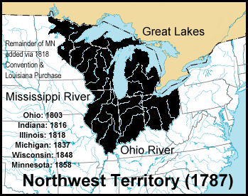
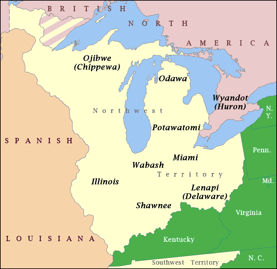
The Northwest Indian War (1786–1795), also known by other names, was an armed conflict for control of the Northwest Territory fought between the United States and a united group of Native American nations known today as the Northwestern Confederacy. The United States Army considers it the first of the American Indian Wars. Following centuries of conflict for control of this region, it was granted to the new United States by the Kingdom of Great Britain in article 2 of the Treaty of Paris, which ended the American Revolutionary War. The treaty used the Great Lakes as a border between British territory and the United States. This granted significant territory to the United States, initially known as the Ohio Country and the Illinois Country, which had previously been prohibited to new settlements. However, numerous Native American peoples inhabited this region, and the British maintained a military presence and continued policies that supported their Native allies. With t ... [...More Info...] [...Related Items...] OR: [Wikipedia] [Google] [Baidu] |
Western Confederacy
The Northwestern Confederacy, or Northwestern Indian Confederacy, was a loose confederacy of Native Americans in the Great Lakes region of the United States created after the American Revolutionary War. Formally, the confederacy referred to itself as the United Indian Nations, at their Confederate Council. It was known infrequently as the Miami Confederacy since many contemporaneous federal officials overestimated the influence and numerical strength of the Miami tribes based on the size of their principal city, Kekionga. The confederacy, which had its roots in pan-tribal movements dating to the 1740s, formed in an attempt to resist the expansion of the United States and the encroachment of American settlers into the Northwest Territory after Great Britain ceded the region to the U.S. in the 1783 Treaty of Paris. American expansion resulted in the Northwest Indian War (1785–1795), in which the Confederacy won significant victories over the United States, but concluded with ... [...More Info...] [...Related Items...] OR: [Wikipedia] [Google] [Baidu] |
Fort Michilimackinac
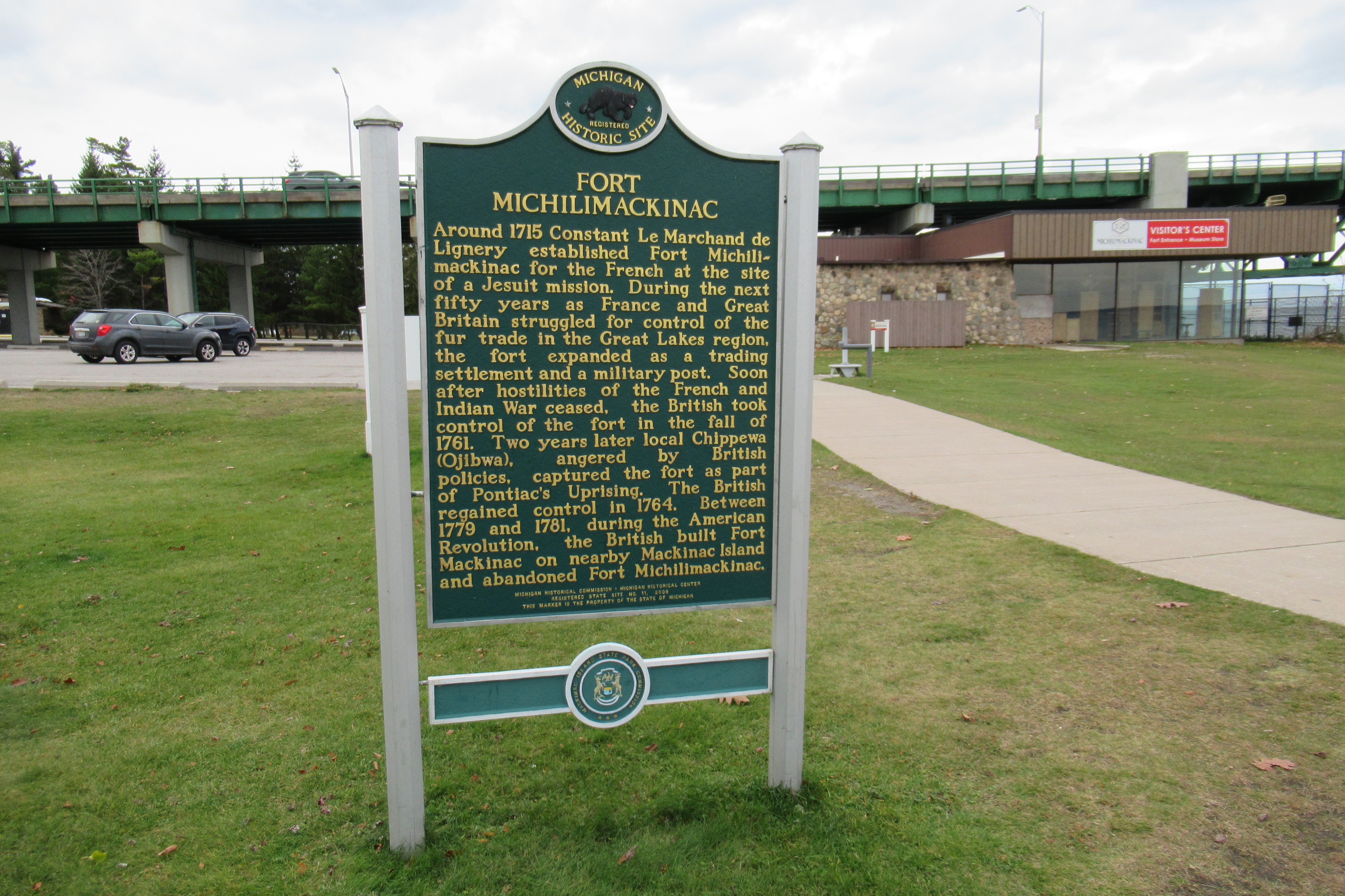
Fort Michilimackinac was an 18th-century French, and later British, fort and trading post at the Straits of Mackinac; it was built on the northern tip of the lower peninsula of the present-day state of Michigan in the United States. Built around 1715, and abandoned in 1783, it was located along the Straits, which connect Lake Huron and Lake Michigan of the Great Lakes of North America. The present-day village of Mackinaw City developed around the site of the fort, which has been designated as a National Historic Landmark. It is preserved as an open-air historical museum, with several reconstructed wooden buildings and palisade, and is now part of Fort Michilimackinac State Park. History The primary purpose of the fort was as part of the French-Canadian trading post system, which stretched from the Atlantic Coast and the St. Lawrence River to the Great Lakes, and south to the Mississippi River through the Illinois Country. The fort served as a supply depot for traders in the ... [...More Info...] [...Related Items...] OR: [Wikipedia] [Google] [Baidu] |
Fort Shelby (Michigan)
Fort Shelby was a military fort in Detroit, Michigan that played a significant role in the War of 1812. It was built by the British in 1779 as Fort Lernoult, and was ceded to the United States by the Jay Treaty in 1796. It was renamed Fort Detroit by Secretary of War Henry Dearborn in 1805. The American commander William Hull surrendered the fort in 1812, but it was reclaimed by the US in 1813. The Americans renamed it Fort Shelby in 1813, but references to "Fort Detroit" relating to the War of 1812 are to this fort. The earlier Fort Detroit, built by the French, had been abandoned by the British in 1779 in favor of Fort Lernoult. Fort Shelby was given to the city of Detroit in 1826 and dismantled in 1827. History Fort Lernoult under the British In the fall of 1778, Captain Richard Lernoult, the commander of the British Army at Fort Detroit, feared that the existing encampment would not be sufficient to defend against the oncoming American forces. Under the command of Co ... [...More Info...] [...Related Items...] OR: [Wikipedia] [Google] [Baidu] |
Kekionga
Kekionga (meaning "blackberry bush"), also known as KiskakonCharles R. Poinsatte, ''Fort Wayne During the Canal Era 1828-1855,'' Indianapolis: Indiana Historical Bureau, 1969, p. 1 or Pacan's Village, was the capital of the Miami tribe. It was located at the confluence of the Saint Joseph and Saint Marys rivers to form the Maumee River on the western edge of the Great Black Swamp in present-day Indiana. Over their respective decades of influence from colonial times to after the American Revolution, French and Indian Wars, and the Northwest Indian Wars, the French, British and Americans all established trading posts and forts at the large village, originally known as Fort Miami, due to its key location on the portage connecting Lake Erie to the Wabash and Mississippi rivers. The European-American town of Fort Wayne, Indiana started as a settlement around the American Fort Wayne stockade after the War of 1812. History Long occupied by successive cultures of indigenous peoples ... [...More Info...] [...Related Items...] OR: [Wikipedia] [Google] [Baidu] |
Lake Erie
Lake Erie ( "eerie") is the fourth largest lake by surface area of the five Great Lakes in North America and the eleventh-largest globally. It is the southernmost, shallowest, and smallest by volume of the Great Lakes and therefore also has the shortest average water residence time. At its deepest point Lake Erie is deep. Situated on the International Boundary between Canada and the United States, Lake Erie's northern shore is the Canadian province of Ontario, specifically the Ontario Peninsula, with the U.S. states of Michigan, Ohio, Pennsylvania, and New York on its western, southern, and eastern shores. These jurisdictions divide the surface area of the lake with water boundaries. The largest city on the lake is Cleveland, anchoring the third largest U.S. metro area in the Great Lakes region, after Greater Chicago and Metro Detroit. Other major cities along the lake shore include Buffalo, New York; Erie, Pennsylvania; and Toledo, Ohio. Situated below Lake Huron, Erie's p ... [...More Info...] [...Related Items...] OR: [Wikipedia] [Google] [Baidu] |


