|
Treaty Of Brétigny
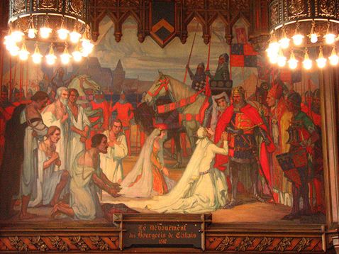
The Treaty of Brétigny was a treaty, drafted on 8 May 1360 and ratified on 24 October 1360, between Kings Edward III of England and John II of France. In retrospect, it is seen as having marked the end of the first phase of the Hundred Years' War (1337–1453) as well as the height of English power on the European continent. It was signed at Brétigny, a village near Chartres, and was later ratified as the Treaty of Calais on 24 October 1360. Background King John II of France, taken as a prisoner of war at the Battle of Poitiers (19 September 1356), worked with King Edward III of England to write out the Treaty of London. The treaty was condemned by the French Estates-General, who advised the Dauphin Charles to reject it. In response, Edward, who wished to yield few of the advantages claimed in the abortive Treaty of London the year before, besieged Rheims. The siege lasted until January and with supplies running low, Edward withdrew to Burgundy. After the English army at ... [...More Info...] [...Related Items...] OR: [Wikipedia] [Google] [Baidu] |
County Of Saintonge
The County of Saintonge (), historically spelled Xaintonge and Xainctonge, is a former province of France located on the west central Atlantic coast. The capital city was Saintes (Xaintes, Xainctes). Other principal towns include Saint-Jean-d'Angély, Jonzac, Frontenay-Rohan-Rohan, Royan, Marennes, Pons, and Barbezieux-Saint-Hilaire. Background The borders of the province shifted slightly through history. Some mapmakers, such as Nicolas Sanson (1650), Johannes Blaeu (1662), and Bernard Antoine Jaillot (1733), show the province extending into Cognac, traditionally part of Angoumois, and to the parishes of Braud-et-Saint-Louis and Étauliers, part of the Pays Gabay on the right bank of the Gironde River. In 1790, during the French Revolution, Saintonge became part of Charente-Inférieure, one of the 83 departments organized by the new government. This was renamed as Charente-Maritime in 1941, during World War II. Today, four-fifths of the historical Saintonge province is wi ... [...More Info...] [...Related Items...] OR: [Wikipedia] [Google] [Baidu] |
Sangatte
Sangatte (; ) is a commune in the Pas-de-Calais department on the northern coast of France on the English Channel. The name is of Flemish origin, meaning hole or gap in the sand. Engineering Sangatte is the location for the Channel Tunnel's French cooling station, its British counterpart being at Samphire Hoe. In addition, it is the French end-point for the HVDC Cross-Channel, the connection between the UK and French electricity grids. History First underwater telegraph Sangatte was the landing point of the world's first operational underwater telegraph cable, laid across the Channel by the Submarine Telegraph Company in 1851 between South Foreland and Sangatte. Pioneering cross-Channel flight 'Blériot-Plage' is named to commemorate Louis Blériot who, on the July 25, 1909, was the first person to fly across the English Channel. He flew from the beach at Sangatte to the White Cliffs of Dover, to claim the prize offered by the Daily Mail. The crossing took 37 minutes in his a ... [...More Info...] [...Related Items...] OR: [Wikipedia] [Google] [Baidu] |
Calais
Calais ( , , traditionally , ) is a port city in the Pas-de-Calais department, of which it is a subprefecture. Although Calais is by far the largest city in Pas-de-Calais, the department's prefecture is its third-largest city of Arras. The population of the city proper is 72,929; that of the urban area is 149,673 (2018).Comparateur de territoire: Aire d'attraction des villes 2020 de Calais (073), Commune de Calais (62193) INSEE Calais overlooks the Strait of Dover, the narrowest point in the |
Ponthieu
Ponthieu (, ) was one of six feudal counties that eventually merged to become part of the Province of Picardy, in northern France.Dunbabin.France in the Making. Ch.4. The Principalities 888-987 Its chief town is Abbeville. History Ponthieu played a small but important role in the politics that led up to the Norman invasion of England in 1066.Barlow, The Godwins, Chapter 5: The Lull Before the Storm. Norman conquest of England Harold Godwinson of England was shipwrecked at Ponthieu, in 1064 and taken captive by Guy I (or ''Wido'' according to the Bayeux Tapestry), the then Count of Ponthieu.Barlow. The Godwins pp. 97 - 98 It is alleged that William (Duke of Normandy, later William I of England), discovering that Harold had been taken captive, sent messengers ordering Count Guy to hand over his prisoner. William then forced Harold to swear to support his claim to the throne, only revealing after the event that the box on which Harold had made his oath contained holy relics, ma ... [...More Info...] [...Related Items...] OR: [Wikipedia] [Google] [Baidu] |
Montreuil-sur-Mer
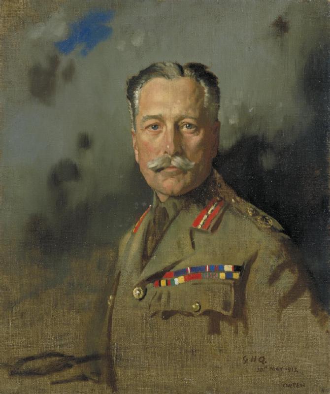
Montreuil (; also nl, Monsterole), also known as Montreuil-sur-Mer (; pcd, Montreu-su-Mér or , literally ''Montreuil on Sea''), is a sub-prefecture in the Pas-de-Calais department, northern France. It is located on the Canche river, not far from Étaples. The sea, however, is now some distance away. Montreuil-sur-Mer station has rail connections to Arras and Étaples. Sights Montreuil is surrounded by notable brickwork ramparts, constructed after the destruction of the town by troops of Habsburg emperor Charles V in June 1537. These fortifications pre-date the extensive fortification of towns in northern France by Sébastien Le Prestre de Vauban in the 17th century. History Montreuil was the headquarters of the British Army in France during the First World War from March 1916 until it closed in April 1919. The military academy there provided excellent facilities for GHQ. Montreuil was chosen as GHQ for a wide variety of reasons. It was on a main road from London to Paris—th ... [...More Info...] [...Related Items...] OR: [Wikipedia] [Google] [Baidu] |
Rouergue
Rouergue (; ) is a former province of France, corresponding roughly with the modern department of Aveyron. Its historical capital is Rodez. It is bounded on the north by Auvergne, on the south and southwest by Languedoc, on the east by Gévaudan and on the west by Quercy. During the Middle Ages Rouergue changed hands a number of times; its rulers included England (due to the Treaty of Brétigny in 1360), Armagnac and Languedoc. Rouergue became a department in 1790, and was renamed Aveyron after the principal river flowing through it. Upon creation of the department of Tarn-et-Garonne in 1808, the canton of Saint-Antonin-Noble-Val was detached from the western extremity of Aveyron and transferred to the new department. The province of Rouergue had a land area of . At the 1999 census there were 269,774 inhabitants on the territory of the province of Rouergue, for a density of only . The largest urban areas are Rodez, with 38,458 inhabitants in 1999; Millau, with 22,840 inhabit ... [...More Info...] [...Related Items...] OR: [Wikipedia] [Google] [Baidu] |
Angoumois
Angoumois (), historically the County of Angoulême, was a county and province of France, originally inferior to the parent duchy of Aquitaine, similar to the Périgord to its east but lower and generally less forested, equally with occasional vineyards throughout. Its capital was Angoulême with its citadel and castle above the river Charente. It almost corresponds to the Charente Department which also takes in the east of the coastal comté de Saintonge. cites Castaigne's 1845 ''Essai d'une bibliothèque historique de l'Angoumois'' History This area was a county and province of France, originally inferior to the parent duchy of Aquitaine, similar to the Périgord to its east. Many of the historic churches and castles, or castle ruins in the county, survive. Today it is noted for sunflowers and Cognac Cognac ( , also , ) is a variety of brandy named after the Communes of France, commune of Cognac, France. It is produced in the surrounding wine-growing region in the D ... [...More Info...] [...Related Items...] OR: [Wikipedia] [Google] [Baidu] |
Gauré
Gauré (; oc, Gaure) is a commune in the Haute-Garonne department in southwestern France. Population The inhabitants of the commune are known as Gauréens See also *Communes of the Haute-Garonne department The following is a list of the 586 communes of the French department of Haute-Garonne. The communes cooperate in the following intercommunalities (as of 2020):Communes of Haute-Garonne {{HauteGaronne-geo-stub ... [...More Info...] [...Related Items...] OR: [Wikipedia] [Google] [Baidu] |
Bigorre
Bigorre ({{IPA-fr, biɡɔʁ; Gascon: ''Bigòrra'') is a region in southwest France, historically an independent county and later a French province, located in the upper watershed of the Adour, on the northern slopes of the Pyrenees, part of the larger region known as Gascony. Today Bigorre comprises the centre and west of the ''département'' of Hautes-Pyrénées, with two small exclaves in the neighbouring Pyrénées Atlantiques. Its inhabitants are called '' Bigourdans''. Before the French Revolution, the province of Bigorre had a land area of 2,574 km² (994 sq. miles). Its capital was Tarbes. At the 1999 French census, there lived 177,575 inhabitants on the territory of the former province of Bigorre, which means a density of 69 inh. per km² (179 inh. per sq. mile). The largest urban areas in Bigorre are Tarbes, with 77,414 inhabitants in 1999, Lourdes, with 15,554 inhabitants in 1999, and Bagnères-de-Bigorre, with 11,396 inhabitants in 1999. At the time of the ... [...More Info...] [...Related Items...] OR: [Wikipedia] [Google] [Baidu] |
Quercy
Quercy (; oc, Carcin , locally ) is a former province of France located in the country's southwest, bounded on the north by Limousin, on the west by Périgord and Agenais, on the south by Gascony and Languedoc, and on the east by Rouergue and Auvergne. Description Quercy comprised the present-day department of Lot, the northern half of the department of Tarn-et-Garonne, and a few communities in the departments of Dordogne, Corrèze, and Aveyron. The traditional capital of Quercy is Cahors, now prefecture (capital) of Lot. The largest town of Quercy is Montauban, prefecture of Tarn-et-Garonne. However, Montauban lies at the traditional border between Quercy and Languedoc, in an area very different from the rest of Quercy, and it is closer historically and culturally to Toulouse and the rest of Languedoc, therefore it should be considered a special case, not totally part of Quercy. Also distinct from the rest of the region is the Quercy Blanc lying between Cahors and the southern ... [...More Info...] [...Related Items...] OR: [Wikipedia] [Google] [Baidu] |
Limousin (province)
Limousin ( oc, Lemosin) is a former province of the Kingdom of France. It existed from 1589 until 1790, when the National Constituent Assembly adopted a more uniform division into departments (''départements'') and districts (''arrondissements''). It is located in the foothills of the western edge of the Massif Central and surrounds the city of Limoges ( oc, Limòtges). The territory of the former province of Limousin corresponds to an area smaller than the administrative region, comprising the current department of Corrèze, the southern half of Haute-Vienne (including Limoges, its historic capital), and a small part of the Dordogne. History The history of Limousin reaches back to Celtic and Roman times (50 BC to 550 AD). Its name is derived from the name of a Gallic tribe, the Lemovices, whose main sanctuary was recently found in Tintignac and became a major research site of the Celtic world. During the 10th century, Limousin was divided into many ''seigneuries''. The mos ... [...More Info...] [...Related Items...] OR: [Wikipedia] [Google] [Baidu] |


