|
Toorak Railway Station
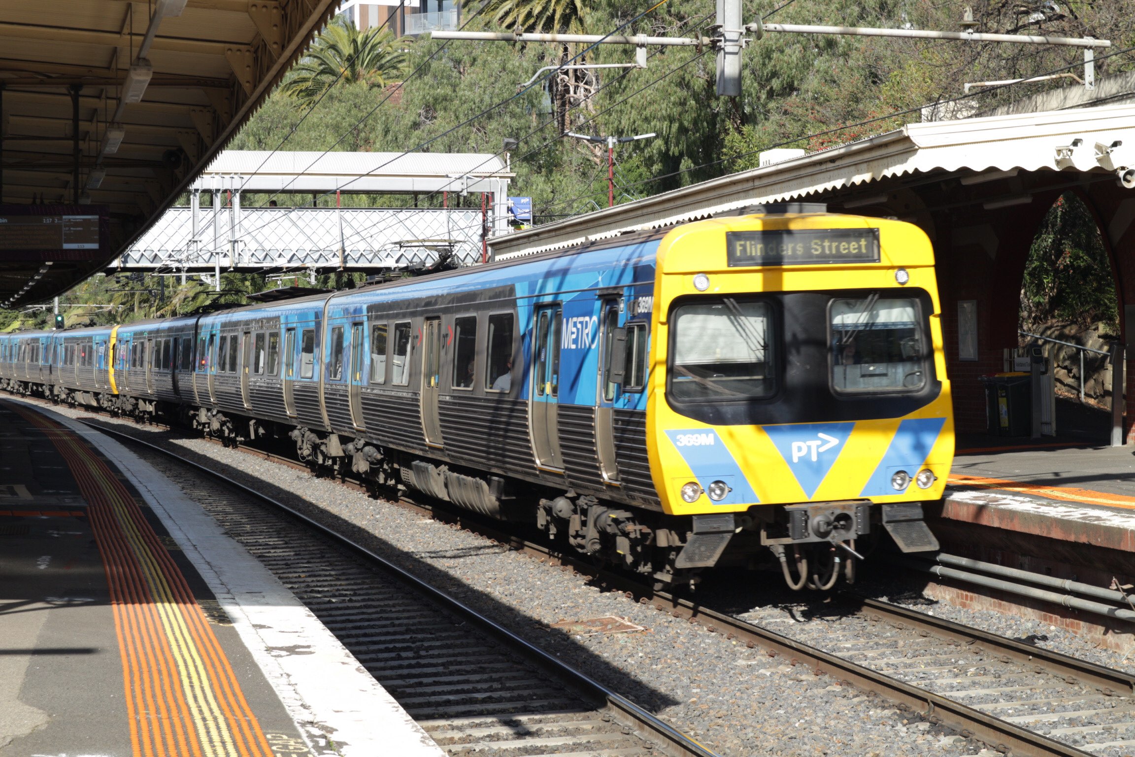
Toorak railway station is a commuter railway station on the northern boundary of Armadale, a suburb of Melbourne, Victoria, Australia. The station is listed on the Victorian Heritage Register, and was opened on 7 May 1879. The station is named after the nearby suburb of Toorak—located north of the station. The station consists of an island platform and two side platforms all accessed by a pedestrian bridge. There are two principal station buildings located on the central platform (platforms 2 and 3) and on platform 4, consisting of a small two and one-story brick buildings. These buildings were provided in 1914, as ticketing and staff offices. The station is only partially accessible due to a multiple steep access ramps. Toorak railway station is served by the Frankston line, part of the Melbourne railway network. The station also connects to the Route 72 tram service and the route 604 and 605 bus services. The journey to Flinders Street railway station is approximately 6 ... [...More Info...] [...Related Items...] OR: [Wikipedia] [Google] [Baidu] |
Public Transport Victoria
Public Transport Victoria (PTV) is the brand name for public transport in the Australian state of Victoria, Australia, Victoria. It was the trading name of the Go Public Transport Development Authority (PTDA), a now-defunct statutory authority in Victoria, responsible for providing, coordinating, and promoting public transport. The PTV began operating on 2 April 2012, taking over many of the responsibilities previously exercised by the Director of Public Transport and the Department of Transport (Victoria, 2008–13), Department of Transport. It also took over the marketing of public transport in Victoria from Metlink and Metlink#Viclink, Viclink, as well as responsibility for the myki ticketing system, formerly handled by the Transport Ticketing Authority. PTV's functions were transferred to the Department of Transport (Victoria), Department of Transport on 1 July 2019. However, PTV continues to exist as the brand for public transport services in Victoria. Governance PTV is ... [...More Info...] [...Related Items...] OR: [Wikipedia] [Google] [Baidu] |
Myki
Myki ( ), stylised as myki, is a reloadable credit card-sized contactless smart card ticketing system used for electronic payment of fares on most public transport services in Melbourne and regional Victoria, Australia. Myki replaced the Metcard ticketing system and became fully operational at the end of 2012. The system was developed by Kamco (Keane Australia Micropayment Consortium) and is used by Public Transport Victoria. The initial 10-year contract was worth approximately A$1.5 billion, described by ''The Age'' as "the orld'sbiggest for a smartcard ticketing system". The Myki contract was extended in July 2016 for a further seven years. Ticketing requirements for trains, trams and buses in Melbourne are mainly contained in the ''Transport (Compliance and Miscellaneous) (Ticketing) Regulations 2017'' and the ''Victorian Fares and Ticketing Manual.'' Usage Operation Passengers can purchase a rechargeable Myki smartcard from the ticket office at a staffed railwa ... [...More Info...] [...Related Items...] OR: [Wikipedia] [Google] [Baidu] |
Up Train
Railroad directions are used to describe train directions on rail systems. The terms used may be derived from such sources as compass directions, altitude directions, or other directions. However, the railroad directions frequently vary from the actual directions, so that, for example, a "northbound" train may really be headed west over some segments of its trip, or a train going "down" may actually be increasing its elevation. Railroad directions are often specific to system, country, or region. Radial directions Many rail systems use the concept of a center (usually a major city) to define rail directions. Up and down In British practice, railway directions are usually described as "up" and "down", with "up" being towards a major location. This convention is applied not only to the trains and the tracks, but also to items of lineside equipment and to areas near a track. Since British trains run on the left, the "up" side of a line is usually on the left when proceeding in the "u ... [...More Info...] [...Related Items...] OR: [Wikipedia] [Google] [Baidu] |
Hawksburn Railway Station
Hawksburn railway station is a commuter railway station on the Frankston line, serving the south Melbourne suburb of South Yarra, Victoria, Australia. Hawksburn is an unstaffed status below ground structure station featuring four platforms, with an island platform and two side platforms all accessed by a pedestrian bridge. The station is listed on the Victorian Heritage Register, and was opened on 7 May 1879, with the stations’ namesake being the locality of Hawksburn, 600 metres from the station. The station is only partially accessible due to multiple steep access ramps. There are two principal station buildings, one of which is located on the stations central island platform (platforms 2 and 3) consisting of a small two story brick building, whilst the other is a one story brick structure situated on platform 4. These buildings were provided for the station in 1914, as ticketing and staff offices. Hawksburn is only served by the Frankston line, part of the Melbourne ... [...More Info...] [...Related Items...] OR: [Wikipedia] [Google] [Baidu] |
Prahran, Victoria
Prahran (), also pronounced colloquially as Pran, is an inner suburb in Melbourne, Victoria, Australia, 5 km south-east of Melbourne's Central Business District, located within the City of Stonnington local government area. Prahran recorded a population of 12,203 at the 2021 census. Prahran is a part of Greater Melbourne, with many shops, restaurants and cafes. Chapel Street is a mix of upscale fashion boutiques and cafes. Greville Street, once the centre of the Melbourne's hippie community, has many cafés, bars, restaurants, bookstores, clothing shops and music shops. Prahran takes its name from Pur-ra-ran, a Boonwurrung word which was thought to mean "land partially surrounded by water". When naming began the suburbs spelling was intended to be Praharan and pronounced Pur-ra-ran, but a spelling mistake on a government form lead to the name Prahran. More recently the word Pur-ra-ran has been identified as a transcription of "Birrarung", the name for the Yarra River, or a spec ... [...More Info...] [...Related Items...] OR: [Wikipedia] [Google] [Baidu] |
Toorak, Victoria
Toorak () is a suburb of Melbourne, Victoria, Australia, south-east of Melbourne's Central Business District, located within the City of Stonnington local government area, on Boonwurrung Land. Toorak recorded a population of 12,817 at the 2021 census. The name Toorak has become synonymous with wealth and privilege, the suburb long having the reputation of being Melbourne's most elite, and ranking among the most prestigious in Australia. It has the highest average property values in Melbourne, and is one of the most expensive suburbs in Australia. It is the nation's second highest earning postcode after Point Piper in Sydney. Located on a rise on the south side (or left bank) of a bend in the Yarra River, Toorak is bordered by South Yarra, at Williams Road on the west, Malvern, at Glenferrie Road on the east, Prahran and Armadale, at Malvern Road to the south and the suburbs of Richmond, Burnley and Hawthorn on the north side of the river. The suburb's main street is consider ... [...More Info...] [...Related Items...] OR: [Wikipedia] [Google] [Baidu] |
Flinders Street Railway Station
Flinders Street railway station is a train station located on the corner of Flinders Street, Melbourne, Flinders and Swanston Street, Swanston streets in the Melbourne city centre, central business district (CBD) of Melbourne, Victoria (Australia), Victoria, Australia. Opened in 1854, the historic station serves the entire Public Transport Victoria, metropolitan rail network, as well as some country services to eastern Victoria. Backing onto the Yarra River in the heart of the city, the complex includes platforms and structures that stretch over more than two whole city blocks, from east of Swanston Street nearly to Market Street, Melbourne, Market Street. Flinders Street is served by Metro Trains Melbourne, Metro's List of Melbourne railway stations, suburban services, and V/Line regional services to Bairnsdale V/Line rail service, Gippsland. It is the busiest station on Melbourne's metropolitan network, with an average of 77,153 daily entries recorded in the 2017/18 fiscal yea ... [...More Info...] [...Related Items...] OR: [Wikipedia] [Google] [Baidu] |
Railways In Melbourne
The Melbourne rail network is a passenger and freight train system in the city of Melbourne, Victoria, Australia. The metropolitan passenger rail network is centred on the Melbourne CBD and consists of 222 stations across 16 lines, which served a ridership of 99.5 million over the year 2021-2022. It is the core of the larger Victorian railway network, with links to both intrastate and interstate systems. The first steam train in Australia commenced service in Melbourne in 1854, with the metropolitan network having grown over the last two centuries to cover much of the city. Metro Trains Melbourne operates the Melbourne metropolitan railway network under franchise from the Government of Victoria, while the government-owned entity V/Line operates trains from Melbourne across regional Victoria. The metropolitan network is a suburban rail system designed to transport passengers from Melbourne's suburbs into the Melbourne central business district (CBD) and associated city ... [...More Info...] [...Related Items...] OR: [Wikipedia] [Google] [Baidu] |
Accessibility
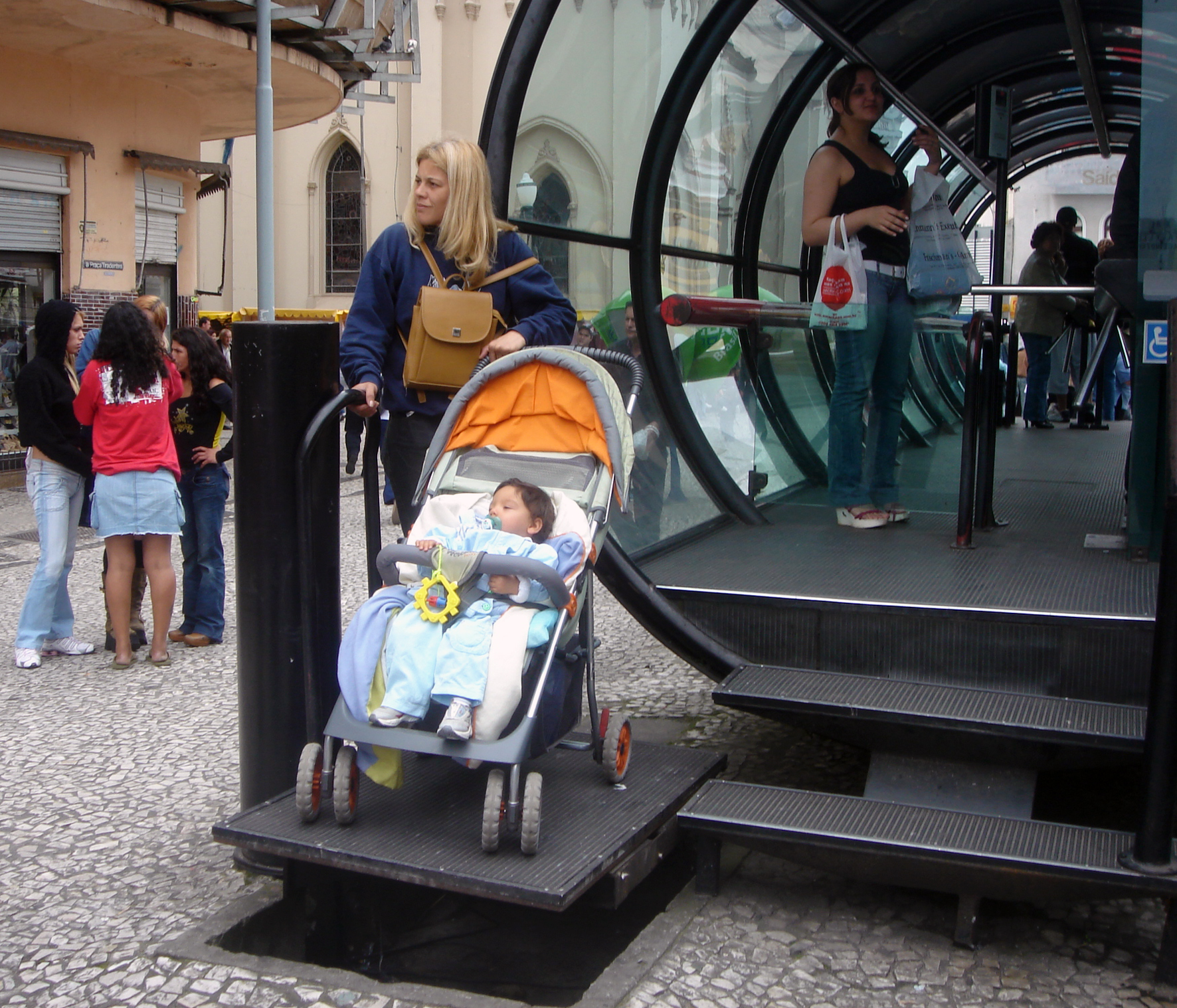
Accessibility is the design of products, devices, services, vehicles, or environments so as to be usable by people with disabilities. The concept of accessible design and practice of accessible development ensures both "direct access" (i.e. unassisted) and "indirect access" meaning compatibility with a person's assistive technology (for example, computer screen readers). Accessibility can be viewed as the "ability to access" and benefit from some system or entity. The concept focuses on enabling access for people with disabilities, or enabling access through the use of assistive technology; however, research and development in accessibility brings benefits to everyone. Accessibility is not to be confused with usability, which is the extent to which a product (such as a device, service, or environment) can be used by specified users to achieve specified goals with effectiveness, efficiency, convenience, or satisfaction in a specified context of use. Accessibility is a ... [...More Info...] [...Related Items...] OR: [Wikipedia] [Google] [Baidu] |
Footbridge
A footbridge (also a pedestrian bridge, pedestrian overpass, or pedestrian overcrossing) is a bridge designed solely for pedestrians.''Oxford English Dictionary'' While the primary meaning for a bridge is a structure which links "two points at a height above the ground", a footbridge can also be a lower structure, such as a boardwalk, that enables pedestrians to cross wet, fragile, or marshy land. Bridges range from stepping stones–possibly the earliest man-made structure to "bridge" water–to elaborate steel structures. Another early bridge would have been simply a fallen tree. In some cases a footbridge can be both functional and artistic. For rural communities in the developing world, a footbridge may be a community's only access to medical clinics, schools, businesses and markets. Simple suspension bridge designs have been developed to be sustainable and easily constructed in such areas using only local materials and labor. An enclosed footbridge between two buildings is ... [...More Info...] [...Related Items...] OR: [Wikipedia] [Google] [Baidu] |
Island Platform
An island platform (also center platform, centre platform) is a station layout arrangement where a single platform is positioned between two tracks within a railway station, tram stop or transitway interchange. Island platforms are popular on twin-track routes due to pragmatic and cost reasons. They are also useful within larger stations where local and express services for the same direction of travel can be provided from opposite sides of the same platform thereby simplifying transfers between the two tracks. An alternative arrangement is to position side platforms on either side of the tracks. The historical use of island platforms depends greatly upon the location. In the United Kingdom the use of island platforms is relatively common when the railway line is in a cutting or raised on an embankment, as this makes it easier to provide access to the platform without walking across the tracks. Advantages and tradeoffs Island platforms are necessary for any station with many th ... [...More Info...] [...Related Items...] OR: [Wikipedia] [Google] [Baidu] |
Caulfield, Victoria
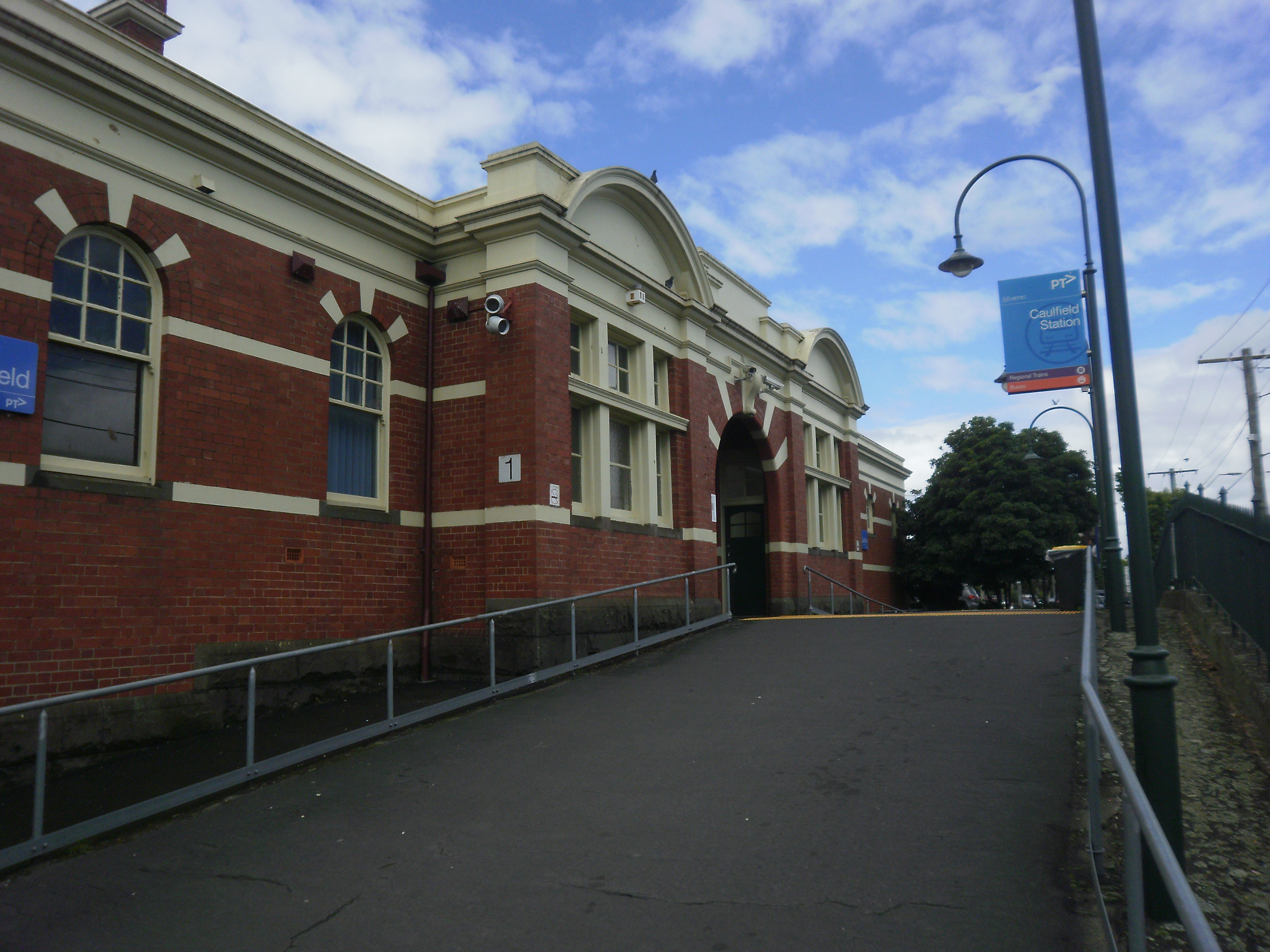
Caulfield is a suburb in Melbourne, Victoria, Australia, south-east of Melbourne's Central Business District, located within the City of Glen Eira local government area. Caulfield recorded a population of 5,748 at the 2021 census. It is bounded by Kooyong Road in the west, Glen Eira Road in the north, Glen Huntly Road in the south and Booran Road in the east. Caulfield is best known as the location of Caulfield Racecourse and the Caulfield campus of Monash University. History Toponymy The origin of the name of Caulfield is not known for certain, but the name seemed to be linked with Baron Caulfield of Ireland, perhaps through John Caulfield, a pioneer of the colony. The name Caulfield was in use by 1853, and the early maps always place it somewhere around the racecourse. Pre-European history The local Yalukit people were coastal and dependent on seafoods, so few Aboriginal relics have been found in Caulfield. Nevertheless, some contact did occur in the area between Aborigin ... [...More Info...] [...Related Items...] OR: [Wikipedia] [Google] [Baidu] |


