|
Tonkin Highway
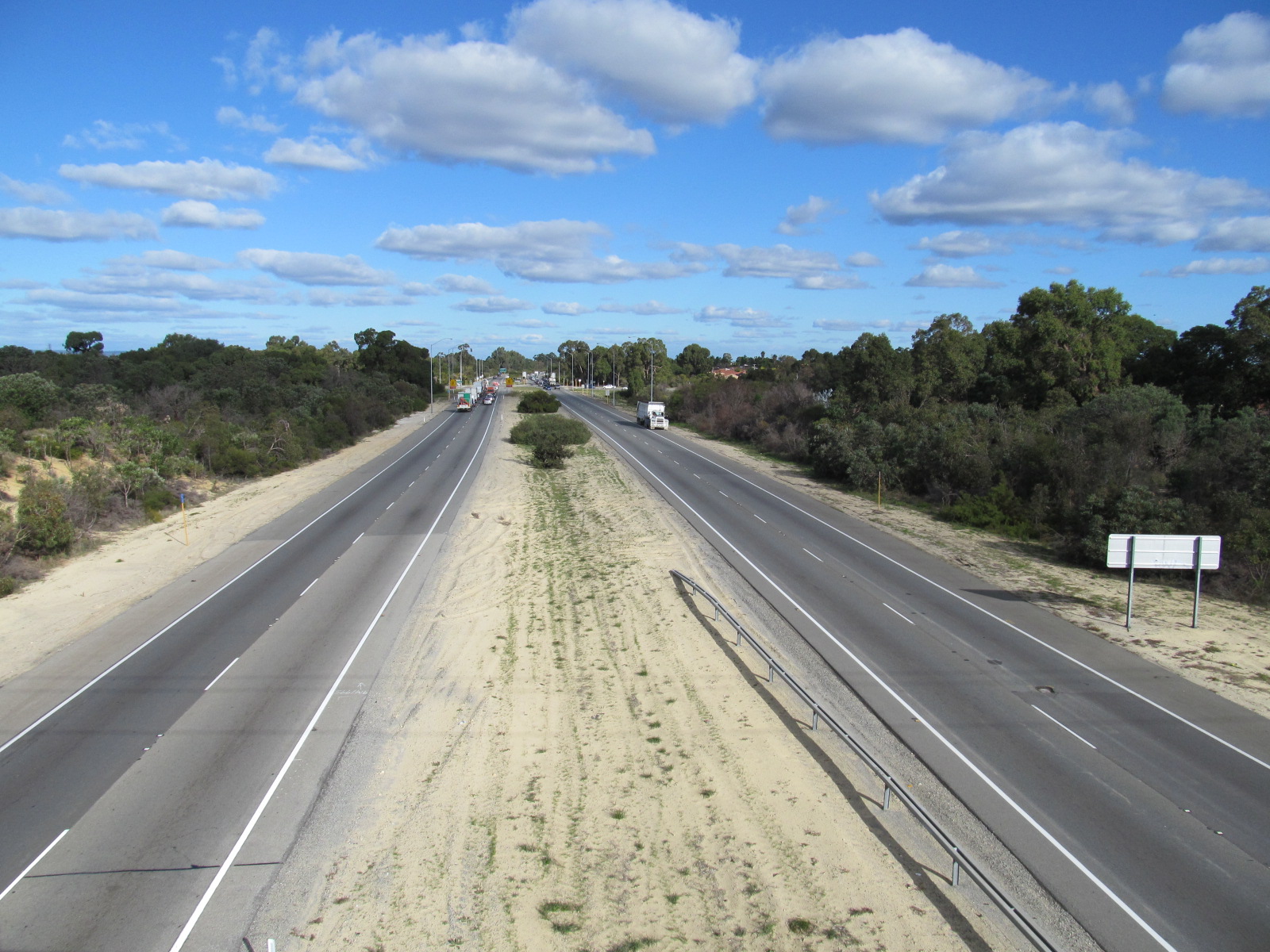
Tonkin Highway is an north–south highway and partial freeway in Perth, Western Australia, linking Perth Airport and Kewdale with the city's north-eastern and south-eastern suburbs. As of April 2020, the northern terminus is at the interchange with Brand Highway and Great Northern Highway in Muchea, and the southern terminus is at Thomas Road in Oakford. It forms the entire length of State Route 4, and connects to several major roads. Besides Brand Highway and Great Northern Highway, it also connects to Reid Highway, Great Eastern Highway, Leach Highway, Roe Highway, and Albany Highway. Planning for the route began in the 1950s, but the first segment between Wattle Grove and Cloverdale was not opened until 1980. Over the next five years, the highway was extended north to Great Eastern Highway and south to Albany Highway, and a discontinuous section was constructed north of the Swan River. In 1988 the Redcliffe Bridge linked these sections, and three years later, Reid H ... [...More Info...] [...Related Items...] OR: [Wikipedia] [Google] [Baidu] |
NorthLink WA
NorthLink WA was a road construction project in Perth, Western Australia, that saw both the northern section of Tonkin Highway upgraded, and the road extended northwards as the Swan Valley Bypass, to bypass Great Northern Highway. These two component projects were separately funded, with both the state and federal governments contributing to each project. Construction commenced in June 2016 and was completed on 23 April 2020. Tonkin Highway upgrade The federal government has allocated $140.6 million to grade-separate Tonkin Highway's intersections with Benara Road, Morley Drive and Collier Road. The funding is part of the five-year phase of the Nation Building Program from 2014–15 to 2018–19. The upgrades are intended to improve freight transportation along the highway. The total cost is expected to be $281.2 million. In the lead up to the 2013 Australian federal election, which resulted in a change a government, the Labor candidate for Perth, Alannah MacTiernan, acc ... [...More Info...] [...Related Items...] OR: [Wikipedia] [Google] [Baidu] |
Main Roads Western Australia
Main Roads Western Australia (formerly the Main Roads Department) is a statutory authority of the Government of Western Australia that is responsible for implementing the state's policies on road access and main roads. It operates under the ''Main Roads Act 1930'' (WA). As at June 2021, it manages of roads, representing the arterial road network in Western Australia. Each of the roads must be declared a "public highway" or "main road" in the ''Western Australian Government Gazette'' and is allocated a highway or main road number – many roads perceived as main roads by the public are in fact managed by local councils. Main Roads Western Australia also regulates heavy vehicles through the issue of permits and notices under the authority granted to the Commissioner of Main Roads under the Road Traffic Act 1974. The Road Transport Compliance Section, a section within the Department, employs Transport Inspectors who, alongside police officers, monitor heavy vehicle movement and ... [...More Info...] [...Related Items...] OR: [Wikipedia] [Google] [Baidu] |
Wattle Grove, Western Australia
Wattle Grove is a suburb of Perth, Western Australia, located within the City of Kalamunda. Description Wattle Grove is approximately 2/3 semi-rural, and 1/3 suburban development. It contains some of Hartfield Park, and extends from Crystal Brook Road to Roe Highway. Major transport routes through the suburb are Welshpool Road, Hale Road, Tonkin Highway and Roe Highway. Public transport Bus routes are: * 294 to Midland Train Station or to Cannington Train Station via Hale Road * 282 to and from Lesmurdie and the city via Welshpool Road * 283 to and from Kalamunda and the city via Crystal Brook Road The nearest train stations are: * Kenwick railway station on the Armadale line * Beckenham railway station on the Armadale line * Cannington railway station on the Armadale line Facilities Playgrounds are located throughout the new subdivisions in the suburb, as well as walking and bike paths leading to newly created artificial lakes. Wattle Grove is served by Wattle Grov ... [...More Info...] [...Related Items...] OR: [Wikipedia] [Google] [Baidu] |
Sidepath
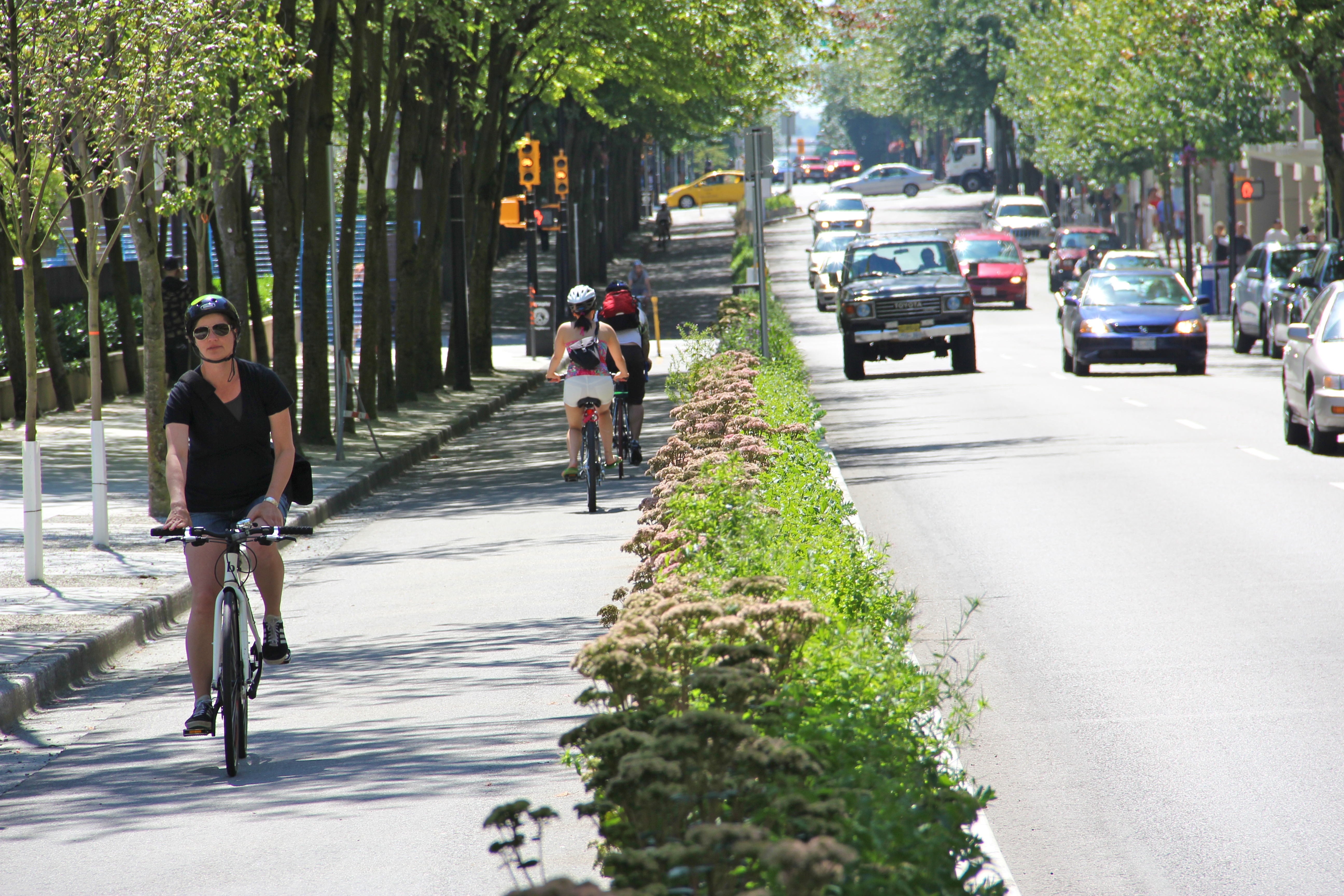
A cycle track, separated bike lane or protected bike lane (sometimes historically referred to as a sidepath) is an exclusive bikeway that has elements of a separated path and on-road bike lane. A cycle track is located within or next to the roadway, but is made distinct from both the sidewalk and general purpose roadway by vertical barriers or elevation differences. In urban planning, cycle tracks are designed to encourage bicycling in an effort to relieve automobile congestion and reduce pollution, reduce bicycling fatalities and injuries by eliminating the need for cars and bicycles to jockey for the same road space, and to reduce overall confusion and tension for all users of the road. Cycle tracks may be one-way or two-way, and may be at road level, at sidewalk level, or at an intermediate level. They all have in common some separation from motor traffic with bollards, car parking, barriers or boulevards. Barriers may include curbs, concrete berms, posts, planting/median ... [...More Info...] [...Related Items...] OR: [Wikipedia] [Google] [Baidu] |
Grade Separation
In civil engineering (more specifically highway engineering), grade separation is a method of aligning a junction of two or more surface transport axes at different heights (grades) so that they will not disrupt the traffic flow on other transit routes when they cross each other. The composition of such transport axes does not have to be uniform; it can consist of a mixture of roads, footpaths, railways, canals, or airport runways. Bridges (or overpasses, also called flyovers), tunnels (or underpasses), or a combination of both can be built at a junction to achieve the needed grade separation. In North America, a grade-separated junction may be referred to as a ''grade separation'' or as an '' interchange'' – in contrast with an '' intersection'', ''at-grade'', a ''diamond crossing'' or a ''level crossing'', which are not grade-separated. Effects Advantages Roads with grade separation generally allow traffic to move freely, with fewer interruptions, and at higher overall ... [...More Info...] [...Related Items...] OR: [Wikipedia] [Google] [Baidu] |
Gosnells, Western Australia
Gosnells is a suburb located within the City of Gosnells. Gosnells is approximately south-east of the Perth central business district. It contains the Gosnells town centre which includes the Council offices, library and the Gosnells Railway Station. History The area where Gosnells is located was used by the Nyoongar Aboriginal people for thousands of years before European settlement. In 1829, when the European settlers arrived in Western Australia, farms were established along the Swan and Canning Rivers, significantly changing the landscape and terrain of Gosnells. In 1862, Charles Gosnell of London purchased the surrounding lands of Gosnells from the Davis Family. In 1890, Western Australia experienced an influx of residents from overseas and interstate due to the gold rush in Kalgoorlie and Coolgardie. This resulted in an increased demand for land on the outskirts of Perth and subsequently a group of developers bought the land (named "Canning Location 16") from the dece ... [...More Info...] [...Related Items...] OR: [Wikipedia] [Google] [Baidu] |
Controlled-access Highway
A controlled-access highway is a type of highway that has been designed for high-speed vehicular traffic, with all traffic flow—ingress and egress—regulated. Common English terms are freeway, motorway and expressway. Other similar terms include ''throughway'' and '' parkway''. Some of these may be limited-access highways, although this term can also refer to a class of highways with somewhat less isolation from other traffic. In countries following the Vienna convention, the motorway qualification implies that walking and parking are forbidden. A fully controlled-access highway provides an unhindered flow of traffic, with no traffic signals, intersections or property access. They are free of any at-grade crossings with other roads, railways, or pedestrian paths, which are instead carried by overpasses and underpasses. Entrances and exits to the highway are provided at interchanges by slip roads (ramps), which allow for speed changes between the highway and arterials ... [...More Info...] [...Related Items...] OR: [Wikipedia] [Google] [Baidu] |
Dual Carriageway
A dual carriageway ( BE) or divided highway ( AE) is a class of highway with carriageways for traffic travelling in opposite directions separated by a central reservation (BrE) or median (AmE). Roads with two or more carriageways which are designed to higher standards with controlled access are generally classed as motorways, freeways, etc., rather than dual carriageways. A road without a central reservation is a single carriageway regardless of the number of lanes. Dual carriageways have improved road traffic safety over single carriageways and typically have higher speed limits as a result. In some places, express lanes and local/collector lanes are used within a local-express-lane system to provide more capacity and to smooth traffic flows for longer-distance travel. History A very early (perhaps the first) example of a dual carriageway was the ''Via Portuensis'', built in the first century by the Roman emperor Claudius between Rome and its port Ostia at the mouth of t ... [...More Info...] [...Related Items...] OR: [Wikipedia] [Google] [Baidu] |
Byford, Western Australia
Byford is a suburb on the south-eastern edge of Perth, Western Australia, and has its origins in a township that was gazetted under the name "Beenup" in 1906. "Beenup", a corruption of the Aboriginal name associated with nearby Beenyup Brook, was the spelling that had been applied to a railway siding there. The uncorrupted form, "Bienyup" received mention in surveyor Robert Austin's account of an expedition through the area in 1848. In 1920, the name of the township was changed to Byford. History Little has been documented of the Aboriginal occupation of the Byford area, but material traces of the district's original inhabitants have been found in numerous locations. The foothills were on the periphery of Thomas Peel's 1834 land grant, and during the 1840s European settlers took up small land holdings in the area. Names of early settlers included Lazenby, Mead, and Liddelow. Mead was an enterprising farmer with numerous landholdings in the foothills between the Serpentine Ri ... [...More Info...] [...Related Items...] OR: [Wikipedia] [Google] [Baidu] |
Perth Darwin National Highway
Great Northern Highway is an Australian highway that links Western Australia's capital city Perth with its northernmost port, Wyndham. With a length of almost , it is the longest highway in Australia, with the majority included as part of the Perth Darwin National Highway. The highway is constructed as a sealed, predominantly two-lane single carriageway, but with some single-lane bridges in the Kimberley. The Great Northern Highway travels through remote areas of the state, and is the only sealed road link between the Northern Territory and northern Western Australia. Economically, it provides vital access through the Wheatbelt and Mid West to the resource-rich regions of the Pilbara and Kimberley. In these areas, the key industries of mining, agriculture and pastoral stations, and tourism are all dependent on the highway. In Perth, the highway begins in Midland near Great Eastern Highway, and further north intersects the Reid and Roe highways, which together form Perth's ri ... [...More Info...] [...Related Items...] OR: [Wikipedia] [Google] [Baidu] |
Guildford Road
Guildford Road is a major road in Perth, Western Australia, linking the inner-city suburb of Mount Lawley with Guildford in the north-east. The road runs mostly parallel to the Swan River, on its northern side, and is part of State Route 51, which runs between Perth's CBD and Midvale. Guildford Road is maintained and controlled by Main Roads Western Australia, which uses the internal designation "H026 Guildford Road" for Guildford Road, as well as Bridge Street and James Street in Guildford. In the 1930s, the name Great Eastern Highway was coined to describe the road, but was actually used for the road on the other side of the Swan River. Route description Guildford Road begins at a three-way junction with Lord Street and Walcott Street in Mount Lawley. It runs in a north-easterly direction, passing under the Midland railway line at the Mount Lawley Subway, and continuing through the residential areas of Maylands and Bayswater After a folded diamond interchange with To ... [...More Info...] [...Related Items...] OR: [Wikipedia] [Google] [Baidu] |
Gateway WA
Gateway WA, formally called the Gateway WA Perth Airport and Freight Access Project, was a $1 billion project that upgraded the road network around Perth Airport. The project was located on portions of the southern parts of Perth Airport land, and adjacent land allocated for transport. It lay mainly within the local government area of the City of Belmont, with the eastern area located in the City of Kalamunda. It was the largest project Main Roads Western Australia had ever undertaken, covering the upgrade of Tonkin, Leach, and Roe Highways, and the construction of four new interchanges. The project was jointly funded by state and federal governments, which provided $317.5 million and $686.4 million respectively. As part of the project, Tonkin Highway was expanded from two to three lanes in both directions, between Great Eastern Highway and Roe Highway, and the existing intersections in this section was grade separated. A new diamond interchange was constructed ... [...More Info...] [...Related Items...] OR: [Wikipedia] [Google] [Baidu] |


_1.jpg)


