|
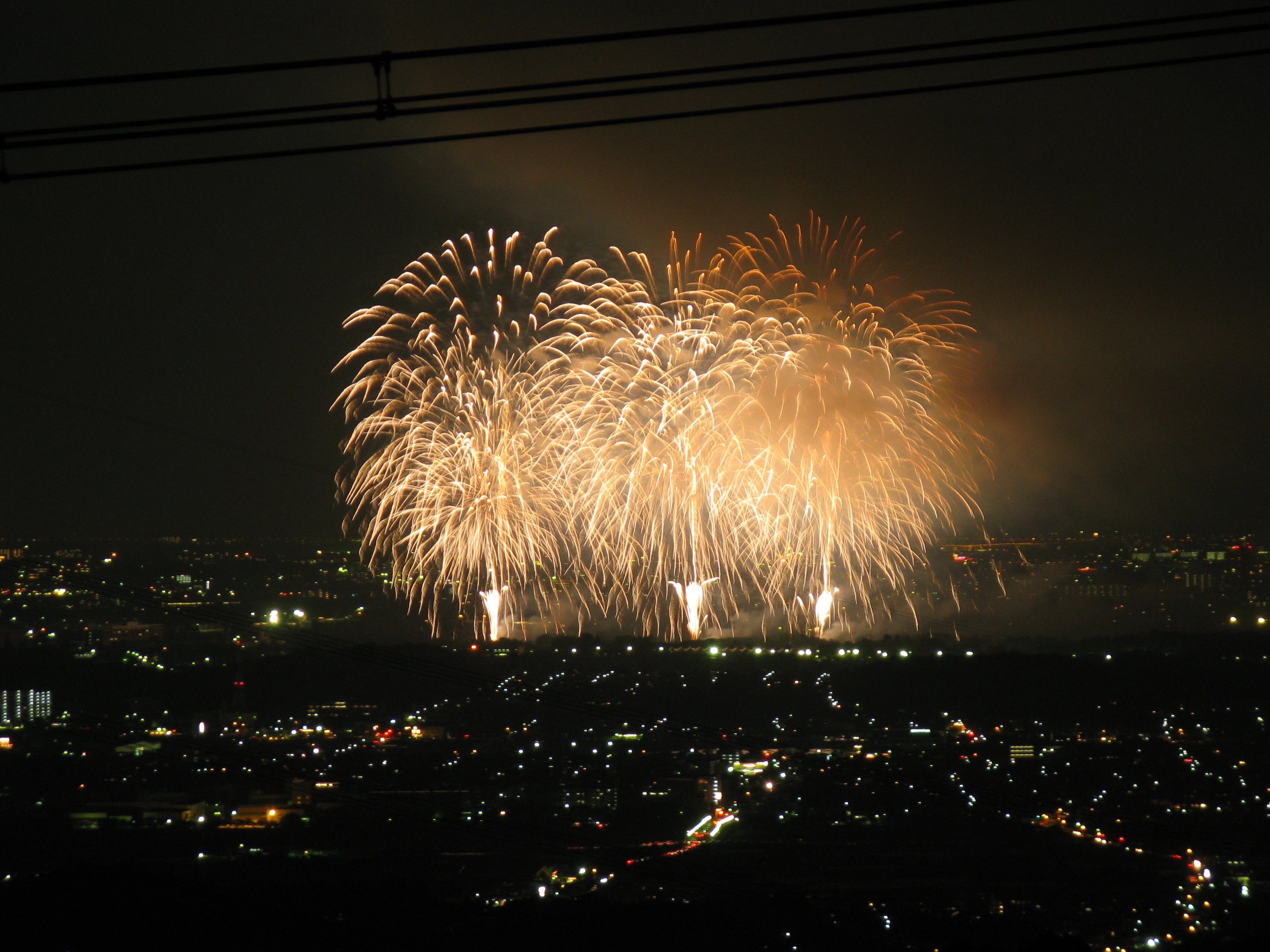
Tondabayashi, Osaka
is a city located in Osaka Prefecture, Japan. , the city had an estimated population of 108803 in 51632 households and a population density of 1200 persons per km². The total area of the city is . Geography Tondabayashi is located in the southeastern part of Osaka Prefecture.The northeastern part of the city is flat, and the Ishikawa River passes through the town. The southern part of the city is hilly, rising gradually to the Kongō Range and Katsuragi Mountains. Neighboring municipalities Osaka Prefecture *Sakai *Habikino *Kawachinagano *Ōsakasayama *Taishi * Kanan * Chihayaakasaka Climate Tondabayashi has a Humid subtropical climate (Köppen ''Cfa'') characterized by warm summers and cool winters with light to no snowfall. The average annual temperature in Tondabayashi is 14.2 °C. The average annual rainfall is 1475 mm with September as the wettest month. The temperatures are highest on average in August, at around 26.3 °C, and lowest in January, at arou ... [...More Info...] [...Related Items...] OR: [Wikipedia] [Google] [Baidu] |
Cities Of Japan
A is a local administrative unit in Japan. Cities are ranked on the same level as and , with the difference that they are not a component of . Like other contemporary administrative units, they are defined by the Local Autonomy Law of 1947. City status Article 8 of the Local Autonomy Law sets the following conditions for a municipality to be designated as a city: *Population must generally be 50,000 or greater (原則として人口5万人以上) *At least 60% of households must be established in a central urban area (中心市街地の戸数が全戸数の6割以上) *At least 60% of households must be employed in commerce, industry or other urban occupations (商工業等の都市的業態に従事する世帯人口が全人口の6割以上) *Any other conditions set by prefectural ordinance must be satisfied (他に当該都道府県の条例で定める要件を満たしていること) The designation is approved by the prefectural governor and the Minister for Internal ... [...More Info...] [...Related Items...] OR: [Wikipedia] [Google] [Baidu] |
Habikino, Osaka
270px, Habikino city office is a city located in Osaka Prefecture, Japan. , the city had an estimated population of 109,479 in 50918 households and a population density of 4100 persons per km². The total area of the city is . The city is known for its grapes, and also for its large number of ancient '' kofun'' burial mounds. The city is also sometimes referred to by its former name . Geography Habikino is located in the southeastern part of Osaka Prefecture, in the Kawachi Plain surrounded by Ikoma, Kongō, and Katsuragi Mountains and Mount Nijō. It is within about 20 kilometers from the center of Osaka metropolis. Neighboring municipalities Osaka Prefecture *Sakai * Matsubara *Fujiidera *Kashiwara *Tondabayashi * Taishi Nara Prefecture * Kashiba Climate Habikino has a Humid subtropical climate (Köppen ''Cfa'') characterized by warm summers and cool winters with light to no snowfall. The average annual temperature in Habikino is 14.2 °C. The average annual rainfal ... [...More Info...] [...Related Items...] OR: [Wikipedia] [Google] [Baidu] |
House Of Representatives Of Japan
The is the lower house of the National Diet of Japan. The House of Councillors (Japan), House of Councillors is the upper house. The composition of the House is established by and of the Constitution of Japan. The House of Representatives has 465 members, elected for a four-year term. Of these, 176 members are elected from 11 multi-member constituencies by a party-list system of proportional representation, and 289 are elected from single-member constituencies. The overall voting system used to elect the House of Representatives is a Parallel voting, parallel system, a form of semi-proportional representation. Under a parallel system the allocation of list seats does not take into account the outcome in the single seat constituencies. Therefore, the overall allocation of seats in the House of Representatives is not proportional, to the advantage of larger parties. In contrast, in bodies such as the German ''Bundestag'' or the New Zealand Parliament the election of single-seat ... [...More Info...] [...Related Items...] OR: [Wikipedia] [Google] [Baidu] |
Osaka Prefectural Assembly
The is the legislature of Osaka Prefecture. As in all prefectures, it is elected to four-year terms by single non-transferable vote in multi- and single-member districts and is responsible for enacting and amending prefectural by-laws, approving the budget and important administrative appointments in the prefectural government, including the prefecture's vice governors. The assembly has a regular membership 88 members. Current composition The 2019 assembly election took place on 7 April 2019 as part of the 19th unified local elections. The Osaka Restoration Association, retained its position as the largest party in the assembly, reclaimed an outright majority, as it had after the April 2011 election. As of 30 April 2019, the assembly was composed as follows: Electoral districts Changes to the electoral districts at the April 2015 election, there are 88 assembly members who are elected in 53 electoral districts, reduced from the 109 members who were elected at the 2011 ... [...More Info...] [...Related Items...] OR: [Wikipedia] [Google] [Baidu] |
Unicameral
Unicameralism (from ''uni''- "one" + Latin ''camera'' "chamber") is a type of legislature, which consists of one house or assembly, that legislates and votes as one. Unicameral legislatures exist when there is no widely perceived need for multicameralism (two or more chambers). Many multicameral legislatures were created to give separate voices to different sectors of society. Multiple houses allowed, for example, for a guaranteed representation of different social classes (as in the Parliament of the United Kingdom or the French States-General). Sometimes, as in New Zealand and Denmark, unicameralism comes about through the abolition of one of two bicameral chambers, or, as in Sweden, through the merger of the two chambers into a single one, while in others a second chamber has never existed from the beginning. Rationale for unicameralism and criticism The principal advantage of a unicameral system is more efficient lawmaking, as the legislative process is simpler and there is ... [...More Info...] [...Related Items...] OR: [Wikipedia] [Google] [Baidu] |
Minamikawachi District, Osaka
is a district located in Osaka Prefecture, Japan. In 2009 the district had an estimated population of 37,695 and a density of 491 persons per km2. The total area is 76.81 km2. Towns and villages * Kanan *Taishi * Chihayaakasaka Mergers *On February 1, 2005, the town of Mihara was merged into the city of Sakai. *On March 1, 2008, the village of Chiahayaakasaka requested a merge into the adjacent city of Kawachinagano after talks of merging with the surrounding towns of Kanan and Taishi fell through.Asahi Shimbun, Osaka edition, April 30th 2007, p. 1, 大阪唯一の村消える? ''Ōsaka yuiitsu no mura kieru?'' These plans also fell through as of August 14, 2009. Famous people * Sasaki Mikirô Sasaki () is the 13th most common Japanese surname. Less common variants are 佐咲, 佐佐木 and 笹木. Notable people with the surname include: Overview *, Japanese figure skater *, Japanese alpine skier *, Japanese idol and singer *, Japane ... (1947- ), poet and es ... [...More Info...] [...Related Items...] OR: [Wikipedia] [Google] [Baidu] |
Sengoku Period
The was a period in History of Japan, Japanese history of near-constant civil war and social upheaval from 1467 to 1615. The Sengoku period was initiated by the Ōnin War in 1467 which collapsed the Feudalism, feudal system of Japan under the Ashikaga shogunate. Various samurai warlords and Japanese clans, clans fought for control over Japan in the power vacuum, while the emerged to fight against samurai rule. The Nanban trade, arrival of Europeans in 1543 introduced the arquebus into Japanese warfare, and Japan ended its status as a Tributary system of China, tributary state of China in 1549. Oda Nobunaga dissolved the Ashikaga shogunate in 1573 and launched a war of political unification by force, including the Ishiyama Hongan-ji War, until his death in the Honnō-ji Incident in 1582. Nobunaga's successor Toyotomi Hideyoshi completed his campaign to unify Japan and consolidated his rule with numerous influential reforms. Hideyoshi launched the Japanese invasions of Korea (159 ... [...More Info...] [...Related Items...] OR: [Wikipedia] [Google] [Baidu] |
Kawachi Province
was a province of Japan in the eastern part of modern Osaka Prefecture. It originally held the southwestern area that was split off into Izumi Province. It was also known as . Geography The area was radically different in the past, with Kawachi Bay and lake dominating the area over what is now land. ''Chiku'' Kawachi was divided into three : , , and . * The northern county comprised the modern Hirakata, Neyagawa, Kadoma, Moriguchi, Shijōnawate, Daitō, and Katano, Osaka areas. * The central county comprised the modern Higashiōsaka, Yao, and Kashiwara, Osaka areas. * The southern county comprised the modern Sakai's eastern part (all of Higashi-ku and Mihara-ku, and part of Kita-ku), Matsubara, Habikino, Fujiidera, Tondabayashi, Kawachinagano, Ōsakasayama, and Minamikawachi District areas. Development Kawachi province was established in the 7th century. On 11 May 716, the Ōtori, Izumi, and Hine districts were split off to form . In December 720, the and district ... [...More Info...] [...Related Items...] OR: [Wikipedia] [Google] [Baidu] |
Humid Subtropical Climate
A humid subtropical climate is a zone of climate characterized by hot and humid summers, and cool to mild winters. These climates normally lie on the southeast side of all continents (except Antarctica), generally between latitudes 25° and 40° and are located poleward from adjacent tropical climates. It is also known as warm temperate climate in some climate classifications. Under the Köppen climate classification, ''Cfa'' and ''Cwa'' climates are either described as humid subtropical climates or warm temperate climates. This climate features mean temperature in the coldest month between (or ) and and mean temperature in the warmest month or higher. However, while some climatologists have opted to describe this climate type as a "humid subtropical climate", Köppen himself never used this term. The humid subtropical climate classification was officially created under the Trewartha climate classification. In this classification, climates are termed humid subtropical when the ... [...More Info...] [...Related Items...] OR: [Wikipedia] [Google] [Baidu] |
Chihayaakasaka, Osaka
file:Kusunoki-Masashige-birthplace.jpg, 250px, Kusunoki Masashige's birthplace file:Tanada (Chihayaakasaka, Osaka).jpg, 250px, Rice Terraces near Shimo-Akasaka Castle is a List of villages in Japan, village located in Minamikawachi District, Osaka, Minamikawachi District, Osaka Prefecture, Japan. , the village had an estimated population of 4,970 in 2267 households and a population density of 130 persons per km². The total area of the village is . Geography Chihayaakasaka is located in the far southeast corner of Osaka Prefecture, bordered by the Yoshino, Nara, Yoshino region of Nara to the east. Most of the village area is mountainous and forested, and is within the borders of the Kongō-Ikoma-Kisen Quasi-National Park. Climate Chihayaakasaka has a Humid subtropical climate (Köppen ''Cfa'') characterized by warm summers and cool winters with light to no snowfall. The average annual temperature in Chihayaakasaka is 13.9 °C. The average annual rainfall is 1636 mm wi ... [...More Info...] [...Related Items...] OR: [Wikipedia] [Google] [Baidu] |
Kanan, Osaka
is a town located in Minamikawachi District, Osaka Prefecture, Japan. , the town had an estimated population of 15,429 and a population density of 610 persons per km². The total area of the town is . Geography Kanan is located in the southeastern part of Osaka Prefecture on the west side of Kongō Range and Katsuragi Mountains which separate Osaka from Nara Prefecture. It is approximately 25 kilometers from central Osaka City. The town is roughly square, measuring 7.5 kilometers east-to-west by 6.7 kilometers north-to-south. The landscape is hilly or mountainous, with about a third of the town area within the borders of Kongō-Ikoma-Kisen Quasi-National Park. Neighboring municipalities Osaka Prefecture * Tondabayashi * Taishi * Chihayaakasaka Nara Prefecture * Katsuragi Climate Kanan has a Humid subtropical climate (Köppen ''Cfa'') characterized by warm summers and cool winters with light to no snowfall. Demographics Per Japanese census data, the population of Kana ... [...More Info...] [...Related Items...] OR: [Wikipedia] [Google] [Baidu] |


