|
Tolworth
Tolworth is a suburban area in the Surbiton district, Royal Borough of Kingston upon Thames, Greater London. It is southwest of Charing Cross. Neighbouring places include Long Ditton, New Malden, Kingston, Surbiton, Berrylands, Hinchley Wood, Chessington, Ewell and Worcester Park. Surbiton is the nearest, about a mile to the northwest. Tolworth is divided in two by the A3 Kingston Bypass and is situated slightly north of the Greater London-Surrey border. History Tolworth, in the Domesday Book, was called ''Taleorde''. Its Domesday assets were held partly by Picot from Richard de Tonebrige and partly by Radulf (Ralph) from the Bishop of Bayeux. It rendered: 2½ hides; also 4 hides with Long Ditton; 1 mill without dues, 8 ploughs, 10½ acres and ½ rod of meadow. It rendered £6. The Evelyn family, who had settled in Surrey, played a prominent role and established gunpowder mills at Tolworth, probably in 1561. In 1870–72, John Marius Wilson's Imperial Gazetteer of ... [...More Info...] [...Related Items...] OR: [Wikipedia] [Google] [Baidu] |
Hogsmill River
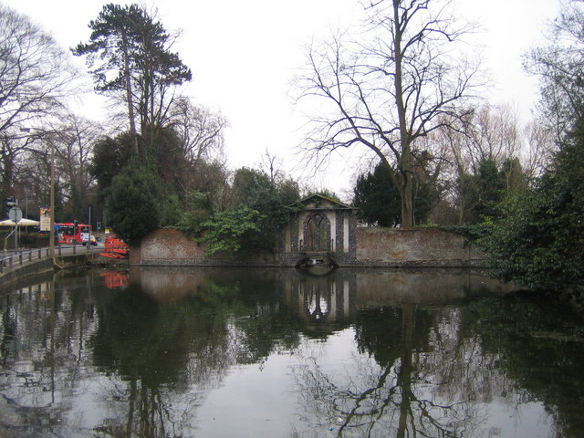
The Hogsmill River in Surrey and Greater London, England is a small chalk stream tributary of the River Thames. It rises in Ewell and flows into the Thames at Kingston upon Thames on the lowest non-tidal reach, that above Teddington Lock. The river is long and has a catchment area of about . Nearby land was formerly flood-meadows; following improvements it is now mostly sports grounds, a sewage treatment works and green space, save for Kingston and Epsom town centres. It is a habitat of many animals, fish and insects. The 12th-century Clattern Bridge, one of the oldest road bridges in England, crosses the river in the southwest of Kingston town centre. The Coronation Stone, now sited close to the river in Kingston, is believed to have been used for the coronation of Saxon kings in the 10th century. It was used as a horse mounting block until 1850 when it was mounted on a plinth in the town centre. The river has five tributaries: Green Lanes Stream, Ewell Court Stream, Horton ... [...More Info...] [...Related Items...] OR: [Wikipedia] [Google] [Baidu] |
Surbiton
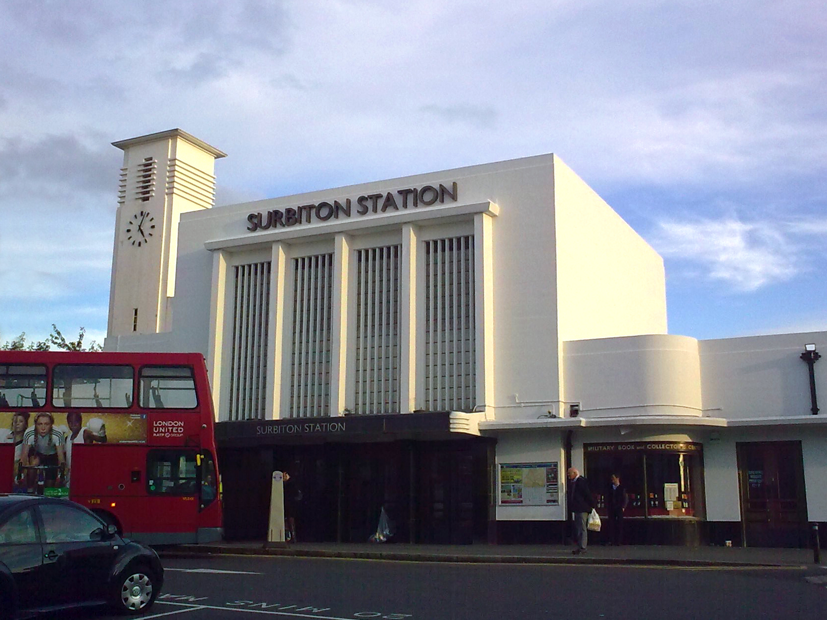
Surbiton is a suburban neighbourhood in South West London, within the Royal Borough of Kingston upon Thames (RBK). It is next to the River Thames, southwest of Charing Cross. Surbiton was in the historic county of Surrey and since 1965 it has been in Greater London. Surbiton comprises four of the RBK's wards: Alexandra, Berrylands, St. Mark's, and Surbiton Hill. Founded originally as Kingston-upon-Railway when the area was first developed in the 1840s, Surbiton possesses a mixture of grand 19th-century townhouses, Art Deco courts, and more recent residential blocks blending in with semi-detached 20th-century housing estates. With a population of 45,132 in 2016, it accounts for approximately 25% of the total population of the Royal Borough of Kingston upon Thames. Surbiton extends over an area of . Etymology Though Surbiton only received its current name in 1869, the name is attested as ''Suberton'' in 1179, ''Surbeton'' in 1263, ''Surpeton'' in 1486, and finally ''Surbi ... [...More Info...] [...Related Items...] OR: [Wikipedia] [Google] [Baidu] |
Kingston And Surbiton (UK Parliament Constituency)
Kingston and Surbiton () is a constituency created in 1997 represented in the House of Commons of the UK Parliament since 2017 by Ed Davey, the Leader of the Liberal Democrats. Kingston and Surbiton has been considered a marginal seat, as well as a swing seat since 2010, as the seat has changed hands twice since that year, and its winner's majority did not exceed 6.6% of the vote since the 13.2% majority won in 2010. In 2019, Davey won a 17.2% majority and a majority of the votes cast and the seat is now a safe seat for the party. Boundaries 1997–2010: The Royal Borough of Kingston upon Thames wards of Berrylands, Burlington, Chessington North, Chessington South, Grove, Hook, Malden Manor, Norbiton Park, Norbiton, St James, St Mark's, Surbiton Hill, Tolworth East, Tolworth South, and Tolworth West. 2010–present: As above less Burlington plus Beverley — and neighbouring Tolworth and Hook wards having been in local government renamed to become Alexandra, Tolworth and ... [...More Info...] [...Related Items...] OR: [Wikipedia] [Google] [Baidu] |
Berrylands
Berrylands is a residential neighbourhood in Surbiton, London, originally forming part of the Municipal Borough of Surbiton, and since 1965 part of the Royal Borough of Kingston upon Thames. It is a suburban development situated south west of Charing Cross. Nearby places include Surbiton, New Malden, Old Malden, Tolworth and Chessington. Berrylands railway station is 24 minutes from London Waterloo by train. History Berrylands is a settlement of Anglo-Saxon origin that is close to the Thames. Berrylands originally formed part of the Municipal Borough of Surbiton, however in 1965 it was incorporated as part of the Royal Borough of Kingston upon Thames. Most of the present housing development took place in the 1930s on the former Berrylands Farm. Old Maps from the 1860s show the western Banks of the Hogsmill River and everything around them to be mostly empty apart from a few small trails and farm buildings with no evidence of real human settlement. In addition the area ... [...More Info...] [...Related Items...] OR: [Wikipedia] [Google] [Baidu] |
Royal Borough Of Kingston Upon Thames
The Royal Borough of Kingston upon Thames is a borough in southwest London. The main town is Kingston upon Thames and it includes Surbiton, Chessington, Malden Rushett, New Malden and Tolworth. It is the oldest of the four royal boroughs in England. The others are Kensington and Chelsea and Greenwich also in London, and Windsor and Maidenhead. The local authority is Kingston upon Thames London Borough Council. Districts in the borough * Berrylands * Canbury * Chessington * Coombe * Hook * Kingston upon Thames * Kingston Vale * Malden Rushett * Motspur Park * New Malden * Norbiton * Old Malden * Surbiton * Tolworth Adjacent local government districts * Elmbridge * Epsom and Ewell * Merton * Mole Valley * Richmond upon Thames * Sutton * Wandsworth History Kingston upon Thames, on the south bank of the River Thames has existed for many hundreds of years. Many Roman relics have been found in the surrounding areas. A church has stood on the site of All Saints' Church, i ... [...More Info...] [...Related Items...] OR: [Wikipedia] [Google] [Baidu] |
A3 Road
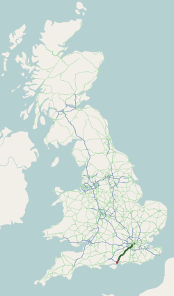
The A3, known as the Portsmouth Road or London Road in sections, is a major road connecting the City of London and Portsmouth passing close to Kingston upon Thames, Guildford, Haslemere and Petersfield. For much of its length, it is classified as a trunk road and therefore managed by National Highways. Almost all of the road has been built to dual carriageway standards or wider. Apart from bypass sections in London, the road travels in a southwest direction and, after Liss, south-southwest. Close to its southerly end, motorway traffic is routed via the A3(M), then either the east–west A27 or the Portsmouth-only M275 which has multiple lanes leading off the westbound A27 — for non-motorway traffic, the A3 continues into Portsmouth alongside the A3(M), mostly as a single carriageway in each direction through Waterlooville and adjoining small towns. The other section of single carriageways is through the urban environs of Battersea, Clapham and Stockwell towards th ... [...More Info...] [...Related Items...] OR: [Wikipedia] [Google] [Baidu] |
Chessington
Chessington is an area in the Royal Borough of Kingston upon Thames within Greater London. Historically part of Surrey, today it is the largest salient of Greater London into that county. At the 2011 census it had a population of 18,973. The Bonesgate Stream, a tributary of the Hogsmill River, runs through it. The popular theme park resort Chessington World of Adventures, which incorporates Chessington Zoo, is located in the south-west of the area. Neighbouring settlements include Tolworth, Ewell, Surbiton, Claygate, Epsom, Oxshott, Leatherhead, Esher, Kingston upon Thames and Worcester Park. History Its name came from Anglo-Saxon ''Cissan dūn'' = "hill belonging to man namedCissa". Chessington appears in the Domesday Book as ''Cisedune'' and ''Cisendone''. It was held partly by Robert de Wateville and partly by Milo (Miles) Crispin. Its Domesday assets were: 1½ hides; part of a mill worth 2s, 4 ploughs, woodland worth 30 hogs. It rendered £7. The mansion at C ... [...More Info...] [...Related Items...] OR: [Wikipedia] [Google] [Baidu] |
New Malden
New Malden is an area in South West London, England. It is located mainly within the Royal Borough of Kingston upon Thames and the London Borough of Merton, and is from Charing Cross. Neighbouring localities include Kingston, Norbiton, Raynes Park, Surbiton, Tolworth, Wimbledon and Worcester Park. Prior to the creation of Greater London in 1965, New Malden was in the administrative county of Surrey. History New Malden was established entirely as a result of the arrival of the railway, when what is now called New Malden railway station was opened on 1 December 1846 on the main line from London Waterloo. Building started slowly in the area just to the north of the station, gathering pace in the late nineteenth and early twentieth centuries with two- and three-bedroom terraced houses. Further out towards Coombe Hill are larger detached and semi-detached houses from the 1930s. The name of the road which leads up the hill to Coombe, Traps Lane, is thought to derive from a farm ... [...More Info...] [...Related Items...] OR: [Wikipedia] [Google] [Baidu] |
Worcester Park
Worcester Park is a suburban town in South West London, England. It lies in the London boroughs of Sutton and Kingston, and partly in the Surrey borough of Epsom and Ewell. The area is southwest of Charing Cross. The suburb's population was 16,031 at the time of the 2001 census. The suburb comprises the Worcester Park ward, an electoral area of the London Borough of Sutton with a population in of , as well as the Cuddington ward, an electoral area of Epsom and Ewell, which had a population of 5,791 at the time of the 2001 census. The Worcester Park post town, which is coterminous with the KT4 postcode district, covers all of the suburb and also extends into Old Malden. The Beverley Brook runs through Worcester Park, alongside Green Lane and past Green Lane Primary School and Cheam Common Junior School for the special needs, traversing up to Cuddington Recreation Ground. Green Lane appears in the Domesday Book. The Huntsmans Hall (now The Brook) was situated on what ... [...More Info...] [...Related Items...] OR: [Wikipedia] [Google] [Baidu] |
Kingston Upon Thames
Kingston upon Thames (hyphenated until 1965, colloquially known as Kingston) is a town in the Royal Borough of Kingston upon Thames, southwest London, England. It is situated on the River Thames and southwest of Charing Cross. It is notable as the ancient market town in which Saxon kings were crowned and today is the administrative centre of the Royal Borough. Historically in the county of Surrey, the ancient parish of Kingston became absorbed in the Municipal Borough of Kingston-upon-Thames, reformed in 1835. From 1893 to 2021 it was the location of Surrey County Council, extraterritorially in terms of local government administration since 1965, when Kingston became a part of Greater London. Today, most of the town centre is part of the KT1 postcode area, but some areas north of Kingston railway station are within KT2. The United Kingdom Census 2011 recorded the population of the town (comprising the four wards of Canbury, Grove, Norbiton and Tudor) as 43,013, w ... [...More Info...] [...Related Items...] OR: [Wikipedia] [Google] [Baidu] |
Hinchley Wood
Hinchley Wood is a suburb in the Elmbridge borough of Surrey, England, approximately 13 miles (21 km) south-west of Charing Cross in central London, and within the Greater London Urban Area. It developed largely around its railway station at its heart on the New Guildford Line — and many of its homes house at least one commuter to Central London. The suburb has one main parade of convenience shops, local services and a petrol station; throughout the area is a light smattering of small businesses. A double-width section of the A309 bisects the suburb which acts as a local spur road to a semi-urban section of the motorway-standard A3 road. The suburb's main retail area is directly north of a traffic light intersection adjoined by a large set of retirement flats. The suburb has no high-rise buildings and gained its first place of worship in 1953. Hinchley Wood, has the London dialling code 020. History The only old listed building is the 16th century Old Farm House i ... [...More Info...] [...Related Items...] OR: [Wikipedia] [Google] [Baidu] |
Ewell
Ewell ( , ) is a suburban area with a village centre in the borough of Epsom and Ewell in Surrey, approximately south of central London and northeast of Epsom. In the 2011 Census, the settlement had a population of 34,872, a majority of which (73%) is in the ABC1 social class, except the Ruxley Ward that is C2DE. Ewell was founded as a spring line settlement, where the permeable chalk of the North Downs meets the impermeable London Clay, and the Hogsmill River (a tributary of the River Thames) still rises at a spring close to Bourne Hall in the village centre. Recorded in Domesday Book as ''Etwelle'', the settlement was granted a licence to hold a market in 1618. The opening of railway stations to the east and west of the centre, in 1847 and 1859 respectively, facilitated the creation of extensive residential areas, which are now contiguous with the Greater London suburbs. History The name ''Ewell'' derives from Old English ''æwell'', which means ''river source'' or ... [...More Info...] [...Related Items...] OR: [Wikipedia] [Google] [Baidu] |


.jpg)


