|
Tobucksy County, Choctaw Nation
Tobucksy County was a political subdivision of the Choctaw Nation of Indian Territory, prior to Oklahoma becoming a state. It was part of the Moshulatubbee District, or First District, one of three administrative super-regions. History The county was also spelled, variously, as Toboxy, Tobuxy and Tobaksi. Its name in Choctaw was ''Tobaksi Kaunti'', for the Choctaw word meaning “coal.” Coal was known to be present in the area at the county's creation and later became its chief industry, in a string of coal mines stretching from McAlester and Perryville eastward. Settlement was confined mostly to the valleys and lowlands, with farming and mining being the major activities. Tobucky County was defined by the Canadian River, which formed its northern border, the Shawnee Hills in the west, and the San Bois Mountains in the east. The crossing of the east–west California Road (later becoming the busy Fort Arbuckle-to- Fort Smith military road) with the north–south Tex ... [...More Info...] [...Related Items...] OR: [Wikipedia] [Google] [Baidu] |
Choctaw Nation Of Oklahoma
The Choctaw Nation (Choctaw: ''Chahta Okla'') is a Native American territory covering about , occupying portions of southeastern Oklahoma in the United States. The Choctaw Nation is the third-largest federally recognized tribe in the United States and the second-largest Indian reservation in area after the Navajo. As of 2011, the tribe has 223,279 enrolled members, of whom 84,670 live within the state of Oklahoma and 41,616 live within the Choctaw Nation's jurisdiction. A total of 233,126 people live within these boundaries, with its tribal jurisdictional area comprising 10.5 counties in the state, with the seat of government being located in Durant, Oklahoma. It shares borders with the reservations of the Chickasaw, Muscogee, and Cherokee, as well as the U.S. states of Texas and Arkansas. By area, the Choctaw Nation is larger than eight U.S. states. The chief of the Choctaw Nation is Gary Batton, who took office on April 29, 2014, after the retirement of Gregory E. Pyle ... [...More Info...] [...Related Items...] OR: [Wikipedia] [Google] [Baidu] |
Indian Territory In The Civil War
During the American Civil War, most of what is now the U.S. state of Oklahoma was designated as the Indian Territory. It served as an Territories of the United States#Formerly unorganized territories, unorganized region that had been set aside specifically for Native Americans in the United States, Native American tribes and was occupied mostly by tribes which had been Indian removal, removed from their ancestral lands in the Southeastern United States following the Indian Removal Act of 1830. As part of the Trans-Mississippi Theater of the American Civil War, Trans-Mississippi Theater, the Indian Territory was the scene of numerous skirmishes and seven officially recognized battles involving both Confederate Units of Indian Territory, Native American units allied with the Confederate States of America and Native Americans loyal to the United States government, as well as other Union (American Civil War), Union and Confederate troops. Most tribal leaders in Indian Territory ali ... [...More Info...] [...Related Items...] OR: [Wikipedia] [Google] [Baidu] |
Pittsburg County, Oklahoma
Pittsburg County is a county located in the U.S. state of Oklahoma. As of the 2010 census, the population was 45,837. Its county seat is McAlester. The county was formed from part of the Choctaw Nation in Indian Territory in 1907. County leaders believed that its coal production compared favorably with Pittsburgh, Pennsylvania at the time of statehood.O'Dell, Larry"Pittsburg County,"''Encyclopedia of Oklahoma History and Culture'', Oklahoma Historical Society, 2009. Accessed April 4, 2015. Pittsburg County comprises the McAlester, OK Micropolitan Statistical Area. History The area forming Pittsburg County was part of the Choctaw Nation after the Choctaw tribe was forced to relocate to Indian Territory from its home in the Southeastern United States in the early 1830s. Unlike the State of Oklahoma, whose county boundaries follow the precise north–south, east–west grid provided by Oklahoma's township and range system, the Choctaw Nation established its internal divisions ... [...More Info...] [...Related Items...] OR: [Wikipedia] [Google] [Baidu] |
Eufaula, Oklahoma
Eufaula is a city and county seat of McIntosh County, Oklahoma, United States. The population was 2,813 at the 2010 census, an increase of 6.6 percent from 2,639 in 2000. Eufaula is in the southern part of the county, north of McAlester and south of Muskogee.John C. Harkey and Mary C. Harkey, "Eufaula," ''Encyclopedia of Oklahoma History and Culture''. Accessed March 10, 2015. The name "Eufaula" comes from the Eufaula tribe, part of the Muscogee Creek Confederacy. The town and county are within the jurisdiction of the f ... [...More Info...] [...Related Items...] OR: [Wikipedia] [Google] [Baidu] |
Checotah, Oklahoma
Checotah is a town in McIntosh County, Oklahoma, United States. It was named for Samuel Checote, the first chief of the Creek Nation elected after the Civil War. Its population was 3,481 at the 2000 census. According to Census 2010, the population has decreased to 3,335; a 4.19% loss. Checotah is home to numerous antique malls, a Civil War battle site, and a downtown historic district. Checotah claims to be the steer wrestling capital of the world. Early boosters called Checotah "The Gem of the Prairie".Checotah Landmark Preservation Society, "Checotah." ''Encyclopedia of Oklahoma History and Culture''. Accessed February 20, 2013.] History [...More Info...] [...Related Items...] OR: [Wikipedia] [Google] [Baidu] |
Sequoyah Constitutional Convention
The Sequoyah Constitutional Convention was an American Indian-led attempt to secure statehood for Indian Territory as an Indian-controlled jurisdiction, separate from the Oklahoma Territory. The proposed state was to be called the State of Sequoyah. The convention drafted a constitution, drew up a plan of organization for the government, put together a map showing the counties to be established, and elected delegates to go to the United States Congress to petition for statehood. The convention's proposals were put to a referendum in Indian Territory, and received overwhelming endorsement by voters. However, the delegation received a cool reception in Washington, D.C., due to party politics, and failed to secure its goals. Although unsuccessful, the convention paved the way for the creation of the U.S. state of Oklahoma. Background The Five Civilized Tribes and other tribes in Indian territory were generally opposed to local and national efforts for statehood. As mandated by t ... [...More Info...] [...Related Items...] OR: [Wikipedia] [Google] [Baidu] |
State Of Sequoyah
The State of Sequoyah was a proposed state to be established from the Indian Territory in the eastern part of present-day Oklahoma. In 1905, with the end of tribal governments looming (as prescribed by the Curtis Act of 1898), Native Americans of the Five Civilized Tribes—the Cherokee, Choctaw, Chickasaw, Creek (Muscogee), and Seminole—in Indian Territory proposed to create a state as a means to retain control of their lands. Their intention was to have a state under Native American constitution and governance. The proposed state was to be named in honor of Sequoyah, the Cherokee who created a writing system in 1825 for the Cherokee language. Background Starting in 1890, when Congress passed the Oklahoma Organic Act, the land that now forms the State of Oklahoma was made up of two separate territories: Oklahoma Territory to the west and the Indian Territory to the east. The Indian Territory had a large Native American population. The territory had been reduced by ... [...More Info...] [...Related Items...] OR: [Wikipedia] [Google] [Baidu] |
Chickasaw Nation
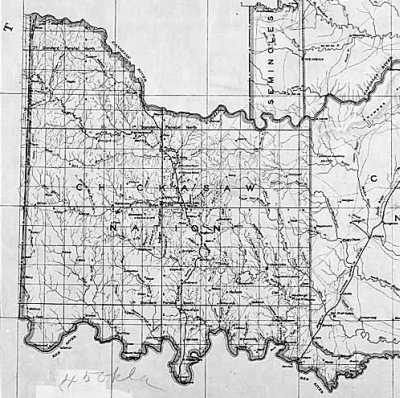
The Chickasaw Nation ( Chickasaw: Chikashsha I̠yaakni) is a federally recognized Native American tribe, with its headquarters located in Ada, Oklahoma in the United States. They are an Indigenous people of the Southeastern Woodlands, originally from northern Mississippi, northernwestern Alabama, southwestern Kentucky, and western Tennessee. Today, the Chickasaw Nation is the 13th largest tribe in the United States. Currently, the nation's jurisdictional territory and reservation includes about 7,648 square miles of south-central Oklahoma, including Bryan, Carter, Coal, Garvin, Grady, Jefferson, Johnston, Love, McClain, Marshall, Murray, Pontotoc, and Stephens counties. These counties are separated into four districts, the Pontotoc, Pickens, Tishomingo, and Panola, with relatively equal populations. Their population today is estimated to be 38,000, with the majority residing in the state of Oklahoma. In the 17th and 18th centuries, European Americans considered the Chi ... [...More Info...] [...Related Items...] OR: [Wikipedia] [Google] [Baidu] |
Oklahoma Organic Act
An Organic Act is a generic name for a statute used by the United States Congress to describe a territory, in anticipation of being admitted to the Union as a state. Because of Oklahoma's unique history (much of the state was a place where aboriginal natives have always lived and after forced removal many other tribes were relocated here) an explanation of the Oklahoma Organic Act needs a historic perspective. In general, the Oklahoma Organic Act may be viewed as one of a series of legislative acts, from the time of Reconstruction, enacted by Congress in preparation for the creation of a unified State of Oklahoma. The Organic Act created Oklahoma Territory, and Indian Territory that were Organized incorporated territories of the United States out of the old "unorganized" Indian Territory. The Oklahoma Organic Act was one of several acts whose intent was the assimilation of the tribes in Oklahoma and Indian Territories through the elimination of tribes' communal ownership of p ... [...More Info...] [...Related Items...] OR: [Wikipedia] [Google] [Baidu] |
Battle Of Perryville (Indian Territory)
The Battle of Perryville took place during the American Civil War on August 23, 1863, in what is now Pittsburg County, Oklahoma. Background Perryville was an important town and county seat of Tobucksy County, Choctaw Nation, in the Indian Territory, about halfway between Skullyville Skullyville (also spelled Scullyville) is an unincorporated rural community in Le Flore County, Oklahoma, United States. It is approximately one mile east of Spiro and southwest of Fort Smith, Arkansas. The community is within the Fort Smith, Ar ... and Boggy Depot. during the mid 19th Century. It was established as a trading post by James Perry, member of a Choctaw family, about 1838, ''Oklahoma: A Guide to the Sooner State''. Federal Writers Project. p. 340. 1941. Retrieved September 21 ... [...More Info...] [...Related Items...] OR: [Wikipedia] [Google] [Baidu] |
Texas Road
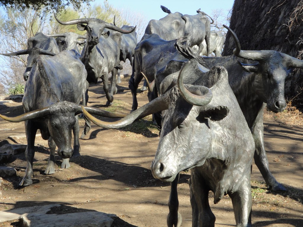
The Texas Road, also known as the Shawnee Trail, Sedalia Trail, or Kansas Trail, was a major trade and emigrant route to Texas across Indian Territory (later Oklahoma, Kansas, and Missouri). Established during the Mexican War by emigrants rushing to Texas, it remained an important route across Indian Territory until Oklahoma statehood. The Shawnee Trail was the earliest and easternmost route by which Texas Longhorn cattle were taken to the north. It played a significant role in the history of Texas, Oklahoma, Missouri, and Kansas in the early and mid-1800s. The Shawnee Trail route "Of the principal routes by which Texas Longhorn cattle were taken afoot to railheads to the north, the earliest and easternmost was the Shawnee Trail. Used before and just after the Civil War, the Shawnee Trail gathered cattle from east and west of its main stem, which passed through Austin, Waco, and Dallas. It crossed the Red River at Rock Bluff, near Preston, and led north along the eastern ... [...More Info...] [...Related Items...] OR: [Wikipedia] [Google] [Baidu] |


