|
Tobermore
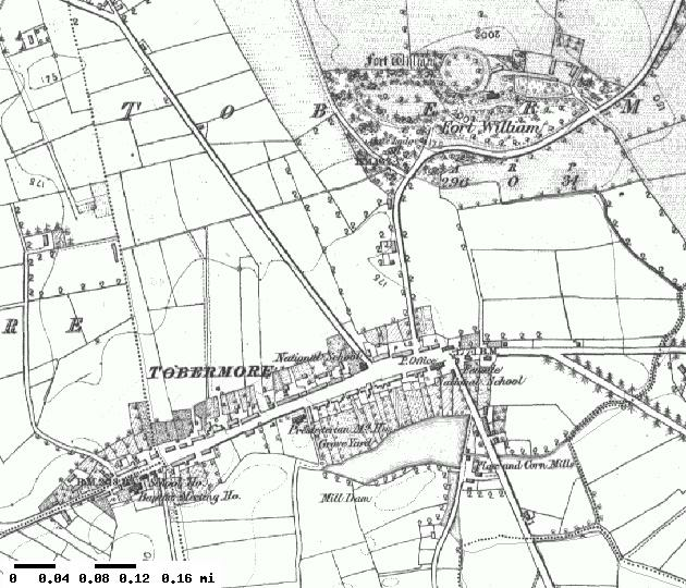
Tobermore (, named after the townland of Tobermore) is a small village in County Londonderry, Northern Ireland. It lies south-south-west of Maghera and north-west of Magherafelt. Tobermore lies within the civil parish of Kilcronaghan and is part of Mid-Ulster District. It was also part of the former barony of Loughinsholin. Tobermore has won the ''Best Kept Small Village'' award four times and the ''Best Kept Large Village'' award in 1986. Most recently in September 2011, Tobermore won the ''Translink Ulster in Bloom'' village category for the third year in a row. Etymology Tobermore is named after the townland of Tobermore which is an anglicisation of the Irish words ''tobar'' meaning "well" and ''mór'' meaning "big/great", thus Tobermore means "big/great well". During the seventeenth century, Tobermore was also known as Tobarmore and Tubbermore, with Tubbermore being the preferred usage of the Masonic Order even to this day. Topography Tobermore lies on the descending ... [...More Info...] [...Related Items...] OR: [Wikipedia] [Google] [Baidu] |
Tobermore (townland)
Tobermore () is a townland lying within the civil parish of Kilcronaghan, County Londonderry, Northern Ireland. It lies in the north-east of the parish, and is bounded by the townlands of; Ballynahone Beg, Calmore, Clooney, Drumballyhagan Clark, Moneyshanere, and Moyesset. It was apportioned to the Drapers company as well as freeholds. The townland was part of the Tobermore electoral ward of the former Magherafelt District Council, however in 1926 it was part of Tobermore district electoral division as part of the Maghera division of Magherafelt Rural District. It was also part of the historic barony of Loughinsholin. History The townland of Tobermore is named after an ancient well that was once sufficiently powerful to power a nearby mill, but has been dry for over a century. Fortwilliam rath and Fortwilliam House are both found in this townland. The townland of Tobermore along with four adjoining townlands formed the "Henry Estate". The town of Tobermore lies mostly in ... [...More Info...] [...Related Items...] OR: [Wikipedia] [Google] [Baidu] |
Kilcronaghan
Kilcronaghan () is a civil parish in County Londonderry, Northern Ireland. Containing one major settlement, Tobermore, and lying on the descending slope of Slieve Gallion, Kilcronaghan is bordered by the civil parishes of Ballynascreen, Desertmartin, Maghera (parish), Maghera, and Termoneeny. It lies within the former historic barony of Loughinsholin and is situated in Mid-Ulster District. As an ecclesiastical parish it lies within the Diocese of Derry and Raphoe. Artefacts of human habitation in the Kilcronaghan area have been traced as far back as 1800-1000 BC. The history of the parish itself can be traced as far back as the 6th century when St Crunathan founded the church from which it takes its name. It has been the site of massacres and executions, with the River Moyola which flows through the parish forming the border between the ancient kingdoms of Ui Tuirtri and Fir Li. Topography The parish of Kilcronaghan lies on the descending slope of Slieve Gallion (), with its hig ... [...More Info...] [...Related Items...] OR: [Wikipedia] [Google] [Baidu] |
Ballynascreen
Draperstown ()Toner, Gregory. ''Place-Names of Northern Ireland'', p. 85. Queen's University of Belfast, 1996; is a village in the Sperrin Mountains in County Londonderry, Northern Ireland. It is situated in the civil parish of Ballinascreen and is part of Mid-Ulster district. It is also part of the Church of Ireland parish of Ballynascreen and the Catholic parish of Ballinascreen, and within the former barony of Loughinsholin. The village lies at the intersection of the townlands of Moykeeran (), Moyheeland (), Cahore and Tonaght. Name Draperstown had its name bestowed upon it in 1818 by the Worshipful Company of Drapers, which had previously named Moneymore as Draperstown.Toner, Gregory; ''Place-Names of Northern Ireland, Volume Five, County Derry I, The Moyola Valley'', 1996. Prior to this however the settlement was originally known as "Borbury" (). It was then recorded as being called "The Cross" in 1813 and "Moyheelan" in 1821. Despite the name given to it by the Drapers ... [...More Info...] [...Related Items...] OR: [Wikipedia] [Google] [Baidu] |
County Londonderry
County Londonderry ( Ulster-Scots: ''Coontie Lunnonderrie''), also known as County Derry ( ga, Contae Dhoire), is one of the six counties of Northern Ireland, one of the thirty two counties of Ireland and one of the nine counties of Ulster. Before the partition of Ireland, it was one of the counties of the Kingdom of Ireland from 1613 onward and then of the United Kingdom after the Acts of Union 1800. Adjoining the north-west shore of Lough Neagh, the county covers an area of and today has a population of about 247,132. Since 1972, the counties in Northern Ireland, including Londonderry, have no longer been used by the state as part of the local administration. Following further reforms in 2015, the area is now governed under three different districts; Derry and Strabane, Causeway Coast and Glens and Mid-Ulster. Despite no longer being used for local government and administrative purposes, it is sometimes used in a cultural context in All-Ireland sporting and cultural even ... [...More Info...] [...Related Items...] OR: [Wikipedia] [Google] [Baidu] |
Ballynahone Beg, Maghera Civil Parish
Ballynahone Beg is a townland lying within the civil parish of Maghera, County Londonderry, Northern Ireland. It lies in the south-west of the parish, and is bounded by the townlands of; Ballynahone More, Clooney, Craigadick, Drumballyhagan, Drumballyhagan Clark, Fallagloon, Falgortrevy, Mullagh, and Tobermore. It was not apportioned to any of the London livery companies, being retained as church lands. The townland in 1926 was part of Maghera district electoral division as part of the Maghera dispensary (registrar's) district of Magherafelt Rural District. As part of Maghera civil parish, Ballynahone Beg also lies within the historic barony of Loughinsholin. See also *Maghera Maghera (pronounced , ) is a small town at the foot of the Glenshane Pass in County Londonderry, Northern Ireland. Its population was 4,220 in the 2011 Census, increasing from 3,711 in the 2001 Census. It is situated within Mid-Ulster Distric ... References Townlands of County Londonde ... [...More Info...] [...Related Items...] OR: [Wikipedia] [Google] [Baidu] |
Draperstown
Draperstown ()Toner, Gregory. ''Place-Names of Northern Ireland'', p. 85. Queen's University of Belfast, 1996; is a village in the Sperrin Mountains in County Londonderry, Northern Ireland. It is situated in the civil parish of Ballinascreen and is part of Mid-Ulster district. It is also part of the Church of Ireland parish of Ballynascreen and the Catholic parish of Ballinascreen, and within the former barony of Loughinsholin. The village lies at the intersection of the townlands of Moykeeran (), Moyheeland (), Cahore and Tonaght. Name Draperstown had its name bestowed upon it in 1818 by the Worshipful Company of Drapers, which had previously named Moneymore as Draperstown.Toner, Gregory; ''Place-Names of Northern Ireland, Volume Five, County Derry I, The Moyola Valley'', 1996. Prior to this however the settlement was originally known as "Borbury" (). It was then recorded as being called "The Cross" in 1813 and "Moyheelan" in 1821. Despite the name given to it by the Drapers ... [...More Info...] [...Related Items...] OR: [Wikipedia] [Google] [Baidu] |
Loughinsholin
Loughinsholin () is a barony in County Londonderry, Northern Ireland. Its southeast borders the northwest shore of Lough Neagh, and itself is bordered by seven other baronies: Dungannon Upper to the south; Strabane Upper to the west; Keenaght and Coleraine to the north; Kilconway, Toome Upper, and Toome Lower to the east. It was formed largely on the extent of the northern part of the medieval Irish túath of Uí Tuirtri. The Sperrin Mountains rise to the west of Loughinsholin, with Slieve Gallion and Carntogher the two most notable mountains of the range in the barony. The Ballinderry River flows along the southern boundary of the barony, with the River Moyola cutting through the middle, both emptying into Lough Neagh. The largest settlement in the barony is town of Magherafelt. History Medieval history and Uí Tuirtri The area of land that forms Loughinsholin has changed control several times throughout history. During the first millennium, it was part of the over-kingdom ... [...More Info...] [...Related Items...] OR: [Wikipedia] [Google] [Baidu] |
Maghera
Maghera (pronounced , ) is a small town at the foot of the Glenshane Pass in County Londonderry, Northern Ireland. Its population was 4,220 in the 2011 Census, increasing from 3,711 in the 2001 Census. It is situated within Mid-Ulster District, as well as the civil parish of Maghera, which it was named after, and the former barony of Loughinsholin. History The town dates back at least to the 6th century to the monastery founded by Saint Lurach whose family were possibly evangelised by Saint Patrick. The ''Annals of Ulster'' say that the seat of the Cenél nEoghain was at Ráth Luraig in Maghera. Standing upon the site of the monastery, the present day ruins of St. Lurach's Church date back to the 10th century. They include, over a doorway, a relief of the crucifixion, possibly the oldest in Ireland. The crucification lintel is reproduced in the contemporary Catholic church, St Mary's. The old church and town were burned in the 12th century. Afterwards, Maghera became the seat ... [...More Info...] [...Related Items...] OR: [Wikipedia] [Google] [Baidu] |
River Moyola
The River Moyola or Moyola River stretches for approximately 27 miles from the Sperrin Mountains to Lough Neagh. The Moyola starts a small river (3-5 metres; 10' to 16') for the first few miles of its length and proceeds to expand to a medium-sized river (5-20 metres; 16' to 65') and then to a large river (20 metres +; 65' plus) for its last couple of miles before Lough Neagh. In ancient times, the River Moyola was known as the 'Bior', and served as the border between the Airgiallan kingdoms of Fir Li and Ui Tuirtri. According to Deirdre and Laurence Flanagan in their book, ''Irish Place Names'', the River Moyola derives its name from ''Magh nÉola'', meaning ''Éolas Plain''.Deirdre & Laurence Flanagan, ''Irish Place Names''; Hydrology The flow or discharge of the river is measured near to its mouth in Lough Neagh. The catchment area to the gauging station is , which yields an average flow of . The maximum recorded flow between 1971 and 2012 was on 19 January 1988. The ... [...More Info...] [...Related Items...] OR: [Wikipedia] [Google] [Baidu] |
Moyola River
The River Moyola or Moyola River stretches for approximately 27 miles from the Sperrin Mountains to Lough Neagh. The Moyola starts a small river (3-5 metres; 10' to 16') for the first few miles of its length and proceeds to expand to a medium-sized river (5-20 metres; 16' to 65') and then to a large river (20 metres +; 65' plus) for its last couple of miles before Lough Neagh. In ancient times, the River Moyola was known as the 'Bior', and served as the border between the Airgiallan kingdoms of Fir Li and Ui Tuirtri. According to Deirdre and Laurence Flanagan in their book, ''Irish Place Names'', the River Moyola derives its name from ''Magh nÉola'', meaning ''Éolas Plain''.Deirdre & Laurence Flanagan, ''Irish Place Names''; Hydrology The flow or discharge of the river is measured near to its mouth in Lough Neagh. The catchment area to the gauging station is , which yields an average flow of . The maximum recorded flow between 1971 and 2012 was on 19 January 1988. The ... [...More Info...] [...Related Items...] OR: [Wikipedia] [Google] [Baidu] |
Fort William, Scotland
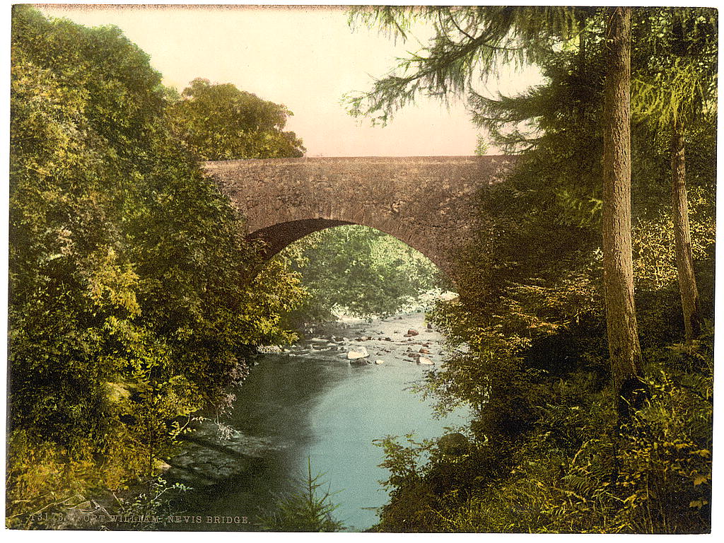
Fort William ( gd, An Gearasdan ; "The Garrison") formerly ( gd, Baile Mairi) and ( gd, Gearasdan dubh Inbhir-Lochaidh) (Lit. "The Black Garrison of Inverlochy"), ( sco, The Fort), formerly ( sco, Maryburgh) is a town in Lochaber in the Scottish Highlands, located on the eastern shore of Loch Linnhe. At the 2011 census, Fort William had a population of 10,459, making it the second largest settlement in both the Highland council area, and the whole of the Scottish Highlands; only the city of Inverness has a larger population. Fort William is a major tourist centre on the Road to the Isles, with Glen Coe just to the south, to the east, and Glenfinnan to the west. It is a centre for hillwalking and climbing due to its proximity to Ben Nevis and many other Munro mountains. It is also known for its nearby downhill mountain bike track. It is the start/end of both the West Highland Way (Milngavie – Fort William) and the Great Glen Way (a walk/cycle way Fort William–Inverness). ... [...More Info...] [...Related Items...] OR: [Wikipedia] [Google] [Baidu] |
William III Of England
William III (William Henry; ; 4 November 16508 March 1702), also widely known as William of Orange, was the sovereign Prince of Orange from birth, Stadtholder of County of Holland, Holland, County of Zeeland, Zeeland, Lordship of Utrecht, Utrecht, Guelders, and Lordship of Overijssel, Overijssel in the Dutch Republic from the 1670s, and King of England, Monarchy of Ireland, Ireland, and List of Scottish monarchs, Scotland from 1689 until his death in 1702. As King of Scotland, he is known as William II. He is sometimes informally known as "King Billy" in Ireland and Scotland. His victory at the Battle of the Boyne in 1690 is The Twelfth, commemorated by Unionism in the United Kingdom, Unionists, who display Orange Order, orange colours in his honour. He ruled Britain alongside his wife and cousin, Queen Mary II, and popular histories usually refer to their reign as that of "William and Mary". William was the only child of William II, Prince of Orange, and Mary, Princess Royal an ... [...More Info...] [...Related Items...] OR: [Wikipedia] [Google] [Baidu] |


