|
Tlaxcala Territory
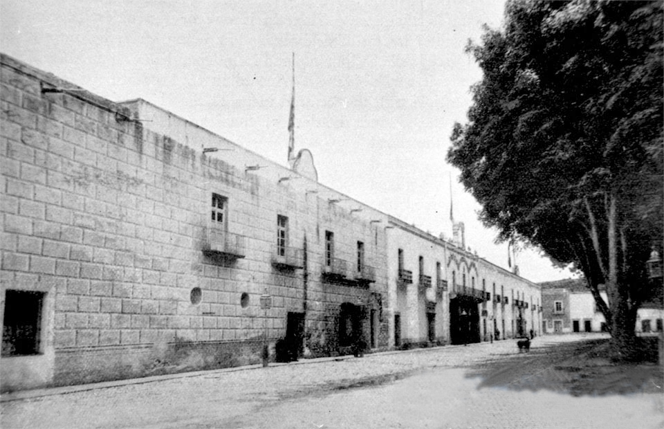
Tlaxcala Territory ( es, Territorio de Tlaxcala) was a territory of Mexico, from 1824 to 1857.https://archivos.juridicas.unam.mx/www/bjv/libros/1/8/32.pdf The capital was Tlaxcala City. The territory was located in East-Central Mexico, in the Altiplano region, with the eastern portion dominated by the Sierra Madre Oriental. The territory was created on 24 November 1824, with its territory carved from the State of Puebla. Under the Centralist Regime, the territory was a part of the Department of Mexico between 1836 and 1846. On 3 October 1857, the territory became the State of Tlaxcala. See also *History of Tlaxcala *Territories of Mexico *1824 Constitution of Mexico The Federal Constitution of the United Mexican States of 1824 ( es, Constitución Federal de los Estados Unidos Mexicanos de 1824) was enacted on October 4 of 1824, after the overthrow of the Mexican Empire of Agustin de Iturbide. In the new Fr ... References Territories of Mexico History of Puebl ... [...More Info...] [...Related Items...] OR: [Wikipedia] [Google] [Baidu] |
Tlaxcala In Mexico (1824)
Tlaxcala (; , ; from nah, Tlaxcallān ), officially the Free and Sovereign State of Tlaxcala ( es, Estado Libre y Soberano de Tlaxcala), is one of the 32 states which comprise the Political divisions of Mexico, Federal Entities of Mexico. It is divided into Municipalities of Tlaxcala, 60 municipalities and the capital city is Tlaxcala City. It is located in East-Central Mexico, in the Mexican plateau, altiplano region, with the eastern portion dominated by the Sierra Madre Oriental. It is bordered by the states of Puebla to the north, east and south, State of Mexico, México to the west and Hidalgo (state), Hidalgo to the northwest. It is the smallest state of the republic, accounting for only 0.2% of the country's territory. The state is named after its capital, Tlaxcala, which was also the name of the Pre-Columbian city and culture. The Tlaxcaltec, Tlaxcalans allied themselves with the Spanish to defeat the Aztecs, with concessions from the Spanish that allowed the territory ... [...More Info...] [...Related Items...] OR: [Wikipedia] [Google] [Baidu] |
Territories Of Mexico
The Territories of Mexico are part of the history of 19th and 20th century independent Mexico. The country created territories (''territorios'') for areas too lightly populated to be states, or for political reasons. The 1824 Constitution of Mexico defined four territories. Seven others were created later in the 19th and early 20th centuries. {, class="wikitable sortable" ! Date !Territory !Change !Legal source , - , width=80px, 1824-10-04 , Alta California Territory , created , 1824 Constitution of Mexico , - , 1824-10-04 , Baja California Territory , created , 1824 Constitution of Mexico , - , 1914-07-04 , Bravo Territory , created from parts of Chihuahua , , - , 1824-10-04 , , created , 1824 Constitution of Mexico , - , 1914-07-04 , Jiménez Territory , created from parts of Chihuahua , , - , 1914-07-04 , Morelos Territory , created from Morelos , , - , 1824-10-04 , Nuevo México Territory , created , 1824 Constitution of Mexico , - , ... [...More Info...] [...Related Items...] OR: [Wikipedia] [Google] [Baidu] |
Tlaxcala City
Tlaxcala, officially Tlaxcala de Xicohténcatl (), is the capital city of the Mexican state of Tlaxcala and seat of the municipality of the same name. The city did not exist during the pre-Hispanic period but was laid out by the Spanish as a center of evangelization and governance after the Spanish conquest of the Aztec Empire. The city was designated as a diocese but eventually lost that status to Puebla as its population declined. The city still has many of its old colonial structures, including the former Franciscan monastery, and newer civic structures like the Xicohtencatl Theatre. History The name Tlaxcala most likely comes from a Nahuatl phrase which means “place of corn bread.” The Aztec glyph for the Mesoamerican dominion is two hills from which emerge a pair of hands making a tortilla. The site of the modern city did not have a settlement for most of the pre Hispanic era. The area was ruled by a coalition of four dominions called Tepeticpac, Ocotelolco, Tizatlan ... [...More Info...] [...Related Items...] OR: [Wikipedia] [Google] [Baidu] |
Mexico
Mexico (Spanish: México), officially the United Mexican States, is a country in the southern portion of North America. It is bordered to the north by the United States; to the south and west by the Pacific Ocean; to the southeast by Guatemala, Belize, and the Caribbean Sea; and to the east by the Gulf of Mexico. Mexico covers ,Mexico ''''. . making it the world's 13th-largest country by are ... [...More Info...] [...Related Items...] OR: [Wikipedia] [Google] [Baidu] |
Mexican Plateau
The Central Mexican Plateau, also known as the Mexican Altiplano ( es, Altiplanicie Mexicana), is a large arid-to-semiarid plateau that occupies much of northern and central Mexico. Averaging above sea level, it extends from the US-Mexico border, United States border in the north to the Trans-Mexican Volcanic Belt in the south, and is bounded by the and to the west and east, respectively. A low east-west mountain range in the state of Zacatecas divides the plateau into northern and southern sections. These two sections, called the Northern Plateau () and Central Plateau (), are now generally regarded by geographers as sections of one plateau. The Mexican Plateau is mostly covered by deserts and xeric shrublands, with madrean pine-oak woodlands, pine-oak forests covering the surrounding mountain ranges and forming sky islands on some of the interior ranges. The Mexican Altiplano is one of six distinct physiographic sections of the Basin and Range Province, which in turn is part ... [...More Info...] [...Related Items...] OR: [Wikipedia] [Google] [Baidu] |
Sierra Madre Oriental
The Sierra Madre Oriental () is a mountain range in northeastern Mexico. The Sierra Madre Oriental is part of the American Cordillera, a chain of mountain ranges (cordillera) that consists of an almost continuous sequence of mountain ranges that form the western "backbone" of North America, Central America, South America, and Antarctica. Setting Spanning the Sierra Madre Oriental runs from the Rio Grande on the border between Coahuila and Texas south through Nuevo León, southwest Tamaulipas, San Luis Potosí, Querétaro, and Hidalgo to northern Puebla, where it joins with the east-west running Eje Volcánico Transversal of central Mexico. The northernmost are the Sierra del Burro and the Sierra del Carmen which reach the border with the United States at the Rio Grande. North of the Rio Grande, the range continues northwestward into Texas and beyond as the Davis and Guadalupe Ranges. Mexico's Gulf Coastal Plain lies to the east of the range, between the mountains and the Gul ... [...More Info...] [...Related Items...] OR: [Wikipedia] [Google] [Baidu] |
Puebla
Puebla ( en, colony, settlement), officially Free and Sovereign State of Puebla ( es, Estado Libre y Soberano de Puebla), is one of the 32 states which comprise the Federal Entities of Mexico. It is divided into 217 municipalities and its capital is the city of Puebla. It is located in East-Central Mexico. It is bordered by the states of Veracruz to the north and east, Hidalgo, México, Tlaxcala and Morelos to the west, and Guerrero and Oaxaca to the south. The origins of the state lie in the city of Puebla, which was founded by the Spanish in this valley in 1531 to secure the trade route between Mexico City and the port of Veracruz. By the end of the 18th century, the area had become a colonial province with its own governor, which would become the State of Puebla, after the Mexican War of Independence in the early 19th century. Since that time the area, especially around the capital city, has continued to grow economically, mostly through industry, despite being the scene o ... [...More Info...] [...Related Items...] OR: [Wikipedia] [Google] [Baidu] |
Centralist Republic Of Mexico
The Centralist Republic of Mexico ( es, República Centralista de México), or in the anglophone scholarship, the Central Republic, officially the Mexican Republic ( es, República Mexicana), was a unitary political regime established in Mexico on October 23, 1835, under a new constitution known as the Seven Laws after conservatives repealed the federalist Constitution of 1824 and ended the First Mexican Republic. It would ultimately last until 1846 when the Constitution of 1824 was restored at the beginning of the Mexican American War. Two presidents would predominate throughout this era: Santa Anna, and Anastasio Bustamante. Mexican conservatives attributed the political chaos of the federal era to the empowerment of states over the federal government, the participation of non-elite men in the political system through universal male suffrage, rebellions, and economic stagnation to the weakness of the federal government. Conservative elites saw the solution to the problem as ... [...More Info...] [...Related Items...] OR: [Wikipedia] [Google] [Baidu] |
Department Of Mexico
The Mexico Department ( es, Departamento de México) was a department during both periods of the Centralist Regime of Mexico in the 19th century, first existing between 1835 and 1846, and again between 1853 and 1856. History The Mexico Department was created on 23 October 1835 as a move prior to the replacement of the federal system in place since 1824 for the centralist system, which was formally implemented through the Seven Laws promulgated on 30 December 1836. The department consisted of what was the State of Mexico, the federal district and the Tlaxcala Territory; its capital was Mexico City. It dissolved on 22 August 1846, when it returned to the federal system and the departments became states again. With the ascension of Antonio López de Santa Anna to power, the federal states lost their autonomy and became departments again, confirmed with the decree of 22 April 1853; the established organization was short lived, since on 1 March 1854 the Plan of Ayulta dictated a r ... [...More Info...] [...Related Items...] OR: [Wikipedia] [Google] [Baidu] |
Tlaxcala
Tlaxcala (; , ; from nah, Tlaxcallān ), officially the Free and Sovereign State of Tlaxcala ( es, Estado Libre y Soberano de Tlaxcala), is one of the 32 states which comprise the Federal Entities of Mexico. It is divided into 60 municipalities and the capital city is Tlaxcala City. It is located in East-Central Mexico, in the altiplano region, with the eastern portion dominated by the Sierra Madre Oriental. It is bordered by the states of Puebla to the north, east and south, México to the west and Hidalgo to the northwest. It is the smallest state of the republic, accounting for only 0.2% of the country's territory. The state is named after its capital, Tlaxcala, which was also the name of the Pre-Columbian city and culture. The Tlaxcalans allied themselves with the Spanish to defeat the Aztecs, with concessions from the Spanish that allowed the territory to remain mostly intact throughout 300 years of colonial period. After Mexican Independence, Tlaxcala was declared a f ... [...More Info...] [...Related Items...] OR: [Wikipedia] [Google] [Baidu] |
Territories Of Mexico
The Territories of Mexico are part of the history of 19th and 20th century independent Mexico. The country created territories (''territorios'') for areas too lightly populated to be states, or for political reasons. The 1824 Constitution of Mexico defined four territories. Seven others were created later in the 19th and early 20th centuries. {, class="wikitable sortable" ! Date !Territory !Change !Legal source , - , width=80px, 1824-10-04 , Alta California Territory , created , 1824 Constitution of Mexico , - , 1824-10-04 , Baja California Territory , created , 1824 Constitution of Mexico , - , 1914-07-04 , Bravo Territory , created from parts of Chihuahua , , - , 1824-10-04 , , created , 1824 Constitution of Mexico , - , 1914-07-04 , Jiménez Territory , created from parts of Chihuahua , , - , 1914-07-04 , Morelos Territory , created from Morelos , , - , 1824-10-04 , Nuevo México Territory , created , 1824 Constitution of Mexico , - , ... [...More Info...] [...Related Items...] OR: [Wikipedia] [Google] [Baidu] |
1824 Constitution Of Mexico
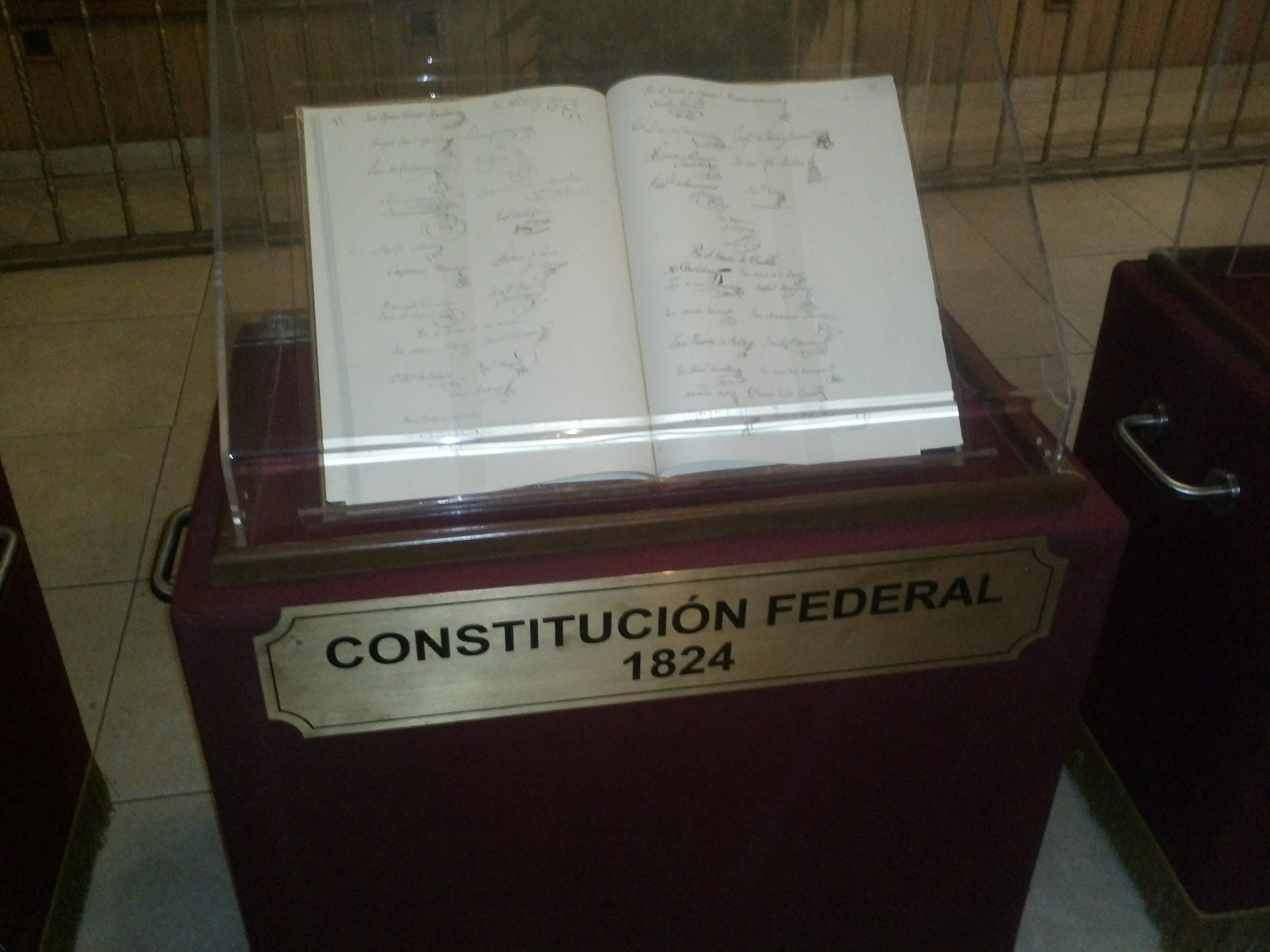
The Federal Constitution of the United Mexican States of 1824 ( es, Constitución Federal de los Estados Unidos Mexicanos de 1824) was enacted on October 4 of 1824, after the overthrow of the Mexican Empire of Agustin de Iturbide. In the new Frame of Government, the republic took the name of United Mexican States, and was defined as a representative federal republic, with Catholicism as the official and unique religion.Federal Constitution of the United Mexican States (1824) It was replaced by the . |


