|
Tirari–Sturt Stony Desert
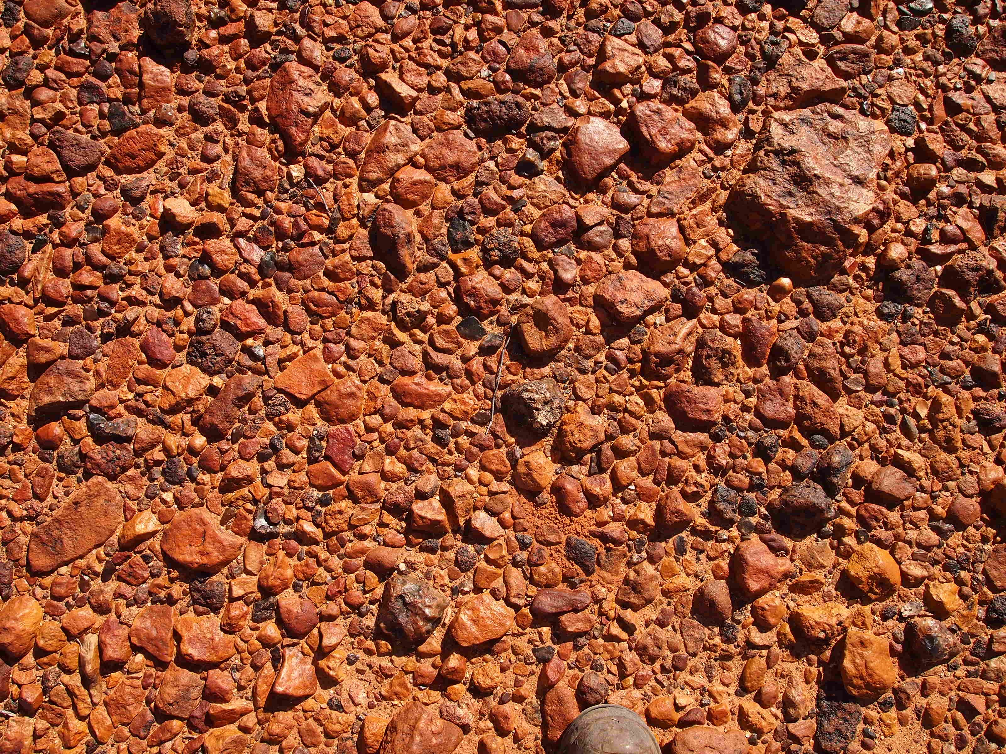
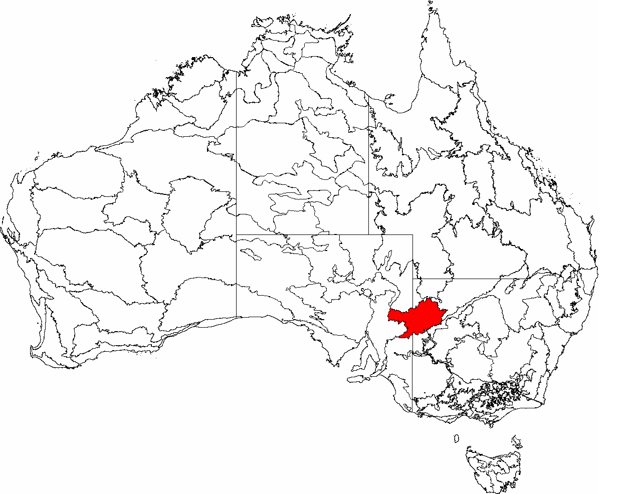
The Tirari–Sturt stony desert is a deserts and xeric shrublands ecoregion in central Australia. Location and description The Tirari–Sturt stony desert ecoregion contains the gibber plains (desert pavement) and red sands of the large Sturt Stony Desert, the Tirari Desert to its southwest and the Flinders and Gawler Ranges to the south. The Tirari has more sand dunes than the Sturt Stony Desert and has also been the site of some important fossil findings. Towns of the ecoregion include the opal mining centre of Coober Pedy, famous for its underground dwellings. The climate is very hot with summer temperatures reaching 50 °C. The region consists of the Stony Plains, Gawler, Flinders Lofty Block and the Broken Hill Complex bioregions of the Interim Biogeographic Regionalisation for Australia (IBRA). [...More Info...] [...Related Items...] OR: [Wikipedia] [Google] [Baidu] |
Gawler Range
The Gawler Ranges are a range of stoney hills in South Australia to the north of Eyre Peninsula. The Eyre Highway skirts the south of the ranges. The Gawler Ranges National Park is in the ranges north of Kimba, South Australia, Kimba and Wudinna, South Australia, Wudinna. The ranges are covered by the Gawler Ranges Native Title Claim. History The traditional owners of the Gawler Ranges are the Barngarla, Kokatha and Wirangu peoples, who have inhabited the area for at least 30,000 years and are now known collectively as the Gawler Ranges Aboriginal People. These Aboriginal Australians, Aboriginal peoples maintained and used rock holes in the granite rock formations as a water source. The ranges were named by Edward John Eyre after the Governor of South Australia, George Gawler in 1839. This was on one of Eyre's Eyre's 1839 expeditions, earlier expeditions before his famous crossing of the Nullarbor Plain further west. It was on this expedition that Edward John Eyre made the fir ... [...More Info...] [...Related Items...] OR: [Wikipedia] [Google] [Baidu] |
Gibber Plain
A desert pavement, also called reg (in the western Sahara), serir (eastern Sahara), gibber (in Australia), or saï (central Asia) is a desert surface covered with closely packed, interlocking angular or rounded rock fragments of pebble and cobble size. They typically top alluvial fans. Desert varnish collects on the exposed surface rocks over time. Geologists debate the mechanics of pavement formation and their age. Formation Several theories have been proposed for the formation of desert pavements. A common theory suggests that they form through the gradual removal of sand, dust and other fine-grained material by the wind and intermittent rain, leaving the larger fragments behind. The larger fragments are shaken into place through the forces of rain, running water, wind, gravity, creep, thermal expansion and contraction, wetting and drying, frost heaving, animal traffic, and the Earth's constant microseismic vibrations. The removal of small particles by wind does not continue ... [...More Info...] [...Related Items...] OR: [Wikipedia] [Google] [Baidu] |
Department Of The Environment And Water Resources
The Minister for Resources is an Australian Government cabinet position which is currently held by Madeleine King following the swearing in of the full Albanese ministry on 1 June 2022. In the Government of Australia, the ministers administer this portfolio through the Department of Industry, Science and Resources. Mission and outcomes Information about the department's functions and/or government funding allocation could be found in the Administrative Arrangements Orders, the annual Portfolio Budget Statements, in the department's annual reports and on the department's website. At its creation, the department was responsible for: *Environment protection and conservation of biodiversity *Air Quality *National fuel quality standards *Land contamination *Meteorology *Administration of the Australian Antarctic Territory and the Territory of Heard Island and McDonald Islands *Natural, built and movable cultural heritage *Greenhouse policy coordination *Environmental research *Wat ... [...More Info...] [...Related Items...] OR: [Wikipedia] [Google] [Baidu] |
Environment Australia
Environment most often refers to: __NOTOC__ * Natural environment, all living and non-living things occurring naturally * Biophysical environment, the physical and biological factors along with their chemical interactions that affect an organism or a group of organisms Other physical and cultural environments *Ecology, the branch of ethology that deals with the relations of organisms to one another and to their physical surroundings *Environment (systems), the surroundings of a physical system that may interact with the system by exchanging mass, energy, or other properties *Built environment, constructed surroundings that provide the setting for human activity, ranging from the large-scale civic surroundings to the personal places *Social environment, the culture that an individual lives in, and the people and institutions with whom they interact *Market environment, business term Arts, entertainment and publishing * ''Environment'' (magazine), a peer-reviewed, popular enviro ... [...More Info...] [...Related Items...] OR: [Wikipedia] [Google] [Baidu] |
Interim Biogeographic Regionalisation For Australia
The Interim Biogeographic Regionalisation for Australia (IBRA) is a biogeographic regionalisation of Australia developed by the Australian government's Department of Sustainability, Environment, Water, Population, and Communities. It was developed for use as a planning tool, for example for the establishment of a national reserve system. The first version of IBRA was developed in 1993–94 and published in 1995. Within the broadest scale, Australia is a major part of the Australasia biogeographic realm, as developed by the World Wide Fund for Nature. Based on this system, the world is also split into 14 terrestrial habitats, of which eight are shared by Australia. The Australian land mass is divided into 89 bioregions and 419 subregions. Each region is a land area made up of a group of interacting ecosystems that are repeated in similar form across the landscape. IBRA is updated periodically based on new data, mapping improvements, and review of the existing scheme. The most ... [...More Info...] [...Related Items...] OR: [Wikipedia] [Google] [Baidu] |
Bioregion
A bioregion is an ecologically and geographically defined area that is smaller than a biogeographic realm, but larger than an ecoregion or an ecosystem, in the World Wide Fund for Nature classification scheme. There is also an attempt to use the term in a rank-less generalist sense, similar to the terms "biogeographic area" or "biogeographic unit". It may be conceptually similar to an ecoprovince. It is also differently used in the environmentalist context, being coined by Berg and Dasmann (1977). WWF bioregions The World Wide Fund for Nature (WWF) scheme divides some of the biogeographic realms into bioregions, defined as "geographic clusters of ecoregions that may span several habitat types, but have strong biogeographic affinities, particularly at taxonomic levels higher than the species level (genus, family)." The WWF bioregions are as follows: * Afrotropical realm **Western Africa and Sahel **Central Africa **Eastern and Southern Africa ** Horn of Africa **Madagascar–I ... [...More Info...] [...Related Items...] OR: [Wikipedia] [Google] [Baidu] |
Broken Hill Complex
The Broken Hill Complex (code ''BHC''), an interim Australian bioregion, is located in both New South Wales and South Australia, and comprises an area of of inland Australia. IBRA 5.1 describes ''BHC'' as being: Hills and colluvial fans on Proterozoic rocks; desert loams and red clays, lithosols and calcareous red earths; supporting chenopod shrublands ''Maireana'' spp. - ''Atriplex'' spp. shrublands, and mulga open shrublands ''Acacia aneura''. See also * Geography of Australia The geography of Australia encompasses a wide variety of biogeographic regions being the world's smallest continent, while comprising the territory of the sixth-largest country in the world. The population of Australia is concentrated along ... References IBRA regions Biogeography of New South Wales Biogeography of South Australia {{SouthAustralia-geo-stub ... [...More Info...] [...Related Items...] OR: [Wikipedia] [Google] [Baidu] |
Flinders Lofty Block
Flinders Lofty Block is an interim Australian bioregion located in South Australia. It has an area of , which includes the Mount Lofty Ranges and Flinders Ranges. Subregions Flinders Lofty Block consists of six subregions * Mount Lofty Ranges The Mount Lofty Ranges are a range of mountains in the Australian state of South Australia which for a small part of its length borders the east of Adelaide. The part of the range in the vicinity of Adelaide is called the Adelaide Hills and ... (FLB01) – * Broughton (FLB02) – * Olary Spur (FLB03) – * Southern Flinders (FLB04) – * Northern Flinders (FLB05) – * Central Flinders (FLB06) – The Mount Lofty Ranges and Broughton subregions are part of the Mount Lofty woodlands ecoregion. The other subregions are part of the Tirari–Sturt stony desert ecoregion. References Biogeography of South Australia IBRA regions Mediterranean forests, woodlands, and scrub in Australia {{SouthAustralia-geo-s ... [...More Info...] [...Related Items...] OR: [Wikipedia] [Google] [Baidu] |
Gawler Bioregion
Gawler is an interim Australian bioregion located in South Australia. It has an area of . Gawler bioregion is part of the Tirari–Sturt stony desert ecoregion. Geography The landscape consists of rolling terrain, rocky hills, plains, and salt-encrusted lake beds.Bastin, G and the ACRIS Management Committee, 2008. ''Rangelands 2008 — Taking the Pulse'', published on behalf of the ACRIS Management Committee by the National Land & Water Resources Audit, Canberra. Ephemeral salt lakes, including Lake Torrens, Lake Gairdner, Lake Macfarlane, Lake Everard, Lake Gilles, Lake Harris, and Lake Acraman, cover extensive areas. The Gawler Ranges lie in the southwestern portion of the bioregion. The Flinders Ranges bound the bioregion to the east. In the southeast the bioregion extends to the Spencer Gulf. Climate The Gawler bioregion has an arid climate. Rainfall is predominantly in the winter, with a spatially-averaged median of 169 mm annually (1890–2005). Rainfall is higher along ... [...More Info...] [...Related Items...] OR: [Wikipedia] [Google] [Baidu] |
Stony Plains
Stony Plains, an interim Australian bioregion, comprises , and is part of two state/territories of Australia: the Northern Territory and South Australia.IBRA Version 6.1 data The bioregion has the code STP. There are seven subregions. See also *Geography of Australia
The geography of Australia encompasses a wide variety of biogeographic regions being the world's smallest continent, while comprising the territory of the sixth-largest country in the world. The population of Australia is concentrated along ...
References Further read ...
|
Coober Pedy
Coober Pedy () is a town in northern South Australia, north of Adelaide on the Stuart Highway. The town is sometimes referred to as the "opal capital of the world" because of the quantity of precious opals that are mined there. Coober Pedy is renowned for its below-ground dwellings, called " dugouts", which are built in this fashion due to the scorching daytime heat. The name "Coober Pedy" is thought to derive from the Aboriginal term ''kupa-piti'', which means "whitefellas' hole", but in 1975 the local Aboriginal people of the town adopted the name Umoona, which means "long life" and is also their name for the mulga tree. In the 2016 Australian census, there were 1,762 people in Coober Pedy. History Aboriginal peoples have a long-standing connection with the area. Coober Pedy is considered by the senior Western Desert people to be the traditional lands of the Arabana people country, but Kokatha and Yankunytjatjara people are also closely attached to some ceremonial ... [...More Info...] [...Related Items...] OR: [Wikipedia] [Google] [Baidu] |
Gawler Ranges
The Gawler Ranges are a range of stoney hills in South Australia to the north of Eyre Peninsula. The Eyre Highway skirts the south of the ranges. The Gawler Ranges National Park is in the ranges north of Kimba, South Australia, Kimba and Wudinna, South Australia, Wudinna. The ranges are covered by the Gawler Ranges Native Title Claim. History The traditional owners of the Gawler Ranges are the Barngarla, Kokatha and Wirangu peoples, who have inhabited the area for at least 30,000 years and are now known collectively as the Gawler Ranges Aboriginal People. These Aboriginal Australians, Aboriginal peoples maintained and used rock holes in the granite rock formations as a water source. The ranges were named by Edward John Eyre after the Governor of South Australia, George Gawler in 1839. This was on one of Eyre's Eyre's 1839 expeditions, earlier expeditions before his famous crossing of the Nullarbor Plain further west. It was on this expedition that Edward John Eyre made the fir ... [...More Info...] [...Related Items...] OR: [Wikipedia] [Google] [Baidu] |


