|
Tibitó
Tibitó is the second-oldest dated archaeological site on the Altiplano Cundiboyacense, Colombia.Caracterización de los sitios arqueológicos Sabana de Bogotá - The is located in the , [...More Info...] [...Related Items...] OR: [Wikipedia] [Google] [Baidu] |
El Abra
El Abra is the name given to an extensive archeological site, located in the valley of the same name. El Abra is situated in the east of the municipality Zipaquirá extending to the westernmost part of Tocancipá in the department of Cundinamarca, Colombia. The several hundred metres long series of rock shelters is in the north of the Bogotá savanna on the Altiplano Cundiboyacense, Eastern Ranges of the Colombian Andes at an altitude of . The rock shelter and cave system is one of the first evidences of human settlement in the Americas, dated at 12,400 ± 160 years BP. The site was used by the hunter-gatherers of the Late Pleistocene epoch. Etymology The name El Abra is taken from a large hacienda of that name at the foot of the western portion of the rock formation. The eastern side of the outcropping sandstones is accessible. Climbing activities at these ''Rocas de Sevilla'' are organised. Stratigraphy The first research in the place was conducted in 1967, and the strati ... [...More Info...] [...Related Items...] OR: [Wikipedia] [Google] [Baidu] |
Bogotá Savanna
The Bogotá savanna is a montane savanna, located in the southwestern part of the Altiplano Cundiboyacense in the center of Colombia. The Bogotá savanna has an extent of and an average altitude of . The savanna is situated in the Eastern Ranges of the Colombian Andes. The Bogotá savanna is crossed from northeast to southwest by the long Bogotá River, which at the southwestern edge of the plateau forms the Tequendama Falls (''Salto del Tequendama''). Other rivers, such as the Subachoque, Bojacá, Fucha, Soacha and Tunjuelo Rivers, tributaries of the Bogotá River, form smaller valleys with very fertile soils dedicated to agriculture and cattle-breeding. Before the Spanish conquest of the Bogotá savanna, the area was inhabited by the indigenous Muisca, who formed a loose confederation of various ''caciques'', named the Muisca Confederation. The Bogotá savanna, known as ''Muyquytá'', was ruled by the ''zipa''. The people specialised in agriculture, the mining of emeralds ... [...More Info...] [...Related Items...] OR: [Wikipedia] [Google] [Baidu] |
Tequendama
Tequendama is a preceramic and ceramic archaeological site located southeast of Soacha, Cundinamarca, Colombia, a couple of kilometers east of Tequendama Falls. It consists of multiple evidences of late Pleistocene to middle Holocene population of the Bogotá savanna, the high plateau in the Colombian Andes. Tequendama was inhabited from around 11,000 years BP, and continuing into the prehistorical, Herrera and Muisca periods, making it the oldest site of Colombia, together with El Abra, located north of Zipaquirá.Nivel Paleoindio. Abrigos rocosos del Tequendama Younger evidences also from the Herrera Period have been found close to the site of Tequendama in Soacha, at the construction site of a new electrical plant. The ... [...More Info...] [...Related Items...] OR: [Wikipedia] [Google] [Baidu] |
Gonzalo Correal Urrego
Gonzalo Correal Urrego ( Gachalá, Colombia, 23 October 1939) is a Colombian anthropologist, palaeontologist and archaeologist.Curriculum Vitae Gonzalo Correal Urrego He has been contributing to the knowledge of prehistoric Colombia for over forty years and has published in and English.List of publications by Gonzalo Correal Urrego - Correal Urrego is considered one of the ... [...More Info...] [...Related Items...] OR: [Wikipedia] [Google] [Baidu] |
Aguazuque
Aguazuque is a pre-Columbian archaeological site located in the western part of the municipality Soacha, close to the municipalities Mosquera and San Antonio del Tequendama in Cundinamarca, Colombia. It exists of evidences of human settlement of hunter-gatherers and in the ultimate phase primitive farmers. The site is situated on the Bogotá savanna, the relatively flat highland of the Altiplano Cundiboyacense close to the present-day course of the Bogotá River at an altitude of above sea level. Aguazuque is just north of another Andean preceramic archaeological site; the rock shelter Tequendama and a few kilometres south of Lake Herrera. The artefacts found mostly belong to the preceramic period, and have been dated to 5025 to 2725 BP (3000 to 700 BCE). Thus, the younger finds also pertain to the later ceramic Herrera Period. There were some difficulties in dating of the uppermost layer due to modern agricultural activity in the area; the sediments of the shallower parts wer ... [...More Info...] [...Related Items...] OR: [Wikipedia] [Google] [Baidu] |
List Of Muisca And Pre-Muisca Sites
This is a list of Muisca and pre-Muisca archaeological sites; sites on the Altiplano Cundiboyacense, where archaeological evidence has been discovered of the Muisca and their ancestors of the Herrera, preceramic and prehistorical periods. Over the course of the centuries and mainly in the 21st century, many sites with evidences of Muisca and pre-Muisca presence have been found and reported.Caracterización de los sitios arqueológicos Sabana de Bogotá - Muñoz Castiblanco, 2006, p.10Martínez & Botiva, 2004aLópez Estupiñán, 2011Martínez & Botiva, 2004b, p.15 The possibly ... [...More Info...] [...Related Items...] OR: [Wikipedia] [Google] [Baidu] |
Muisca Confederation
The Muisca Confederation was a loose confederation of different Muisca rulers (''zaques'', ''zipas'', '' iraca'', and ''tundama'') in the central Andean highlands of present-day Colombia before the Spanish conquest of northern South America. The area, presently called Altiplano Cundiboyacense, comprised the current departments of Boyacá, Cundinamarca and minor parts of Santander. According to some Muisca scholars the Muisca Confederation was one of the best-organized confederations of tribes on the South American continent. Modern anthropologists, such as Jorge Gamboa Mendoza, attribute the present-day knowledge about the confederation and its organization more to a reflection by Spanish chroniclers who predominantly wrote about it a century or more after the Muisca were conquered and proposed the idea of a loose collection of different people with slightly different languages and backgrounds.Gamboa Mendoza, 2016 Geography Climate Muisca Confederation In the time ... [...More Info...] [...Related Items...] OR: [Wikipedia] [Google] [Baidu] |
Haplomastodon
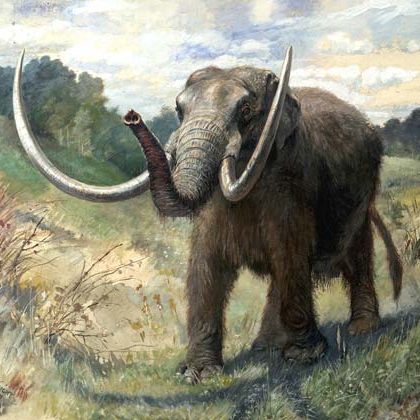
''Notiomastodon'' is an extinct proboscidean genus of gomphotheres (a distant relative to modern elephants) endemic to South America from the Pleistocene to the beginning of the Holocene. ''Notiomastodon'' specimens reached a size similar to that of the modern Asian elephant. Like other brevirostrine gomphotheres such as ''Cuvieronius'' and ''Stegomastodon'', ''Notiomastodon'' was characterized by its short snout and tall, highly arched skull. The short jaw was due to the loss of the lower tusks found in more primitive gomphotheres. ''Notiomastodon'' was a generalist feeder capable of consuming various types of plants, which varied according to local environments. In the course of the last glacial period, there was an adaptation towards the consumption of grasses. The genus was originally named in 1929, and has been controversial in the course of taxonomic history as it has frequently been confused with or synonymized with forms called ''Haplomastodon'' and ''Stegomastodon''. Ext ... [...More Info...] [...Related Items...] OR: [Wikipedia] [Google] [Baidu] |
Tocancipá
Tocancipá () is a municipality and town of Colombia in the Central Savanna Province, part of the department of Cundinamarca. Tocancipá is situated in the northern part of the Bogotá savanna, part of the Altiplano Cundiboyacense in the Eastern Ranges of the Colombian Andes with the urban centre at an altitude of . The capital Bogotá, which metropolitan area includes Tocancipá, is to the south. Tocancipá borders Gachancipá and Nemocón in the north, Zipaquirá in the west, Guasca and Guatavita in the east and Guasca and Sopó in the south. Etymology The name Tocancipá comes from Muysccubun and means "Valley of the joys of the ''zipa''". History The area of Tocancipá was inhabited early in the history of inhabitation of the Altiplano. The archaeological site Tibitó is located within the boundaries of Tocancipá and evidence of inhabitation has been dated to 11,740 ± 110 years BP.Aceituno & Rojas, 2012, p.127 At the time of arrival of the Spanish conquistadore ... [...More Info...] [...Related Items...] OR: [Wikipedia] [Google] [Baidu] |
Colombia
Colombia (, ; ), officially the Republic of Colombia, is a country in South America with insular regions in North America—near Nicaragua's Caribbean coast—as well as in the Pacific Ocean. The Colombian mainland is bordered by the Caribbean Sea to the north, Venezuela to the east and northeast, Brazil to the southeast, Ecuador and Peru to the south and southwest, the Pacific Ocean to the west, and Panama to the northwest. Colombia is divided into 32 departments and the Capital District of Bogotá, the country's largest city. It covers an area of 1,141,748 square kilometers (440,831 sq mi), and has a population of 52 million. Colombia's cultural heritage—including language, religion, cuisine, and art—reflects its history as a Spanish colony, fusing cultural elements brought by immigration from Europe and the Middle East, with those brought by enslaved Africans, as well as with those of the various Amerindian civilizations that predate colonization. Spanish is th ... [...More Info...] [...Related Items...] OR: [Wikipedia] [Google] [Baidu] |
Andean Preceramic
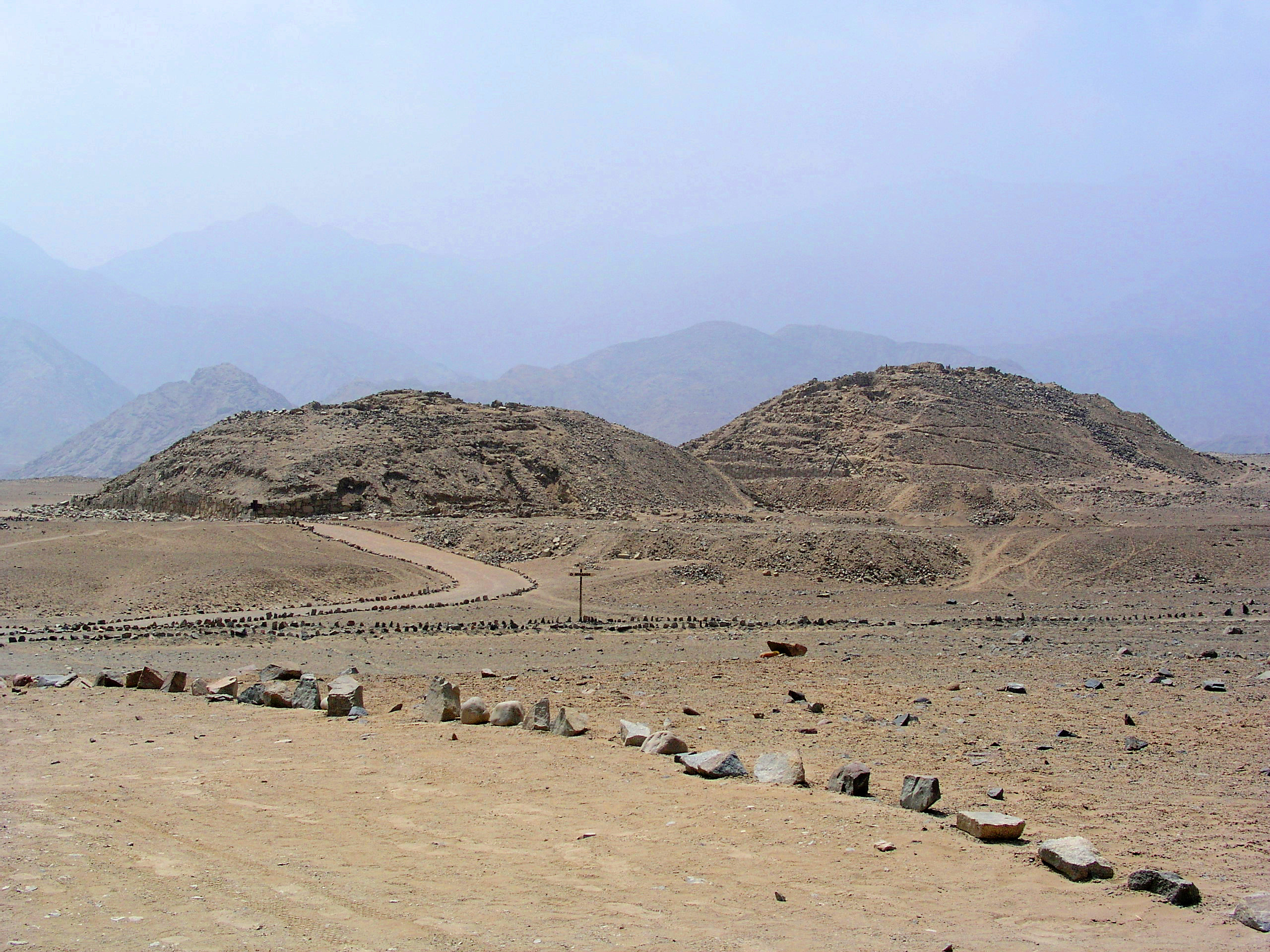
The Andean preceramic refers to the early period of human occupation in the Andean area of South America that preceded the introduction of ceramics. This period is also called pre-ceramic or aceramic. Earliest human occupations The earliest humans that came to South America are known as Paleo-Indians. This period is generally known as the Lithic stage. After this came the period that is widely known as Archaic, although there are also some different classifications of this period. The precise classification is complicated because somewhat different terminologies tend to be used for North America and Mesoamerica. The Andean preceramic period would include cultures that belong to Lithic and Archaic stages. Preceramic in Peru The Zaña Valley in northern Peru contains the earliest known canals in South America. These were small stone-lined canals which drew water from streams in the Andes Mountains region. These canals may have been built as early as 4700 BC. A great deal of a ... [...More Info...] [...Related Items...] OR: [Wikipedia] [Google] [Baidu] |
Altiplano Cundiboyacense
The Altiplano Cundiboyacense () is a high plateau located in the Eastern Cordillera of the Colombian Andes covering parts of the departments of Cundinamarca and Boyacá. The altiplano corresponds to the ancient territory of the Muisca. The Altiplano Cundiboyacense comprises three distinctive flat regions; the Bogotá savanna, the valleys of Ubaté and Chiquinquirá, and the valleys of Duitama and Sogamoso. The average altitude of the altiplano is about above sea level but ranges from roughly to . Etymology ''Altiplano'' in Spanish means "high plain" or "high plateau", the second part is a combination of the departments Cundinamarca and Boyacá. Geography The limits of the Altiplano are not strictly defined. The high plateau is enclosed by the higher mountains of the Eastern Ranges, with the Sumapaz mountains in the south and Chingaza to the east. The Tenza Valley is located to the east of the Altiplano and the Ocetá Páramo and Chicamocha Canyon are situated to the ... [...More Info...] [...Related Items...] OR: [Wikipedia] [Google] [Baidu] |


.png)