|
Thundridge
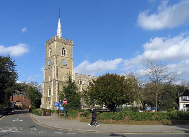
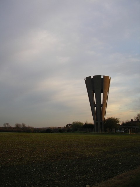
Thundridge is a village and civil parish in the East Hertfordshire district, in the county of Hertfordshire, England. It is about two miles away from the town of Ware and about seven miles away from the large town of Hertford, the county town of Hertfordshire. Nearby settlements Nearby villages include Wadesmill and Tonwell, and the hamlets of Cold Christmas and High Cross. Transport Road Thundridge is on Ermine Street, which is a Roman road, and it was on the A10 road until it was by-passed in 2005, restoring it to a quiet village. Rail Ware is the nearest railway station. There was formerly a line in the Rib valley, the Buntingford branch line Amenities Thundridge has a primary school, along with three pubs in the shape of The Anchor, The Maltons (previously The Sow & Pigs), and The Feathers. The village also has a cricket team, along with Thundridge United Football Club, who play in the Hertford and District League 2. History The village of Thundri ... [...More Info...] [...Related Items...] OR: [Wikipedia] [Google] [Baidu] |
Wadesmill
Wadesmill is a hamlet in Hertfordshire, England, located on the north side of the River Rib with an estimated population of 264. At the 2011 Census the population of the hamlet was included in the civil parish of Thundridge. Running through the centre of Wadesmill is the road formerly known as the A10 - the main London to King's Lynn (via Cambridge) road - but now that the A10 by-pass has been built, Wadesmill and surrounding villages have returned to the quiet of former times. The route that was formerly the A10 is an ancient one with portions of it following the line of the Roman Road Ermine Street. Ermine street also figures as the former main street in Wadesmill's adjacent village Thundridge. History Historically Wadesmill is particularly notable for two features - it is the location of the first turnpike in England (and therefore the world), and the presence of the Clarkson Memorial halfway up nearby High Cross hill, a memorial to Thomas Clarkson's rest point in his trav ... [...More Info...] [...Related Items...] OR: [Wikipedia] [Google] [Baidu] |
Ware, Hertfordshire
Ware is a town in Hertfordshire, England close to the county town of Hertford. It is also a civil parish in East Hertfordshire district. Location The town lies on the north–south A10 road which is partly shared with the east–west A414 (for Hertford to the west and Harlow to the east). There is a large viaduct over the River Lea at Kings Meads. The £3.6m two-mile bypass opened on 17 January 1979. At the north end of the bypass is the Wodson Park Sports and Leisure Centre and Hanbury Manor, a hotel and country club. The former route of the A10 through the town is now the A1170. The railway station is on the Hertford East Branch Line and operated by Greater Anglia and is on a short single track section of the otherwise double track line. History Archaeology has shown that Ware has been occupied since at least the Mesolithic period (which ended about 4000 BC). The Romans had a sizeable settlement here and foundations of several buildings, including a temple, and two cemeter ... [...More Info...] [...Related Items...] OR: [Wikipedia] [Google] [Baidu] |
North East Hertfordshire
North East Hertfordshire is a constituency represented in the House of Commons of the UK Parliament since 1997 by Oliver Heald, a Conservative. Constituency profile The constituency includes the towns of Letchworth, Baldock and Royston and the undulating rural area, strewn with traditional English villages primarily to their south, most of which are within the more accessible parts of the London Commuter Belt and west of London Stansted Airport. History The constituency was created in for the 1997 general election largely from parts of the abolished County Constituency of North Hertfordshire, including Letchworth, Baldock and Royston. It also included rural areas of the District of East Hertfordshire transferred from the constituencies of Hertford and Stortford and Stevenage. Boundaries 1997–2010: The District of North Hertfordshire wards of Arbury, Baldock, Grange, Letchworth East, Letchworth South East, Letchworth South West, Newsells, Royston East, Royston West, Sa ... [...More Info...] [...Related Items...] OR: [Wikipedia] [Google] [Baidu] |
East Hertfordshire
East Hertfordshire is a local government district in Hertfordshire, England. Its council is based in Hertford, the county town of Hertfordshire. The largest town in the district is Bishop's Stortford, and the other main towns are Ware, Buntingford and Sawbridgeworth. At the 2011 Census, the population of the district was 137,687. The district was formed on 1 April 1974, under the Local Government Act 1972, by the merger of the municipal borough of Hertford with Bishop's Stortford, Sawbridgeworth and Ware urban districts, and Braughing Rural District, Ware Rural District and part of Hertford Rural District. By area it is the largest of the ten local government districts in Hertfordshire. It borders the North Hertfordshire district and the boroughs of Stevenage, Welwyn Hatfield and Broxbourne in Hertfordshire, and the districts of Epping Forest, Harlow and Uttlesford in Essex. In the 2006 edition of Channel 4's "Best and Worst Places to Live in the UK", East Hertford ... [...More Info...] [...Related Items...] OR: [Wikipedia] [Google] [Baidu] |
The Hundred Parishes
The Hundred Parishes is an area of the East of England with no formal recognition or status, albeit that the concept has the blessing of county and district authorities. It encompasses around 450 square miles (1,100 square kilometres) of northwest Essex, northeast Hertfordshire and southern Cambridgeshire. The area comprises just over 100 administrative parishes, hence its name. It contains over 6,000 listed buildings and many conservation areas, village greens, ancient hedgerows, protected features and a historical pattern of small rural settlements in close proximity to one another. Origins The idea of recognising the area for its special heritage characteristics was originally conceived by local historian and author David Heathcote. A steering group of local historians, conservationists and a local authority representative, spearheaded by the Essex branch of the Campaign to Protect Rural England (CPRE), progressed the idea and defined a boundary. The name arose in response ... [...More Info...] [...Related Items...] OR: [Wikipedia] [Google] [Baidu] |
A10 Road (England)
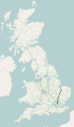
The A10 (in certain sections known as ''Great Cambridge Road'' or Old North Road) is a major road in England. Its southern end is at London Bridge in the London Borough of Southwark, and its northern end is the Norfolk port town of King's Lynn. From London to Royston it chiefly follows the line of Roman Ermine Street. The main route to Cambridge is now via the M11 motorway, however non-motorway traffic still uses the A10. Route Within the City of London, the route of the A10 comprises King William Street, Gracechurch Street, Bishopsgate and Norton Folgate. It then becomes Shoreditch High Street, Kingsland Road, Kingsland High Street and Stoke Newington Road. It runs through Stoke Newington as Stoke Newington High Street and then becomes Stamford Hill, through Stamford Hill until Tottenham. In July 2013, the Tottenham Hale gyratory was removed and the A10 now follows the route of Tottenham High Road in both directions. North of Tottenham, the A10 leaves its ... [...More Info...] [...Related Items...] OR: [Wikipedia] [Google] [Baidu] |
River Rib
The River Rib originates near the East Hertfordshire village of Therfield and runs parallel with the A10 through Chipping, Wyddial, Buntingford, Westmill, Braughing, Puckeridge and Standon, before dividing the villages of Thundridge and Wadesmill and continuing until it reaches its confluence with the River Lea near Hertford. History The River Rib was used to power an overshot watermill at Ware Park between Hertford and Ware. The River Rib used to have frequent floods due to heavy rain in the autumn, but this propensity was resolved by dredging and engineering work in the 1970s. It was used as the main water supply in Buntingford and the surrounding areas before a pump was installed. See also * Index: River Lea References External links * Rib, River Rib In vertebrate anatomy, ribs ( la, costae) are the long curved bones which form the rib cage, part of the axial skeleton. In most tetrapods, ribs surround the chest, enabling the lungs to expand ... [...More Info...] [...Related Items...] OR: [Wikipedia] [Google] [Baidu] |
Tonwell
Tonwell is a small village in Bengeo Rural parish, Hertfordshire. The village is situated just off the A602 (formerly B1001), having been bypassed in 1987 - making the A10 and therefore London and Cambridge easily accessible by road. Tonwell has a population of about 300 persons, being included at the 2011 Census in the civil parish of Bengeo Rural. The demographic is similar to that of Hertfordshire itself, with a number of family properties as well as those more suited to elderly people. Near the village are Paynes Hall (south of the village by half a mile, where the A602 crosses the River Rib); Bengeo Temple farm; and the parkland at Sacombe (listed in the landscape character assessment as a rare and significant example of Victorian parkland.) Tonwell has close ties to the neighbouring hamlet of Chapmore End; the only other settlement in the parish. The two settlements have held combined events such as the village fete, and events in the village hall in Tonwell. Vi ... [...More Info...] [...Related Items...] OR: [Wikipedia] [Google] [Baidu] |
Thor
Thor (; from non, Þórr ) is a prominent god in Germanic paganism. In Norse mythology, he is a hammer-wielding god associated with lightning, thunder, storms, sacred groves and trees, strength, the protection of humankind, hallowing, and fertility. Besides Old Norse , the deity occurs in Old English as , in Old Frisian as ', in Old Saxon as ', and in Old High German as , all ultimately stemming from the Proto-Germanic theonym , meaning 'Thunder'. Thor is a prominently mentioned god throughout the recorded history of the Germanic peoples, from the Roman occupation of regions of , to the Germanic expansions of the Migration Period, to his high popularity during the Viking Age, when, in the face of the process of the Christianization of Scandinavia, emblems of his hammer, , were worn and Norse pagan personal names containing the name of the god bear witness to his popularity. Due to the nature of the Germanic corpus, narratives featuring Thor are only atte ... [...More Info...] [...Related Items...] OR: [Wikipedia] [Google] [Baidu] |
Villages In Hertfordshire
A village is a clustered human settlement or community, larger than a hamlet but smaller than a town (although the word is often used to describe both hamlets and smaller towns), with a population typically ranging from a few hundred to a few thousand. Though villages are often located in rural areas, the term urban village is also applied to certain urban neighborhoods. Villages are normally permanent, with fixed dwellings; however, transient villages can occur. Further, the dwellings of a village are fairly close to one another, not scattered broadly over the landscape, as a dispersed settlement. In the past, villages were a usual form of community for societies that practice subsistence agriculture, and also for some non-agricultural societies. In Great Britain, a hamlet earned the right to be called a village when it built a church. [...More Info...] [...Related Items...] OR: [Wikipedia] [Google] [Baidu] |
Civil Parish
In England, a civil parish is a type of Parish (administrative division), administrative parish used for Local government in England, local government. It is a territorial designation which is the lowest tier of local government below districts of England, districts and metropolitan and non-metropolitan counties of England, counties, or their combined form, the Unitary authorities of England, unitary authority. Civil parishes can trace their origin to the ancient system of Parish (Church of England), ecclesiastical parishes, which historically played a role in both secular and religious administration. Civil and religious parishes were formally differentiated in the 19th century and are now entirely separate. Civil parishes in their modern form came into being through the Local Government Act 1894, which established elected Parish councils in England, parish councils to take on the secular functions of the vestry, parish vestry. A civil parish can range in size from a sparsely ... [...More Info...] [...Related Items...] OR: [Wikipedia] [Google] [Baidu] |
Standon, Hertfordshire
Standon is a village and civil parish in Hertfordshire, England. The parish includes the adjoining village of Puckeridge. The village church of St Mary has Saxon origins with much Victorian restoration. It contains the ornate tomb of the Tudor courtier Sir Ralph Sadler. The Prime Meridian passes to the west of Standon. The place-name is first attested in a Saxon charter of 944–46 AD and means "stony hill". Standon village has many local facilities. In addition to the church, there is a village hall, two public houses, a Chinese restaurant, post office, butcher, baker, and newsagent. Villagers also make frequent use of facilities in neighbouring Puckeridge, which include a pharmacy, estate agent, petrol station, public houses, doctor's surgery and primary schools (including St Thomas of Canterbury, a Roman Catholic primary school). Arthur Martin-Leake, one of only three men to be awarded the Victoria Cross twice, was born in the village. The Standon Calling music fest ... [...More Info...] [...Related Items...] OR: [Wikipedia] [Google] [Baidu] |


